A place for conversations from the University of Edinburgh community on topics around social responsibility and sustainability.
Volunteering to map green infrastructure in Edinburgh
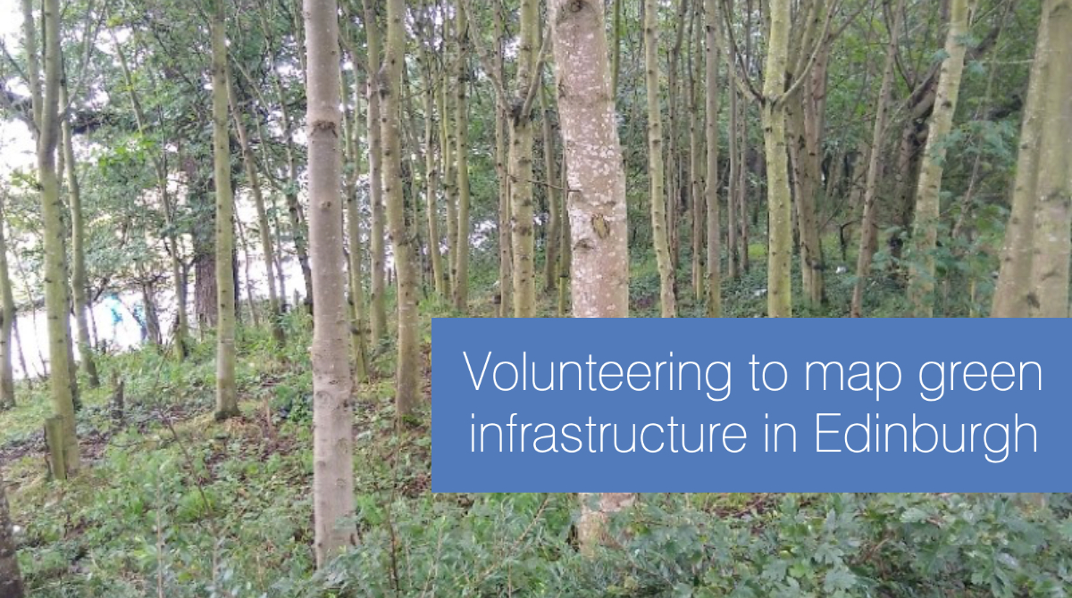
Four community and alumni volunteers, Melanie Gillies, Judith Bull, Daniela Izquierdo and Cat Andrade-Robertsen, share their experience of volunteering to map green and blue space in Edinburgh. They used an app to determine the value of areas for people and wildlife, summarised as a Green Infrastructure (GI) Factor.
About the project
Liz Vander Meer, Research & Policy Manager (Climate Change and Biodiversity)
The GI Mapping pilot project, part of the City of Edinburgh Council-led Edinburgh’s Thriving Green Spaces project, is developing and testing a green infrastructure mapping application on park sites in the city of Edinburgh. The pilot is led by the University of Edinburgh (EDINA, Department for Social Responsibility and Sustainability and GeoSciences) and based on the “How Green is Your Campus” app created for our university campuses. Park sites for the pilot include:
- Meadows/Bruntsfield Links
- Burdiehouse Burn Valley Park
- Cramond Foreshore Park
- Inch Park
- Saughton Park
The app provides a means to map green and blue spaces to determine their quality, in terms of biodiversity and ecosystem services value, generating a Green Infrastructure (GI) Factor for an area. This is an important factor to consider when making improvements to parks for biodiversity and climate change adaptation, but also for associated human health and wellbeing. The scoring system was developed by the Scottish Wildlife Trust (SWT) as the Natural Capital Standard for Green Infrastructure; the pilot is testing and refining the scoring system while also eventually providing a multi-functional tool for use by parks staff and Edinburgh residents.
We could not have a successful pilot project without our passionate and committed volunteers, who live in communities near the parks that are being mapped. Volunteers have acted as citizen scientists, going out individually to gather data on vegetation types in each park using the app; they also provide us with a critical view, so that we can revise the app and the GI Factor scoring system. In order to showcase their efforts, we are pleased to share four volunteers’ experiences of their local parks and of participating in the GI Mapping project. Huge thanks to Melanie, Judith, Daniela and Cat for contributing! They bring to life the value of Cramond Foreshore Park and Inch Park as well as their interactions with the app. And many thanks to all of our volunteers, who have made this work possible in the midst of Covid-19.
Edinburgh Green Spaces Mapping: Cramond Foreshore
Melanie Gillies
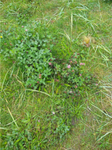
Cramond Foreshore on a warm, or cold, clear sunny day is beautiful. It is a great place to visit for walkers, cyclists, dog owners and families also for visitors who love the views, the pretty village and the cafes. I’ve lived within walking distance of Cramond Foreshore for 20 years and have often taken walks along the promenade but the frequency increased 10 years ago when I acquired two dogs. The recent coronavirus pandemic and its restrictions has meant I now go to the Foreshore almost every day and taking part in the mapping programme encouraged me to look more closely at what is actually there.
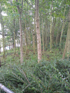
There are large areas of grass with naturalised patches of long grass and wild flowers. There are long strips of grass along the paths containing lines of trees and benches for people to stop and take in the view of Cramond Island and Fife. I noticed that the most predominant tree along these strips was a Sycamore and learnt that these trees are not native to Scotland but have become naturalised which must be because they like it here!
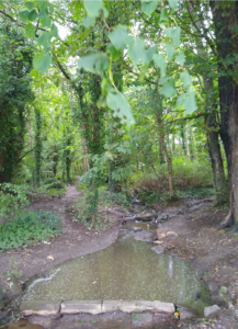
Using the ArcGIS App I took photos of things I couldn’t confidently categorise or things that I really liked. This wooded area is on a slope and contains two streams one at each side, these help with drainage, one stream goes under the main path to the sea but the other doesn’t so when the rainfall is heavy it floods. There is a mixture of trees and shrubs in this wood including some bamboo!
The dune field before the beach can look a bit bleak, sparse and dry but it contains shrubs and flowers as well as grasses. Looking closely some of the shrubs are very pretty and I would love to see more. Edinburgh Council Natural Heritage Service have been working on this area removing some shrubs and replacing others which I hope in time will thrive.
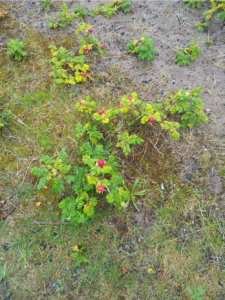
Pretty shrubs
I am very lucky to live in an area that is close to some beautiful walks.
Cramond Foreshore is an easy walk, it’s flat and the paved areas mean it doesn’t get too muddy in the rain. You can sit on the grass or on the sand on a bench or at a cafe and you can walk for as little or as much as you want. A great place to take any visitors of any age and a great place to enjoy on your own.
Judith Bull
I joined the mapping project as a volunteer almost by chance, when my husband mentioned a link he had seen in a newsletter from Friends of the River Almond. Some years ago I recorded for PlantLife and it seemed a good opportunity to renew an interest in environmental projects.
The app proved a bit of a challenge as I am not very familiar with this type of programme, but once downloaded it proved very easy to use. Some of the categories of vegetation were quite broad, so that an area classified as “more than 10 trees” could be deciduous woodland, plantation or grassland with clumps of trees. while this may not make much difference in terms of recreational use as urban green space, it could be quite important for wildlife including insects. “Grassland” included mown areas and rough patches full of thistles where I saw at least a dozen tortoiseshell butterflies.
Judith Bull
 I have lived in Edinburgh for 27 years, just off the Queensferry Road in Barnton. Having explored with my children when they were young I thought I knew the Cramond area pretty well. Mapping the foreshore in some detail helped me to discover paths and areas of woodland that I had been only vaguely aware of. I suspect that my sons would have known far more about it from biking with friends and making dens.
Having grown up in a rural part of the English Midlands, I absorbed my family’s interest in the natural environment and have always loved being out of doors, whether in a garden or somewhere wilder. The last few months of social restriction had unexpected benefits in allowing time to walk and cycle much more than usual, and to observe the wildlife in my own garden. I have got to know my local green spaces much better, watching the changes through the seasons and really appreciating what is there, perhaps the first greening of a birch tree in spring, cherry blossom by the river, mayflies on the River Almond. My favourite walks include the Cammo estate, Dalmeny estate, footpaths beside the River Almond, Corstorphine Hill and Davidsons’ Mains park, and of course the shore at Cramond. Green space has become head space, helping to keep me sane.
It has also been interesting to observe my fellow walkers and cyclists, and people’s different attitudes. Why cycle with headphones on when there is birdsong to listen to? Why festoon the bushes by the path with little black bags of dog poo? One thing that does concern me very much is the steady encroachment of new housing developments on Edinburgh green belt. I hope that the 750 new houses under construction next to the Cammo estate do not increase the pressure on an already very popular wild area to the detriment of its natural inhabitants.
I hope our green spaces will be there for a long time to come. I think the key is to engage and educate the local communities so that people really appreciate the resources on their own doorstep and how to care for them.
Edinburgh Green Space Mapping: Inch Park
Daniela Izquierdo
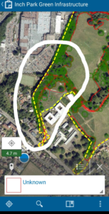
The mapping technology
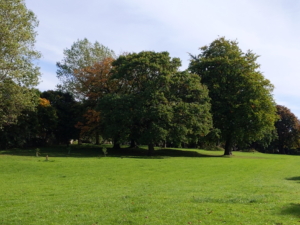
I love my local park, Inch Park, because I know that I can have a pleasant and relaxed time in this green area. I usually go for a walk to relax by hearing the birds, the wind going through the branches of the trees, and looking for squirrels and different types of birds. Also, I enjoy cycling with my family in this area, and my favourite part of the park is the narrow cycle path in the middle of the forest! Green spaces make me feel part of the community and I know that I can find nice people or friends doing the same as me.
I enjoy doing fieldwork and exploring nature. So, I did my dissertation about green spaces in Edinburgh and how they contribute to society’s wellbeing. Unfortunately, since I finished my Master’s in Ecological Economics, I haven’t had the opportunity to put in practice what I have learned. The positive outcome that I got during lockdown is that I visited more green spaces than in a year. However, I had been thinking about what I could do now that I have lots of free time if I wanted to improve my career and learn more thinks about greens paces.
I saw the opportunity to be a volunteer in GI mapping on twitter and I remember that I thought, wow this is my opportunity! All the volunteers received an introductory online workshop about the mapping pilot project. Regarding my experience, the app was very easy to use (ArcGIS Collector), I liked the option in which I can add photos and describe what I found in each area of the park.
Elizabeth and Guy provided us the natural capital standard list to assess the quantity and quality of the green space. I could say the most “difficult” thing to do was to assign the correct value of the GI Surface selected in the app and also these could vary from one volunteer to another. Additionally, here in Edinburgh, green spaces are so rich in biodiversity and you can find different ecosystems in one area. For example, in one little section of the park, I found a grassland area that has a little forest an outdoor gym, a bench, and a little patch with wildflowers for pollinators. that is difficult to measure because it provides more than one green cover category. I think the team can enhance this by firstly giving a broad explanation to the volunteers about each of the categories of the list provided such as what is included in each of the categories listed, and consider being able to include more than one GISurface category at the same green space section. This project can be used as an informative tool for students, experts, or the public in general and it’s a great opportunity to get to know your local area and how rich it is in biodiversity and green spaces. Overall, I enjoyed and learned from GI mapping and I am looking forward to knowing more about it in the future. I’m proud of our University and how green it is.
Cat Andrade-Robertsen
 Inch Park is my nearest, big, local park and I was curious about the mapping project Elizabeth and her team were conducting so I signed up to be a volunteer mapper. After a short training session, downloading the mapping app and having a play about I set about mapping on a lovely sunny autumn day.
The app was really easy to use and one of the things It made me realise is just how many trees were in the section of the park I was given to map. I typically take my dog for a walk to the Inch at least once a week and never really noticed just how many trees were dotted around.
I’m originally from London and one of the reasons I was drawn to move to Edinburgh was the amount of green space that is so accessible within the city. I really enjoy walking my dog to my small local park and to the Inch. They provide a great way to meet neighbours, find out what’s going on in the local community and get some much needed fresh air and exercise for both me and my dog!


Recent comments