Any views expressed within media held on this service are those of the contributors, should not be taken as approved or endorsed by the University, and do not necessarily reflect the views of the University in respect of any particular issue.
Digimap is an online map and data delivery service, available by subscription to UK Higher and Further Education establishments. Operated by EDINA at the University of Edinburgh, Digimap offers a number of data collections, including Ordnance Survey, historical, geological, aerial photography, LiDAR, marine maps, land cover mapping, global mapping and census data. For more information about Digimap go to our website: https://digimap.edina.ac.uk Background image Contains OS data (c) Crown Copyright and database right 2022
Digimap invites you to join us for an illuminating session exploring Ordnance Survey data, AddressBase, and the OS National Geographic Database (OS NGD). Learn how these valuable datasets can support your projects in a presentation by Eddie Bulpitt, Geospatial Consultant at Ordnance Survey.
Join us for an insightful webinar on Accessing OS Data using the NGD, presented by Eddie Bulpitt, a GI Developer/Consultant at Ordnance Survey. In this session, Eddie will demonstrate how to efficiently access and work with OS data through the NGD, offering practical tips and valuable insights, particularly for users of Digimap. Whether you’re involved in geographic information systems (GIS), data analysis, or simply interested in exploring the full potential of the NGD, this webinar is a must-attend for anyone looking to enhance their skills and knowledge in working with OS data.
Ordnance Survey have released nearly 5000 extra 5km squares of building height data, with the total coverage increasing from 2578 to 7302. Each square has at least one building with height attributes added, with most fully covered. We have added this data to Digimap’s Data Download facility allowing you easy access to the data you need.
The Building Heights data is available from Data Download in a range of formats created especially for Digimap users. The most straightforward to use are DWG, File Geodatabase and KML which can be viewed directly in CAD, GIS and Google Earth respectively. You can also take the data as a CSV list that can be joined to the attribute table of any existing MasterMap Building data you have, using the TOID identifier. This means that you don’t have to recreate your project work with new data if you have already spent a lot of time working on it; as long as the buildings still have a TOID in their attribute data you can add the height information to it.
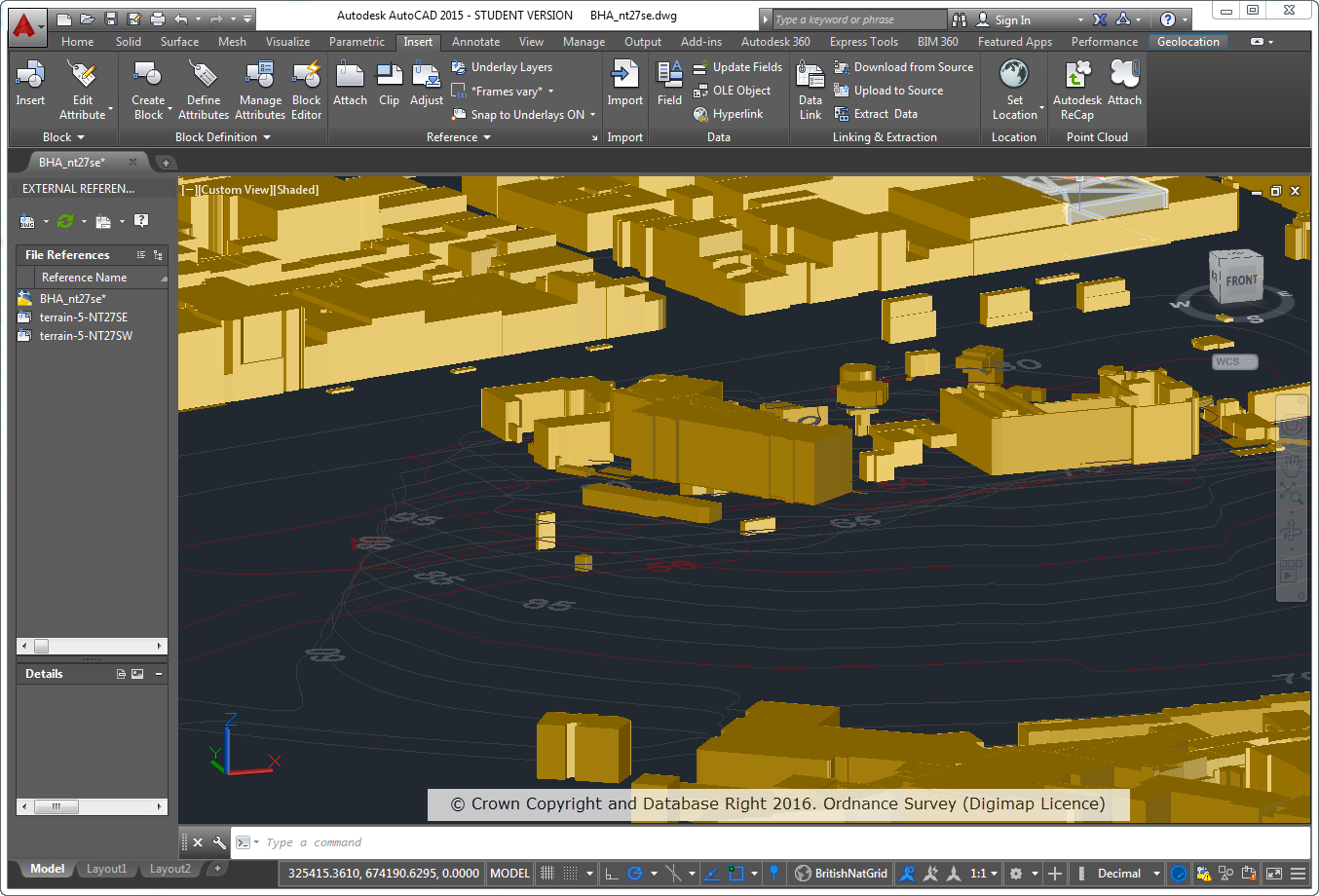
The Building Heights data is ideal for anyone working with the MasterMap data in 3D and has a range of applications in Architecture, Landscape Architecture, Environmental Modelling, Archaeological Reconstructions and many more different disciplines. Here are a couple of examples:
OS MasterMap Topography Layer Building Height Attribute data on top of OS Terrain 5 Contours
3D model using Aerial Imagery, OS Terrain 5 DTM and MasterMap Building Heights Data
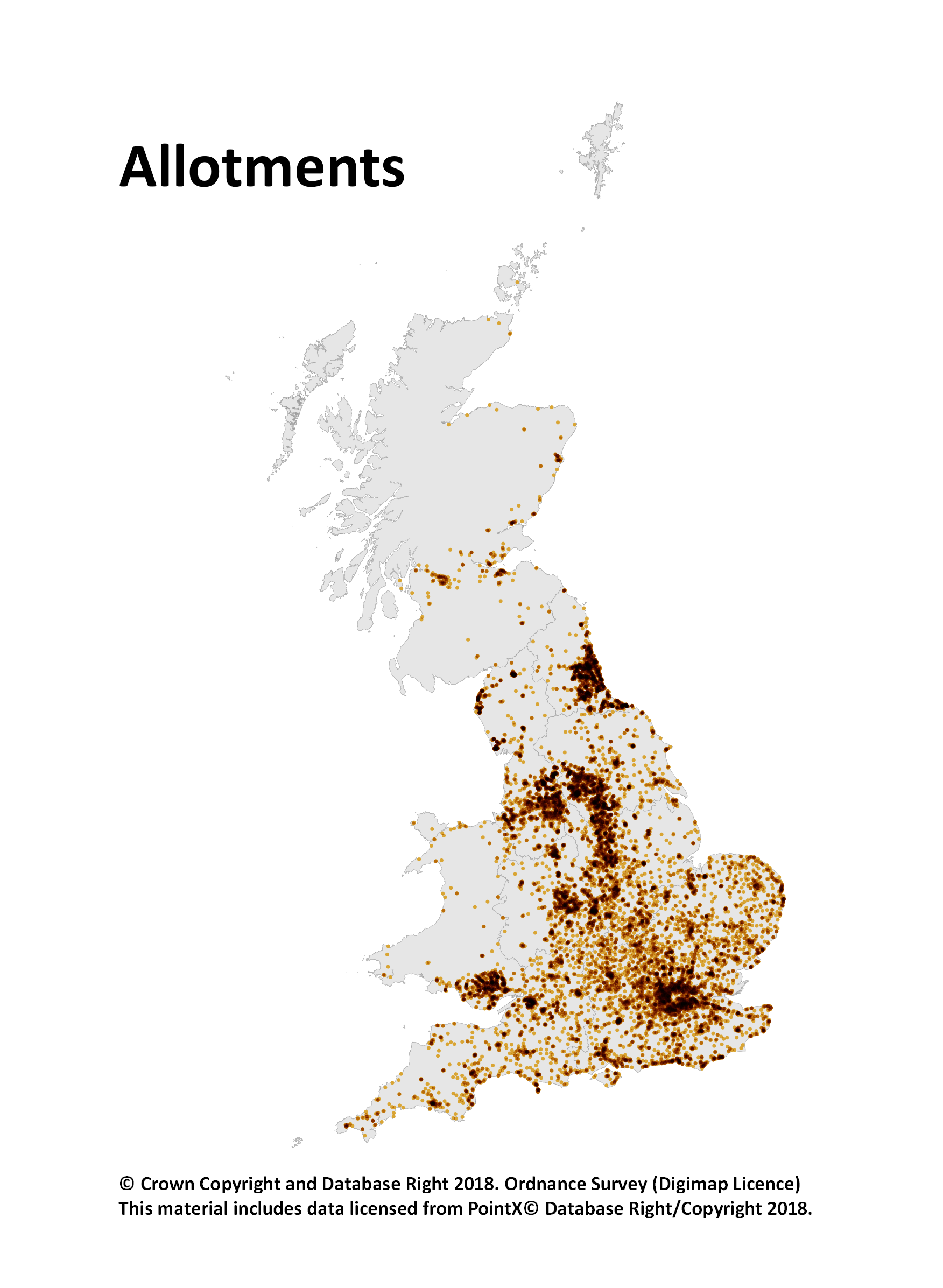
The Points of Interest (PoI) data is great for research and you can make fantastic looking maps too as we have been showcasing on our twitter account. You have certainly been making the most of it too, with 16,877 PoI downloads being made since May 2015. Here are 3 dot density maps we made to show a single class of PoI data:
However until today you had to take all the different classes of points for your specified area and you were limited to taking no more than 10,000 Km2 in a single download. As PoI data is split into 9 groups, 52 categories and over 600 classes (see the full scheme here), we though it would make things easier if we exposed some of this hierarchy in Digimap’s Data Download service.
You can now select one or more of the groups or categories to download, taking some of the data processing load off you and making your downloads more manageable. Being able to filter the features in your download by group or category means smaller downloads so we have also removed the limit on the area you can take; you can now take the whole country in one download if you want.
One note of caution though, the PoI data has around 4.5 million records and is over 1gb in size as a simple CSV file. So if you are taking national coverage you may want to only take one group or a few categories to minimise the amount of data you are dealing with.
To select a group or category of features simply add PoI data to your basket then use the drop down menu in the layers column to choose what you are interested in.
We hope that you find this change really improves the accessibility of the Points of Interest data, we look forward to seeing some of the interesting analyses and maps you produce!
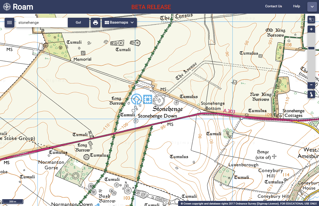
On 3rd October 2017, we released a Beta version of a new Roam mapping client for Digimap’s Ordnance Survey Collection. OS Roam – Beta is available next to the existing version, simply log in to the Digimap service and select Ordnance Survey Collection to view the new beta version:
Whilst the functionality remains the same, we hope you agree that the look and feel of the interface is more modern. The majority of functions are available from a new menu panel down the left hand side, which is hidden by default, maximising the area available for the main map element.
There are some issues we are aware of in this version, which we are working on, for example, some elements can be slow using Internet Explorer and Edge.
New versions of the Roam applications in all other collections will be available in due course. Both new and old versions will run side by side for an extended period of time to give users the opportunity to get used to the new interface.
We would encourage you to try the beta version and we welcome any feedback you have.
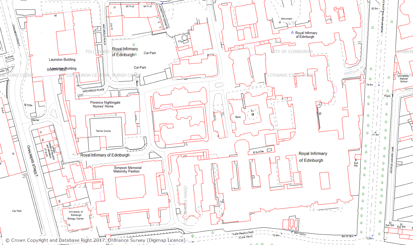
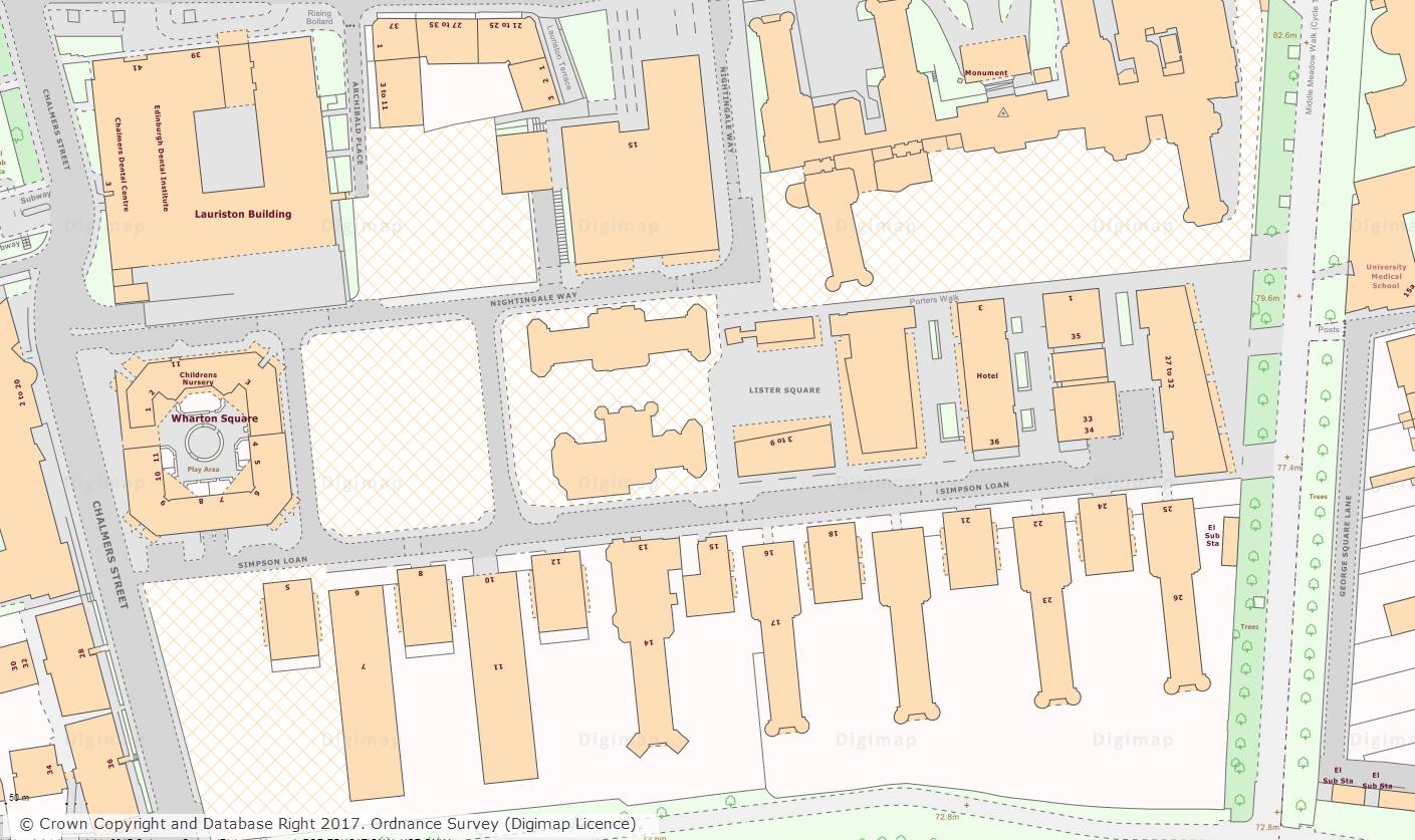
Today we have made a huge amount of archived Land-Line data available to download from Digimap. You access the data through the Data Download application in the Digimap: Ordnance Survey Collection. Land-Line was the pre-cursor to the OS MasterMap Topography Layer, and was the most detailed topographic mapping available from Ordnance Survey at the time. The archive released consists of annual snapshots of the whole of Great Britain from 1999 to 2006. This data will be vital for researchers who are undertaking longitudinal studies, examining how areas have changed over time.
Land-Line.Plus showing Edinburgh’s Quartermile area from 1999OS MasterMap showing Edinburgh’s Quartermile area from 2017
The data can be found in the Withdrawn Datasets category in the Data Download interface and is currently available in its original tiles and format.
Land-Line comes on 500m, 1km and 5km tiles depending on whether the area is Urban, Rural or Moorland. It is supplied in National Transfer Format (NTF) which was the standard format of the time. We have put together a short help page that explains how to import this data in to common GIS and CAD applications which may be of use for anyone unfamiliar with this format of data.
IMPORTANT: Between 2001 and 2006 Ordnance Survey carried it’s Positional Accuracy Improvement (PAI) programme. This means that there will be discrepancies in the positions of features on these maps and the OS MasterMap data: Read more on PAI
The Land-Line data that we have made available significantly bolsters the amount of detailed topographic data that is available for download from Digimap. The most detailed topographic mapping currently available from Digimap, OS MasterMap Topography Layer, is available for download going back to 2007. The addition of Land-Line data to Digimap means that users now have access to download the most detailed topographic mapping data for Great Britain going back a further eight years to 1999.
We hope you find this new addition of recent historic data useful, if you have any questions about the data please contact us:
May was one of the busiest in terms of dataset updates in the history of Digimap. Around 20 separate datasets have been updated bringing them bang up to date with the most recent data available from the data suppliers. All the updates are listed in the tables below, broken down by the Collection and service that they can be found in.
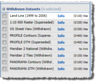
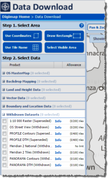
Withdrawn Datasets (OS Collection):
OS Download Withdrawn Datasets [click to expand]Along with the updated data, Ordnance Survey have recently withdrawn three datasets:
These withdrawn datasets are still available to download through the Ordnance Survey Data Download application in Digimap, but users should be aware that they are no longer updated by Ordnance Survey. Withdrawn datasets have their own separate category in the Select Data panel in OS Data Download, as shown by the image on the left hand side.
OS Roam:
Product Name
OS Publication Date
1:50,000 Colour Raster
March 2017
OS Open Map – Local (vector)
April 2017
VectorMap Local (vector)
April 2017
VectorMap District (vector)
March 2017
VectorMap Local Raster
April 2017
VectorMap District Raster
March 2017
OS Download:
Product Name
OS Publication Date
VectorMap Local Raster
April 2017
VectorMap District Raster
March 2017
VectorMap District (vector)
March 2017
OS Open Roads
October 2016 and April 2017
OS Open Map – Local (raster)
April 2017
OS Open Map – Local (vector)
April 2017
OS Terrain 5 DTM
April 2017
OS Terrain 5 Contours
April 2017
OS Open Names
April 2017
VectorMap Local (vector)
April 2017
Code-Point with Polygons
April 2017
OS Open Rivers
April 2017
Geology Download:
Product Name
BGS Publication Date
Borehole index
April 2017
The datset update pages are kept up to date with all dataset updates in the collections:
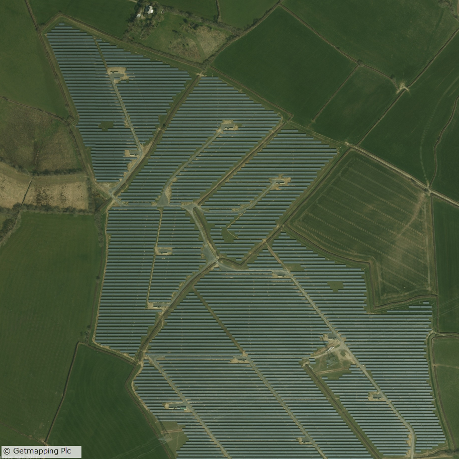
Canworthy Solar Farm, which became operational in 2014 and covers approximately 55 hectares (~67 football fields)
Aerial Digimap updates
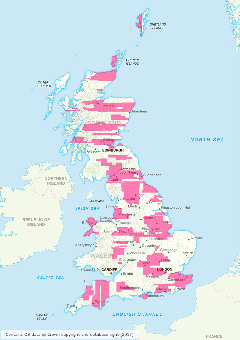
March/April 2017 has been a busy couple of months for the Data Team who have been working hard to process a huge area of updated aerial imagery data from the data supplier, Getmapping. The update consists of around 80,000 individual 1km tiles, all captured in 2015, which is approximately 30% of the country.
Prior to the update just over 50% of the data was from 2013 or later; after the update 77% of the data is from 2013 or later.
This means that more up to date imagery is now available for viewing and download through Aerial Digimap for a significant proportion of the country.
The map below shows the approximate distribution of the updated data.
Click on map to view larger version
This is the first update we have received from Getmapping, but we are expecting another update later this year containing imagery captured in 2016.
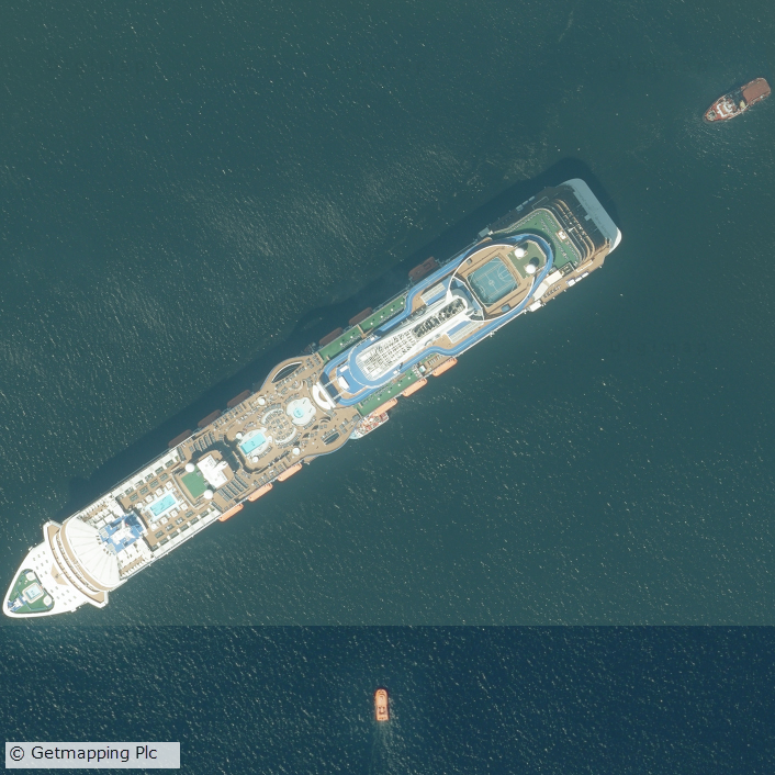
Cruise liner in the Firth of Forth
We will add this to the service as quickly as we can to ensure that the most up to date data is always available to Aerial Digimap users. In order to make it clear where the data has been updated, we will add an Availability/Reference Grid to Aerial Download so that users can easily identify if the imagery has been updated in their study area(s). This grid will be added to the system in the next couple of weeks.
We are still investigating the best way to make previous versions of the data available, but in the mean time only the most recent data is available through Aerial Roam and Aerial Download.
Webinar resources
We recently ran a webinar highlighting the data and showcasing a number of potential uses for the imagery. The webinar was recorded in full and is available on our YouTube channel. The slides used during the webinar and a transcript of all questions and answers are available on our help page.
3D model using Aerial Imagery, OS Terrain 5 DTM and MasterMap Building Height Attribute
Data information
The aerial imagery data in the service is 25cm resolution vertical aerial orthophotography supplied by Getmapping PLC, and is the most detailed aerial imagery available for the whole of Great Britain. As well as being a really interesting dataset the imagery also has a number of practical uses across a wide range of disciplines from urban planning and 3D modelling to land use and archaeological studies.
Subscribing
To see if your institution already subscribes to Aerial Digimap, please see our subscribing institutions help page. Information on how to subscribe to the new service is available on the Aerial Digimap Subscription page.
If you have any questions about the service please consult the dedicated Aerial Digimap help pages or contact the Digimap support team using the details below.
Dataset updates in Ordnance Survey Digimap
OS Data Download:
Product Name
OS Publication Date
Code-Point
February 2017
1:25,000 Colour Raster
March 2017
1:50,000 Colour Raster
March 2017
Points of Interest
March 2017
OS Roam:
Product Name
OS Publication Date
1:25,000 Colour Raster
March 2017
The OS data update page is kept up to date with all dataset updates in the collections.
If you have any questions about the dataset updates or Digimap please contact us:
In March 2017 Ordnance Survey withdrew the Meridian 2 dataset from their portfolio. It remains available within Digimap, but has moved within the Data Download application from Vector Data to the Withdrawn Datasets category.
Both national and tiled coverages are still available here. Documentation about this dataset can also be found in the help pages: Meridian 2 Data
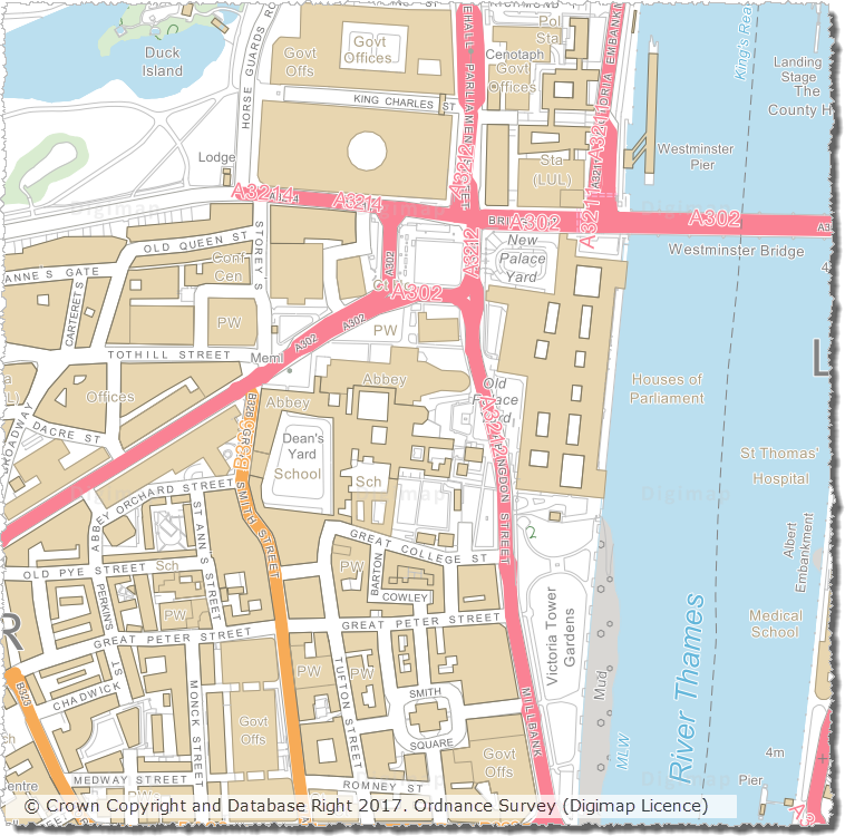
We have updated a number of key datasets in Jan/Feb 2017 in the Ordnance Survey collection of Digimap. These updates bring the datasets available from Digimap inline with the latest versions published by Ordnance Survey. Of particular note are the updates to the two most detailed mapping products available from Ordnance Survey: OS MasterMap Topography Layer and OS VectorMap Local.
OS VectorMap Local showing WestminsterOS MasterMap Topography Layer showing Westminster
OS Data Download:
Product Name
OS Publication Date
Integrated Transport Network (ITN) Layer
December 2016
OS MasterMap Topography Layer
December 2016
OS MasterMap Water Network Layer
January 2017
OS VectorMap Local
January 2017
OS VectorMap Local Raster
January 2017
MiniScale
January 2017
OS Terrain 5 Contours
January 2017
OS Terrain 5 DTM
January 2017
OS Open Names
January 2017
Code-Point with polygons
January 2017
Code-Point Open
February 2017
OS Roam:
Product Name
OS Publication Date
OS MasterMap Topography Layer
December 2016
OS VectorMap Local
Jan 2017
OS VectorMap Local Raster
Jan 2017
MiniScale
January 2017
The OS data update page is kept up to date with all dataset updates in the collections.
If you have any questions about the dataset updates or Digimap please contact us: