Any views expressed within media held on this service are those of the contributors, should not be taken as approved or endorsed by the University, and do not necessarily reflect the views of the University in respect of any particular issue.
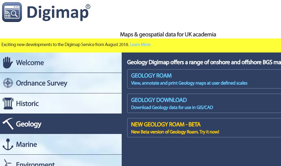
Digimap is an online map and data delivery service, available by subscription to UK Higher and Further Education establishments. Operated by EDINA at the University of Edinburgh, Digimap offers a number of data collections, including Ordnance Survey, historical, geological, aerial photography, LiDAR, marine maps, land cover mapping, global mapping and census data. For more information about Digimap go to our website: https://digimap.edina.ac.uk Background image Contains OS data (c) Crown Copyright and database right 2022
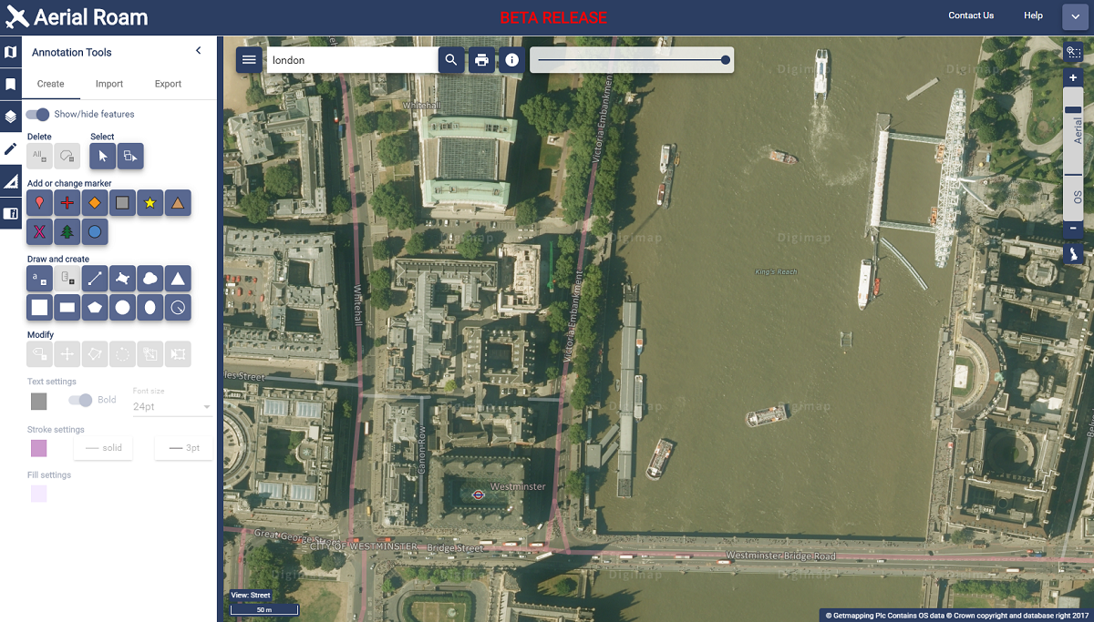
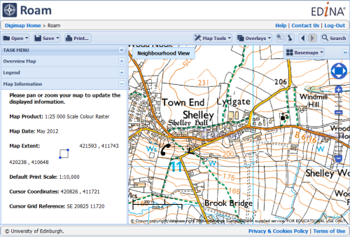
On 30th November 2017, we released Beta versions of our new Roam mapping application for all Digimap Collections. Log in to Digimap and click on each Collection to find the link to each new Roam:
The functionality of the new application remains the same, but we hope you agree that the updated look is easier to use.
Most importantly, BOTH versions of Roam (new and old) will run in parallel for an extended period of time to give users the opportunity to get used to the new interface. We will review this at the beginning of March 2018 with a view to establishing a date for withdrawal of the old application.
New Aerial Roam showing the London Eye
Known Issues
All applications have undergone thorough testing, but there are still a few issues that we working on, for example some elements can be slow using Internet Explorer. If you spot anything that is not behaving correctly, please report this to us.
We encourage you to try the new beta versions and we welcome any feedback you have.
As mentioned at Geoforum earlier this year, we’re currently working hard on a new version of Digimap Roam. The new-look application will bring Digimap Roam, the online mapping tool in the Digimap family, bang up to date with the latest web technologies available. Whilst the functionality will remain the same, the look and feel of the interface will be more modern. The majority of functions will be available from a new menu panel down the left hand side which is hidden by default maximising the area available for the main map element. By utilising the latest technologies we will be able to add new functionality and make further enhancements to the application in the future.
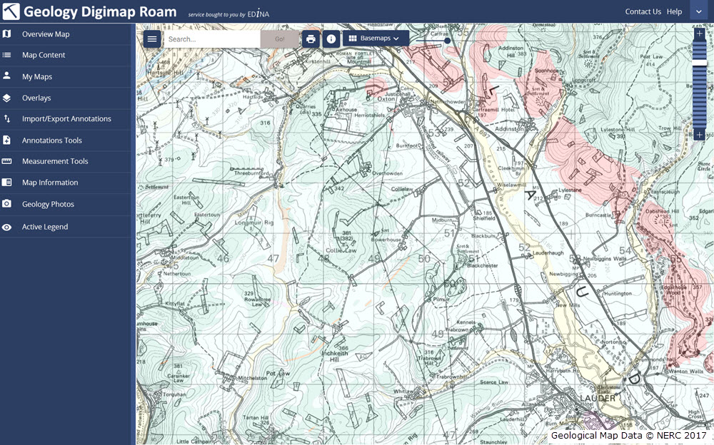
The new interface makes further improvements to the experience on mobile devices, an area where we’re seeing an increase in usage across the service. A mock up of how the new Geology Roam interface might look is included below to give you an idea of the proposed layout and styling:
Mockup of the new Geology Roam interface
Currently we are on target to launch the new interface early in the first semester of the 2017-2018 academic year, but we will post progress updates on this blog as the new interface approaches completion. There will be a phased release with the new Roam applications with the Ordnance Survey Collection being first in line.
We appreciate that you may have teaching or lecture materials that may require updating as a result of this change in interface, so we will run all the existing Roam applications alongside the new versions so you can get up to speed with the new interface whilst the existing versions are still available. At the moment we anticipate running both versions in each Collection side by side until at least the end of the year. During this period we would welcome any comments and feedback that you may have.
As ever, if you have any questions about the new Roam, please do not hesitate to contact us.
May was one of the busiest in terms of dataset updates in the history of Digimap. Around 20 separate datasets have been updated bringing them bang up to date with the most recent data available from the data suppliers. All the updates are listed in the tables below, broken down by the Collection and service that they can be found in.
Withdrawn Datasets (OS Collection):
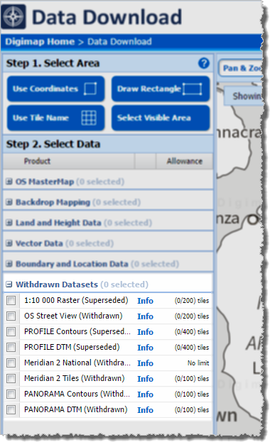
OS Download Withdrawn Datasets [click to expand]Along with the updated data, Ordnance Survey have recently withdrawn three datasets:
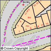
These withdrawn datasets are still available to download through the Ordnance Survey Data Download application in Digimap, but users should be aware that they are no longer updated by Ordnance Survey. Withdrawn datasets have their own separate category in the Select Data panel in OS Data Download, as shown by the image on the left hand side.
OS Roam:
Product Name
OS Publication Date
1:50,000 Colour Raster
March 2017
OS Open Map – Local (vector)
April 2017
VectorMap Local (vector)
April 2017
VectorMap District (vector)
March 2017
VectorMap Local Raster
April 2017
VectorMap District Raster
March 2017
OS Download:
Product Name
OS Publication Date
VectorMap Local Raster
April 2017
VectorMap District Raster
March 2017
VectorMap District (vector)
March 2017
OS Open Roads
October 2016 and April 2017
OS Open Map – Local (raster)
April 2017
OS Open Map – Local (vector)
April 2017
OS Terrain 5 DTM
April 2017
OS Terrain 5 Contours
April 2017
OS Open Names
April 2017
VectorMap Local (vector)
April 2017
Code-Point with Polygons
April 2017
OS Open Rivers
April 2017
Geology Download:
Product Name
BGS Publication Date
Borehole index
April 2017
The datset update pages are kept up to date with all dataset updates in the collections:
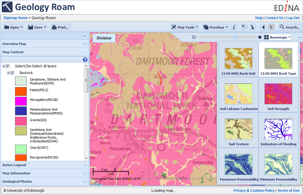
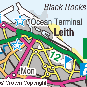
EDINA has updated Geology Roam with a whole range of new data, allowing users access to nearly all the data available from Geology Download without needing to put it into GIS software. We have also updated the Active legend, so you can now order it by the Age of the Rocks on the map.
New Data
As you can see in the image above the most zoomed out levels now have the Offshore Geology data (DigRock250 and DigSBS250) allowing you to see the rocks and sea bed sediments around the coast of the United kingdom. We have also added in the most detailed onshore geological mapping from the British Geological Survey, the 1:10,000 and 1:25,000 scale maps (DiGMapGB-10 and DiGMapGB25). Please note that these datasets do not have national coverage, where they are not present there is a water mark on the map to inform you. As there is almost no overlap between these two large scale datasets EDINA has combined them into a single detailed geology layer.
Basemaps
To allow different datasets to be viewed at the same scale we have introduced the basemaps tab so that the geology data can be switched with the scale remaining the same. Adding the basemaps tab has also allowed us to introduce new ways of viewing the same data, with all the geology layers now viewable as both the Rock Unit e.g. Kimmeridge Clay Formation and Rock Type e.g. Mudstone.
The basemaps tab has allowed many datasets to be view at the same scale so in addition to the new geological data we have also added several extra types of data which provide information about the soil and hydrogeology of Great Britain. The Geological Indicators of Flooding; Permeability (Max and Min); 1:625,000 Scale Hydrogeology; along with Soil Strength, Texture and Calcium Carbonate content from the Soil Parent Material Data are now all available as basemaps.
Active Legend
Click image to enlarge…
The final change made to the Geology Roam interface has been to the Active Legends which now allow you to order the entries by their age. The ordering is based on the MAX_INDEX attribute in the geology data that allows you to order the Rock Units based on its oldest age.
The active legend still lets you rocks on the map by clicking on the legend and vice versa.
A full list of the products available in each view / scale can be found in the Geology Roam “How To Guide” here:
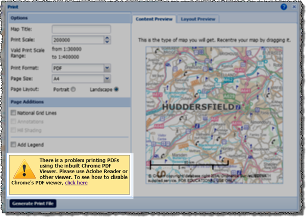
We are getting a few reports from users experiencing issues when printing PDF maps using Chrome web browser. Unfortunately, the map watermark and any semi-transparent annotations are being printed as solid filled features. We have discovered that this occurs when the PDF is viewed and printed from within the Chrome browser, using Chrome’s in built PDF plugin.
We have investigated this problem and discovered that the bug is with Chrome and occurs with all PDFs with semi-tranparent layers not just those created by Digimap. The problem only happens on Windows computers with versions of Chrome released since the end of April (Chrome 34.0.1847 onwards).
Digimap users with Chrome should see a warning when they open the Print… window, informing them about the problem.
As the alert message suggests you can disable the plug-in to prevent it from opening PDFs or you can use the following workaround.
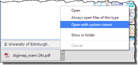
Create your printable map as normal it will appear at the bottom of your web browser.
Don’t click the file name to open the PDF, click the little arrow and choose ‘Open with system viewer’.
Providing it is installed on your machine, the map will open in Adobe Reader which will print the semi transparent layers correctly.
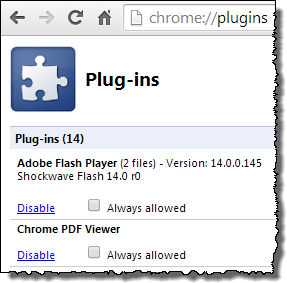
We hope that the issue is resolved by Google who develop the Chrome browser, it has been reported to them. Should you wish to disable the plug-in entirely then you can follow the instructions with the image below. You can also download the map as a file to your computer, and then open it directly with Adobe Reader, this is usually the best option anyway as it allows you to print the PDF multiple times or store it if you don’t want to print it just yet.
Type Chrome://plugins into the web address bar in chrome, this opens a list of all the plug-ins you have installed for Chrome.
Scroll down to the Chrome PDF Viewer on the Plug-ins page and click on the blue “Disable” link.
You will no longer have the option to view PDFs in the web browser.
Use this page to reactivate the plug-in if you want to reverse the change in the future.
If you need any assistance with opening your PDF map, please contact the EDINA helpdesk:
This year’s annual data update will take place at the beginning of September. There will be a refresh the following Ordnance Survey products:
MasterMap Topography and ITN Layers
VectorMap Local
Meridian2
Strategi
MiniScale
Code-Point
Code-Point with Polygons
Boundary Line
1:250,000 Colour Raster
1:50 000 Colour Raster
1:25 000 Colour Raster
1:10 000 Raster
1:50 000 Scale Gazetteer
There will also be updated Hydrospatial data in Marine Digimap and a new version of the DiGMapGB-50 data in Geology Digimap.
Along with the new data Ancient Roam will be getting the Annotation Tools and there may be a bit of a surprise bonus addition to Digimap Roam. More information will be posted on the Blog, Twitter and Facebook page nearer the time.
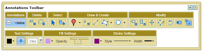
Following on from the success of the annotation tools in Digimap Roam, we have now added them to Geology Roam. The tools are the same as the one in Digimap Roam at the moment but we hope to add in a set of geology specific symbols and features in the near future.
We’d like to know what sort of annotations you’d like to put on the geology maps; perhaps a dip and strike symbol you can rotate and add a dip value to, or a borehole symbol that you can label with a depth and ID number. Please comment on this article if you have any ideas or send us an email:
Due to this work there will be some short Disruptions to all the services between 17:30 and 18:30. We hope you find the new features useful, please let us know if you have any feedback:
We have had another very busy month and so a new batch of improvements for the Digimap services will be coming soon.
Printing in Ancient Roam
At the moment downloading data or saving screen images are the only ways to use the maps available in Historic Digimap once you have logged out. Soon you will be able to create and save high quality PDF maps from Ancient Roam for use offline. We hope you will find this a much better way to get the best quality mapping out of the service.
A sample image of what a PDF from Ancient Roam may look like.
New Data in Digimap Roam
Since the arrival of the Ordnance Survey’s latest large scale product, VectorMap Local, we have been busy thinking of the best way to include it in the Digimap Roam. We have decided to use it to create four new representations available at two different scale levels.
Here is a quick look at what the four different representations might look like:
Vectormap Local- StandardVectormap Local - StreetviewVectormap Local - PlanVectormap Local - 1:10,000 Raster
We haven’t stopped there either; we are also going to add in Line Drawing style mapping to the two most zoomed in levels; for those who like their MasterMap plain and simple, similar to planning application maps.
MasterMap - Line Drawing
You will be able to select the different views from the Map Content Control Tab using a drop down list.
For more information about VectorMap Local look in the Digimap help pages as it is already available for download:
For those of you who have tried the annotation tools in Digimap Roam it will come as no surprise that we are very pleased to announce that we are now working on adding the same functionality in Geology Roam. Again the annotation tools are a first draft and will have exactly the same functionality as Digimap Roam’s tools.
Once they are released we’d really like to hear from you about which functions you use and what else you would like added. We are already hoping to add in some Geology Mapping symbols for you to add to the maps.
As an added bonus we are also putting in the measurement tools so you can measure areas and distances too, so you can tell how long a fault is or what area is covered by different rock types.