Welcome to Digimap for 2025-26!
We have some exciting updates to share for the start of the new academic year:
Society Digimap: New Census Data Available
We’ve refreshed the interface and added the most recent census data: Scotland (2022) and England & Wales (2021). This provides richer demographic and societal information for your projects and research.
Global Digimap: Updated Maps and Data
We have switched our global mapping provider from OpenStreetMap to Overture Maps. Overture is based on OpenStreetMap but is enriched with data from other sources. This means you’ll benefit from the very best open-source mapping, with a smoother user experience and data updated to March 2025.The data will be also available for download.
OS Data: New and Updated Datasets
We’ve added the new Multimodal Routing Network (MRN) data to the OS Collection, ideal for users needing detailed transport and routing information. This includes the speed data previously available under trial from Basemap.Ordnance Survey National Geographic Database (OS NGD) data has been updated to the May 2025 version, also available in the OS Collection.All other products continue to be updated according to their usual schedules.
Trials: Map Impact environmental risks data
Data from Map Impact is available for trial and testing in Pilot Digimap until December 2025. Go to Pilot Digimap >> Data Download tab >> Map Impact to download samples. The data available relates to Biodiversity, Drought Risk, Wildfire Risk, and Heat Risk. It is supplied as H3 hex grids on WGS84 (EPSG:4326) projection
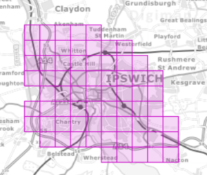
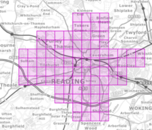
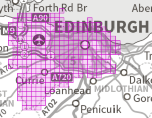
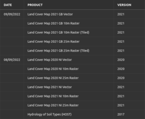
Environment Digimap: LandCoverMap 2024 data now available
The latest version of the LandCoverMap for 2024 from UKCEH is now available for download in Environment Digimap. We are working on making this available for mapping too, and hope to have this available soon.
Marine Digimap: New Shipping Forecast overlay available
Celebrating 100 years or broadcast this year, the Shipping Forecast has not only saved lives and grown as an important safety tool, but it’s also established itself as a cultural staple in UK and Republic of Ireland. Now these forecast areas can be added to maps in Marine Digimap, adding context and illustration for further research work.
Ordnance Survey data: withdrawal of OSMM Water Network announced
OS continually develop their product range and as part of this process some products are “retired” and no longer updated or made available. Digimap maintains a historical archive of data previously licensed from OS, which enables continuity of supply for research purposes. The following products have been given a withdrawal date:
- OS MasterMap Water Network Layer will be withdrawn on 31 March 2026
This will be superseded by the NGD Water Theme – Water Collection, which already exists and is available through Digimap (your institution will need to purchase a subscription to the OS NGD data). You can read the withdrawal notice on Ordnance Survey’s website.
Action Required: Licence re-agreements
All Digimap licences expired on 31 July 2025. To continue accessing Digimap you must re-agree to the licences for the collections and products your institution subscribes to from 1 August 2025.
Please note your institution may not have renewed every subscription it held for 2024/25. To re-agree to the licences, please log in to Digimap as usual and follow the prompts. Help with this is available on the help page about accepting licence terms . There are no substantive changes to the licences between last year and this.
Digimap Webinars: October 2025
We are hosting the following webinars in October 2025. For more information/to register, please visit our blog by clicking the button below.
- 8 October 2025, 13:00 BST. Verisk Land and Buildings data for the UK – Exploring Verisk land and property data in Digimap. Presented by Jeremy Thomas, Business Development Consultant and Tom Timms, Sales Director at Verisk.
- 9 October 2025, 13:00 BST. Historical Map Products in Digimap. Presented by Giles Martin, Head of Data Sales at Landmark Information Group.
If you would like to receive updates like this by email, please log in to Digimap and go to Change User Details from the My Digimap link (top right hand corner). You can leave your details the same, but check the box to say you’d like to hear from us!