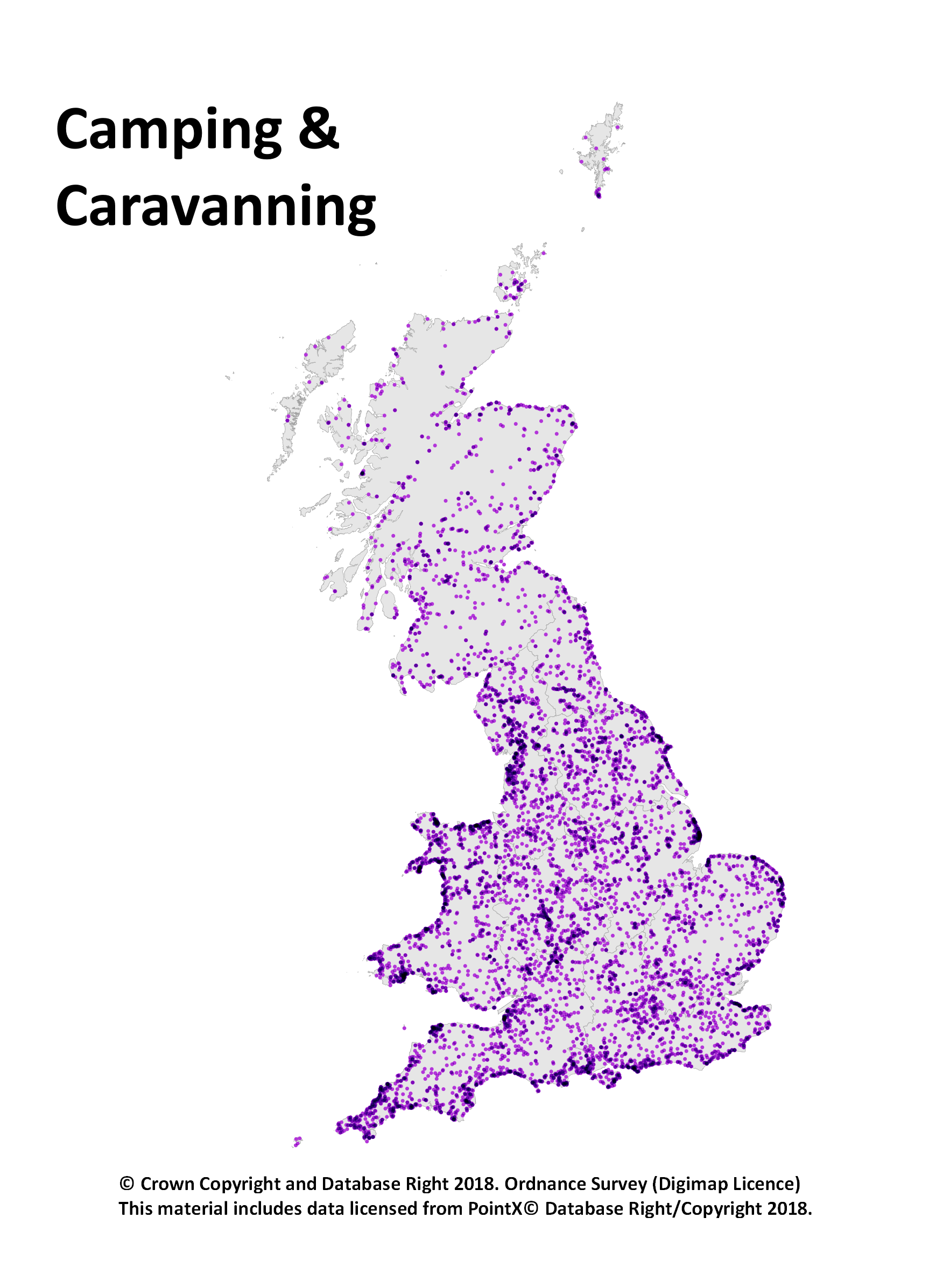
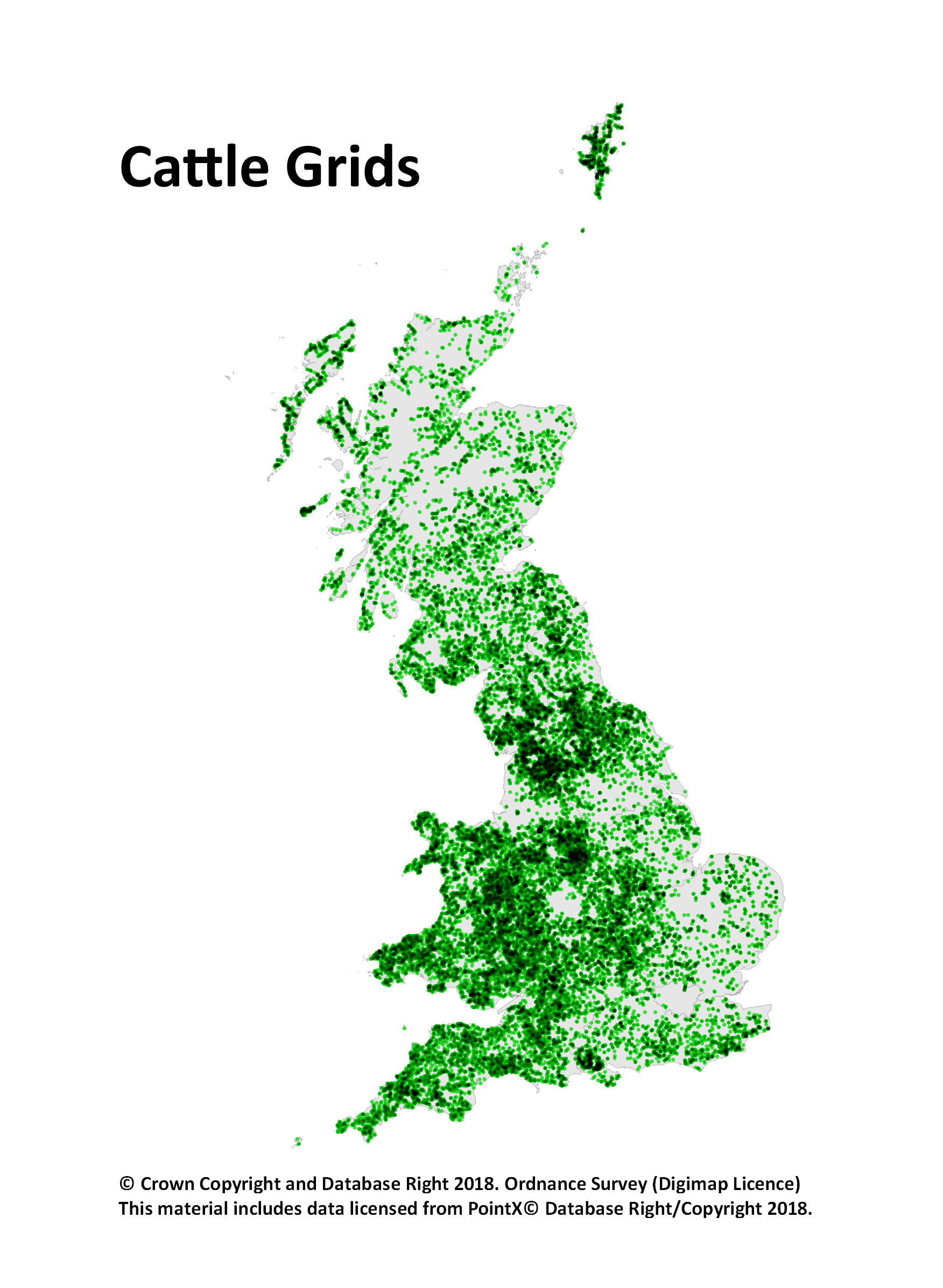
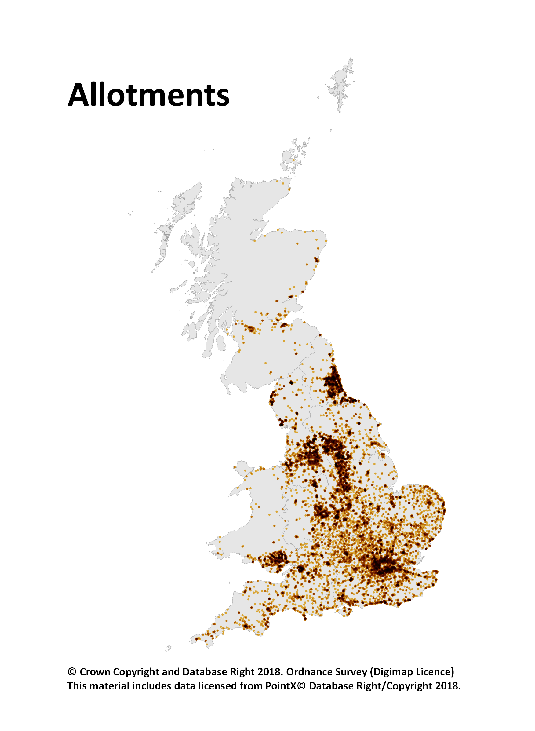
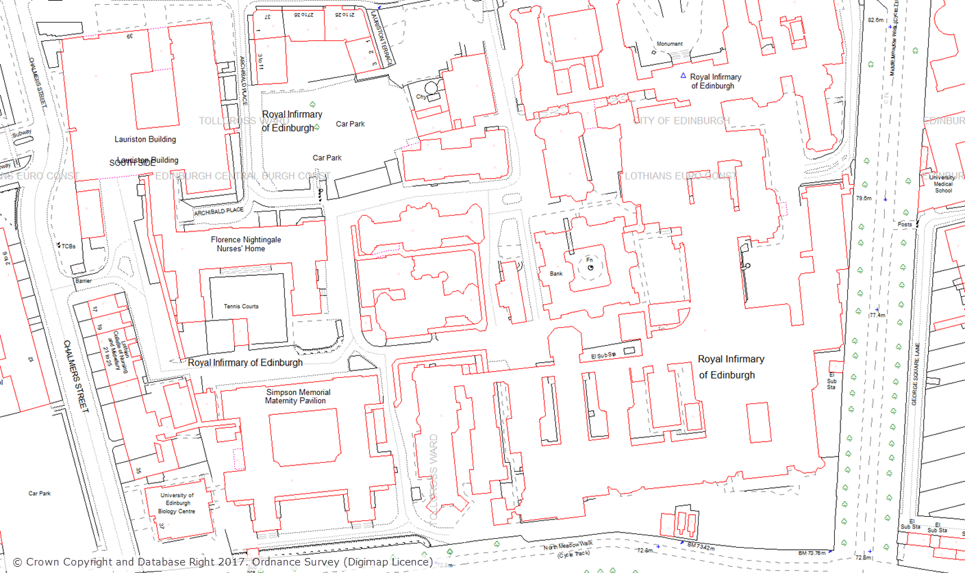
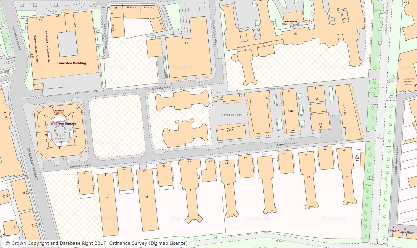
Additional vertical aerial imagery for Digimap

Night time aerial imagery of London Waterloo and the London Eye

We recently made available, through the Digimap Lidar Collection, a wealth of Vertical Aerial Imagery data captured by the Environment Agency for England.  The Environment Agency has been capturing vertical aerial imagery since 2006 on a project by project basis, so the coverage is not continuous across England. Availability grids for each year of data are available in the Lidar Download application. Data is available in some locations for multiple dates where the location has been surveyed on more than one occasion.

Some of the imagery was captured at night time giving an insight in to the effects of urban light pollution.

Data format

The data is supplied in the raster ECW (enhance compressed wavelet) format, which should be readable by most modern GIS and image processing software.  The data is tiled and tile sizes range from 1km x 1km to 5km x 5km and the resolution of the data ranges from 10cm to 50cm. There are three types of imagery available:

  • True colour – red, green, blue (RGB)
  • Near Infra-Red (NIR)
  • 4-band (RGBN)
RGBN aerial imagery of Spurn Head in Humberside

Access

Lidar download is available to all institutions that subscribe to Aerial Digimap, meaning that subscribing institutions now have access to another detailed aerial imagery dataset.

For information on subscribing to Aerial Digimap, please see the subscription page.


If you have any questions about the new data or Digimap please contact us:

  • Email: edina@ed.ac.uk

Lidar Digimap now included with Aerial Digimap

3D scene with Aerial imagery and Lidar
3D scene showing imagery with hillshading derived from the 50cm Lidar DSM. © Getmapping Plc, © Environment Agency copyright and/or database right 2016

We have now reached the end of the Lidar Digimap Preview. We hope that everyone who has used the service has found it a great way to access the Lidar data available. From now on the service will continue to be available to Digimap Users whose institution subscribes to the Aerial Digimap service.

Find out here if your institution subscribes

Lidar Point Cloud Forth Rail Bridge
Lidar Point Cloud Forth Rail Bridge. Crown copyright Scottish Government, SEPA and Scottish Water (2012).

Despite the addition of Lidar Digimap, Aerial Digimap subscription prices will not be increased for the 17/18 academic year. We will also be looking to add further datasets to Lidar Digimap over the next 12 months, these include:

  • Additional Point Cloud datasets ideal for use in CAD software for creating 3D models like this one of the Forth Rail Bridge
  • Photography; aerial images captured at the same time as the Lidar data

We’d also like to thank the hundreds of people who took the time to fill in our user feedback survey on Lidar Digimap, we have seen a huge range of uses for the data across a very broad range of disciplines. This feedback exercise has been very successful and we will be making the draw to see who has won the Amazon vouchers very soon. Keep watching the blog for the announcement in the coming weeks.

If you would like any more information about the Lidar or Aerial Digimap collections or details on how to subscribe then please do not hesitate to contact us:

  • Email: edina@ed.ac.uk


Huge Digimap Land-Line data archive (1999-2006) released

Today we have made a huge amount of archived Land-Line data available to download from Digimap. You access the data through the Data Download application in the Digimap: Ordnance Survey Collection.  Land-Line was the pre-cursor to the OS MasterMap Topography Layer, and was the most detailed topographic mapping available from Ordnance Survey at the time. The archive released consists of annual snapshots of the whole of Great Britain from 1999 to 2006. This data will be vital for researchers who are undertaking longitudinal studies,  examining how areas have changed over time.

Land-Line.Plus showing Edinburgh's Quartermile area from 1999
Land-Line.Plus showing Edinburgh’s Quartermile area from 1999
OS MasterMap showing Edinburgh's Quartermile area from 2017
OS MasterMap showing Edinburgh’s Quartermile area from 2017

The data can be found in the Withdrawn Datasets category in the Data Download interface and is currently available in its original tiles and format.

Land-Line download location

Land-Line comes on 500m, 1km and 5km tiles depending on whether the area is Urban, Rural or Moorland.  It is supplied in National Transfer Format (NTF) which was the standard format of the time. We have put together a short help page that explains how to import this data in to common GIS and CAD applications which may be of use for anyone unfamiliar with this format of data.

IMPORTANT:  Between 2001 and 2006 Ordnance Survey carried it’s Positional Accuracy Improvement (PAI) programme. This means that there will be discrepancies in the positions of features on these maps and the OS MasterMap data: Read more on PAI

The Land-Line data that we have made available significantly bolsters the amount of detailed topographic data that is available for download from Digimap. The most detailed topographic mapping currently available from Digimap, OS MasterMap Topography Layer, is available for download going back to 2007. The addition of Land-Line data to Digimap means that users now have access to download the most detailed topographic mapping data for Great Britain going back a further eight years to 1999.

We hope you find this new addition of recent historic data useful, if you have any questions about the data please contact us:

  • Email: edina@ed.ac.uk

Lidar Digimap: new collection of data available now!

Lidar
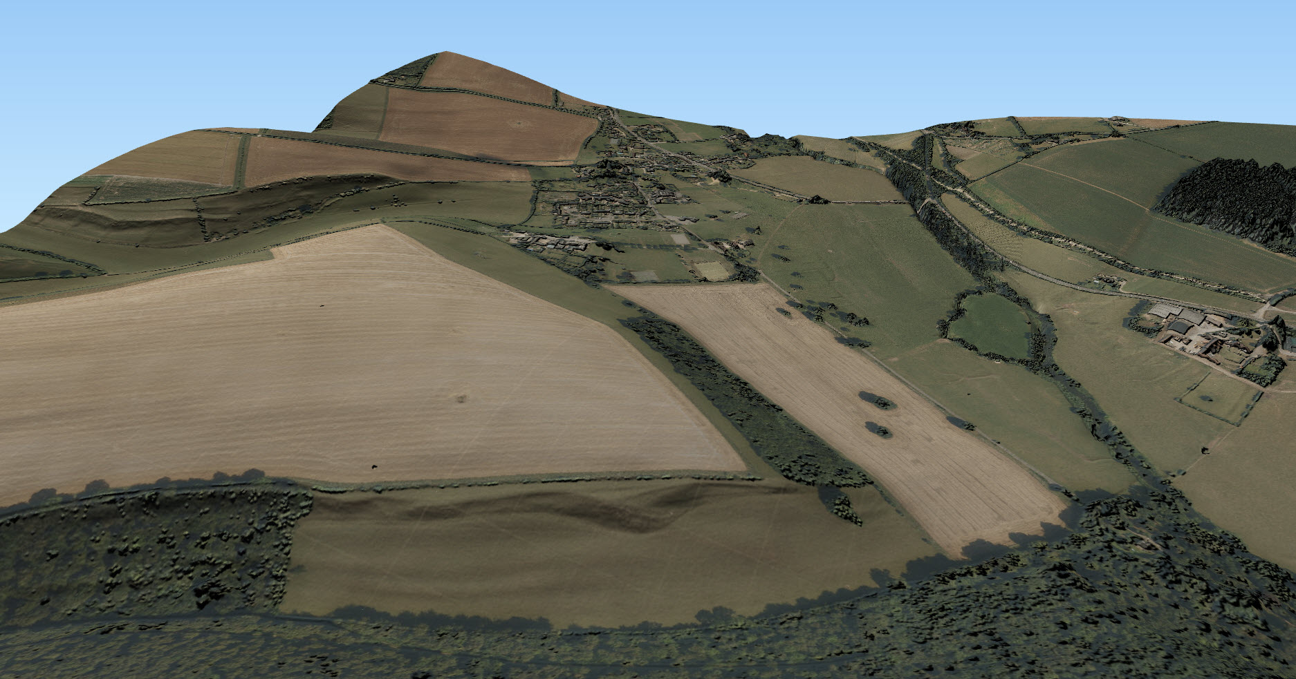
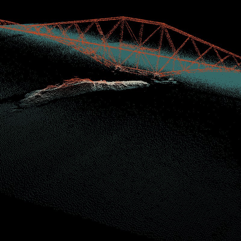
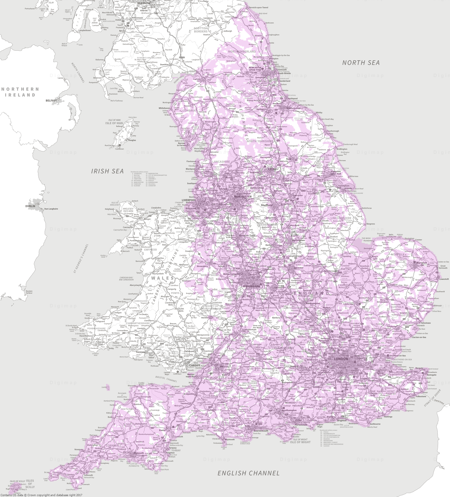
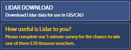
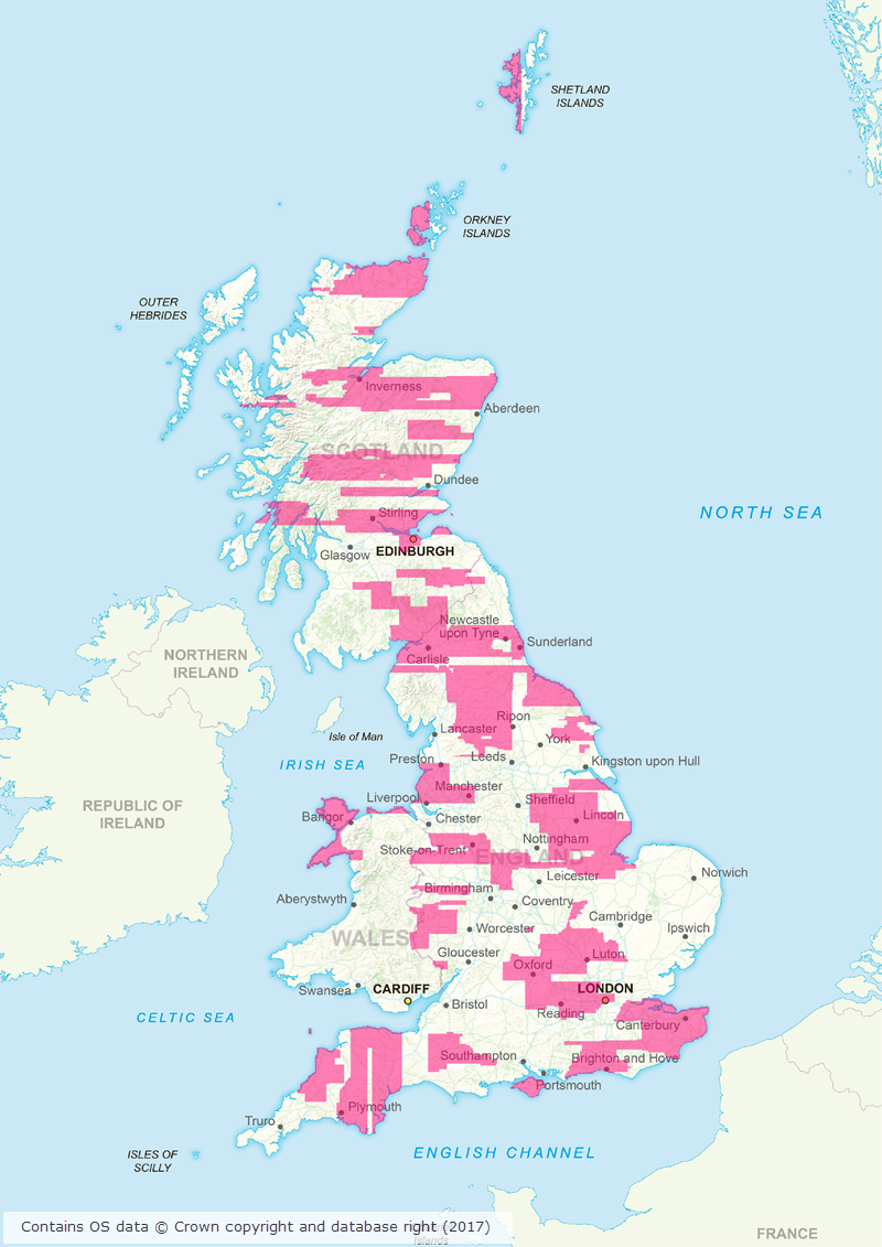
Today we have launched our new Lidar Digimap Collection. The new Collection is available to preview for all Digmap users until the 31st of July 2017. Lidar data can be downloaded through the Lidar Download for use in GIS and CAD applications; there is no Lidar Roam application for viewing the data.

Lidar Point Cloud Forth Rail Bridge
Lidar Point Cloud Forth Rail Bridge. Crown copyright Scottish Government, SEPA and Scottish Water (2014).

The service allows you to download current and past Lidar data from the Environment Agency (EA), Natural Resources Wales (NRW) and Scottish Environmental Protection Agency (SEPA).

There is already a large amount of data available in the service but we are still processing some of the datasets. Once it has all been processed the service aims to have complete coverage of all the data available from these agencies, including the raw LAS point cloud data and Orthophotography captured during the flights (where available).

Lidar data is very useful when creating 3D terrains and models as can be seen from the images to the left and below. For creating 3D scenes such as the one below, it is very useful to use a Digital Surface Model (DSM) to create a surface and hillshading from which you can drape other data over, such as the imagery from Aerial Digimap in this example:

3D scene with Aerial imagery and Lidar
3D scene showing imagery with hillshading derived from the 50cm Lidar DSM. © Getmapping Plc, © Environment Agency copyright and/or database right 2015. All rights reserved.

The following datasets are available through Lidar Digimap at present:

Dataset Availability and publication date
Digital Terrain Model and Digital Surface Model (DTM and DSM) England

  • 25cm: 2009-2015
  • 50cm: 2009-2015
  • 1m: 2010-2016
  • 2m: 2010-2015

Scotland

  • Phase 1 (1m): 2011-2012
  • Phase 2 (1m): 2013-2014

Wales

  • 25cm: 2015
  • 50cm: 2009-2016
  • 1m: 2010-2016
  • 2m: 2010-2016
Point Cloud Scotland

  • Phase 1: 2011-2012
  • Phase 2: 2013-2014


We are currently processing the following datasets and hope to have them available in the service shortly:

Dataset Availability and publication date
Digital Terrain Model and Digital Surface Model (DTM and DSM) England

  • Historical data: 1998-2015

Scotland

  • 50cm
  • 2m
Point Cloud England

  • 2005-2016
Orthophotographs England

  • 2006-2015


The data was collected for flood risk analysis and modelling and primarily follows water courses and coastal habitats. The data covers approximately 72% of England, 20% of Scotland and 70% of Wales. The image below shows the 1m resolution DTM coverage in England:

1m DTM Lidar coverage in England
1m DTM Lidar coverage in England [click to expand]
We are also very keen to know what you have been doing with Lidar data in the past or what you plan to do with the Lidar data you are going to get from the new service. To find out this information from you we have put a survey in the interface and you have the chance to win a £20 Amazon just for filling it in!

Digimap Lidar Survey

Lidar Options

We hope you like using the new Collection, if you have any questions about the data please contact us:

  • Email: edina@ed.ac.uk

Massive area of updated Aerial Imagery and other Digimap dataset updates in March/April 2017

Canworthy solar farm
Canworthy Solar Farm, which became operational in 2014 and covers approximately 55 hectares (~67 football fields)

Aerial Digimap updates

March/April 2017 has been a busy couple of months for the Data Team who have been working hard to process a huge area of updated aerial imagery data from the data supplier, Getmapping. The update consists of around 80,000 individual 1km tiles, all captured in 2015, which is approximately 30% of the country.

Prior to the update just over 50% of the data was from 2013 or later; after the update 77% of the data is from 2013 or later.

This means that more up to date imagery is now available for viewing and download through Aerial Digimap for a significant proportion of the country.

The map below shows the approximate distribution of the updated data.

2015 update to Aerial Digimap data
Click on map to view larger version

This is the first update we have received from Getmapping, but we are expecting another update later this year containing imagery captured in 2016.

Cruise liner in Firth of Forth
Cruise liner in the Firth of Forth

We will add this to the service as quickly as we can to ensure that the most up to date data is always available to Aerial Digimap users. In order to make it clear where the data has been updated, we will add an Availability/Reference Grid to Aerial Download so that users can easily identify if the imagery has been updated in their study area(s). This grid will be added to the system in the next couple of weeks.

We are still investigating the best way to make previous versions of the data available, but in the mean time only the most recent data is available through Aerial Roam and Aerial Download.


Webinar resources

We recently ran a webinar highlighting the data and showcasing a number of potential uses for the imagery. The webinar was recorded in full and is available on our YouTube channel. The slides used during the webinar and a transcript of all questions and answers are available on our help page.

3D model using Aerial Imagery, OS Terrain 5 DTM and MasterMap Building Height Attribute

Data information

The aerial imagery data in the service is 25cm resolution vertical aerial orthophotography supplied by Getmapping PLC, and is the most detailed aerial imagery available for the whole of Great Britain. As well as being a really interesting dataset the imagery also has a number of practical uses across a wide range of disciplines from urban planning and 3D modelling to land use and archaeological studies.

Subscribing

To see if your institution already subscribes to Aerial Digimap, please see our subscribing institutions help page. Information on how to subscribe to the new service is available on the Aerial Digimap Subscription page.

If you have any questions about the service please consult the dedicated Aerial Digimap help pages or contact the Digimap support team using the details below.


Dataset updates in Ordnance Survey Digimap

OS Data Download:

Product Name OS Publication Date
Code-Point February 2017
1:25,000 Colour Raster March 2017
1:50,000 Colour Raster March 2017
Points of Interest March 2017


OS Roam:

Product Name OS Publication Date
1:25,000 Colour Raster March 2017


The OS data update page is kept up to date with all dataset updates in the collections.

If you have any questions about the dataset updates or Digimap please contact us:

  • Phone: 0131 650 3302
  • Email: edina@ed.ac.uk

Meridian 2 data on the move

meridian withdrawl

In March 2017 Ordnance Survey withdrew the Meridian 2 dataset from their portfolio.  It remains available within Digimap, but has moved within the Data Download application from Vector Data to the Withdrawn Datasets category.

Both national and tiled coverages are still available here.  Documentation about this dataset can also be found in the help pages: Meridian 2 Data


Aerial Digimap: huge area of new images coming soon!

Aerial imageryAerial Digimap was only launched at the end of last year but the response from the Digimap Community has been amazing. The service already has thousands of active users who have created hundreds of thousands of screen maps. Users have downloaded tens of thousands of square kilometres of this data, for use directly in reports or GIS and CAD software.


Data updates

Whilst we’re excited to see such a high level of usage of the new service, behind the scenes our Data Team are currently processing the 2015 data which will be available in the service early next month. This is the first update we have received from the data supplier, Getmapping, and contains updates to around 80,000 tiles. This is a significant update as it covers roughly 30% of the country providing more up to date imagery for a large proportion of Great Britain. The map below shows the likely distribution of the updated 2015 data.

2015 update to Aerial Digimap data
Click on map to view larger version

Webinar resources

We recently ran a webinar highlighting the data and showcasing a number of potential uses for the imagery. The webinar was recorded in full and is available on our YouTube channel. The slides used during the webinar and a transcript of all questions and answers are available on our help page.

3D model using Aerial Imagery, OS Terrain 5 DTM and MasterMap Building Height Attribute


Data information

The aerial imagery data in the service is 25cm resolution vertical aerial imagery supplied by Getmapping PLC, and is the most detailed aerial imagery available for the whole of Great Britain. As well as being a really interesting dataset the imagery also has a number of practical uses across a wide range of disciplines from urban planning and 3D modelling to land use and archaeological studies.


Subscribing

To see if your institution already subscribes to Aerial Digimap, please see our subscribing institutions help page. Information on how to subscribe to the new service is available on the Aerial Digimap Subscription page.

If you have any questions about the service please consult the dedicated Aerial Digimap help pages or contact the Digimap support team using the details below.

  • Phone: 0131 650 3302
  • Email: edina@ed.ac.uk

Digimap dataset updates: January-February 2017

We have updated a number of key datasets in Jan/Feb 2017 in the Ordnance Survey collection of Digimap. These updates bring the datasets available from Digimap inline with the latest versions published by Ordnance Survey. Of particular note are the updates to the two most detailed mapping products available from Ordnance Survey: OS MasterMap Topography Layer and OS VectorMap Local.

OS VectorMap Local showing Westminster
OS MasterMap Topography Layer showing Westminster

OS Data Download:

Product Name OS Publication Date
Integrated Transport Network (ITN) Layer December 2016
OS MasterMap Topography Layer December 2016
OS MasterMap Water Network Layer January 2017
OS VectorMap Local January 2017
OS VectorMap Local Raster January 2017
MiniScale January 2017
OS Terrain 5 Contours January 2017
OS Terrain 5 DTM January 2017
OS Open Names January 2017
Code-Point with polygons January 2017
Code-Point Open February 2017


OS Roam:

Product Name OS Publication Date
OS MasterMap Topography Layer December 2016
OS VectorMap Local Jan 2017
OS VectorMap Local Raster Jan 2017
MiniScale January 2017


The OS data update page is kept up to date with all dataset updates in the collections.

If you have any questions about the dataset updates or Digimap please contact us:

  • Phone: 0131 650 3302
  • Email: edina@ed.ac.uk

Digimap dataset updates: December 2016

The tables below list the datasets that were updated in December 2016 and at the very start of January 2017. The most significant change is the addition of OS Open Map – Local to Roam, which was covered in an earlier blog post. The other updates bring the data available up to date with the most recent versions published by Ordnance Survey.


Cold Christmas, 1:25,000 Colour Raster

OS Data Download:

Product Name OS Publication Date
1:25,000 Colour Raster December 2016
1:50,000 Colour Raster December 2016
Points of Interest December 2016


OS Roam:

Product Name OS Publication Date
OS Open Map – Local December 2016
1:25,000 Colour Raster December 2016
1:50,000 Colour Raster December 2016
OS VectorMap District September 2016


The OS data update page is kept up to date with all dataset updates in the collections.

If you have any questions about the dataset updates or Digimap please contact us:

  • Phone: 0131 650 3302
  • Email: edina@ed.ac.uk

OS Open Map Local added to Roam

OS Open Map – Local (OML) was recently added to the Digimap Roam application, giving users the ability to create maps online with a detailed, vector open dataset. OML is the most detailed vector mapping product available from Ordnance Survey as Open Data. We have added this dataset to the following map views in Digimap Roam:

Map View Default Print Scale
Neighbourhood View 1:10,000
Street View 1:5,000
Detailed View 1:2,500

The dataset is rich in features and includes detailed building outlines and Car Charging Points, which are sourced from the National Charge Registry.

OS Open Map - Local showing Coventry City Centre
OS Open Map – Local showing Coventry City Centre

Ordnance Survey first released OML as a beta product in March 2015 and Digimap users have been able to download this dataset via the Data Download application since April 2015. The October 2016 release of OML marks the end of the beta period and provides the first main version of the dataset.

OML is intended to be used as a detailed basemap on which to visualise your own data and is designed to be an alternative to OS Street View, which will be withdrawn in March 2017 by Ordnance Survey.

The cartography team at Digimap have worked hard to implement a consistent style with that of the smaller scale VectorMap District product, ensuring a familiar look and feel between the two Open Data products. Contours from the OS Terrain 50 product are included when viewing the data in Roam, to give greater context especially in rural and hilly areas.

OS Open Map - Local showing Canary Wharf
OS Open Map – Local showing Canary Wharf

Further information on the new dataset can be found on the Digimap help page or the Ordnance Survey website. We hope you like the new data, if you have any questions about the dataset or Digimap please contact us:

  • Phone: 0131 650 3302
  • Email: edina@ed.ac.uk