Any views expressed within media held on this service are those of the contributors, should not be taken as approved or endorsed by the University, and do not necessarily reflect the views of the University in respect of any particular issue.
Digimap is an online map and data delivery service, available by subscription to UK Higher and Further Education establishments. Operated by EDINA at the University of Edinburgh, Digimap offers a number of data collections, including Ordnance Survey, historical, geological, aerial photography, LiDAR, marine maps, land cover mapping, global mapping and census data. For more information about Digimap go to our website: https://digimap.edina.ac.uk Background image Contains OS data (c) Crown Copyright and database right 2022
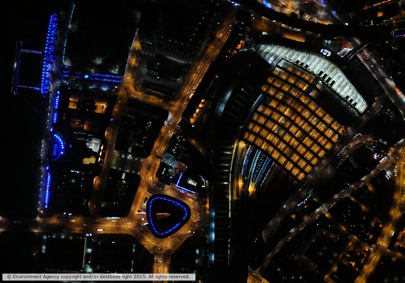
Night time aerial imagery of London Waterloo and the London Eye
We recently made available, through the Digimap Lidar Collection, a wealth of Vertical Aerial Imagery data captured by the Environment Agency for England. The Environment Agency has been capturing vertical aerial imagery since 2006 on a project by project basis, so the coverage is not continuous across England. Availability grids for each year of data are available in the Lidar Download application. Data is available in some locations for multiple dates where the location has been surveyed on more than one occasion.
Some of the imagery was captured at night time giving an insight in to the effects of urban light pollution.
Data format
The data is supplied in the raster ECW (enhance compressed wavelet) format, which should be readable by most modern GIS and image processing software. The data is tiled and tile sizes range from 1km x 1km to 5km x 5km and the resolution of the data ranges from 10cm to 50cm. There are three types of imagery available:
True colour – red, green, blue (RGB)
Near Infra-Red (NIR)
4-band (RGBN)
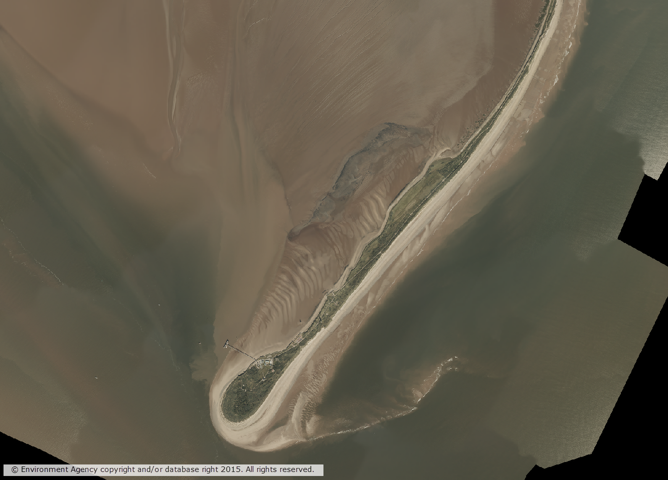
RGBN aerial imagery of Spurn Head in Humberside
Access
Lidar download is available to all institutions that subscribe to Aerial Digimap, meaning that subscribing institutions now have access to another detailed aerial imagery dataset.
For information on subscribing to Aerial Digimap, please see the subscription page.
If you have any questions about the new data or Digimap please contact us:
Today we have launched our new Lidar Digimap Collection. The new Collection is available to preview for all Digmap users until the 31st of July 2017. Lidar data can be downloaded through the Lidar Download for use in GIS and CAD applications; there is no Lidar Roam application for viewing the data.
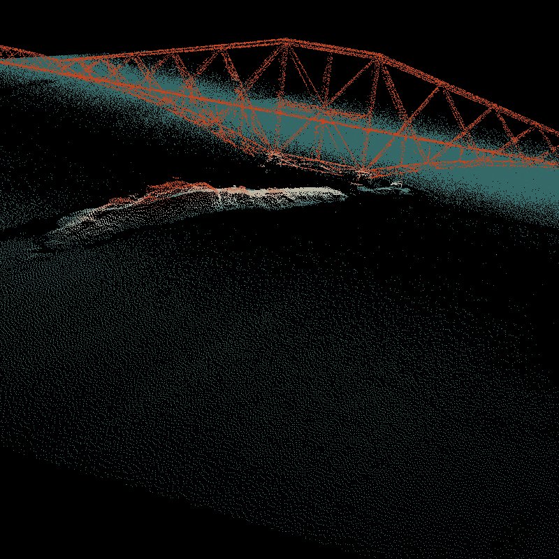
Lidar Point Cloud Forth Rail Bridge. Crown copyright Scottish Government, SEPA and Scottish Water (2014).
The service allows you to download current and past Lidar data from the Environment Agency (EA), Natural Resources Wales (NRW) and Scottish Environmental Protection Agency (SEPA).
There is already a large amount of data available in the service but we are still processing some of the datasets. Once it has all been processed the service aims to have complete coverage of all the data available from these agencies, including the raw LAS point cloud data and Orthophotography captured during the flights (where available).
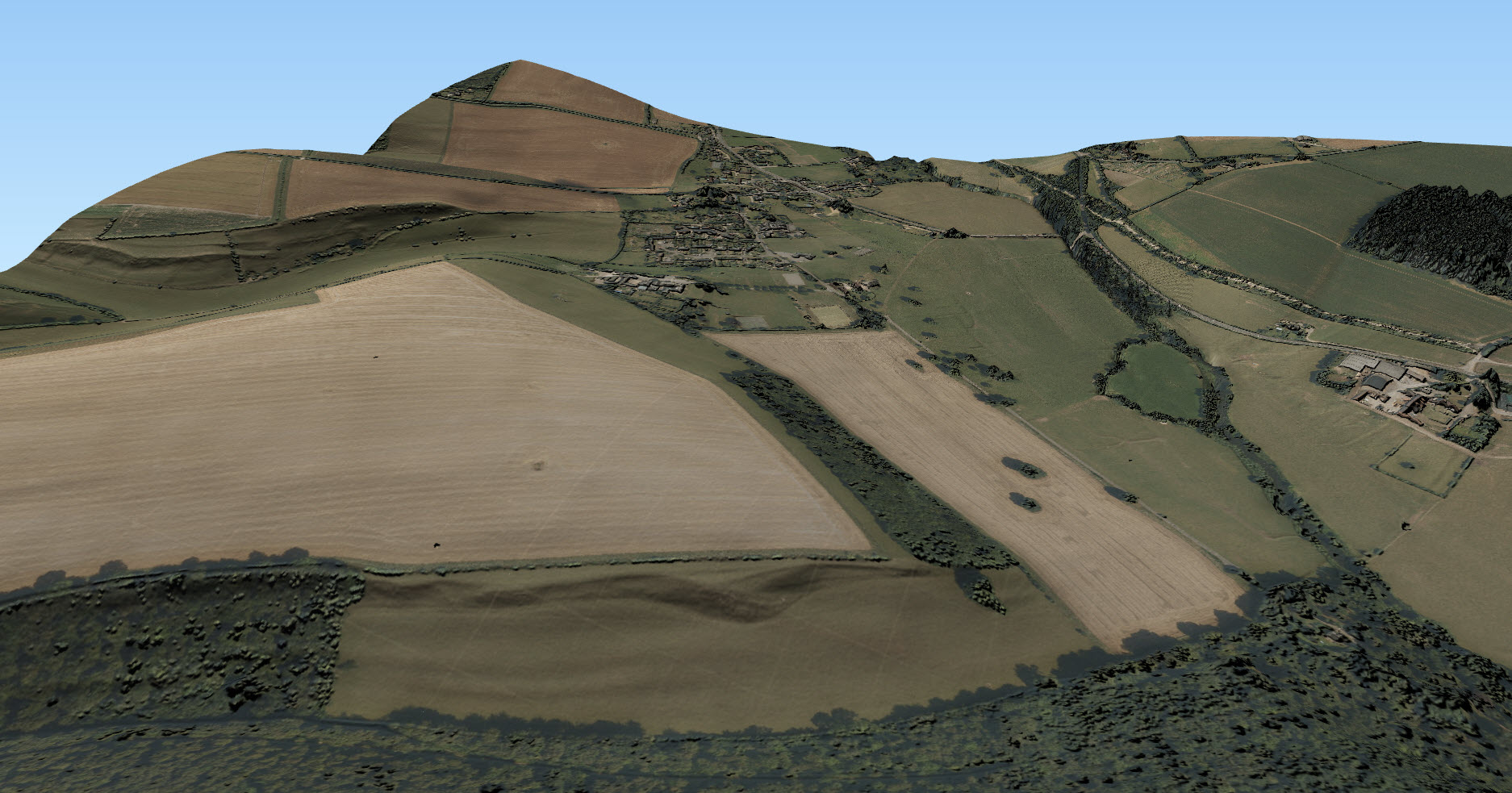
Lidar data is very useful when creating 3D terrains and models as can be seen from the images to the left and below. For creating 3D scenes such as the one below, it is very useful to use a Digital Surface Model (DSM) to create a surface and hillshading from which you can drape other data over, such as the imagery from Aerial Digimap in this example:
The following datasets are available through Lidar Digimap at present:
Dataset
Availability and publication date
Digital Terrain Model and Digital Surface Model (DTM and DSM)
England
25cm: 2009-2015
50cm: 2009-2015
1m: 2010-2016
2m: 2010-2015
Scotland
Phase 1 (1m): 2011-2012
Phase 2 (1m): 2013-2014
Wales
25cm: 2015
50cm: 2009-2016
1m: 2010-2016
2m: 2010-2016
Point Cloud
Scotland
Phase 1: 2011-2012
Phase 2: 2013-2014
We are currently processing the following datasets and hope to have them available in the service shortly:
Dataset
Availability and publication date
Digital Terrain Model and Digital Surface Model (DTM and DSM)
England
Historical data: 1998-2015
Scotland
50cm
2m
Point Cloud
England
2005-2016
Orthophotographs
England
2006-2015
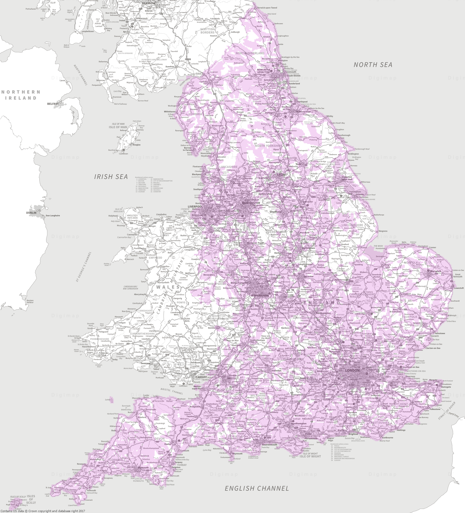
The data was collected for flood risk analysis and modelling and primarily follows water courses and coastal habitats. The data covers approximately 72% of England, 20% of Scotland and 70% of Wales. The image below shows the 1m resolution DTM coverage in England:
1m DTM Lidar coverage in England [click to expand]We are also very keen to know what you have been doing with Lidar data in the past or what you plan to do with the Lidar data you are going to get from the new service. To find out this information from you we have put a survey in the interface and you have the chance to win a £20 Amazon just for filling it in!

 Today we have launched our new Lidar Digimap Collection. The new Collection is available to preview for all Digmap users until the 31st of July 2017. Lidar data can be downloaded through the Lidar Download for use in GIS and CAD applications; there is no Lidar Roam application for viewing the data.