Updating Roam: 17 May 2018

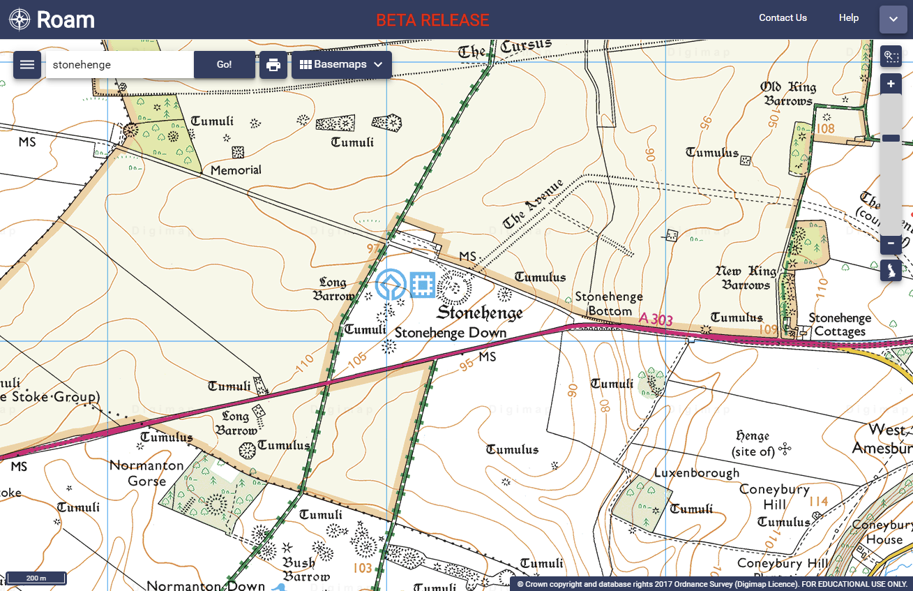
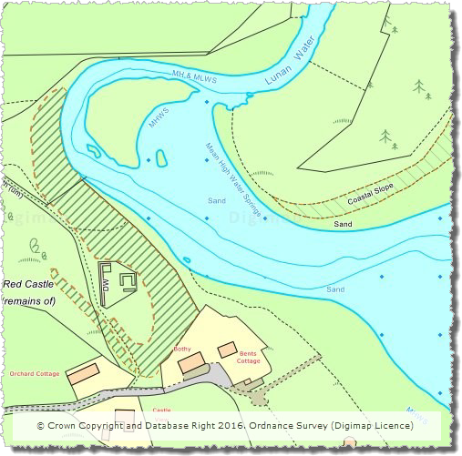
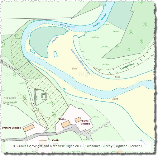
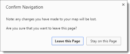
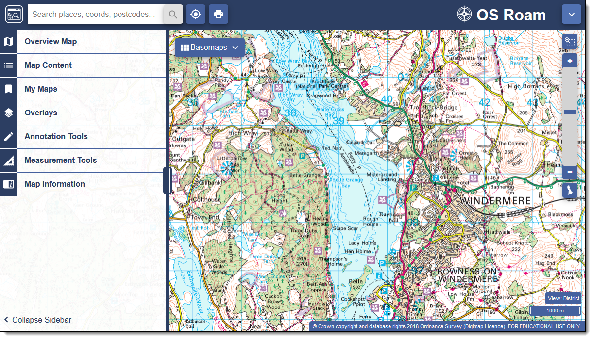
EDINA is very pleased to announce that Digimap Roam will be updated on Thursday 17th May 2018 to the new version currently available as beta. This change will apply to all Digimap Collections.  The beta version has been available since November 2017 and as a result of feedback we have continued to improve it, adding some useful new features:

  • A “locate me” button – puts a pin on the map according to your current location
  • A “coordinate capture” tool – under Map Information, allows you to click a point and copy/paste the coordinates into other applications
  • A Variable width side panel to offer a larger map window

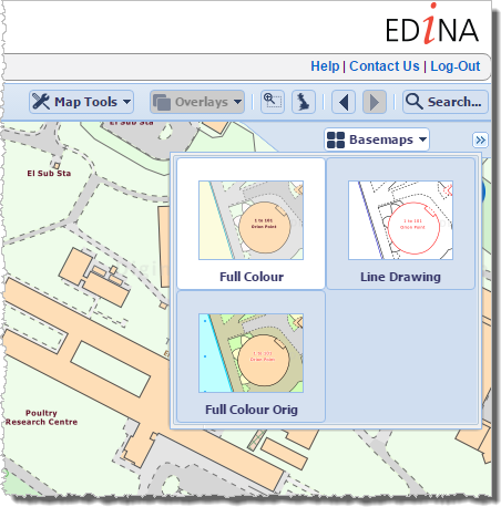
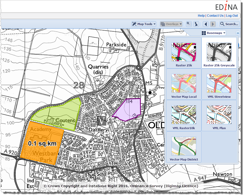
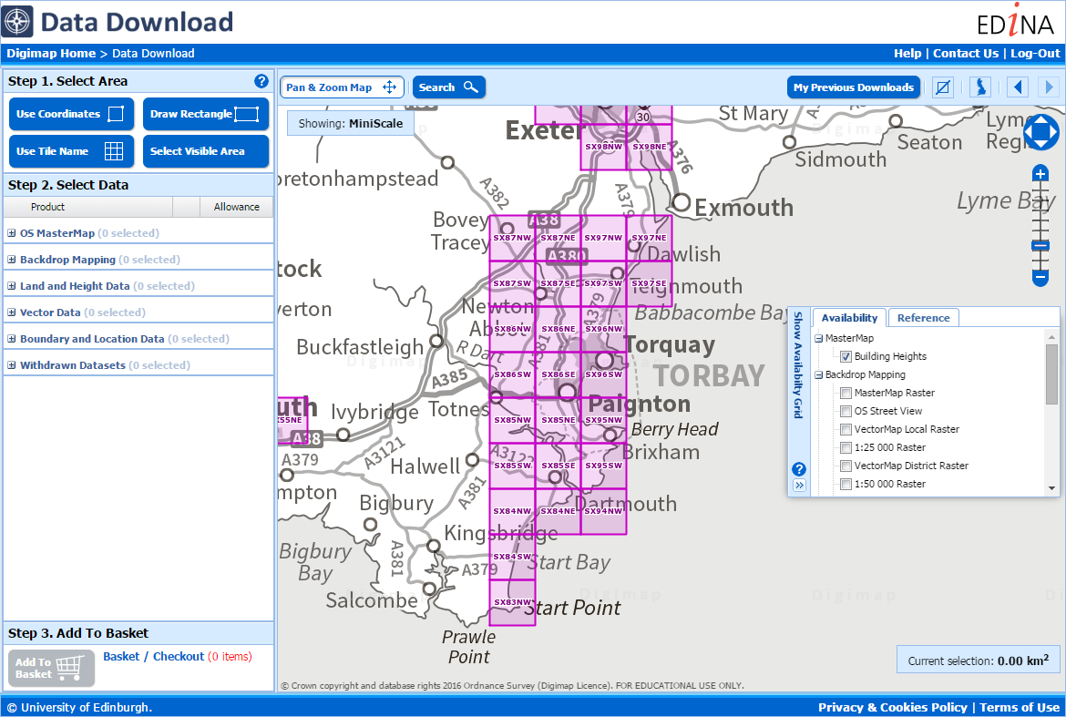
We are very excited about the new Roam, which has a fresher feel and a more modern look; it’s tablet-friendly with tools that are easier to find and use.  All the main functions are located in the top left hand area, with a pull-out side panel ensuring maximum visibility of the map.

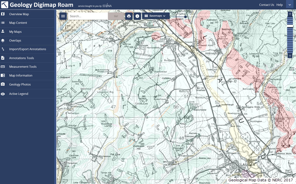
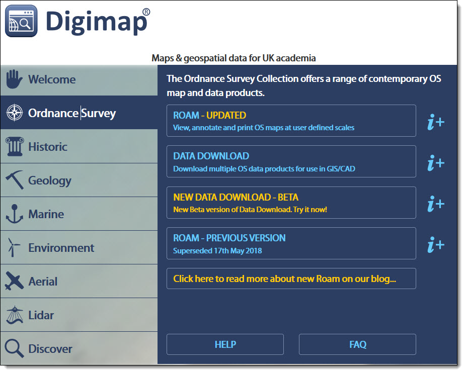
The new version of Roam will appear at the top of the list of applications in each Collection and will be labelled “Updated”. The previous version for each Collection will still be available until 31st July 2018:

We will be running a webinar about the new version of Roam on Wednesday 23 May from 1- 2pm. You can register for this here http://edina.ac.uk/training-and-events. Places are limited, but the webinar will be recorded and available to view later on our YouTube channel. Help pages for the new version of Roam will also be available.

As ever, we welcome feedback on Digimap. Please don’t hesitate to get in touch using any of our social media channels or use our email address or telephone number:

Beta version of OS Roam now available

On 3rd October 2017, we released a Beta version of a new Roam mapping client for Digimap’s Ordnance Survey Collection.  OS Roam – Beta is available next to the existing version, simply log in to the Digimap service and select Ordnance Survey Collection to view the new beta version:

OS Roam - Beta

Whilst the functionality remains the same, we hope you agree that the look and feel of the interface is more modern. The majority of functions are available from a new menu panel down the left hand side, which is hidden by default, maximising the area available for the main map element.

There are some issues we are aware of in this version, which we are working on, for example, some elements can be slow using Internet Explorer and Edge.

New versions of the Roam applications in all other collections will be available in due course. Both new and old versions will run side by side for an extended period of time to give users the opportunity to get used to the new interface.

We would encourage you to try the beta version and we welcome any feedback you have.

  • Email: edina@ed.ac.uk

Coming soon: New Roam for Digimap

As mentioned at Geoforum earlier this year, we’re currently working hard on a new version of Digimap Roam. The new-look application will bring Digimap Roam, the online mapping tool in the Digimap family, bang up to date with the latest web technologies available. Whilst the functionality will remain the same, the look and feel of the interface will be more modern. The majority of functions will be available from a new menu panel down the left hand side which is hidden by default maximising the area available for the main map element. By utilising the latest technologies we will be able to add new functionality and make further enhancements to the application in the future.

The new interface makes further improvements to the experience on mobile devices, an area where we’re seeing an increase in usage across the service. A mock up of how the new Geology Roam interface might look is included below to give you an idea of the proposed layout and styling:

Mockup of the new Geology Roam interface

Currently we are on target to launch the new interface early in the first semester of the 2017-2018 academic year, but we will post progress updates on this blog as the new interface approaches completion. There will be a phased release with the new Roam applications with the Ordnance Survey Collection being first in line.

We appreciate that you may have teaching or lecture materials that may require updating as a result of this change in interface, so we will run all the existing Roam applications alongside the new versions so you can get up to speed with the new interface whilst the existing versions are still available. At the moment we anticipate running both versions in each Collection side by side until at least the end of the year. During this period we would welcome any comments and feedback that you may have.

As ever, if you have any questions about the new Roam, please do not hesitate to contact us.

Massive area of updated Aerial Imagery and other Digimap dataset updates in March/April 2017

Canworthy solar farm
Canworthy Solar Farm, which became operational in 2014 and covers approximately 55 hectares (~67 football fields)

Aerial Digimap updates

March/April 2017 has been a busy couple of months for the Data Team who have been working hard to process a huge area of updated aerial imagery data from the data supplier, Getmapping. The update consists of around 80,000 individual 1km tiles, all captured in 2015, which is approximately 30% of the country.

Prior to the update just over 50% of the data was from 2013 or later; after the update 77% of the data is from 2013 or later.

This means that more up to date imagery is now available for viewing and download through Aerial Digimap for a significant proportion of the country.

The map below shows the approximate distribution of the updated data.

2015 update to Aerial Digimap data
Click on map to view larger version

This is the first update we have received from Getmapping, but we are expecting another update later this year containing imagery captured in 2016.

Cruise liner in Firth of Forth
Cruise liner in the Firth of Forth

We will add this to the service as quickly as we can to ensure that the most up to date data is always available to Aerial Digimap users. In order to make it clear where the data has been updated, we will add an Availability/Reference Grid to Aerial Download so that users can easily identify if the imagery has been updated in their study area(s). This grid will be added to the system in the next couple of weeks.

We are still investigating the best way to make previous versions of the data available, but in the mean time only the most recent data is available through Aerial Roam and Aerial Download.


Webinar resources

We recently ran a webinar highlighting the data and showcasing a number of potential uses for the imagery. The webinar was recorded in full and is available on our YouTube channel. The slides used during the webinar and a transcript of all questions and answers are available on our help page.

3D model using Aerial Imagery, OS Terrain 5 DTM and MasterMap Building Height Attribute

Data information

The aerial imagery data in the service is 25cm resolution vertical aerial orthophotography supplied by Getmapping PLC, and is the most detailed aerial imagery available for the whole of Great Britain. As well as being a really interesting dataset the imagery also has a number of practical uses across a wide range of disciplines from urban planning and 3D modelling to land use and archaeological studies.

Subscribing

To see if your institution already subscribes to Aerial Digimap, please see our subscribing institutions help page. Information on how to subscribe to the new service is available on the Aerial Digimap Subscription page.

If you have any questions about the service please consult the dedicated Aerial Digimap help pages or contact the Digimap support team using the details below.


Dataset updates in Ordnance Survey Digimap

OS Data Download:

Product Name OS Publication Date
Code-Point February 2017
1:25,000 Colour Raster March 2017
1:50,000 Colour Raster March 2017
Points of Interest March 2017


OS Roam:

Product Name OS Publication Date
1:25,000 Colour Raster March 2017


The OS data update page is kept up to date with all dataset updates in the collections.

If you have any questions about the dataset updates or Digimap please contact us:

  • Phone: 0131 650 3302
  • Email: edina@ed.ac.uk

Digimap dataset updates: January-February 2017

We have updated a number of key datasets in Jan/Feb 2017 in the Ordnance Survey collection of Digimap. These updates bring the datasets available from Digimap inline with the latest versions published by Ordnance Survey. Of particular note are the updates to the two most detailed mapping products available from Ordnance Survey: OS MasterMap Topography Layer and OS VectorMap Local.

OS VectorMap Local showing Westminster
OS MasterMap Topography Layer showing Westminster

OS Data Download:

Product Name OS Publication Date
Integrated Transport Network (ITN) Layer December 2016
OS MasterMap Topography Layer December 2016
OS MasterMap Water Network Layer January 2017
OS VectorMap Local January 2017
OS VectorMap Local Raster January 2017
MiniScale January 2017
OS Terrain 5 Contours January 2017
OS Terrain 5 DTM January 2017
OS Open Names January 2017
Code-Point with polygons January 2017
Code-Point Open February 2017


OS Roam:

Product Name OS Publication Date
OS MasterMap Topography Layer December 2016
OS VectorMap Local Jan 2017
OS VectorMap Local Raster Jan 2017
MiniScale January 2017


The OS data update page is kept up to date with all dataset updates in the collections.

If you have any questions about the dataset updates or Digimap please contact us:

  • Phone: 0131 650 3302
  • Email: edina@ed.ac.uk

OS Open Map Local added to Roam

OS Open Map – Local (OML) was recently added to the Digimap Roam application, giving users the ability to create maps online with a detailed, vector open dataset. OML is the most detailed vector mapping product available from Ordnance Survey as Open Data. We have added this dataset to the following map views in Digimap Roam:

Map View Default Print Scale
Neighbourhood View 1:10,000
Street View 1:5,000
Detailed View 1:2,500

The dataset is rich in features and includes detailed building outlines and Car Charging Points, which are sourced from the National Charge Registry.

OS Open Map - Local showing Coventry City Centre
OS Open Map – Local showing Coventry City Centre

Ordnance Survey first released OML as a beta product in March 2015 and Digimap users have been able to download this dataset via the Data Download application since April 2015. The October 2016 release of OML marks the end of the beta period and provides the first main version of the dataset.

OML is intended to be used as a detailed basemap on which to visualise your own data and is designed to be an alternative to OS Street View, which will be withdrawn in March 2017 by Ordnance Survey.

The cartography team at Digimap have worked hard to implement a consistent style with that of the smaller scale VectorMap District product, ensuring a familiar look and feel between the two Open Data products. Contours from the OS Terrain 50 product are included when viewing the data in Roam, to give greater context especially in rural and hilly areas.

OS Open Map - Local showing Canary Wharf
OS Open Map – Local showing Canary Wharf

Further information on the new dataset can be found on the Digimap help page or the Ordnance Survey website. We hope you like the new data, if you have any questions about the dataset or Digimap please contact us:

  • Phone: 0131 650 3302
  • Email: edina@ed.ac.uk

Digimap dataset updates October 2016

A number of datasets were updated last month in both the Ordnance Survey and Geology collections. In the Ordnance Survey Collection we also added the new OS MasterMap Highways Network to the service. The screen grab below shows the detail included in the Highways Network; there will be a separate blog post about this dataset shortly.

OS MasterMap Highways Network with OS MasterMap Topography Layer
OS MasterMap Highways Network with OS MasterMap Topography Layer (raster version)

The tables below list the datasets that were updated.


OS Data Download:

Product Name OS Publication Date
Points of Interest September 2016
OS VectorMap District Raster September 2016
OS VectorMap District September 2016
Boundary-Line October 2016
OS MasterMap Topography Layer – Raster (1:1,000 and 1:2,000) June 2016
OS Open Rivers October 2016
OS Integrated Transport Network Layer Urban Paths Theme July 2016
OS Open Names October 2016
Code-Point with Polygons October 2016
OS MasterMap Highways Network June 2016


OS Roam:

Product Name OS Publication Date
OS VectorMap District Raster September 2016


Geology Download:

Product Name BGS Publication Date
Onshore Borehole Index October 2016


The OS data update and Geology data update pages are kept up to date with all dataset updates in the collections.

If you have any questions about the dataset updates or Digimap please contact us:

  • Phone: 0131 650 3302
  • Email: edina@ed.ac.uk

New MasterMap style in OS Roam

This summer our cartographic team have been busy working on a new style for OS MasterMap Topography layer. These are the maps displayed at the three most detailed zoom levels in Digimap OS Roam. The original style, created more than ten years ago, followed the official style published by Ordnance Survey and has undergone little change since its creation. Later this year Ordnance Survey are making significant changes to the underlying MasterMap data so we thought it was high time the cartography was refreshed to give it a more modern feel.

The design brief had three broad requirements:

  • make it look ‘nicer’!
  • tone down the colours to allow annotations to stand out more
  • use the same colours as OS VectorMap Local, the second most detailed data product

The images below show the original and new styling for a number of areas which highlight the improvements that have been made in both urban and rural areas.

Changes to styling in urban areas:

MasterMap urban original stylingMasterMap urban new styling

The colours in urban areas have been muted, removing the large areas of yellow and making ‘unclassified’ land appear with hatching rather than as blank areas on the map.

Improvements in text styling:

MasterMap original text stylingMasterMap updated text styling

Text labels have been updated to emphasise building names and reduce the size of the labels for named urban areas.

Updated rural styling:

MasterMap original rural stylingMasterMap updated rural styling

Styling in rural areas with mixed land use is a challenge as there are multiple types which need to be conveyed to the user. We have increased the number of shades of green and improved the symbol spacing and placement in order to improve the appearance of these areas. Additionally we have changed the fill colour for tracks allowing them to be more easily distinguished from paved roads.

Updated foreshore styling:

MasterMap original foreshore stylingMasterMap updated foreshore styling

Foreshore areas now display using the yellow ‘sand’ colour, making them far easier to visualise.

We hope you like the new style, however the original style can still be accessed from the Basemap menu in OS Roam:

OS Roam MasterMap basemap options


If you have any questions about the updates or Digimap please contact us:

  • Phone: 0131 650 3302
  • Email: edina@ed.ac.uk

Dataset updates Summer 2016

A number of datasets available through the Ordnance Survey collection in Digimap have been updated over the summer as show in the tables below.

OS Data Download:

Product Name OS Publication Date
OS MasterMap Topography Layer June 2016
OS VectorMap Local Raster July 2016
OS Terrain 5 (DTM) July 2016
OS Terrain 5 (Contours) July 2016
OS Open Names July 2016
Points of Interest June 2016
Code-Point with Polygons July 2016
Code-Point August2016
Code-Point Open August2016


OS Roam:

Product Name OS Publication Date
OS MasterMap Topography Layer June 2016


The data product updates help page is kept up to date with all dataset updates in the Ordnance Survey collection.

If you have any questions about the dataset updates or Digimap please contact us:

  • Phone: 0131 650 3302
  • Email: edina@ed.ac.uk

Improvements to Digimap February/March 2016

Last week (3rd March) we released a new version of Digimap which includes a number of changes that may be of interest to our growing user base. Our set-up allows us to release new versions without requiring any downtime so the recent changes are highlighted below as they may not be obvious at first glance.

Greyscale versions of the 1:25,000 Colour Raster and 1:50,000 Colour Raster have been added to OS Roam

We have added greyscale versions of the 1:25,000 Colour Raster and 1:50,000 Colour Raster products in the Roam client of the Ordnance Survey Collection. These can be selected using the Basemaps drop-down.

Greyscale 1:25,000 Colour Raster with annotations

The new greyscale versions make it much easier to see your annotations on top of the basemap. The greyscale versions can be saved and printed like all other basemaps available in OS Roam.

Warning about losing changes in all Roam clients

If you customise a map in one of the Roam clients, for example by modifying the layers that are displayed or by creating annotations on the map, then press the browsers back button or navigate away from Roam you will now see a warning prompt advising you that you may lose your changes. The prompt that is displayed in Chrome is shown below:

Confirm navigation

The prompt is not displayed if you have saved the map, printed the map, or exported the annotations.

Updates to the Open/Save wording in all Roam clients

We have updated the text on the Open and Save menus in all Roam clients to make it clearer what each option does:

Roam Open drop down

Open > Saved maps allows you to open any maps you have previously created and saved within Roam.

Open > Import annotations is where you go to import external datasets in to Roam (we currently support the import of datasets in Shapefile, KML, GPX, CSV, and GeoJSON formats).


Roam Save drop down

Save > Save map will save the current map extents along with any annotations to Digimap for retrieval at a later date.

Save > Export annotations allows you to export annotations from Roam as an external dataset for use GIS/CAD (we currently support the export of datasets in Shapefile, KML, and GeoJSON formats).


Background mapping in Data Download of all Collections is now shown in greyscale

The background mapping data in all Data Download clients has been converted to greyscale:

OS Data Download

This makes it much easier to see the availability and reference grids in these applications.

Further improvements

We hope you enjoy using these new features. We are continually improving the service so if you have any suggestions for improvements to the service please get in touch:

  • Phone: 0131 650 3302
  • Email: edina@ed.ac.uk