
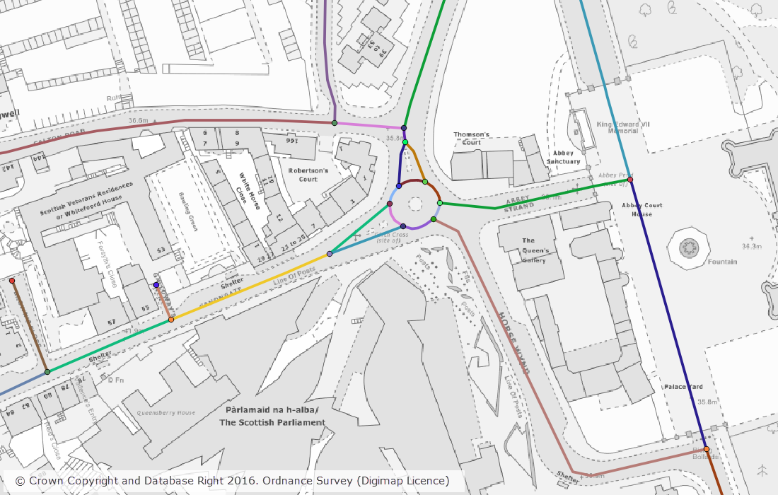
A number of datasets were updated last month in both the Ordnance Survey and Geology collections. In the Ordnance Survey Collection we also added the new OS MasterMap Highways Network to the service. The screen grab below shows the detail included in the Highways Network; there will be a separate blog post about this dataset shortly.
The tables below list the datasets that were updated.
OS Data Download:
| Product Name | OS Publication Date |
| Points of Interest | September 2016 |
| OS VectorMap District Raster | September 2016 |
| OS VectorMap District | September 2016 |
| Boundary-Line | October 2016 |
| OS MasterMap Topography Layer – Raster (1:1,000 and 1:2,000) | June 2016 |
| OS Open Rivers | October 2016 |
| OS Integrated Transport Network Layer Urban Paths Theme | July 2016 |
| OS Open Names | October 2016 |
| Code-Point with Polygons | October 2016 |
| OS MasterMap Highways Network | June 2016 |
OS Roam:
| Product Name | OS Publication Date |
| OS VectorMap District Raster | September 2016 |
Geology Download:
| Product Name | BGS Publication Date |
| Onshore Borehole Index | October 2016 |
The OS data update and Geology data update pages are kept up to date with all dataset updates in the collections.
If you have any questions about the dataset updates or Digimap please contact us:
- Phone: 0131 650 3302
- Email: edina@ed.ac.uk
Digimap dataset updates October 2016 / by ecls is licensed under a Creative Commons Attribution CC BY 3.0