Any views expressed within media held on this service are those of the contributors, should not be taken as approved or endorsed by the University, and do not necessarily reflect the views of the University in respect of any particular issue.
Digimap is an online map and data delivery service, available by subscription to UK Higher and Further Education establishments. Operated by EDINA at the University of Edinburgh, Digimap offers a number of data collections, including Ordnance Survey, historical, geological, aerial photography, LiDAR, marine maps, land cover mapping, global mapping and census data. For more information about Digimap go to our website: https://digimap.edina.ac.uk Background image Contains OS data (c) Crown Copyright and database right 2022
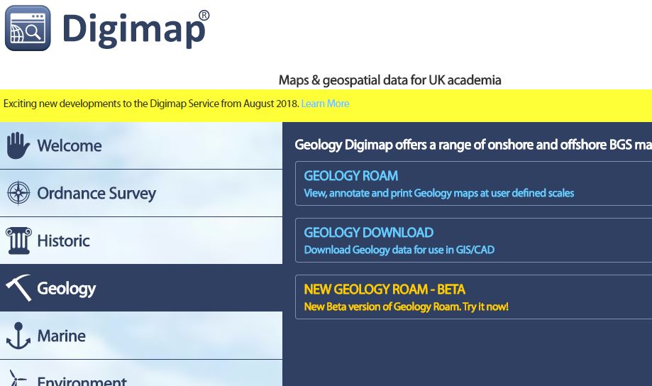
On 30th November 2017, we released Beta versions of our new Roam mapping application for all Digimap Collections. Log in to Digimap and click on each Collection to find the link to each new Roam:
The functionality of the new application remains the same, but we hope you agree that the updated look is easier to use.
Most importantly, BOTH versions of Roam (new and old) will run in parallel for an extended period of time to give users the opportunity to get used to the new interface. We will review this at the beginning of March 2018 with a view to establishing a date for withdrawal of the old application.
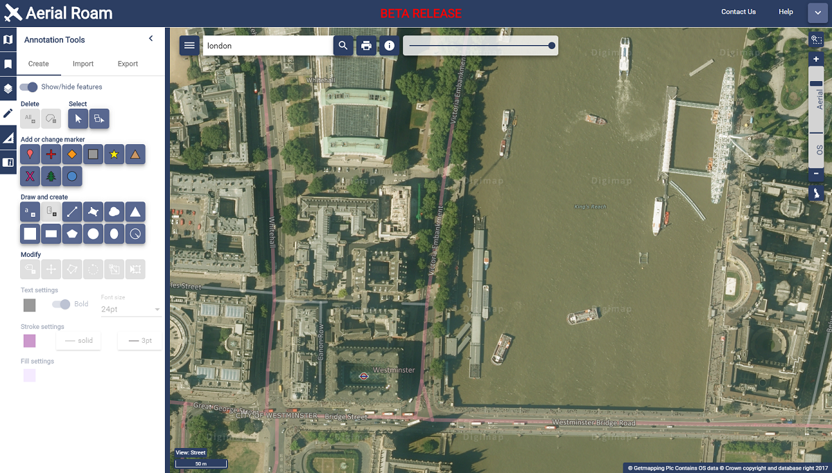
New Aerial Roam showing the London Eye
Known Issues
All applications have undergone thorough testing, but there are still a few issues that we working on, for example some elements can be slow using Internet Explorer. If you spot anything that is not behaving correctly, please report this to us.
We encourage you to try the new beta versions and we welcome any feedback you have.
As mentioned at Geoforum earlier this year, we’re currently working hard on a new version of Digimap Roam. The new-look application will bring Digimap Roam, the online mapping tool in the Digimap family, bang up to date with the latest web technologies available. Whilst the functionality will remain the same, the look and feel of the interface will be more modern. The majority of functions will be available from a new menu panel down the left hand side which is hidden by default maximising the area available for the main map element. By utilising the latest technologies we will be able to add new functionality and make further enhancements to the application in the future.
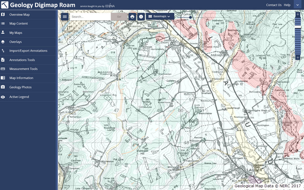
The new interface makes further improvements to the experience on mobile devices, an area where we’re seeing an increase in usage across the service. A mock up of how the new Geology Roam interface might look is included below to give you an idea of the proposed layout and styling:
Mockup of the new Geology Roam interface
Currently we are on target to launch the new interface early in the first semester of the 2017-2018 academic year, but we will post progress updates on this blog as the new interface approaches completion. There will be a phased release with the new Roam applications with the Ordnance Survey Collection being first in line.
We appreciate that you may have teaching or lecture materials that may require updating as a result of this change in interface, so we will run all the existing Roam applications alongside the new versions so you can get up to speed with the new interface whilst the existing versions are still available. At the moment we anticipate running both versions in each Collection side by side until at least the end of the year. During this period we would welcome any comments and feedback that you may have.
As ever, if you have any questions about the new Roam, please do not hesitate to contact us.
Aerial Digimap was only launched at the end of last year but the response from the Digimap Community has been amazing. The service already has thousands of active users who have created hundreds of thousands of screen maps. Users have downloaded tens of thousands of square kilometres of this data, for use directly in reports or GIS and CAD software.
Data updates
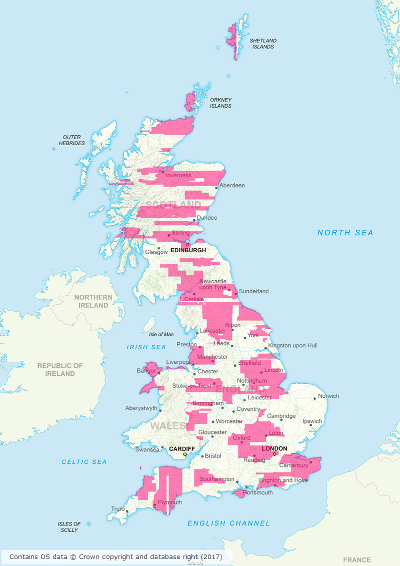
Whilst we’re excited to see such a high level of usage of the new service, behind the scenes our Data Team are currently processing the 2015 data which will be available in the service early next month. This is the first update we have received from the data supplier, Getmapping, and contains updates to around 80,000 tiles. This is a significant update as it covers roughly 30% of the country providing more up to date imagery for a large proportion of Great Britain. The map below shows the likely distribution of the updated 2015 data.
Click on map to view larger version
Webinar resources
We recently ran a webinar highlighting the data and showcasing a number of potential uses for the imagery. The webinar was recorded in full and is available on our YouTube channel. The slides used during the webinar and a transcript of all questions and answers are available on our help page.
3D model using Aerial Imagery, OS Terrain 5 DTM and MasterMap Building Height Attribute
Data information
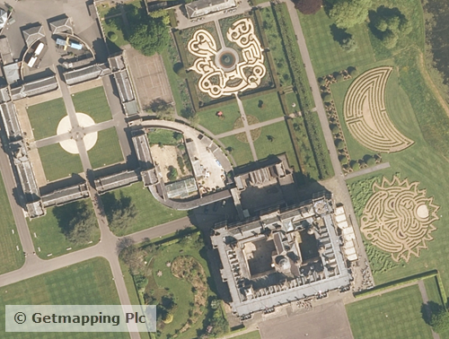
The aerial imagery data in the service is 25cm resolution vertical aerial imagery supplied by Getmapping PLC, and is the most detailed aerial imagery available for the whole of Great Britain. As well as being a really interesting dataset the imagery also has a number of practical uses across a wide range of disciplines from urban planning and 3D modelling to land use and archaeological studies.
Subscribing
To see if your institution already subscribes to Aerial Digimap, please see our subscribing institutions help page. Information on how to subscribe to the new service is available on the Aerial Digimap Subscription page.
If you have any questions about the service please consult the dedicated Aerial Digimap help pages or contact the Digimap support team using the details below.
EDINA will be running a free webinar about Aerial Digimap on Wednesday 25th January at 13:00 – 13:30pm.
Please join us to learn more about Aerial Digimap and the benefits the data can bring to research, teaching and education. The webinar is free, but you will need to register (see link below). Places on the webinar are limited with only 100 available, so book now to secure your place.
In the webinar you will hear about the new Digimap Aerial Collection launched in October 2016. We will give you a guided tour of the new Aerial Roam application explaining the data and functionality available.
You can read more about the Aerial Digimap service in this previous blog post: