Aerial Imagery Data available by Year

You can now search and download the imagery data from Aerial Digimap by the year it was flown.

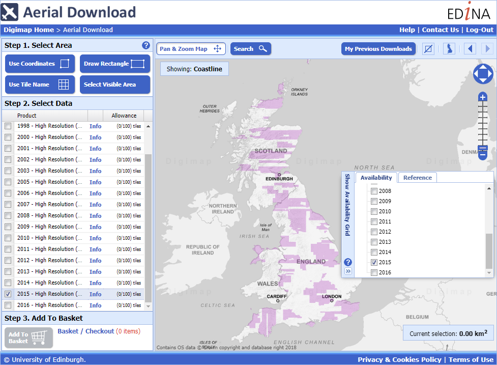
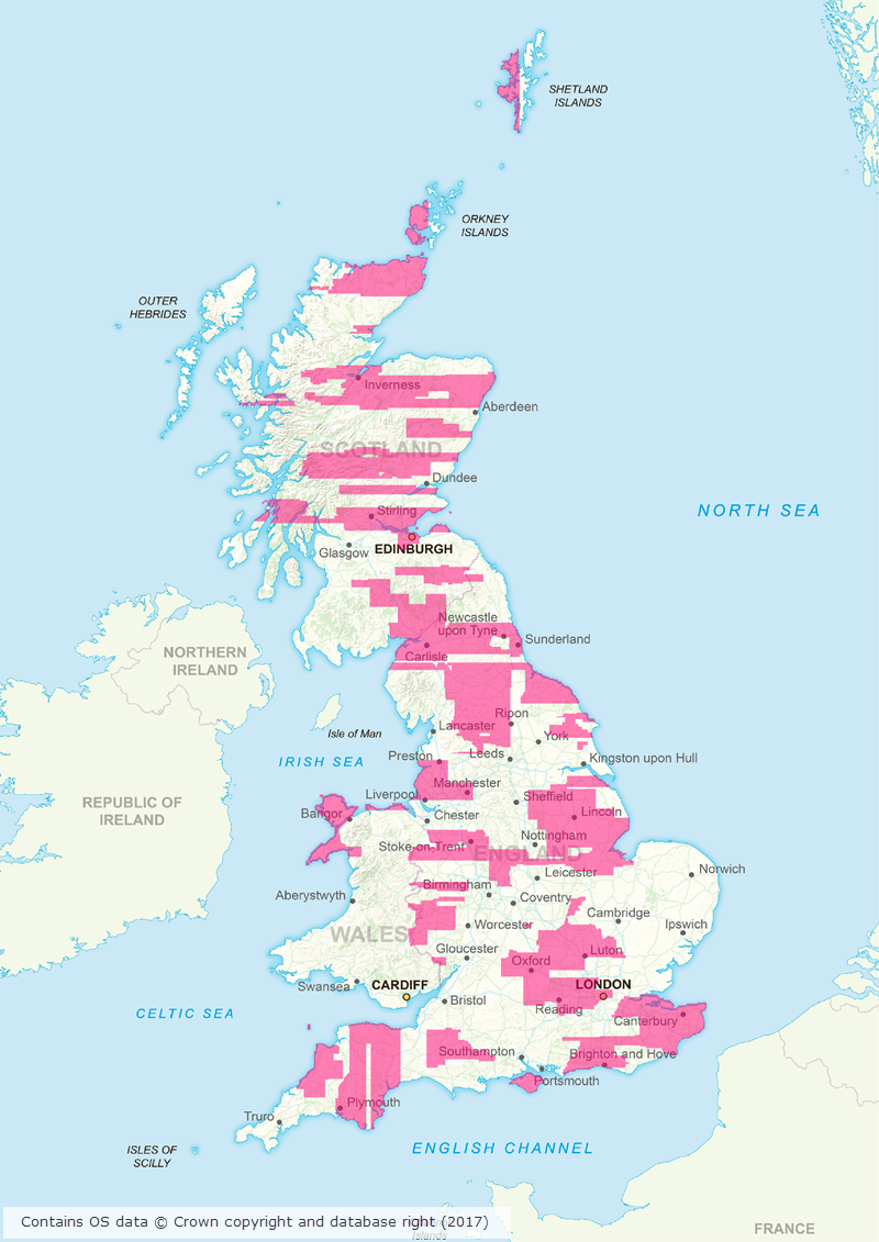
This allows you to be sure that you are downloading only the latest data, but it also allows you to download multiple images for the same location taken on different dates. We currently have data from 1998 through to 2016, with more English and Welsh images coming for 2016. When you are in Aerial Download you can see the extents of each year using the Show Availability Grid tool on the right side of the map as shown in the image above.

There is a table below detailing how many 1x1km images there are for each year, with the majority coming from 2013 to 2016, but some of the older images will be very useful to compare to the newer ones where they overlap:

Year Number of Images
1998 165
2000 855
2001 891
2002 75
2003 11
2005 423
2006 4,620
2007 7,799
2008 5,757
2009 25,066
2010 35,607
2011 18,642
2012 16,619
2013 54,534
2014 71,404
2015 81,378
2016 18,769


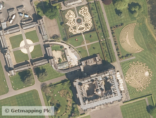
Here are two images of Lerwick taken 8 years apart:

Lerwick 2008 from Aerial Digimap
Lerwick 2008 from Aerial Digimap.
Lerwick 2016 from Aerial Digimap
Lerwick 2016 from Aerial Digimap.

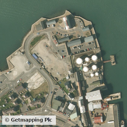
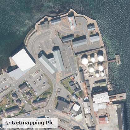
As you can see there has been construction in the West of the area with new buildings and car parks added.

We hope that you find the ability to make this sort of comparison useful for your research. If you have any questions about this or any other aspects of the Digimap service then please don’t hesitate to contact us.

  • Email: edina@ed.ac.uk
  • Phone: 0131 650 3302

Aerial Digimap: huge area of new images coming soon!

Aerial imageryAerial Digimap was only launched at the end of last year but the response from the Digimap Community has been amazing. The service already has thousands of active users who have created hundreds of thousands of screen maps. Users have downloaded tens of thousands of square kilometres of this data, for use directly in reports or GIS and CAD software.


Data updates

Whilst we’re excited to see such a high level of usage of the new service, behind the scenes our Data Team are currently processing the 2015 data which will be available in the service early next month. This is the first update we have received from the data supplier, Getmapping, and contains updates to around 80,000 tiles. This is a significant update as it covers roughly 30% of the country providing more up to date imagery for a large proportion of Great Britain. The map below shows the likely distribution of the updated 2015 data.

2015 update to Aerial Digimap data
Click on map to view larger version

Webinar resources

We recently ran a webinar highlighting the data and showcasing a number of potential uses for the imagery. The webinar was recorded in full and is available on our YouTube channel. The slides used during the webinar and a transcript of all questions and answers are available on our help page.

3D model using Aerial Imagery, OS Terrain 5 DTM and MasterMap Building Height Attribute


Data information

The aerial imagery data in the service is 25cm resolution vertical aerial imagery supplied by Getmapping PLC, and is the most detailed aerial imagery available for the whole of Great Britain. As well as being a really interesting dataset the imagery also has a number of practical uses across a wide range of disciplines from urban planning and 3D modelling to land use and archaeological studies.


Subscribing

To see if your institution already subscribes to Aerial Digimap, please see our subscribing institutions help page. Information on how to subscribe to the new service is available on the Aerial Digimap Subscription page.

If you have any questions about the service please consult the dedicated Aerial Digimap help pages or contact the Digimap support team using the details below.

  • Phone: 0131 650 3302
  • Email: edina@ed.ac.uk

Free Aerial Digimap Webinar: 25th January 2017

Aerial imagery: giraffes at Chester Zoo
Aerial imagery: Giraffes at Chester Zoo

EDINA will be running a free webinar about Aerial Digimap on Wednesday 25th January at 13:00 – 13:30pm.

Please join us to learn more about Aerial Digimap and the benefits the data can bring to research, teaching and education. The webinar is free, but you will need to register (see link below). Places on the webinar are limited with only 100 available, so book now to secure your place.

Register here:

https://attendee.gotowebinar.com/register/7136525734914725378

Land Use
Aerial imagery: A solar farm in Wiltshire

In the webinar you will hear about the new Digimap Aerial Collection launched in October 2016.  We will give you a guided tour of the new Aerial Roam application explaining the data and functionality available.

You can read more about the Aerial Digimap service in this previous blog post:

Aerial Digimap – open for subscriptions