Improvements to Digimap February/March 2016

Last week (3rd March) we released a new version of Digimap which includes a number of changes that may be of interest to our growing user base. Our set-up allows us to release new versions without requiring any downtime so the recent changes are highlighted below as they may not be obvious at first glance.

Greyscale versions of the 1:25,000 Colour Raster and 1:50,000 Colour Raster have been added to OS Roam

We have added greyscale versions of the 1:25,000 Colour Raster and 1:50,000 Colour Raster products in the Roam client of the Ordnance Survey Collection. These can be selected using the Basemaps drop-down.

Greyscale 1:25,000 Colour Raster with annotations

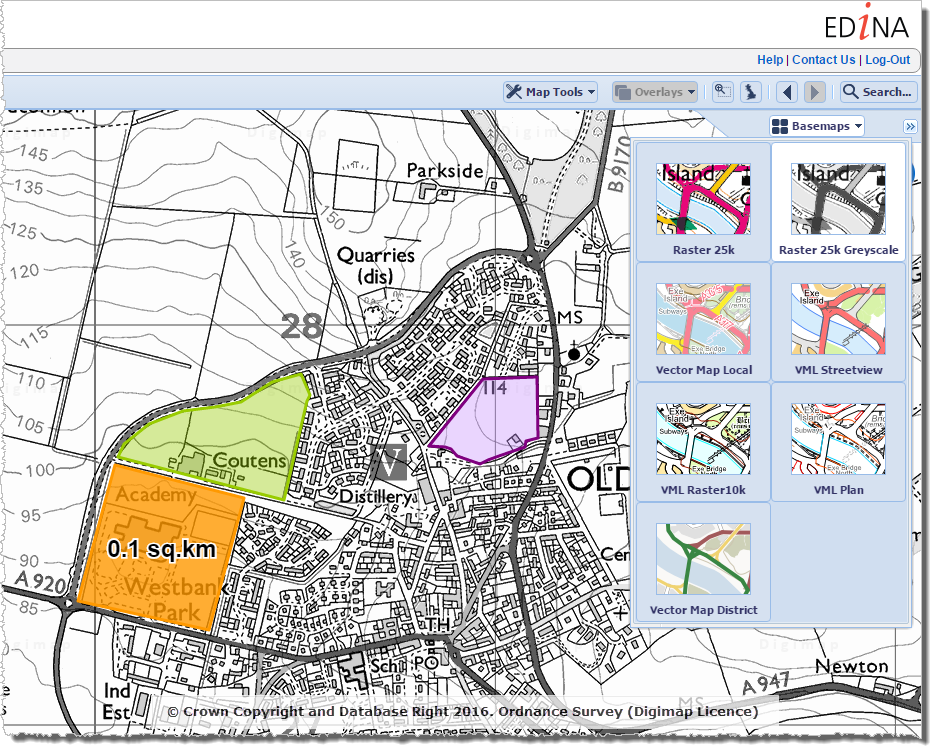
The new greyscale versions make it much easier to see your annotations on top of the basemap. The greyscale versions can be saved and printed like all other basemaps available in OS Roam.

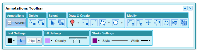
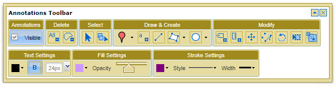
Warning about losing changes in all Roam clients

If you customise a map in one of the Roam clients, for example by modifying the layers that are displayed or by creating annotations on the map, then press the browsers back button or navigate away from Roam you will now see a warning prompt advising you that you may lose your changes. The prompt that is displayed in Chrome is shown below:

Confirm navigation

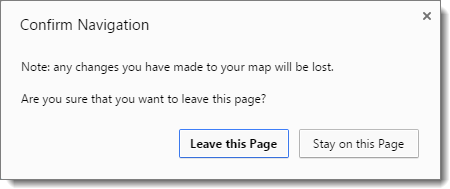
The prompt is not displayed if you have saved the map, printed the map, or exported the annotations.

Updates to the Open/Save wording in all Roam clients

We have updated the text on the Open and Save menus in all Roam clients to make it clearer what each option does:

Roam Open drop down

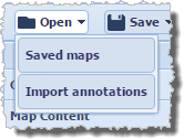
Open > Saved maps allows you to open any maps you have previously created and saved within Roam.

Open > Import annotations is where you go to import external datasets in to Roam (we currently support the import of datasets in Shapefile, KML, GPX, CSV, and GeoJSON formats).


Roam Save drop down

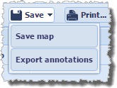
Save > Save map will save the current map extents along with any annotations to Digimap for retrieval at a later date.

Save > Export annotations allows you to export annotations from Roam as an external dataset for use GIS/CAD (we currently support the export of datasets in Shapefile, KML, and GeoJSON formats).


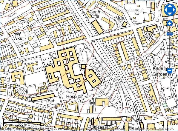
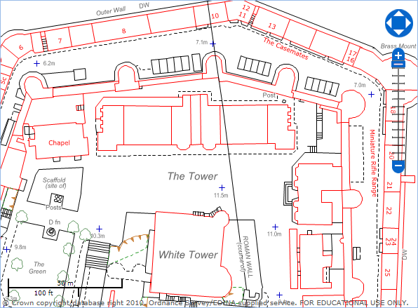
Background mapping in Data Download of all Collections is now shown in greyscale

The background mapping data in all Data Download clients has been converted to greyscale:

OS Data Download

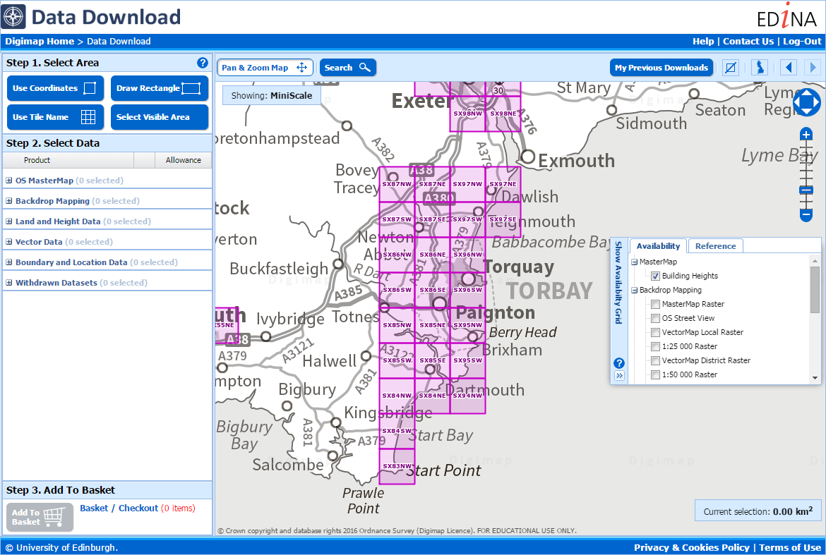
This makes it much easier to see the availability and reference grids in these applications.

Further improvements

We hope you enjoy using these new features. We are continually improving the service so if you have any suggestions for improvements to the service please get in touch:

  • Phone: 0131 650 3302
  • Email: edina@ed.ac.uk

Annotation Tools in Marine Roam

Now we have the annotation tools up and running they are being added to all the Roam services thick and fast! Marine Roam is the latest to get the tools, again they are an initial version with the basic set of features.

Marine Annotation Tools

Please let us know if you have any requests for symbols, line styles or any other features you would like to be able to annotate the map with. You can comment on this post or email us directly here:

Mailto: EDINA help desk

Remember there is a video on how to use the general features of the Annotation tools on YouTube:

[youtube width=”640″ height=”390″]http://www.youtube.com/watch?v=PSkTZvMNyKU&hd=1[/youtube]

There is also a section in the How to use Marine Roam help page that covers how to use all the different tools:

Annotation Tools in Geology Roam

Following on from the success of the annotation tools in Digimap Roam, we have now added them to Geology Roam. The tools are the same as the one in Digimap Roam at the moment but we hope to add in a set of geology specific symbols and features in the near future.

Geology Annotation Tools

We’d like to know what sort of annotations you’d like to put on the geology maps; perhaps a dip and strike symbol you can rotate and add a dip value to, or a borehole symbol that you can label with a depth and ID number. Please comment on this article if you have any ideas or send us an email:

Mailto: EDINA help desk

Don’t forget we have a quick guide on what you can do with the annotation tools on YouTube:

[youtube width=”640″ height=”390″]http://www.youtube.com/watch?v=PSkTZvMNyKU&hd=1[/youtube]

We also have a section in the Geology Roam help page that describes how each of the different tools works:

Geology Roam Help

We hope to add the annotation tools to the remaining services over the summer, keep checking the blog for news of when they will be released.

More Improvements Added 28th June

Service "At Risk".Some of the features mentioned in the previous blog post will be added into the services tomorrow, Tuesday 28th June:

More Improvements Coming Soon

Due to this work there will be some short Disruptions to all the services between 17:30 and 18:30. We hope you find the new features useful, please let us know if you have any feedback:

Mailto: EDINA help desk

or call us on: 0131 650 3302

More Improvements Coming Soon

We have had another very busy month and so a new batch of improvements for the Digimap services will be coming soon.

Printing in Ancient Roam

At the moment downloading data or saving screen images are the only ways to use the maps available in Historic Digimap once you have logged out.  Soon you will be able to create and save high quality PDF maps from Ancient Roam for use offline. We hope you will find this a much better way to get the best quality mapping out of the service.

Ancient Roam PDF
A sample image of what a PDF from Ancient Roam may look like.

New Data in Digimap Roam

Since the arrival of the Ordnance Survey’s latest large scale product, VectorMap Local,  we have been busy thinking of the best way to include it in the Digimap Roam. We have decided to use it to create four new representations available at two different scale levels.

Here is a quick look at what the four different representations might look like:

VML standard
Vectormap Local- Standard
VML Streetview
Vectormap Local - Streetview
VML Plan
Vectormap Local - Plan
VML Raster10k
Vectormap Local - 1:10,000 Raster

We haven’t stopped there either; we are also going to add in Line Drawing style mapping to the two most zoomed in levels; for those who like their MasterMap plain and simple, similar to planning application maps.

MasterMap - Plan
MasterMap - Line Drawing

You will be able to select the different views from the Map Content Control Tab using a drop down list.Alternate representations choice Menu

For more information about VectorMap Local look in the Digimap help pages as it is already available for download:

OS Products: OS VectorMap Local

Annotation Tools in Geology Roam

For those of you who have tried the annotation tools in Digimap Roam it will come as no surprise that we are very pleased to announce that we are now working on adding the same functionality in Geology Roam. Again the annotation tools are a first draft and will have exactly the same functionality as Digimap Roam’s tools.

Geology Annotation Tools

Once they are released we’d really like to hear from you about which functions you use and what else you would like added. We are already hoping to add in some Geology Mapping symbols for you to add to the maps.

As an added bonus we are also putting in the measurement tools so you can measure areas and distances too, so you can tell how long a fault is or what area is covered by different rock types.

Annotation Tools now in Digimap Roam

The Annotation tools are now available to use in Digimap Roam.  We have a quick guide on what you can do with them on YouTube:

[youtube width=”640″ height=”390″]http://www.youtube.com/watch?v=PSkTZvMNyKU&hd=1[/youtube]

We also have a section in the Digimap Help Pages that describes how each of the different tools works:

Annotation Tools Help

Annotations ToolbarThese annotation tools are a first phase, to see what you find the most useful. We would like to hear from you about any changes or additions you would like making to the tools. Please send feedback to our help desk:

Mailto: EDINA help desk