Any views expressed within media held on this service are those of the contributors, should not be taken as approved or endorsed by the University, and do not necessarily reflect the views of the University in respect of any particular issue.
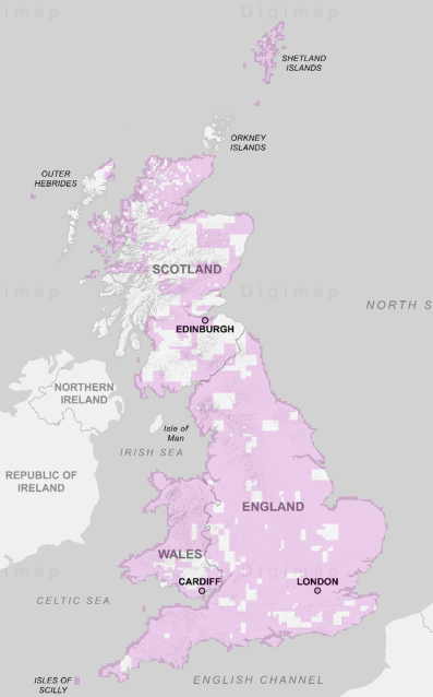
Digimap is an online map and data delivery service, available by subscription to UK Higher and Further Education establishments. Operated by EDINA at the University of Edinburgh, Digimap offers a number of data collections, including Ordnance Survey, historical, geological, aerial photography, LiDAR, marine maps, land cover mapping, global mapping and census data. For more information about Digimap go to our website: https://digimap.edina.ac.uk Background image Contains OS data (c) Crown Copyright and database right 2022
The session, “Data Standards and Q-FAIR — A view from Ordnance Survey,” will explore how Q-FAIR principles can help target data standards interventions, and why metadata and addressing standards are so important for discoverability and interoperability.
Allan Jamieson from Ordnance Survey will also introduce the National Geospatial Data Standards Register and discuss current and future efforts in data standardisation across the UK and internationally.
This webinar will be of interest to data scientists, researchers, GIS professionals, educators, and anyone working with geospatial or linked datasets. Whether you are combining data from different sources and time periods or simply want to learn more about standards and formats that support effective data use.
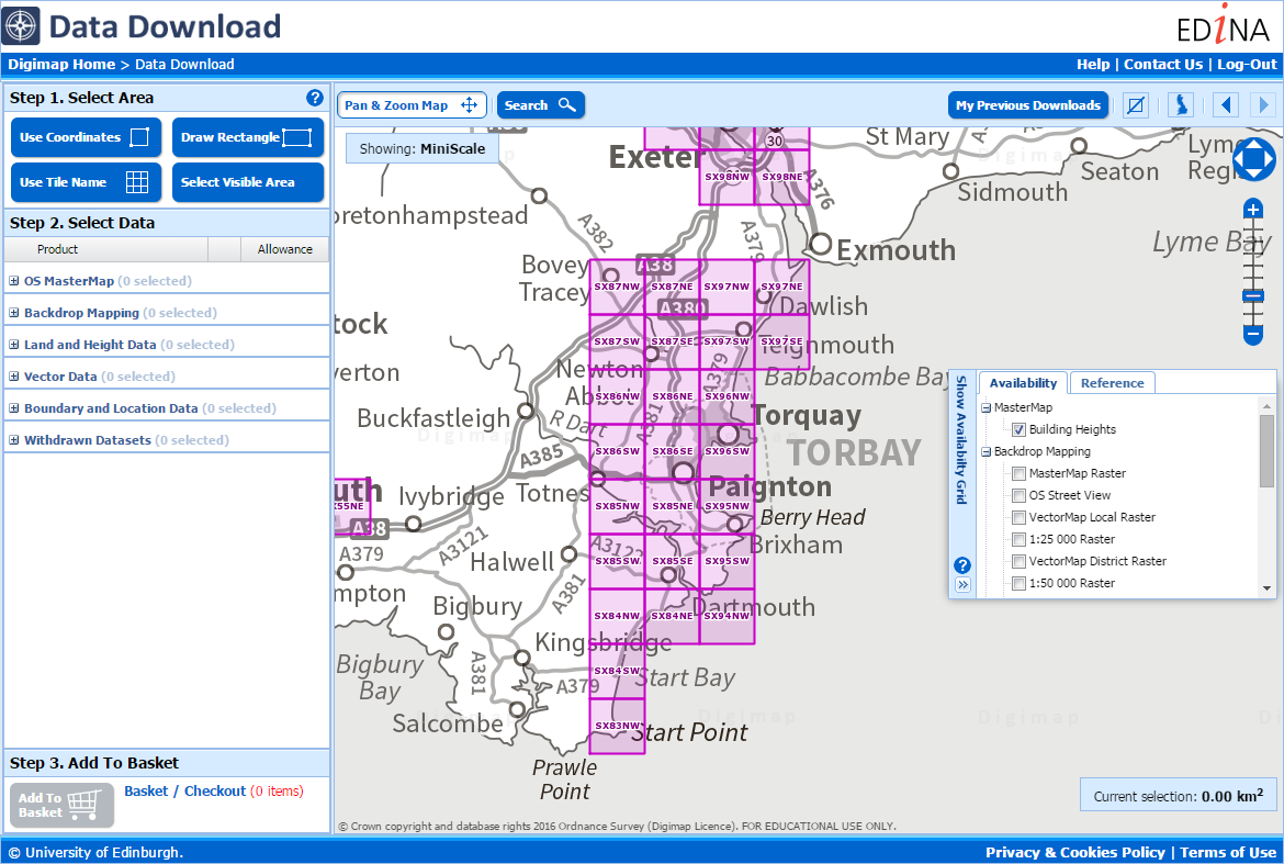
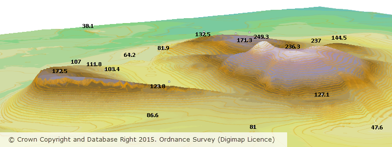
Ordnance Survey have released nearly 5000 extra 5km squares of building height data, with the total coverage increasing from 2578 to 7302. Each square has at least one building with height attributes added, with most fully covered. We have added this data to Digimap’s Data Download facility allowing you easy access to the data you need.
The Building Heights data is available from Data Download in a range of formats created especially for Digimap users. The most straightforward to use are DWG, File Geodatabase and KML which can be viewed directly in CAD, GIS and Google Earth respectively. You can also take the data as a CSV list that can be joined to the attribute table of any existing MasterMap Building data you have, using the TOID identifier. This means that you don’t have to recreate your project work with new data if you have already spent a lot of time working on it; as long as the buildings still have a TOID in their attribute data you can add the height information to it.
The Building Heights data is ideal for anyone working with the MasterMap data in 3D and has a range of applications in Architecture, Landscape Architecture, Environmental Modelling, Archaeological Reconstructions and many more different disciplines. Here are a couple of examples:
OS MasterMap Topography Layer Building Height Attribute data on top of OS Terrain 5 Contours
3D model using Aerial Imagery, OS Terrain 5 DTM and MasterMap Building Heights Data
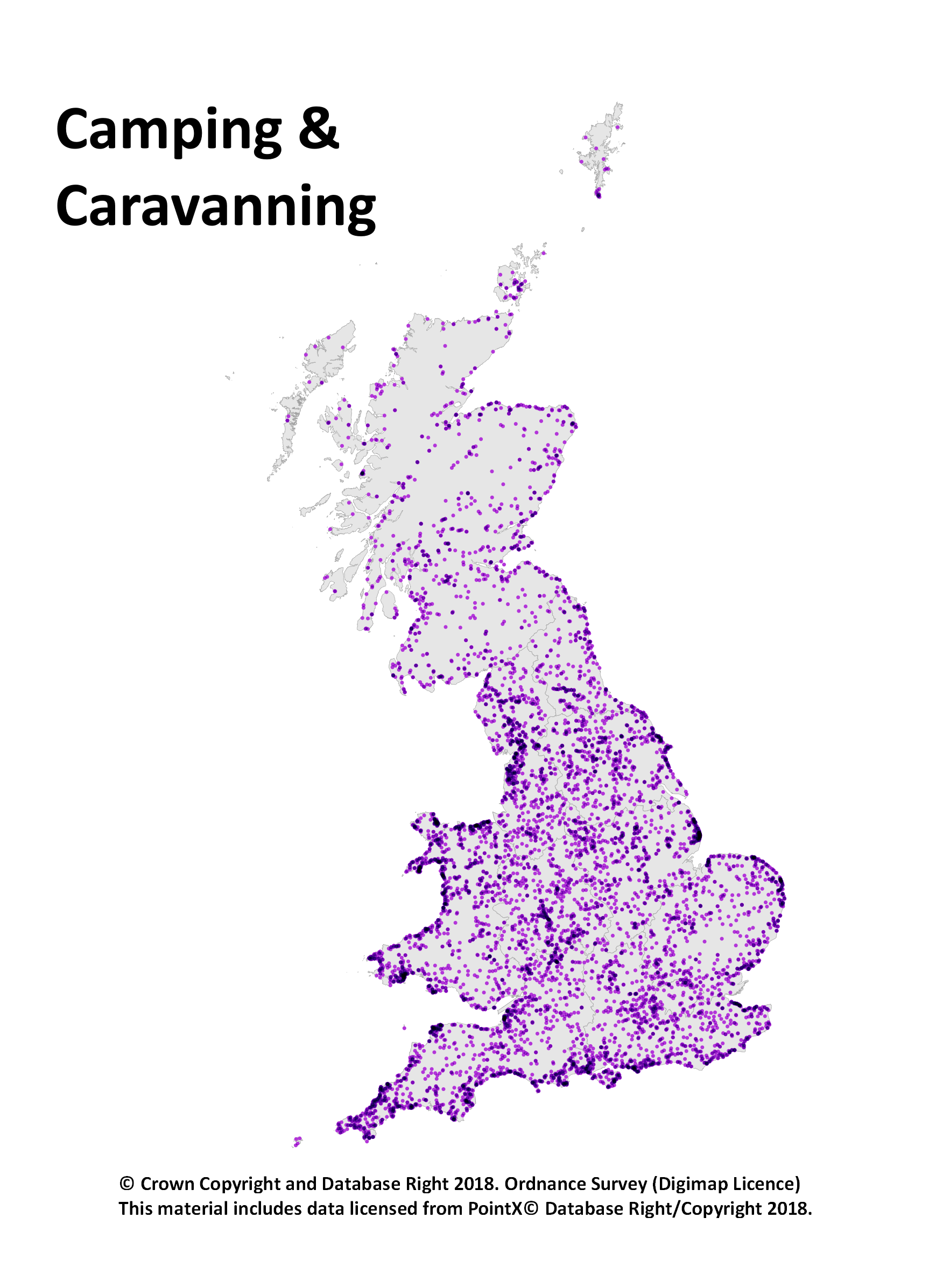
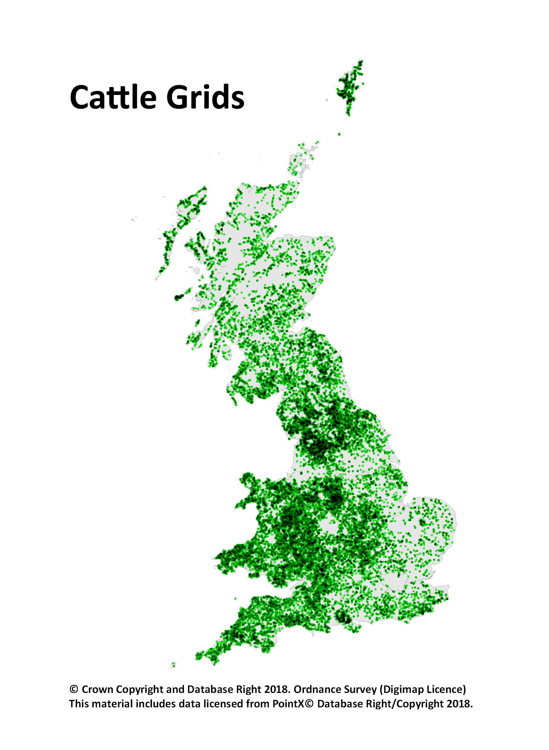
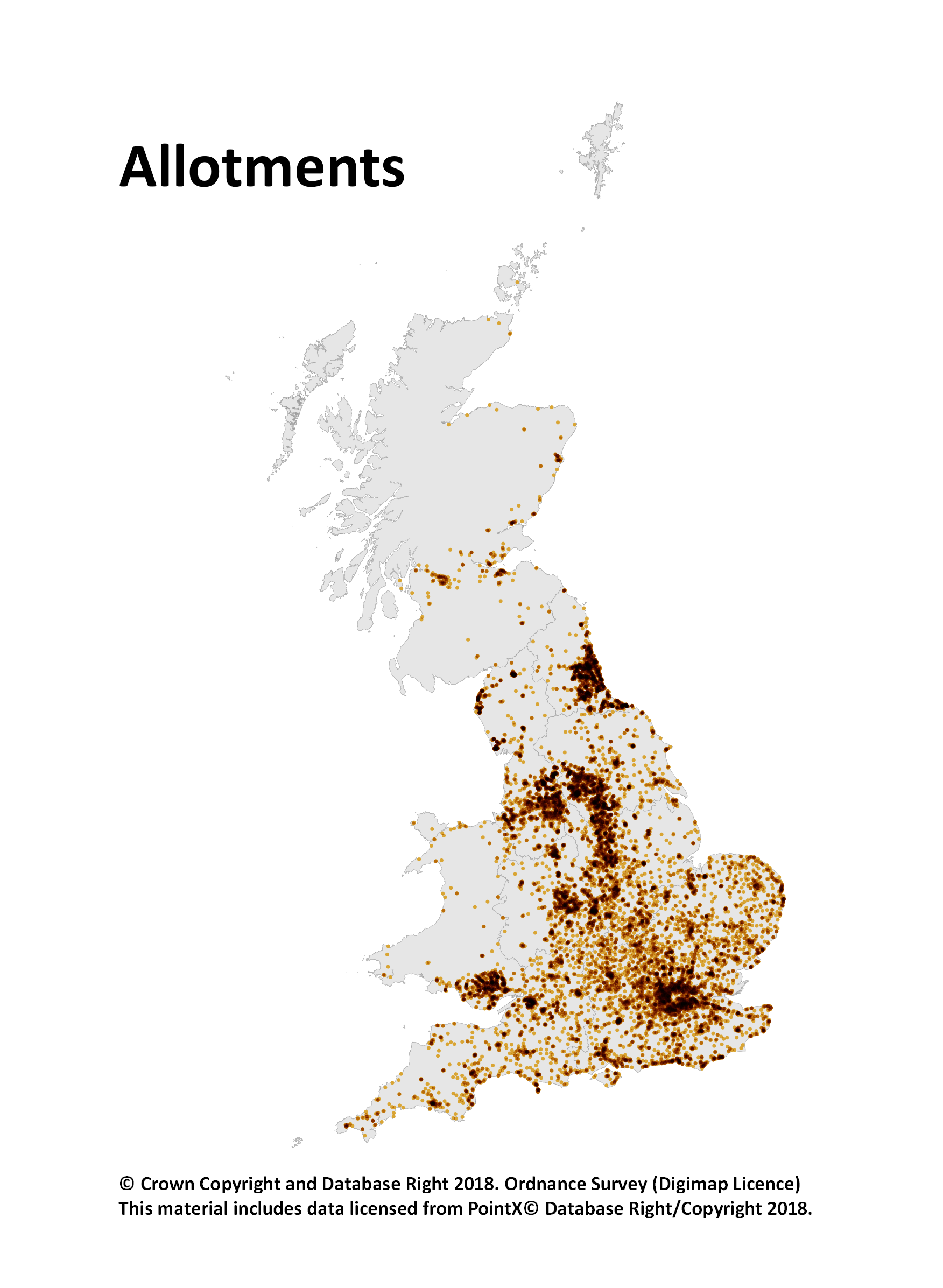
The Points of Interest (PoI) data is great for research and you can make fantastic looking maps too as we have been showcasing on our twitter account. You have certainly been making the most of it too, with 16,877 PoI downloads being made since May 2015. Here are 3 dot density maps we made to show a single class of PoI data:
However until today you had to take all the different classes of points for your specified area and you were limited to taking no more than 10,000 Km2 in a single download. As PoI data is split into 9 groups, 52 categories and over 600 classes (see the full scheme here), we though it would make things easier if we exposed some of this hierarchy in Digimap’s Data Download service.
You can now select one or more of the groups or categories to download, taking some of the data processing load off you and making your downloads more manageable. Being able to filter the features in your download by group or category means smaller downloads so we have also removed the limit on the area you can take; you can now take the whole country in one download if you want.
One note of caution though, the PoI data has around 4.5 million records and is over 1gb in size as a simple CSV file. So if you are taking national coverage you may want to only take one group or a few categories to minimise the amount of data you are dealing with.
To select a group or category of features simply add PoI data to your basket then use the drop down menu in the layers column to choose what you are interested in.
We hope that you find this change really improves the accessibility of the Points of Interest data, we look forward to seeing some of the interesting analyses and maps you produce!
May was one of the busiest in terms of dataset updates in the history of Digimap. Around 20 separate datasets have been updated bringing them bang up to date with the most recent data available from the data suppliers. All the updates are listed in the tables below, broken down by the Collection and service that they can be found in.
Withdrawn Datasets (OS Collection):
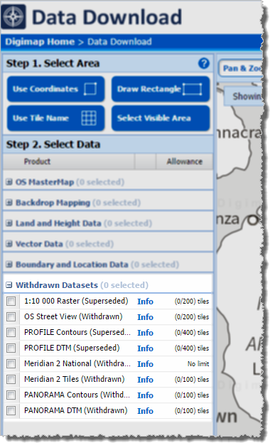
OS Download Withdrawn Datasets [click to expand]Along with the updated data, Ordnance Survey have recently withdrawn three datasets:
These withdrawn datasets are still available to download through the Ordnance Survey Data Download application in Digimap, but users should be aware that they are no longer updated by Ordnance Survey. Withdrawn datasets have their own separate category in the Select Data panel in OS Data Download, as shown by the image on the left hand side.
OS Roam:
Product Name
OS Publication Date
1:50,000 Colour Raster
March 2017
OS Open Map – Local (vector)
April 2017
VectorMap Local (vector)
April 2017
VectorMap District (vector)
March 2017
VectorMap Local Raster
April 2017
VectorMap District Raster
March 2017
OS Download:
Product Name
OS Publication Date
VectorMap Local Raster
April 2017
VectorMap District Raster
March 2017
VectorMap District (vector)
March 2017
OS Open Roads
October 2016 and April 2017
OS Open Map – Local (raster)
April 2017
OS Open Map – Local (vector)
April 2017
OS Terrain 5 DTM
April 2017
OS Terrain 5 Contours
April 2017
OS Open Names
April 2017
VectorMap Local (vector)
April 2017
Code-Point with Polygons
April 2017
OS Open Rivers
April 2017
Geology Download:
Product Name
BGS Publication Date
Borehole index
April 2017
The datset update pages are kept up to date with all dataset updates in the collections:
OS Open Map – Local (OML) was recently added to the Digimap Roam application, giving users the ability to create maps online with a detailed, vector open dataset. OML is the most detailed vector mapping product available from Ordnance Survey as Open Data. We have added this dataset to the following map views in Digimap Roam:
Map View
Default Print Scale
Neighbourhood View
1:10,000
Street View
1:5,000
Detailed View
1:2,500
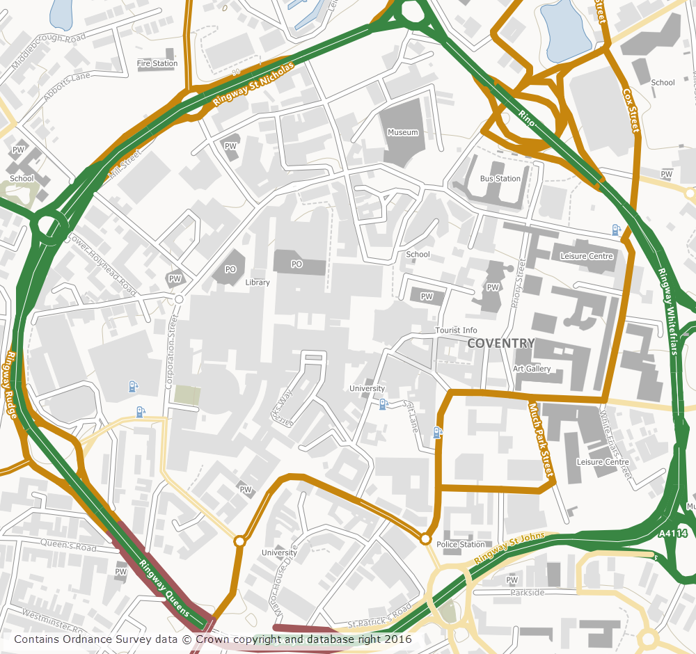
The dataset is rich in features and includes detailed building outlines and Car Charging Points, which are sourced from the National Charge Registry.
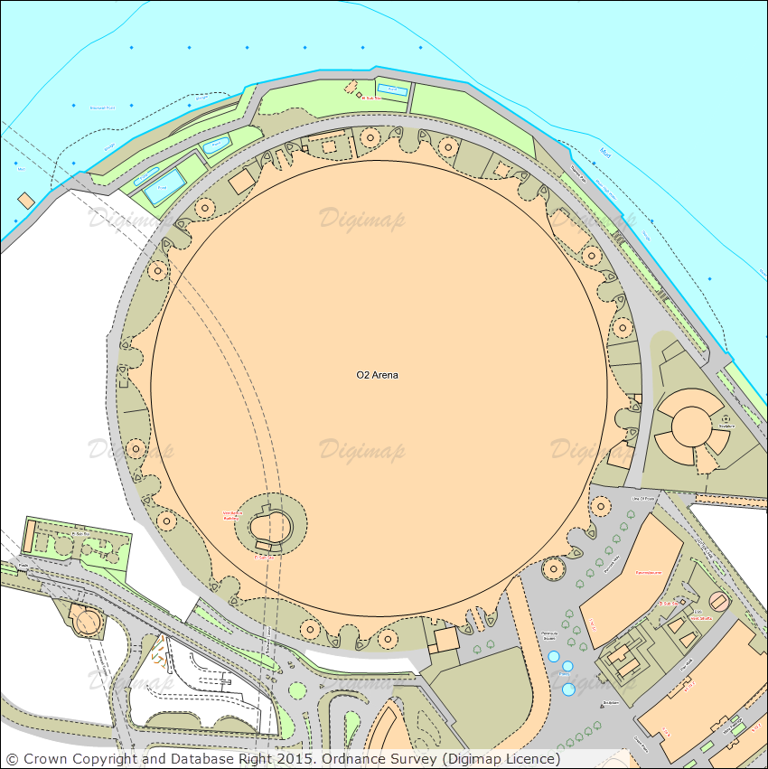
OS Open Map – Local showing Coventry City Centre
Ordnance Survey first released OML as a beta product in March 2015 and Digimap users have been able to download this dataset via the Data Download application since April 2015. The October 2016 release of OML marks the end of the beta period and provides the first main version of the dataset.
OML is intended to be used as a detailed basemap on which to visualise your own data and is designed to be an alternative to OS Street View, which will be withdrawn in March 2017 by Ordnance Survey.
The cartography team at Digimap have worked hard to implement a consistent style with that of the smaller scale VectorMap District product, ensuring a familiar look and feel between the two Open Data products. Contours from the OS Terrain 50 product are included when viewing the data in Roam, to give greater context especially in rural and hilly areas.
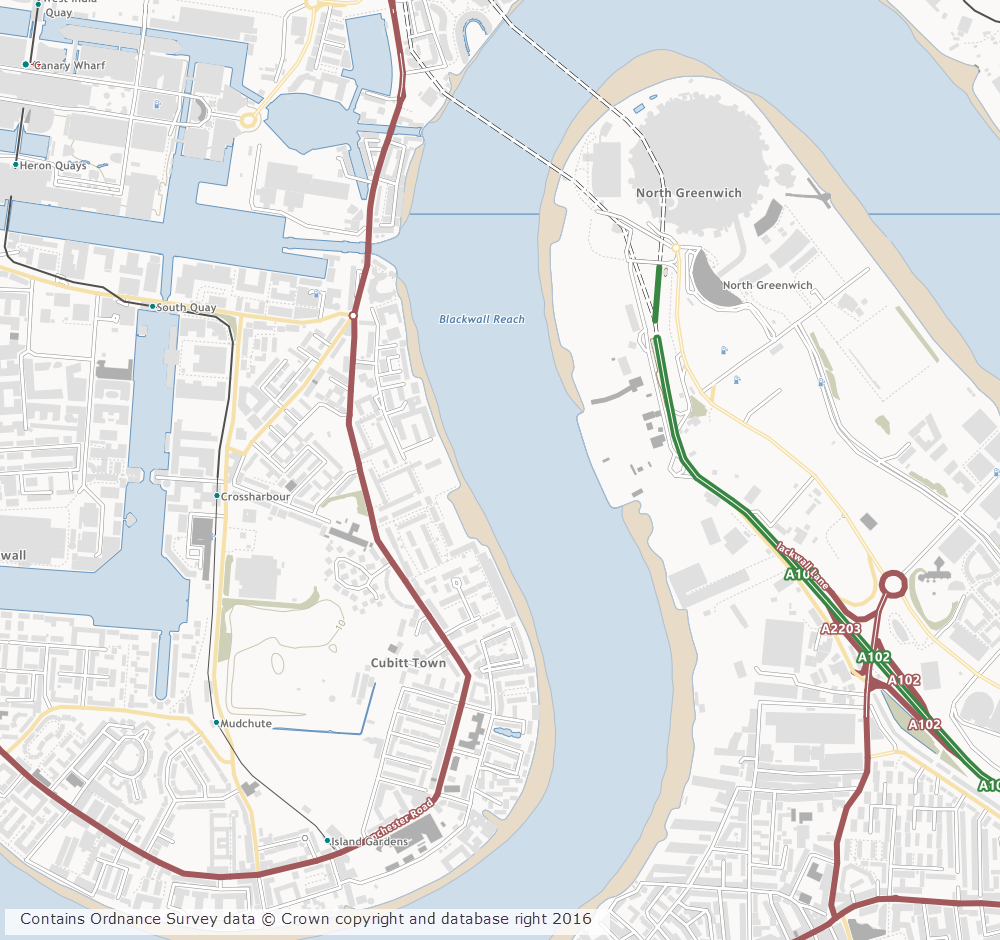
OS Open Map – Local showing Canary Wharf
Further information on the new dataset can be found on the Digimap help page or the Ordnance Survey website. We hope you like the new data, if you have any questions about the dataset or Digimap please contact us:
Last week (3rd March) we released a new version of Digimap which includes a number of changes that may be of interest to our growing user base. Our set-up allows us to release new versions without requiring any downtime so the recent changes are highlighted below as they may not be obvious at first glance.
Greyscale versions of the 1:25,000 Colour Raster and 1:50,000 Colour Raster have been added to OS Roam
We have added greyscale versions of the 1:25,000 Colour Raster and 1:50,000 Colour Raster products in the Roam client of the Ordnance Survey Collection. These can be selected using the Basemaps drop-down.
The new greyscale versions make it much easier to see your annotations on top of the basemap. The greyscale versions can be saved and printed like all other basemaps available in OS Roam.
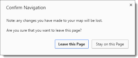
Warning about losing changes in all Roam clients
If you customise a map in one of the Roam clients, for example by modifying the layers that are displayed or by creating annotations on the map, then press the browsers back button or navigate away from Roam you will now see a warning prompt advising you that you may lose your changes. The prompt that is displayed in Chrome is shown below:
The prompt is not displayed if you have saved the map, printed the map, or exported the annotations.
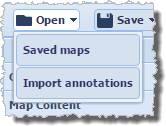
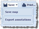
Updates to the Open/Save wording in all Roam clients
We have updated the text on the Open and Save menus in all Roam clients to make it clearer what each option does:
Open > Saved maps allows you to open any maps you have previously created and saved within Roam.
Open > Import annotations is where you go to import external datasets in to Roam (we currently support the import of datasets in Shapefile, KML, GPX, CSV, and GeoJSON formats).
Save > Save map will save the current map extents along with any annotations to Digimap for retrieval at a later date.
Save > Export annotations allows you to export annotations from Roam as an external dataset for use GIS/CAD (we currently support the export of datasets in Shapefile, KML, and GeoJSON formats).
Background mapping in Data Download of all Collections is now shown in greyscale
The background mapping data in all Data Download clients has been converted to greyscale:
This makes it much easier to see the availability and reference grids in these applications.
Further improvements
We hope you enjoy using these new features. We are continually improving the service so if you have any suggestions for improvements to the service please get in touch:
A number of datasets have recently been updated in Ordnance Survey Roam, the Digimap online mapping application, bringing them up to date with the most recent versions available from Ordnance Survey. All datasets are available to view using the Roam application in the Ordnance Survey collection.
The table below lists all the datasets that have been updated and includes the OS release date:
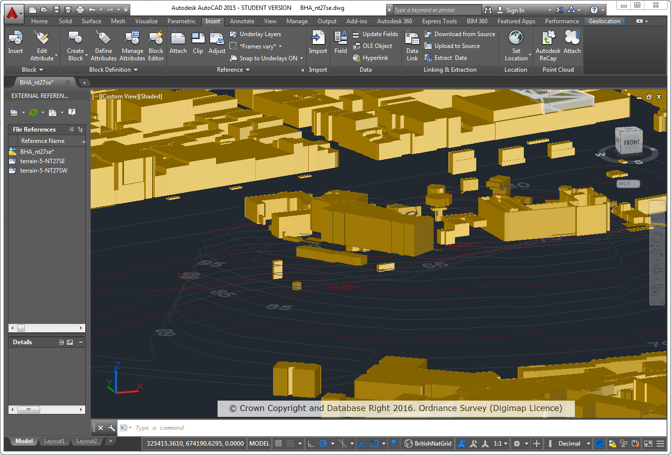
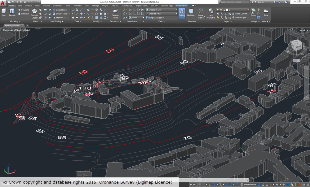
We are pleased to announce the release of DWG versions of both OS Terrain™ 5 (vector) and OS MasterMap® Topography Layer Building Height Attribute, which makes their use in CAD applications much easier and quicker.
Recently we have been working to produce DWG versions of the detailed vector dataset OS Terrain™ 5 and the popular Building Height Attribute component of OS MasterMap® Topography Layer. Both these datasets have proved popular with CAD users for detailed modelling applications but until now using them has proved time-consuming as many steps were required to convert them in to a format suitable for use in CAD applications.
OS Terrain 5 Vector
OS Terrain 5 Vector is dataset consisting of contour lines with five metre vertical spacing and spot heights (point features). The dataset also includes contours for mean high and low water around coastal areas, along with labels for both spot heights and contours. OS Terrain 5 is the most detailed height dataset available from Ordnance Survey. A Digital Terrain Model (DTM) version is also available in ASCII grid format and can be downloaded through Digimap.
Building Height Attribute (BHA)
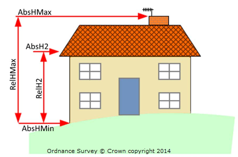
As with the other BHA datasets provided through Digimap the DWG version is supplied as a dataset of building polygons together with the building height attributes supplied by OS in the latest alpha release of their Building Height Attribute dataset (December 2014 at the time of writing). The DWG dataset is a 3D dataset which uses two of the height attributes supplied by OS to create the 3D features. The base height of buildings is set using the value of the AbsHMin attribute and the roof height is defined by the AbsH2 attribute:
All height attributes supplied by OS, as indicated in the image above, are included as XDATA which can be readily viewed in CAD applications.
Note: the DWG BHA dataset is not supplied with a terrain surface so the building features will appear to float above the surface if it is displayed without a suitable terrain surface. We recommend using either OS Terrain 5 or OS Terrain 50, both of which can be downloaded from Digimap.
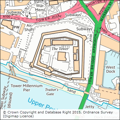
The image below shows OS Terrain 5 vector overlaid with BHA in AutoCAD 2015 for the area around Edinburgh Castle. Both datasets were supplied by Digimap in DWG format and required no manipulation or processing in order to display them.
OS Terrain 5 vector and OS MasterMap BHA datasets are supplied on a 5x5km grid, so you may receive multiple multiple files if your area covers more than one 5km grid square.
We hope this makes it much easier to use the data and we welcome any feedback you may have.
A number of datasets have been updated recently bringing them up to date with the most recent versions available from Ordnance Survey. All datasets are available to download using the Digimap Data Download application in the Ordnance Survey collection.
The table below lists all the datasets that have been updated and includes the OS release date:
Of particular note at this time is that Ordnance Survey have announced the withdrawal of the 1:50 000 Scale Gazetteer and OS Locator products following the release of OS Open Names in March 2015.
The last product update for 1:50 000 Scale Gazetteer will be June 2016.
The last product update for OS Locator will be May 2016
Following these releases Ordnance Survey will no longer supply, maintain or support the use of either OS Locator or 1:50 000 Scale Gazetteer.
If you have any questions about the dataset updates or Digimap please contact us: