OS MasterMap Building Height Data gets significant update

new building height coverage
Building Height Coverage

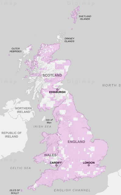
Ordnance Survey have released nearly 5000 extra 5km squares of building height data, with the total coverage increasing from 2578 to 7302. Each square has at least one building with height attributes added, with most fully covered. We have added this data to Digimap’s Data Download facility allowing you easy access to the data you need.

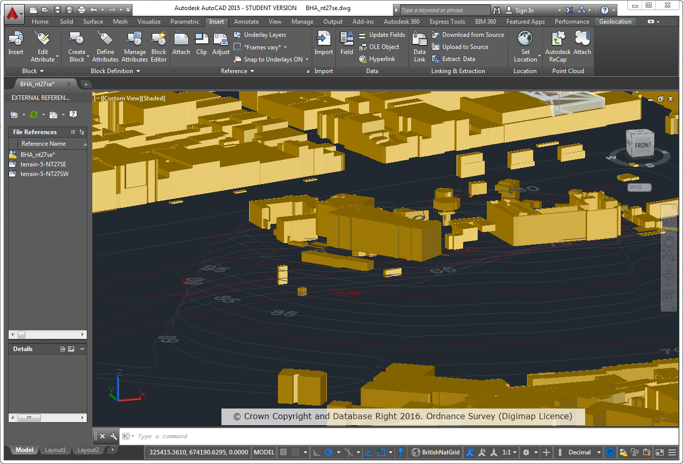
The Building Heights data is available from Data Download in a range of formats created especially for Digimap users. The most straightforward to use are DWG, File Geodatabase and KML which can be viewed directly in CAD, GIS and Google Earth respectively. You can also take the data as a CSV list that can be joined to the attribute table of any existing MasterMap Building data you have, using the TOID identifier. This means that you don’t have to recreate your project work with new data if you have already spent a lot of time working on it; as long as the buildings still have a TOID in their attribute data you can add the height information to it.

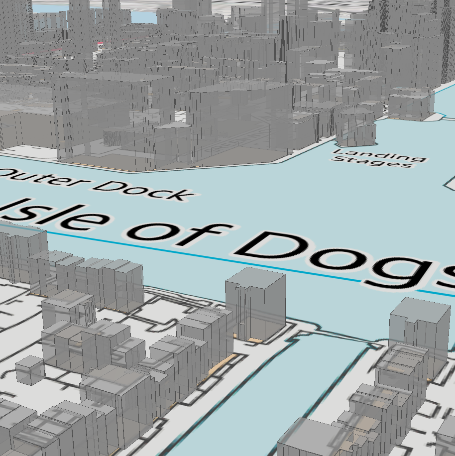
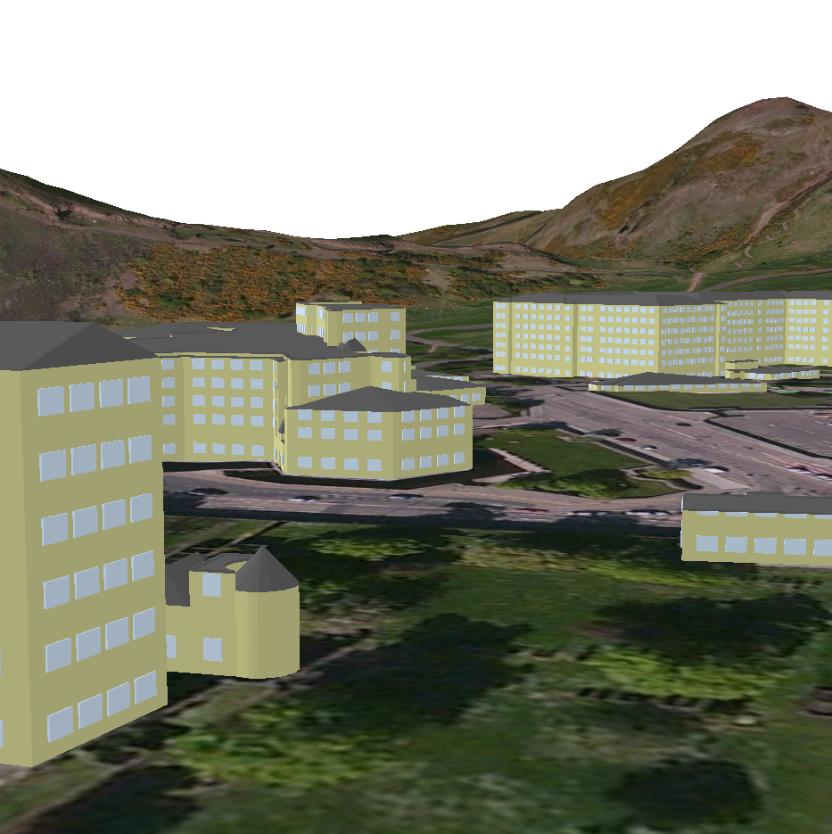
The Building Heights data is ideal for anyone working with the MasterMap data in 3D and has a range of applications in Architecture, Landscape Architecture, Environmental Modelling, Archaeological Reconstructions and many more different disciplines. Here are a couple of examples:

OS MasterMap Topography Layer Building Height Attribute data on top of OS Terrain 5 Contours


3D model using Aerial Imagery, OS Terrain 5 DTM and MasterMap Building Height Attribute
3D model using Aerial Imagery, OS Terrain 5 DTM and MasterMap Building Heights Data


OS Building Height Attribute now available in file geodatabase format

3D Building Heights in ArcGIS
© Crown Copyright and Database Right 2015. Ordnance Survey (Digimap Licence)

We are pleased to announce that users can now download OS MasterMap Building Height Attribute data in file geodatabase format. The data consists of building polygons together with the building height attributes supplied by OS in the latest alpha release of their Building Height Attribute dataset (December 2014 at the time of writing).

This makes the process of visualising the data in 3D much simpler for the majority of GIS users. The file geodatabase format can be read by both QGIS and ArcGIS, including the new ArcGIS Pro, without the need for any complex data processing. Making the data available in file geodatabase format removes the need for users to download building features from OS MasterMap Topography Layer and then use the JOIN function in GIS to connect the Building Height Attribute data to the buildings.

3D Buildings in ArcGIS
© Crown Copyright and Database Right 2015. Ordnance Survey (Digimap Licence)

The data is supplied on a 5x5km grid, so you may receive multiple separate geodatabases if your area covers multiple 5km grid cells, however it is easy to merge the datasets together using common GIS functions.

We hope this makes it much easier to use the data but we welcome any feedback you may have.

  • Email: edina@ed.ac.uk
  • Phone: 0131 650 3302