Points of Interest now easier to download

The Points of Interest (PoI) data is great for research and you can make fantastic looking maps too as we have been showcasing on our twitter account. You have certainly been making the most of it too, with 16,877 PoI downloads being made since May 2015. Here are 3 dot density maps we made to show a single class of PoI data:

Points of Interest: Camping and Caravanning Dot Density mapPoints of Interest: Cattle Grids Dot Density mapPoints of Interest: Allotments Dot Density Map

However until today you had to take all the different classes of points for your specified area and you were limited to taking no more than 10,000 Km2 in a single download. As PoI data is split into 9 groups, 52 categories and over 600 classes (see the full scheme here), we though it would make things easier if we exposed some of this hierarchy in Digimap’s Data Download service.

You can now select one or more of the groups or categories to download, taking some of the data processing load off you and making your downloads more manageable. Being able to filter the features in your download by group or category means smaller downloads so we have also removed the limit on the area you can take; you can now take the whole country in one download if you want.

One note of caution though, the PoI data has around 4.5 million records and is over 1gb in size as a simple CSV file. So if you are taking national coverage you may want to only take one group or a few categories to minimise the amount of data you are dealing with.

To select a group or category of features simply add PoI data to your basket then use the drop down menu in the layers column to choose what you are interested in.

Points of Interest data in the digimap download basket

We hope that you find this change really improves the accessibility of the Points of Interest data, we look forward to seeing some of the interesting analyses and maps you produce!

Digimap Data: New datasets coming in the New Year

The new Ordnance Survey Licence includes some new and very interesting datasets for the Digimap service. We have already added OS Terrain 5, Ordnance Survey’s most detailed digital terrain model and contour data to the the Data Download facility. The other new datasets will require some additional effort to add into the service but we should have them available to download early in the new year. These new datasets are as follows:


OS MasterMap ITN Urban Paths

Routing information for walkers and cyclists in towns and cities.

More Info from Ordnance Survey…

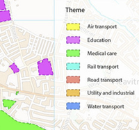
OS MasterMap Sites LayerOS MasterMap Sites Layer

Identifies areas as being in categories such as schools, hospitals, transport facilities etc. The data also highlights access points to the sites and routing destinations for more accurate travel distances.

More Info from Ordnance Survey…

Points of Interest

Over 4 million points of interest classified into 3 tiers; 9 groups, 52 categories and 616 classes. The points of interest include accommodation, eating and drinking, commercial services, attractions, sport and entertainment, education and health, public infrastructure, manufacturing and production,retail, and transport.

Please note that Points of Interest data is made available under slightly different terms to the other Digimap Ordnance Survey datasets. Please see the EULA and FAQs for further details.

More Info from Ordnance Survey…


EDINA has had many requests for these datasets, especially the Urban Paths so we are very pleased to be able to offer them to you. We also intend adding some of these datasets to Digimap Roam so that they can be added to the maps you view and print as well.

Please contact the EDINA help desk if you want access to the datasets mentioned above before they are made available in the Data Download service:

  • Phone: 0131 6503302
  • Email: edina@ed.ac.uk