
EDINA are pleased to announce the release of new sample data to Pilot Digimap. From 12th January 2023 until 31 July 2023, the following data from Getmapping plc will be available for these sample areas:
- EDINBURGH – Digital Surface Model (2m)
- EDINBURGH Digital Terrain Model (2m) – download only
- EDINBURGH – Colour Infrared Imagery (50cm)
- EDINBURGH – Colour Infrared Imagery (12.5cm) – download only
- EDINBURGH – High Resolution Vertical Aerial Imagery (12.5cm)
- ISPWICH – City View High Resolution Imagery (5cm)
- READING – City View High Resolution Imagery (5cm)
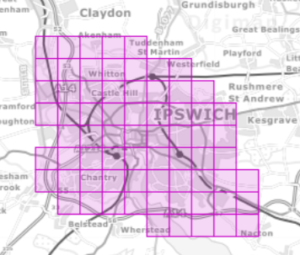 City View (5cm) aerial photography, Ipswich |
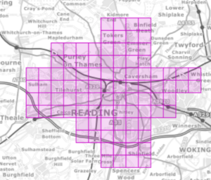 City View (5cm) aerial photography, Reading |
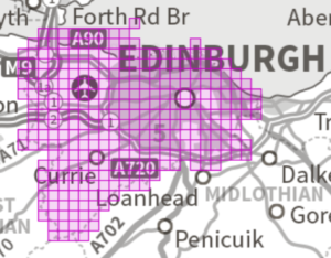
High Resolution Vertical Aerial Photography (12.5cm), |
Images contain OS data (c) Crown Copyright and database right 2023
Digimap’s Pilot Collection provides access to data that we would like to evaluate against demand from the Digimap user community. Only sample areas are available through Pilot Digimap, but should demand for the data warrant it, we will explore options for longer term licensing solutions. This means that the data are only available for a short time: January to July 2023.
Please take a look at the data in Pilot Digimap and rate the datasets you would like to see available in future. Please also contact us if you have any questions or would like to discuss any potential future use of these datasets: digimap@ed.ac.uk