Any views expressed within media held on this service are those of the contributors, should not be taken as approved or endorsed by the University, and do not necessarily reflect the views of the University in respect of any particular issue.
Digimap is an online map and data delivery service, available by subscription to UK Higher and Further Education establishments. Operated by EDINA at the University of Edinburgh, Digimap offers a number of data collections, including Ordnance Survey, historical, geological, aerial photography, LiDAR, marine maps, land cover mapping, global mapping and census data. For more information about Digimap go to our website: https://digimap.edina.ac.uk Background image Contains OS data (c) Crown Copyright and database right 2022
The tables below list the datasets that were updated in December 2016 and at the very start of January 2017. The most significant change is the addition of OS Open Map – Local to Roam, which was covered in an earlier blog post. The other updates bring the data available up to date with the most recent versions published by Ordnance Survey.
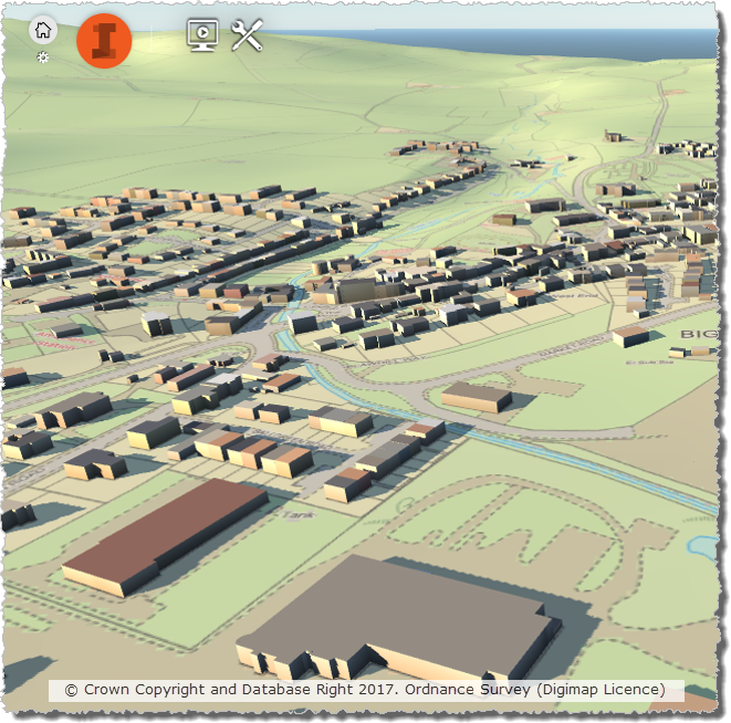
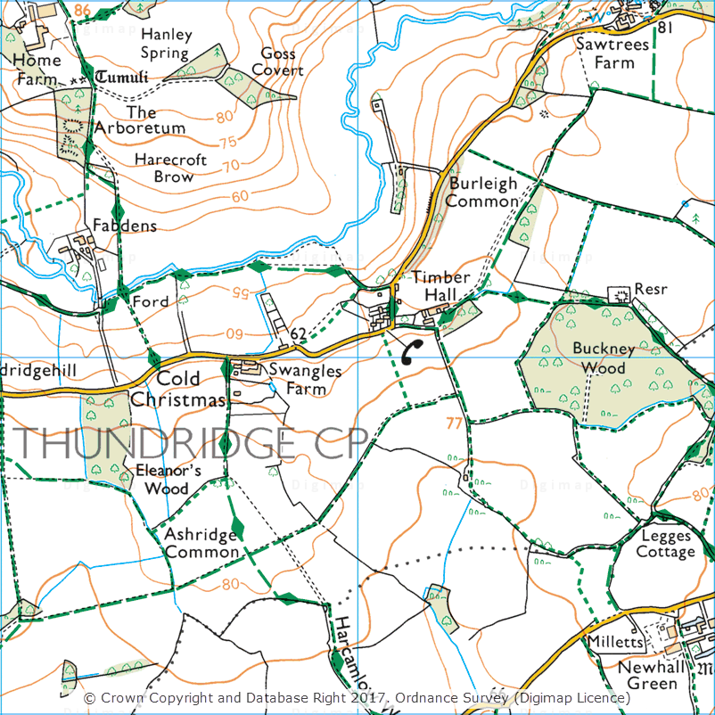
Cold Christmas, 1:25,000 Colour Raster
OS Data Download:
Product Name
OS Publication Date
1:25,000 Colour Raster
December 2016
1:50,000 Colour Raster
December 2016
Points of Interest
December 2016
OS Roam:
Product Name
OS Publication Date
OS Open Map – Local
December 2016
1:25,000 Colour Raster
December 2016
1:50,000 Colour Raster
December 2016
OS VectorMap District
September 2016
The OS data update page is kept up to date with all dataset updates in the collections.
If you have any questions about the dataset updates or Digimap please contact us:
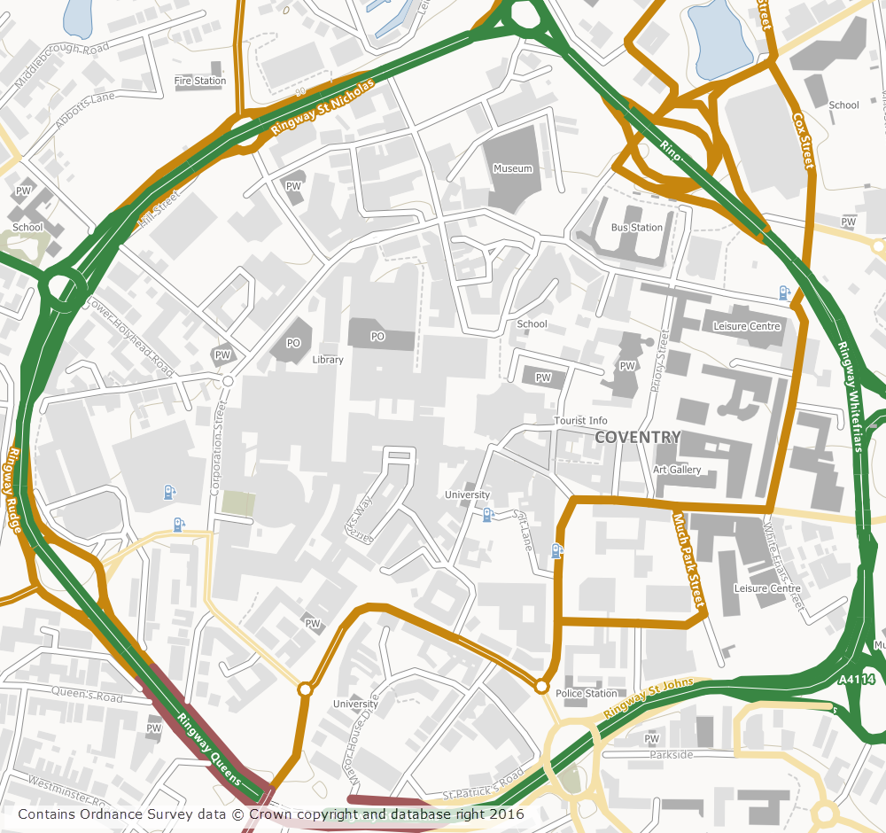
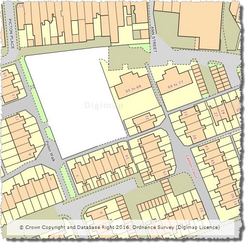
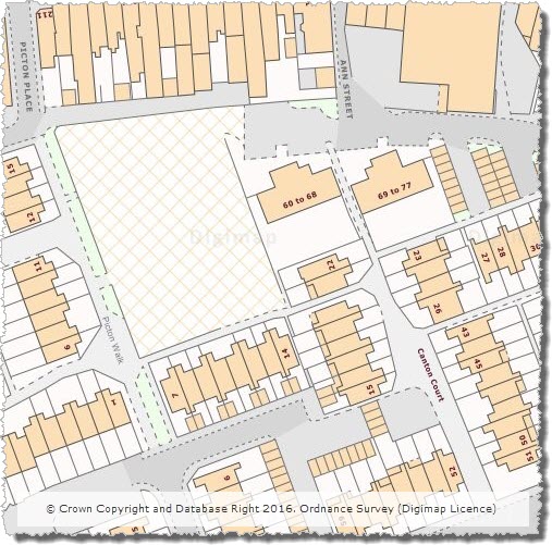
OS Open Map – Local (OML) was recently added to the Digimap Roam application, giving users the ability to create maps online with a detailed, vector open dataset. OML is the most detailed vector mapping product available from Ordnance Survey as Open Data. We have added this dataset to the following map views in Digimap Roam:
Map View
Default Print Scale
Neighbourhood View
1:10,000
Street View
1:5,000
Detailed View
1:2,500
The dataset is rich in features and includes detailed building outlines and Car Charging Points, which are sourced from the National Charge Registry.
OS Open Map – Local showing Coventry City Centre
Ordnance Survey first released OML as a beta product in March 2015 and Digimap users have been able to download this dataset via the Data Download application since April 2015. The October 2016 release of OML marks the end of the beta period and provides the first main version of the dataset.
OML is intended to be used as a detailed basemap on which to visualise your own data and is designed to be an alternative to OS Street View, which will be withdrawn in March 2017 by Ordnance Survey.
The cartography team at Digimap have worked hard to implement a consistent style with that of the smaller scale VectorMap District product, ensuring a familiar look and feel between the two Open Data products. Contours from the OS Terrain 50 product are included when viewing the data in Roam, to give greater context especially in rural and hilly areas.
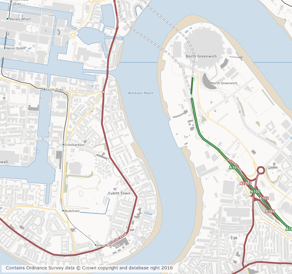
OS Open Map – Local showing Canary Wharf
Further information on the new dataset can be found on the Digimap help page or the Ordnance Survey website. We hope you like the new data, if you have any questions about the dataset or Digimap please contact us:
As well as releasing the new OS MasterMap Water Network Layer earlier this month, we have also updated a number of datasets available in the Ordnance Survey collection. Most notably this month we have updated OS Open Map – Local, the most detailed OpenData product available from Ordnance Survey. OS Open Map – Local was initially released as a beta product in March 2015. The October 2016 release of Open Map – Local marks the end of the beta period and provides the first main version of the dataset.
The first main release of Open Map – Local has a few changes over the prevous beta version, including:
enhancements to the features included in the Important Buildings feature class
creation of a raster version optimised for display at 1:10,000 scale, this will be the replacement for OS Street View which is no longer updated and will be withdrawn by OS in March 2017
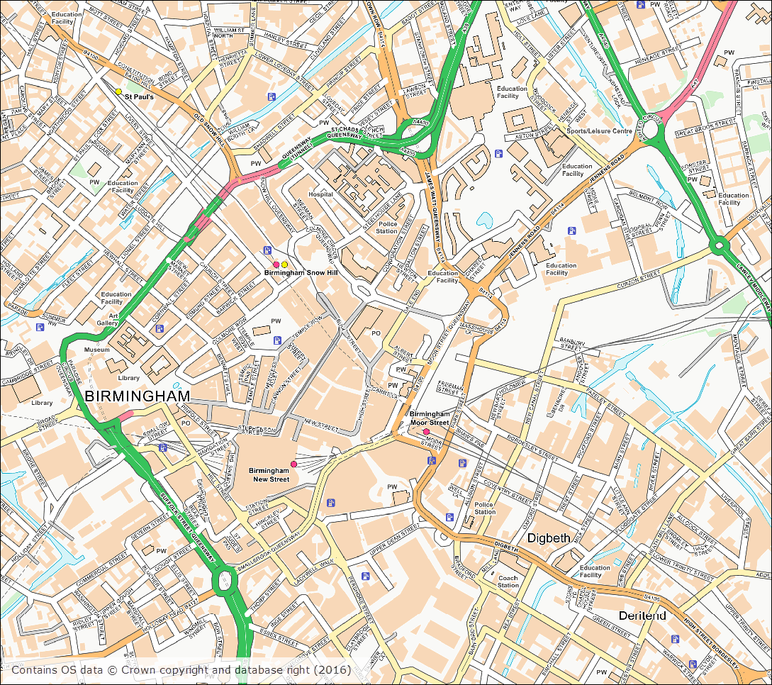
OS Open Map – Local (Raster) Birmingham city centre
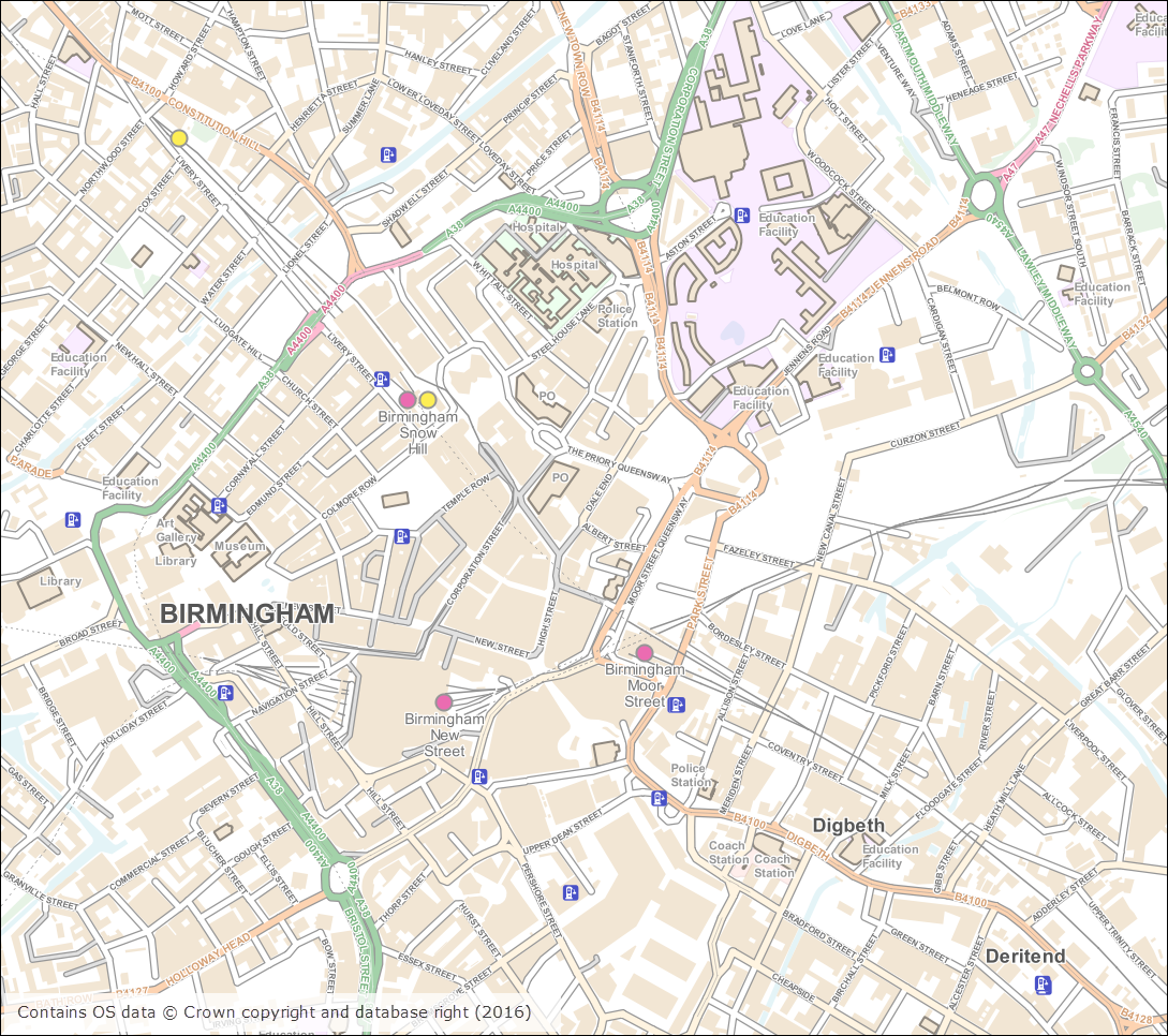
OS Open Map – Local (Vector) Birmingham city centre
The tables below list all the datasets that were updated this month.
OS Data Download:
Product Name
OS Publication Date
OS MasterMap Water Network Layer
October 2016
OS MasterMap Sites Layer
October 2016
OS VectorMap Local
October 2016
OS VectorMap Local Raster
October 2016
OS Terrain 5 DTM
October 2016
OS Terrain 5 Contours
October 2016
OS Open Map – Local (Raster)
October 2016
OS Open Map – Local (Vector)
October 2016
Code-Point
November 2016
Code-Point Open
November 2016
OS Roam:
Product Name
OS Publication Date
OS VectorMap Local
October 2016
OS VectorMap Local Raster
October 2016
The OS data update page is kept up to date with all dataset updates in the collections.
If you have any questions about the dataset updates or Digimap please contact us:
A number of datasets were updated last month in both the Ordnance Survey and Geology collections. In the Ordnance Survey Collection we also added the new OS MasterMap Highways Network to the service. The screen grab below shows the detail included in the Highways Network; there will be a separate blog post about this dataset shortly.
OS MasterMap Highways Network with OS MasterMap Topography Layer (raster version)
The tables below list the datasets that were updated.
OS Data Download:
Product Name
OS Publication Date
Points of Interest
September 2016
OS VectorMap District Raster
September 2016
OS VectorMap District
September 2016
Boundary-Line
October 2016
OS MasterMap Topography Layer – Raster (1:1,000 and 1:2,000)
June 2016
OS Open Rivers
October 2016
OS Integrated Transport Network Layer Urban Paths Theme
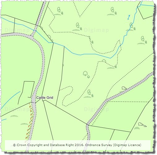
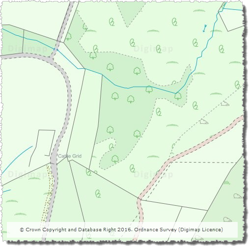
This summer our cartographic team have been busy working on a new style for OS MasterMap Topography layer. These are the maps displayed at the three most detailed zoom levels in Digimap OS Roam. The original style, created more than ten years ago, followed the official style published by Ordnance Survey and has undergone little change since its creation. Later this year Ordnance Survey are making significant changes to the underlying MasterMap data so we thought it was high time the cartography was refreshed to give it a more modern feel.
The design brief had three broad requirements:
make it look ‘nicer’!
tone down the colours to allow annotations to stand out more
use the same colours as OS VectorMap Local, the second most detailed data product
The images below show the original and new styling for a number of areas which highlight the improvements that have been made in both urban and rural areas.
Changes to styling in urban areas:
The colours in urban areas have been muted, removing the large areas of yellow and making ‘unclassified’ land appear with hatching rather than as blank areas on the map.
Improvements in text styling:
Text labels have been updated to emphasise building names and reduce the size of the labels for named urban areas.
Updated rural styling:
Styling in rural areas with mixed land use is a challenge as there are multiple types which need to be conveyed to the user. We have increased the number of shades of green and improved the symbol spacing and placement in order to improve the appearance of these areas. Additionally we have changed the fill colour for tracks allowing them to be more easily distinguished from paved roads.
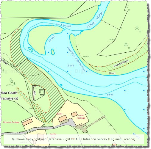
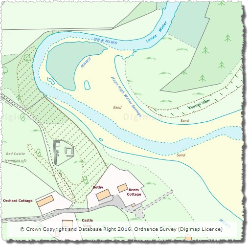
Updated foreshore styling:
Foreshore areas now display using the yellow ‘sand’ colour, making them far easier to visualise.
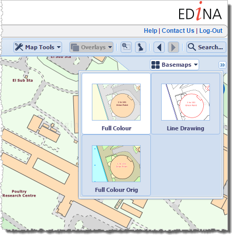
We hope you like the new style, however the original style can still be accessed from the Basemap menu in OS Roam:
If you have any questions about the updates or Digimap please contact us:
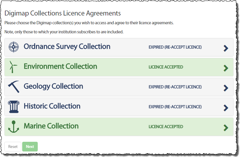
We are now at the start of a new academic year and Digimap has new licence agreements in place for the Ordnance Survey, Geology and Historic Map and Data Collections. You may have noticed already that you have been asked to agree to the licence again when you logged in. This is because some of the terms are different and you are required to agree to these new terms prior to accessing the data within the service.
When you login you will notice the Licence Agreements button at the top right of the home page.
Clicking on this will allow to you to view the licences you have agreed to and to agree to those you have not yet agreed to.
If a Collection has a new licence, the applications (e.g. Roam and Data Download) in that Collection will also appear grey. By trying to access an application which has a new licence, you will automatically be taken through the process of agreeing to it if you have not yet done so.
All you need to do is accept the licence and restate your purpose for using the service (which may or may not have changed since you agreed to the previous licence) and you will have access to the service once more.
If you have any questions or need any help or guidance have a look at the Agreeing to Licences for Digimap Collections section half way down the following help page:
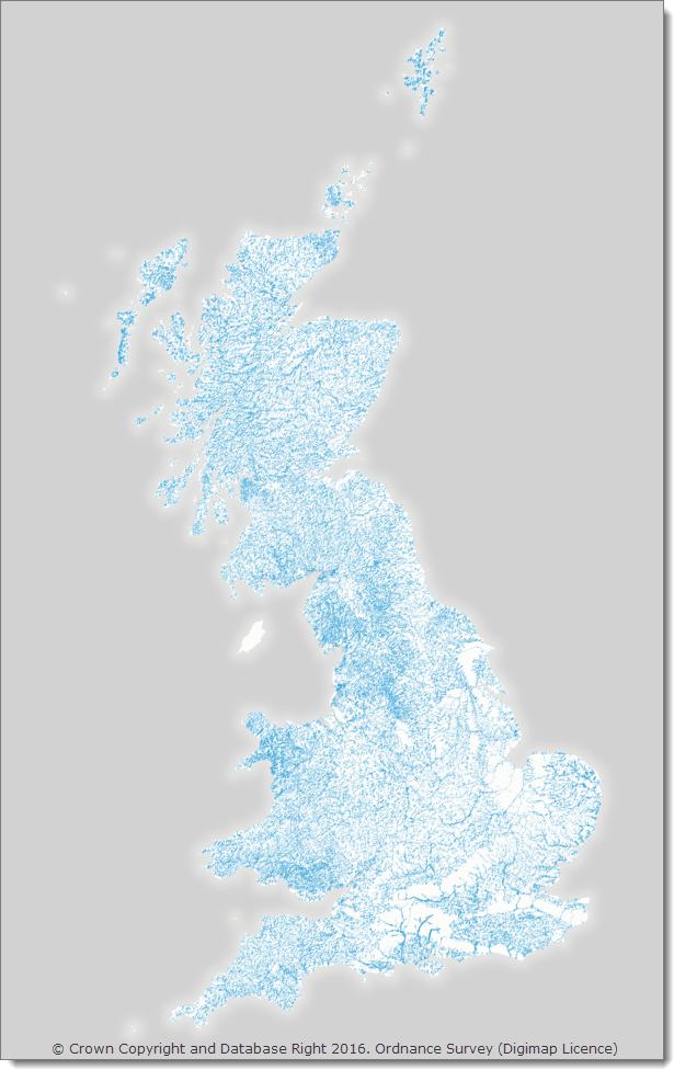
A number of datasets have been updated in June 2016, all in the Digimap Ordnance Survey Collection. As well as updates to the 1:25,000 and 1:50,000 Colour Raster products (which are the digital versions of the ever popular Explorer and Landranger paper map series), this month we have also updated the relatively new OS Open Rivers dataset, an image of the full network is shown on the right hand side. This is the first update to the dataset which was first released in March 2015. Users should note that this dataset is still a Beta version, so changes to the specification and/or delivery method are still possible.
OS Data Download:
Product Name
OS Publication Date
OS MasterMap ITN Layer Urban Paths Theme
April 2016
Code-Point
May 2016
1:250,000 Scale Colour Raster
June 2016
1:25,000 Scale Colour Raster
June 2016
1:50,000 Scale Colour Raster
June 2016
OS Open Rivers
June 2016
*1:50,000 Scale Gazetteer
May 2016
* Note: this is the last update to 1:50,000 Scale Gazetteer as Ordnance Survey have announced that they are retiring this product. Users are advised to use OS Open Names instead. Whilst the data will still be available to download through Digimap, this product will no longer be updated to reflect changes in the real world.
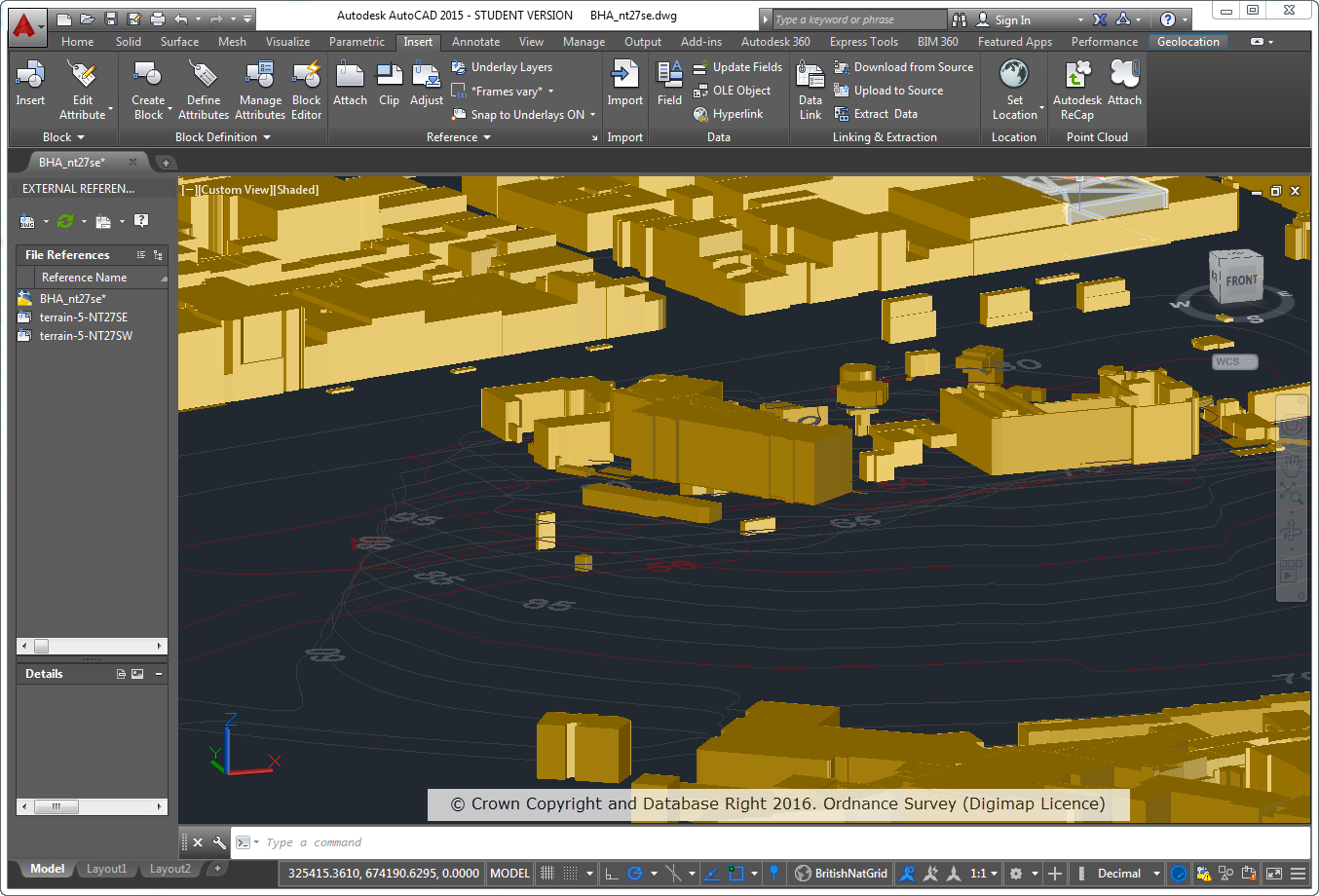
As many of you may be aware, the number of users of the Digimap service using CAD systems has increased considerably over the years. As this user base has grown we have endeavoured to make the data we provide as easy to use as possible in these systems. As part of this effort to continually improve the service we offer, we have made some considerable enhancements to the products we offer for use in CAD systems.
Part of the problem is that there is a proliferation of systems in use under the general banner of ‘CAD’ systems, including AutoCAD, Revit, Rhinoceros, Vectorworks to name a few. A common factor between these systems is that they can accept vector data in DWG format, however, the way that DWG data is handled can vary between systems.
A number of our products in DWG format were loading into CAD systems but some were not correctly spatially referenced. This meant that although the data looked fine and worked perfectly well on its own, but it was difficult to overlay or integrate it with other datasets. We have now fixed this issue, so that it is possible to overlay common products together much more easily.
To accompany the DWG map data we also provide Digital Terrain Model (DTM) data to allow you to create a landsurface to loacte buildings and infrastructure on. In the past we only provided the OS Terrain 5 DTM in a format that was not so easily used in some CAD systems. To remedy this, we are now delivering OS Terrain 5 DTM in the XYZ format that can be used in most CAD systems.
These are the Changes we have made:
All data available as DWG should overlay correctly where appropriate in AutoCAD Map 3D, AutoCAD, AutoCAD Civil, Revit and Rhinoceros.
All data has the correct Spatial Reference (British National Grid) and Units (metres).
OS Terrain 5 Contours are available as 3D Polyline data which is suitable for creating surfaces in Revit and Rhinoceros 5.
OS Terrain 5 DTM is available in an XYZ format which can be used to create surfaces in AutoCAD and Rhinoceros 5.
OS MasterMap Sites Layer is now available in DWG.
OS MasterMap Topography Layer Building Height Attribute data on top of OS Terrain 5 Contours
We have updated our help pages in line with these changes and recommend that you consult the AutoCAD FAQ page which has further details for how you can load Digimap data in to common CAD packages.
We hope our CAD users find these changes useful but if you have any questions about using Digimap data in a CAD system please let us know. Similarly if you can provide us with any information about using Digimap data in a CAD system we would be very pleased to hear from you.