Points of Interest now easier to download

The Points of Interest (PoI) data is great for research and you can make fantastic looking maps too as we have been showcasing on our twitter account. You have certainly been making the most of it too, with 16,877 PoI downloads being made since May 2015. Here are 3 dot density maps we made to show a single class of PoI data:

Points of Interest: Camping and Caravanning Dot Density mapPoints of Interest: Cattle Grids Dot Density mapPoints of Interest: Allotments Dot Density Map

However until today you had to take all the different classes of points for your specified area and you were limited to taking no more than 10,000 Km2 in a single download. As PoI data is split into 9 groups, 52 categories and over 600 classes (see the full scheme here), we though it would make things easier if we exposed some of this hierarchy in Digimap’s Data Download service.

You can now select one or more of the groups or categories to download, taking some of the data processing load off you and making your downloads more manageable. Being able to filter the features in your download by group or category means smaller downloads so we have also removed the limit on the area you can take; you can now take the whole country in one download if you want.

One note of caution though, the PoI data has around 4.5 million records and is over 1gb in size as a simple CSV file. So if you are taking national coverage you may want to only take one group or a few categories to minimise the amount of data you are dealing with.

To select a group or category of features simply add PoI data to your basket then use the drop down menu in the layers column to choose what you are interested in.

Points of Interest data in the digimap download basket

We hope that you find this change really improves the accessibility of the Points of Interest data, we look forward to seeing some of the interesting analyses and maps you produce!

New Digimap Roam for all Collections

On 30th November 2017, we released Beta versions of our new Roam mapping application for all Digimap Collections. Log in to Digimap and click on each Collection to find the link to each new Roam:

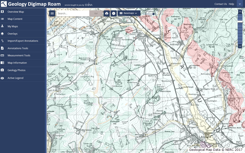
New Geology Roam

The functionality of the new application remains the same, but we hope you agree that the updated look is easier to use.

Most importantly, BOTH versions of Roam (new and old) will run in parallel for an extended period of time to give users the opportunity to get used to the new interface. We will review this at the beginning of March 2018 with a view to establishing a date for withdrawal of the old application.

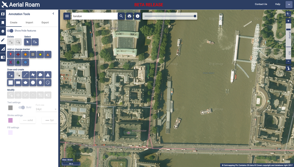
New Aerial Roam showing the London Eye

Known Issues

All applications have undergone thorough testing, but there are still a few issues that we working on, for example some elements can be slow using Internet Explorer. If you spot anything that is not behaving correctly, please report this to us.

We encourage you to try the new beta versions and we welcome any feedback you have.

  • Email: edina@ed.ac.uk

Beta version of OS Roam now available

On 3rd October 2017, we released a Beta version of a new Roam mapping client for Digimap’s Ordnance Survey Collection.  OS Roam – Beta is available next to the existing version, simply log in to the Digimap service and select Ordnance Survey Collection to view the new beta version:

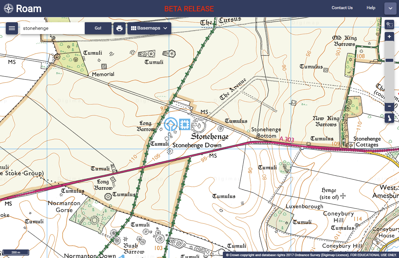
OS Roam - Beta

Whilst the functionality remains the same, we hope you agree that the look and feel of the interface is more modern. The majority of functions are available from a new menu panel down the left hand side, which is hidden by default, maximising the area available for the main map element.

There are some issues we are aware of in this version, which we are working on, for example, some elements can be slow using Internet Explorer and Edge.

New versions of the Roam applications in all other collections will be available in due course. Both new and old versions will run side by side for an extended period of time to give users the opportunity to get used to the new interface.

We would encourage you to try the beta version and we welcome any feedback you have.

  • Email: edina@ed.ac.uk

Coming soon: New Roam for Digimap

As mentioned at Geoforum earlier this year, we’re currently working hard on a new version of Digimap Roam. The new-look application will bring Digimap Roam, the online mapping tool in the Digimap family, bang up to date with the latest web technologies available. Whilst the functionality will remain the same, the look and feel of the interface will be more modern. The majority of functions will be available from a new menu panel down the left hand side which is hidden by default maximising the area available for the main map element. By utilising the latest technologies we will be able to add new functionality and make further enhancements to the application in the future.

The new interface makes further improvements to the experience on mobile devices, an area where we’re seeing an increase in usage across the service. A mock up of how the new Geology Roam interface might look is included below to give you an idea of the proposed layout and styling:

Mockup of the new Geology Roam interface

Currently we are on target to launch the new interface early in the first semester of the 2017-2018 academic year, but we will post progress updates on this blog as the new interface approaches completion. There will be a phased release with the new Roam applications with the Ordnance Survey Collection being first in line.

We appreciate that you may have teaching or lecture materials that may require updating as a result of this change in interface, so we will run all the existing Roam applications alongside the new versions so you can get up to speed with the new interface whilst the existing versions are still available. At the moment we anticipate running both versions in each Collection side by side until at least the end of the year. During this period we would welcome any comments and feedback that you may have.

As ever, if you have any questions about the new Roam, please do not hesitate to contact us.

Lidar Digimap now included with Aerial Digimap

3D scene with Aerial imagery and Lidar
3D scene showing imagery with hillshading derived from the 50cm Lidar DSM. © Getmapping Plc, © Environment Agency copyright and/or database right 2016

We have now reached the end of the Lidar Digimap Preview. We hope that everyone who has used the service has found it a great way to access the Lidar data available. From now on the service will continue to be available to Digimap Users whose institution subscribes to the Aerial Digimap service.

Find out here if your institution subscribes

Lidar Point Cloud Forth Rail Bridge
Lidar Point Cloud Forth Rail Bridge. Crown copyright Scottish Government, SEPA and Scottish Water (2012).

Despite the addition of Lidar Digimap, Aerial Digimap subscription prices will not be increased for the 17/18 academic year. We will also be looking to add further datasets to Lidar Digimap over the next 12 months, these include:

  • Additional Point Cloud datasets ideal for use in CAD software for creating 3D models like this one of the Forth Rail Bridge
  • Photography; aerial images captured at the same time as the Lidar data

We’d also like to thank the hundreds of people who took the time to fill in our user feedback survey on Lidar Digimap, we have seen a huge range of uses for the data across a very broad range of disciplines. This feedback exercise has been very successful and we will be making the draw to see who has won the Amazon vouchers very soon. Keep watching the blog for the announcement in the coming weeks.

If you would like any more information about the Lidar or Aerial Digimap collections or details on how to subscribe then please do not hesitate to contact us:

  • Email: edina@ed.ac.uk


Lidar Digimap: new collection of data available now!

LidarToday we have launched our new Lidar Digimap Collection. The new Collection is available to preview for all Digmap users until the 31st of July 2017. Lidar data can be downloaded through the Lidar Download for use in GIS and CAD applications; there is no Lidar Roam application for viewing the data.
Lidar Point Cloud Forth Rail Bridge
Lidar Point Cloud Forth Rail Bridge. Crown copyright Scottish Government, SEPA and Scottish Water (2014).

The service allows you to download current and past Lidar data from the Environment Agency (EA), Natural Resources Wales (NRW) and Scottish Environmental Protection Agency (SEPA).

There is already a large amount of data available in the service but we are still processing some of the datasets. Once it has all been processed the service aims to have complete coverage of all the data available from these agencies, including the raw LAS point cloud data and Orthophotography captured during the flights (where available).

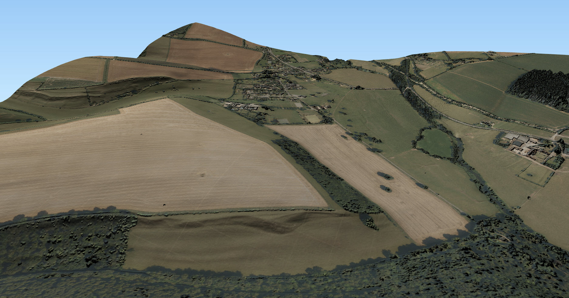
Lidar data is very useful when creating 3D terrains and models as can be seen from the images to the left and below. For creating 3D scenes such as the one below, it is very useful to use a Digital Surface Model (DSM) to create a surface and hillshading from which you can drape other data over, such as the imagery from Aerial Digimap in this example:

3D scene with Aerial imagery and Lidar
3D scene showing imagery with hillshading derived from the 50cm Lidar DSM. © Getmapping Plc, © Environment Agency copyright and/or database right 2015. All rights reserved.

The following datasets are available through Lidar Digimap at present:

Dataset Availability and publication date
Digital Terrain Model and Digital Surface Model (DTM and DSM) England

  • 25cm: 2009-2015
  • 50cm: 2009-2015
  • 1m: 2010-2016
  • 2m: 2010-2015

Scotland

  • Phase 1 (1m): 2011-2012
  • Phase 2 (1m): 2013-2014

Wales

  • 25cm: 2015
  • 50cm: 2009-2016
  • 1m: 2010-2016
  • 2m: 2010-2016
Point Cloud Scotland

  • Phase 1: 2011-2012
  • Phase 2: 2013-2014


We are currently processing the following datasets and hope to have them available in the service shortly:

Dataset Availability and publication date
Digital Terrain Model and Digital Surface Model (DTM and DSM) England

  • Historical data: 1998-2015

Scotland

  • 50cm
  • 2m
Point Cloud England

  • 2005-2016
Orthophotographs England

  • 2006-2015


The data was collected for flood risk analysis and modelling and primarily follows water courses and coastal habitats. The data covers approximately 72% of England, 20% of Scotland and 70% of Wales. The image below shows the 1m resolution DTM coverage in England:

1m DTM Lidar coverage in England
1m DTM Lidar coverage in England [click to expand]
We are also very keen to know what you have been doing with Lidar data in the past or what you plan to do with the Lidar data you are going to get from the new service. To find out this information from you we have put a survey in the interface and you have the chance to win a £20 Amazon just for filling it in!

Digimap Lidar Survey

Lidar Options

We hope you like using the new Collection, if you have any questions about the data please contact us:

  • Email: edina@ed.ac.uk

New Contact Us system launched across all Digimap Collections

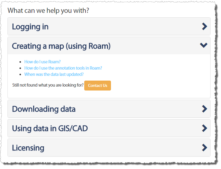
As part of our continuous work to improve Digimap and make it more user friendly, we recently added a new Contact Us system. The new system is available in all Digimap Collections and guides you to useful help resources based on what it is you want to know:

Contact Us - stage 1
Contact Us – stage 1

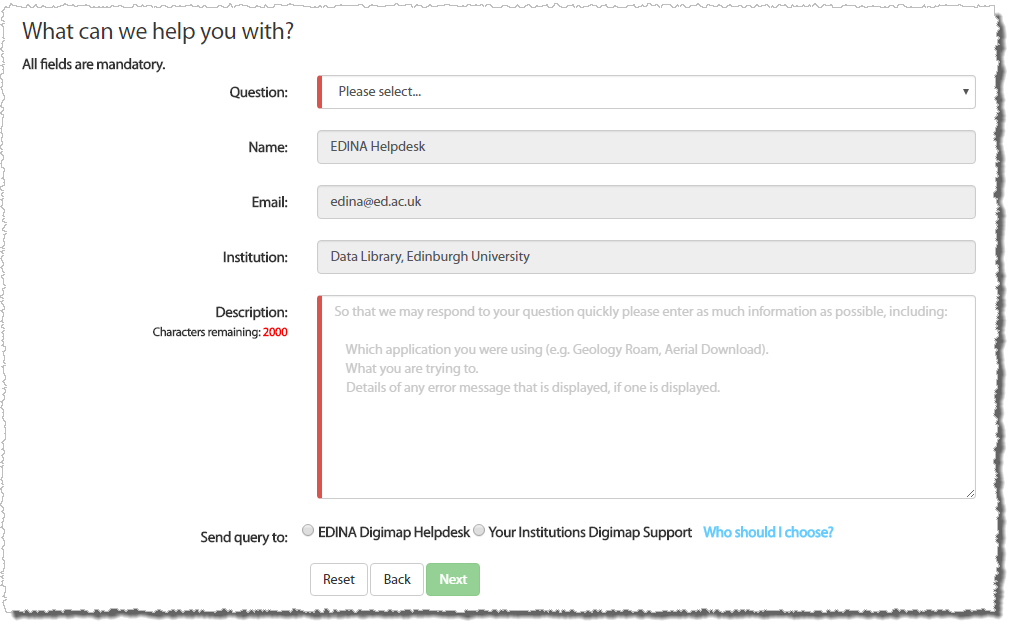
If you are not able to find the answer to your question using the resources then you are asked to complete a short form outlining the problem you are experiencing:

Contact Us - stage 2
Contact Us – stage 2

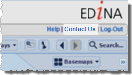
If you are logged in to Digimap you have the option to submit the completed form to either the local Digimap support team at your institution or to the Digimap Helpdesk at EDINA. All queries submitted by users who are not logged in to the service are automatically routed to the EDINA Digimap Helpdesk. The details are sent by email, and copied to you so that you have a full record of what was asked. The new system has been available since the beginning of May and is available from the all Contact Us links in the Roam and Data Download clients, as well as the Contact Us link on the footer of the Digimap home page:

Contact Us Link in Data Download
Contact Us Link in Roam

We hope you like using this improved feature, but if you have any questions or comments regarding this or anything else to do with Digimap, please get in touch using the email address below, or try out the new Contact Us form in Digimap!

  • Email: edina@ed.ac.uk

Digimap dataset updates: January-February 2017

We have updated a number of key datasets in Jan/Feb 2017 in the Ordnance Survey collection of Digimap. These updates bring the datasets available from Digimap inline with the latest versions published by Ordnance Survey. Of particular note are the updates to the two most detailed mapping products available from Ordnance Survey: OS MasterMap Topography Layer and OS VectorMap Local.

OS VectorMap Local showing Westminster
OS MasterMap Topography Layer showing Westminster

OS Data Download:

Product Name OS Publication Date
Integrated Transport Network (ITN) Layer December 2016
OS MasterMap Topography Layer December 2016
OS MasterMap Water Network Layer January 2017
OS VectorMap Local January 2017
OS VectorMap Local Raster January 2017
MiniScale January 2017
OS Terrain 5 Contours January 2017
OS Terrain 5 DTM January 2017
OS Open Names January 2017
Code-Point with polygons January 2017
Code-Point Open February 2017


OS Roam:

Product Name OS Publication Date
OS MasterMap Topography Layer December 2016
OS VectorMap Local Jan 2017
OS VectorMap Local Raster Jan 2017
MiniScale January 2017


The OS data update page is kept up to date with all dataset updates in the collections.

If you have any questions about the dataset updates or Digimap please contact us:

  • Phone: 0131 650 3302
  • Email: edina@ed.ac.uk

Digimap dataset updates: December 2016

The tables below list the datasets that were updated in December 2016 and at the very start of January 2017. The most significant change is the addition of OS Open Map – Local to Roam, which was covered in an earlier blog post. The other updates bring the data available up to date with the most recent versions published by Ordnance Survey.


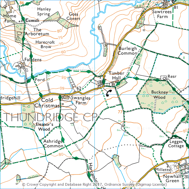
Cold Christmas, 1:25,000 Colour Raster

OS Data Download:

Product Name OS Publication Date
1:25,000 Colour Raster December 2016
1:50,000 Colour Raster December 2016
Points of Interest December 2016


OS Roam:

Product Name OS Publication Date
OS Open Map – Local December 2016
1:25,000 Colour Raster December 2016
1:50,000 Colour Raster December 2016
OS VectorMap District September 2016


The OS data update page is kept up to date with all dataset updates in the collections.

If you have any questions about the dataset updates or Digimap please contact us:

  • Phone: 0131 650 3302
  • Email: edina@ed.ac.uk

OS Open Map Local added to Roam

OS Open Map – Local (OML) was recently added to the Digimap Roam application, giving users the ability to create maps online with a detailed, vector open dataset. OML is the most detailed vector mapping product available from Ordnance Survey as Open Data. We have added this dataset to the following map views in Digimap Roam:

Map View Default Print Scale
Neighbourhood View 1:10,000
Street View 1:5,000
Detailed View 1:2,500

The dataset is rich in features and includes detailed building outlines and Car Charging Points, which are sourced from the National Charge Registry.

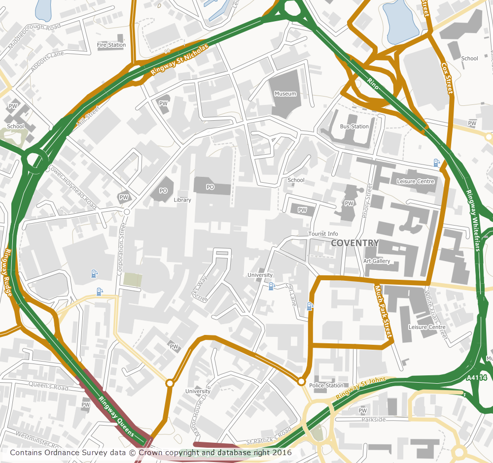
OS Open Map - Local showing Coventry City Centre
OS Open Map – Local showing Coventry City Centre

Ordnance Survey first released OML as a beta product in March 2015 and Digimap users have been able to download this dataset via the Data Download application since April 2015. The October 2016 release of OML marks the end of the beta period and provides the first main version of the dataset.

OML is intended to be used as a detailed basemap on which to visualise your own data and is designed to be an alternative to OS Street View, which will be withdrawn in March 2017 by Ordnance Survey.

The cartography team at Digimap have worked hard to implement a consistent style with that of the smaller scale VectorMap District product, ensuring a familiar look and feel between the two Open Data products. Contours from the OS Terrain 50 product are included when viewing the data in Roam, to give greater context especially in rural and hilly areas.

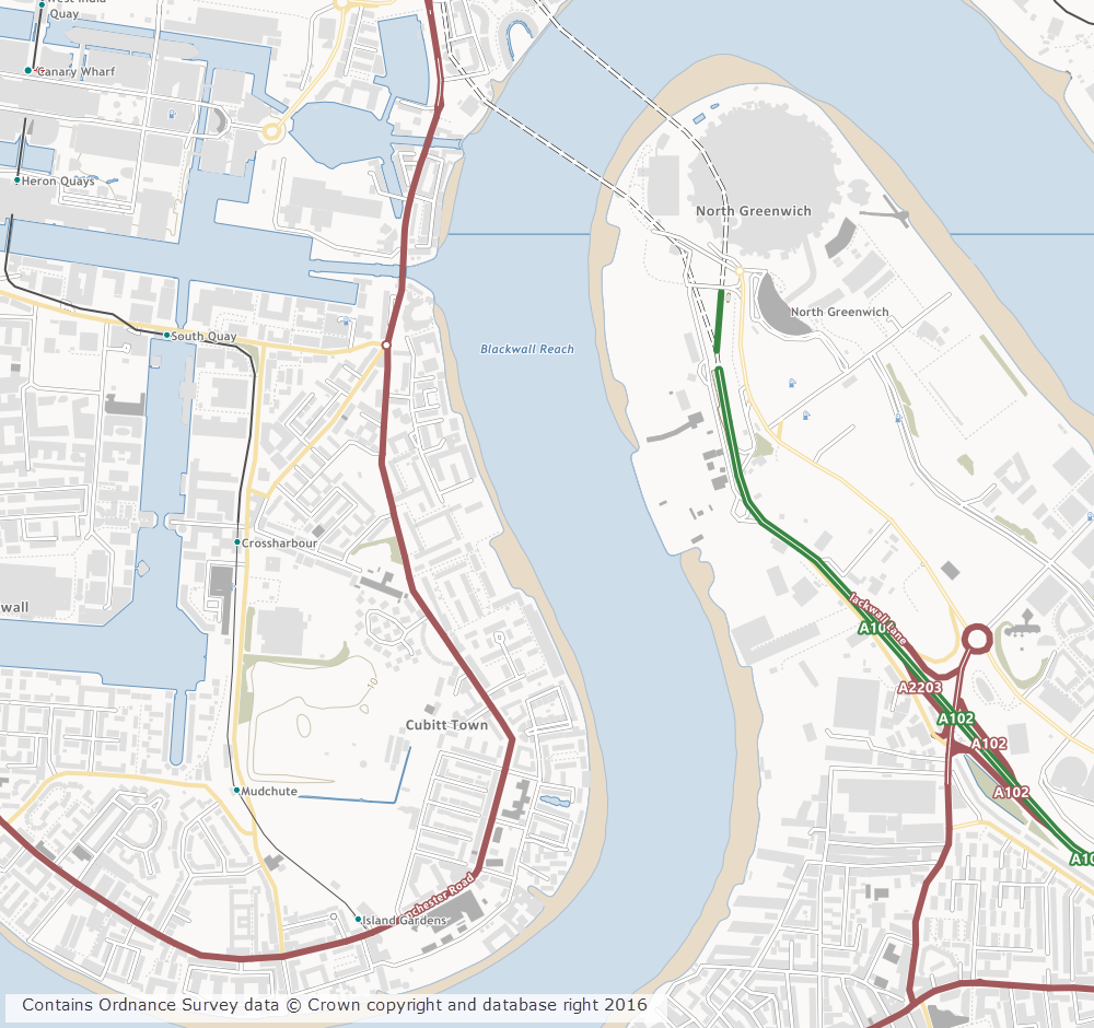
OS Open Map - Local showing Canary Wharf
OS Open Map – Local showing Canary Wharf

Further information on the new dataset can be found on the Digimap help page or the Ordnance Survey website. We hope you like the new data, if you have any questions about the dataset or Digimap please contact us:

  • Phone: 0131 650 3302
  • Email: edina@ed.ac.uk