Any views expressed within media held on this service are those of the contributors, should not be taken as approved or endorsed by the University, and do not necessarily reflect the views of the University in respect of any particular issue.
Digimap is an online map and data delivery service, available by subscription to UK Higher and Further Education establishments. Operated by EDINA at the University of Edinburgh, Digimap offers a number of data collections, including Ordnance Survey, historical, geological, aerial photography, LiDAR, marine maps, land cover mapping, global mapping and census data. For more information about Digimap go to our website: https://digimap.edina.ac.uk Background image Contains OS data (c) Crown Copyright and database right 2022
The VectorMap Local (VML) maps mentioned in the previous blog posts are now working in Digimap Roam. There is a video on YouTube showing you how to view all the different mapping styles that are now available at the four most zoomed in levels; including all the VML maps and Land-Line style MasterMap:
We have had another very busy month and so a new batch of improvements for the Digimap services will be coming soon.
Printing in Ancient Roam
At the moment downloading data or saving screen images are the only ways to use the maps available in Historic Digimap once you have logged out. Soon you will be able to create and save high quality PDF maps from Ancient Roam for use offline. We hope you will find this a much better way to get the best quality mapping out of the service.
A sample image of what a PDF from Ancient Roam may look like.
New Data in Digimap Roam
Since the arrival of the Ordnance Survey’s latest large scale product, VectorMap Local, we have been busy thinking of the best way to include it in the Digimap Roam. We have decided to use it to create four new representations available at two different scale levels.
Here is a quick look at what the four different representations might look like:
Vectormap Local- StandardVectormap Local - StreetviewVectormap Local - PlanVectormap Local - 1:10,000 Raster
We haven’t stopped there either; we are also going to add in Line Drawing style mapping to the two most zoomed in levels; for those who like their MasterMap plain and simple, similar to planning application maps.
MasterMap - Line Drawing
You will be able to select the different views from the Map Content Control Tab using a drop down list.
For more information about VectorMap Local look in the Digimap help pages as it is already available for download:
For those of you who have tried the annotation tools in Digimap Roam it will come as no surprise that we are very pleased to announce that we are now working on adding the same functionality in Geology Roam. Again the annotation tools are a first draft and will have exactly the same functionality as Digimap Roam’s tools.
Once they are released we’d really like to hear from you about which functions you use and what else you would like added. We are already hoping to add in some Geology Mapping symbols for you to add to the maps.
As an added bonus we are also putting in the measurement tools so you can measure areas and distances too, so you can tell how long a fault is or what area is covered by different rock types.
The GA Publishers’ Awards aim to recognise material which is likely to make a significant contribution to geography in primary schools, secondary schools or colleges, and to encourage the creative development of new materials. Further information about the awards can be found here: http://www.geography.org.uk/news/publishersawards/
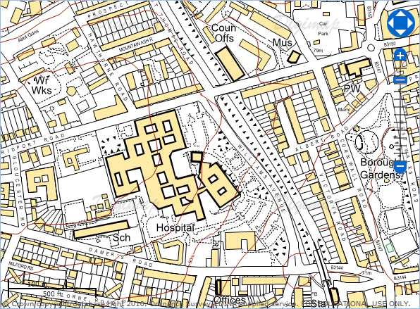
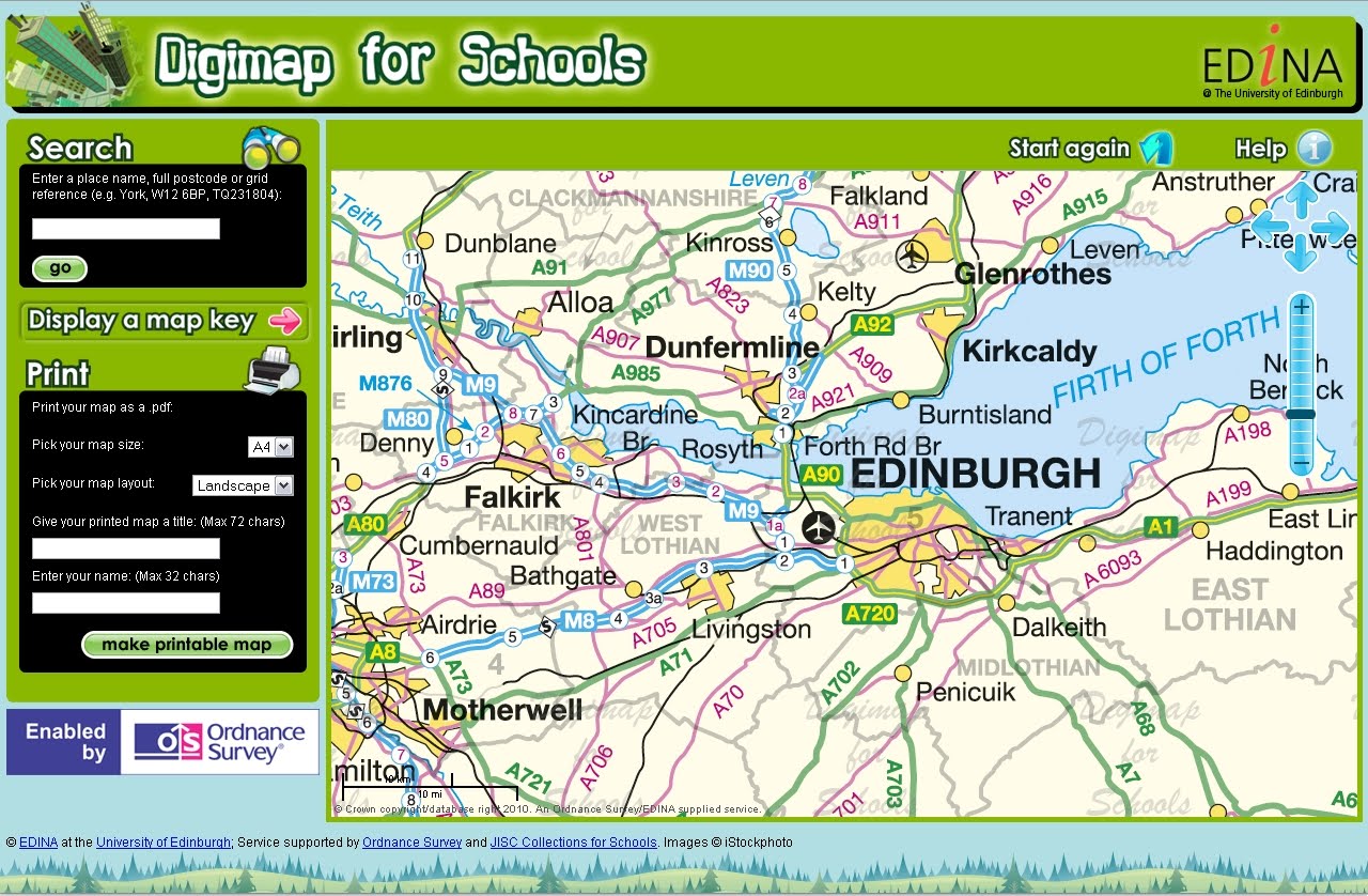
OS MasterMap available through Digimap for Schools
The Award was presented at the Geographical Association’s Annual Conference at the University of Surrey, Guildford on Thursday 14th April 2011 to EDINA’s Director Peter Burnhill and Ordnance Survey’s Director General and CEO, Vanessa Lawrence.
Peter Burnhill said, “This Gold Certification from the Geography Association Publishers is splendid recognition for all those who have worked together on Digimap for Schools to bring Ordnance Survey mapping into the classroom.
“At EDINA, which is based at the University of Edinburgh, we aim to live up to your expectations and do for primary and secondary schools what we have done so successfully for universities and colleges, encouraging love of maps as well as helping to prepare students for the future.”
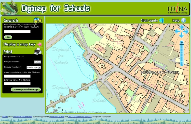
About Digimap for Schools Digimap for Schools is a joint venture between EDINA(University of Edinburgh), Ordnance Survey and JISC Collections and provides easy access to a wide range of current Ordnance Survey maps including national coverage of OS MasterMap, Landranger and Explorer series. Also included are street level maps showing street names and road-atlas style maps.
Subscribing schools can use a seamless digital map of Great Britain at each scale available. Maps can be printed as PDF files at A3 or A4 size and in landscape or portrait orientation. Maps can be printed with an individual’s own map title and name included with the scale bar and school name and address. Search tools include postcode, place name or national grid reference and maps can be moved to centre on any chosen location within Great Britain. Map keys are available for each scale map to explain the symbols used within the map.
For information about Digimap for Schools, how to subscribe and links to a free trial demonstration version of the service, please check the following links:
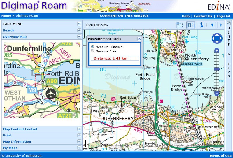
Digimap Roam has new measurement tools that allow you to easily check the distance between two or more points and find out the area of a polygon you draw on the map.
Click on the icon above the map to activate the tools. Select Distance or Area then start clicking on the map to define your line or polygon; use a double click to finish.
The new measurement tools in Digimap Roam
New Local Plus View:
Digimap Roam has also got a new zoom level to go with the measurement tools, bringing the total to 13. The view, called Local Plus, is a more zoomed out view of the 1:50,000 colour raster maps found in the Local view. The image above uses this new view as well as the measurement tools.
The Local Plus view prints at 1:40,000 compared to 1:20,000 for the Local view.
Ordnance Survey have recently release the next version (the beta version) of their VectorMap District product. This dataset is part of the OS OpenData package.
EDINA will be updating the version of VectorMap District available through both Digimap’s OS Collection and Digimap OpenStream. The current (alpha) version will be withdrawn completely.
There is some processing work to be done on VectorMap District before it can be available through EDINA’s services. With this in mind, we aim to release the new version through Digimap’s Data Download facility on Tuesday 5th April and through Digimap OpenStream by Thursday 31st March.
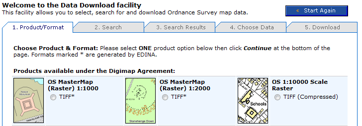
OS MasterMap data is now available to download in a rasterised (image) format from Digimap’s Data Download facility. If you need an image of OS MasterMap data (for example, as a backdrop map) but don’t need the complexity of the original vector data, this new stuff is for you.
OS MasterMap – detailed but complex
OS MasterMap is the most detailed product offered by Ordnance Survey. Maps made with with OS MasterMap have been available through Digimap’s mapping facilities since 2007, but if you wanted to use OS MasterMap as background for a customised map by overlaying your own data in a GIS you needed to download and convert the raw GML data. If all you want is a detailed colour background image, this seems like a significant investment of time.
Rasterised OS MasterMap – images not data
Digimap now offers OS MasterMap as .tif images at two scales: 1:1000 and 1:2000 through the usual Data Download facility. This saves you having to download, convert and import the data using specialist GIS software.
Where do I get the OS MasterMap raster background maps?
Log in to Digimap’s OS Collection, go to Data Download and select which scale of OS MasterMap image you want from the list of products. The images are tiled in 1km square tiles, so you can select your area of interest, and the tiles covering it, in the same way as other tiled datasets.
The scales are determined according to the distance on the ground represented by each pixel. The larger scale images are based on a measurement of 0.3125m per pixel. The smaller scale images are based on a measurement of 0.625m per pixel. These equate to approximate scales of 1:1000 and 1:2000 respectively, although these are dependent on the screen resolution of your monitor. You can easily display the maps at other scales, but some loss of image quality may occur if you do.
EDINA has been asked to post the following request for assistance from Ordnance Survey regarding the usability of particular datasets. Please follow the links below if you can help.
You may remember a similar survey being conducted in June 2010. This latest survey refers to different datasets.
Hello,
My name is Michael Brown and I work for the Ordnance Survey research department. My work includes the development and application of methods to improve the usability of OS products. I am currently exploring the use of questionnaires to evaluate the usability of our products and guide their further development. If you have any experience of the following Ordnance Survey products please follow the links provided and complete the questionnaire. Each should only take a few minutes to complete, and I would appreciate it if you could complete as many as you can.
If you have any questions feel free to contact me. Thank you for your time.
Dr. Michael Brown
Usability Specialist
Research, L1F2, Ordnance Survey
Adanac Drive, SOUTHAMPTON, United Kingdom, SO16 0AS
michael.brown@ordnancesurvey.co.uk
Ordnance Survey is currently promoting the GeoVation Challenge with a particular emphasis on the use of OS OpenData. EDINA’s Digimap OpenStream service, providing access to a Web Map Service (WMS) offering OS OpenData products, is available free of charge and can be used to enter the GeoVation Challenge! You just need a .ac.uk email address to register online. Read on for details of the innovation awards funding and prize money.
The current Challenge is “How can we improve transport in Britain?” Check the GeoVation Challenge website for further details. The challenge is open until 12.00 noon on 11 February 2011. If you have a great idea that uses geography to address the challenge, you could win a slice of £150,000 to help make it happen, funded by the Ideas in Transit project. There is also a share of £10,000 for the idea that demonstrates the best use of OS OpenData. The Challenge is open to UK residents 18 and over.
Baroness Joan Hanham CBE, Parliamentary Under Secretary of State for Communities and Local Government (CLG) has launched a brand new service to help improve the teaching of geography in schools with Dr Vanessa Lawrence CB, Director General and Chief Executive of national mapping agency Ordnance Survey. The launch took place at Graveney School in Wandsworth, London on Wednesday 10 November at 2pm.
Ordnance Survey is increasing its support for the teaching of geography at all levels by launching a brand new online mapping service for all schools across Great Britain. ‘Digimap for Schools’ provides schools with easy access to Ordnance Survey’s most detailed digital mapping for the whole of Great Britain. For the first time, pupils will have access to maps showing individual building outlines as well as familiar scales of mapping used by outdoor enthusiasts and on websites.
EDINA is pleased to announce the release of Digimap OpenStream – a web service delivering OS OpenData to the UK academic sector using open standard WMS technology.
Digimap OpenStream is an EDINA Digimap value-added service freely available to the academic community. Access is not restricted to registered Digimap users, although a one-off online registration is required. The OS OpenData offered is accessible 24/7 and users are able to embed it into their own application software without the overheads of downloading and managing large quantities of data.
Digimap OpenStream provides access to the following OS OpenData products:
MiniScale®
1:250,000 Scale Colour Raster
OS Vector Map™ District (Raster)
OS Street View®
Details of the Application Programming Interface (API) are provided along with simple guides illustrating how to use the service within popular GIS software.