 EDINA are delighted to announce that the new Digimap for Schools service has been awarded the GOLD Certificate for the best overall resource in the the Geographical Association’s 2011 Publishers’ Awards.
The GA Publishers’ Awards aim to recognise material which is likely to make a significant contribution to geography in primary schools, secondary schools or colleges, and to encourage the creative development of new materials. Further information about the awards can be found here: http://www.geography.org.uk/news/publishersawards/
The Award was presented at the Geographical Association’s Annual Conference at the University of Surrey, Guildford on Thursday 14th April 2011 to EDINA’s Director Peter Burnhill and Ordnance Survey’s Director General and CEO, Vanessa Lawrence.
Peter Burnhill said, “This Gold Certification from the Geography Association Publishers is splendid recognition for all those who have worked together on Digimap for Schools to bring Ordnance Survey mapping into the classroom.
“At EDINA, which is based at the University of Edinburgh, we aim to live up to your expectations and do for primary and secondary schools what we have done so successfully for universities and colleges, encouraging love of maps as well as helping to prepare students for the future.”
About Digimap for Schools
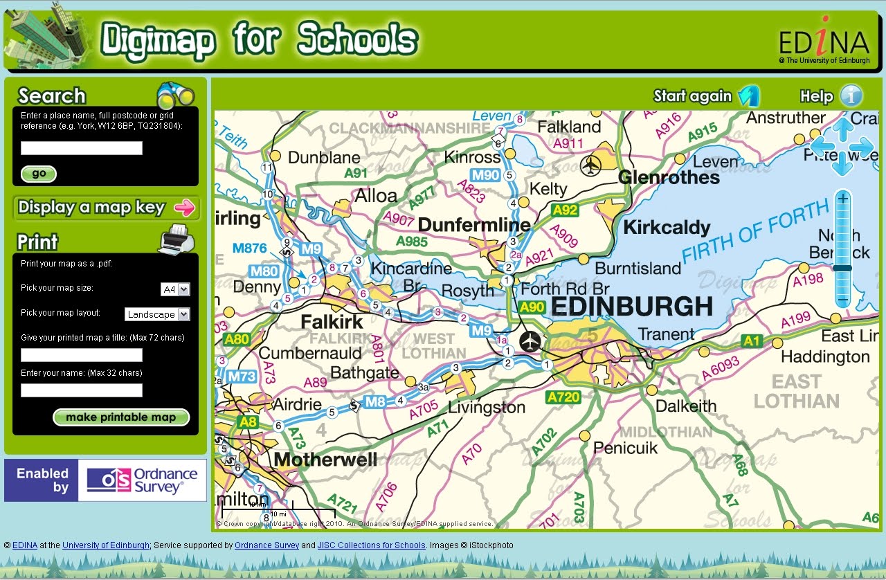
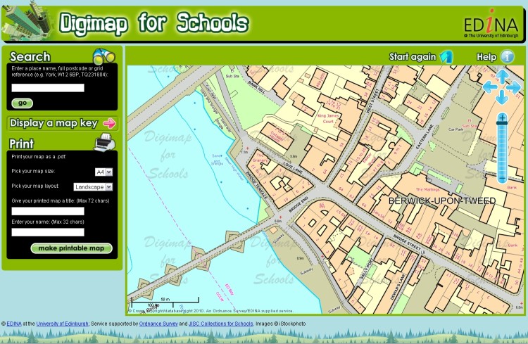
Digimap for Schools is a joint venture between EDINA (University of Edinburgh), Ordnance Survey and JISC Collections and provides easy access to a wide range of current Ordnance Survey maps including national coverage of OS MasterMap, Landranger and Explorer series. Also included are street level maps showing street names and road-atlas style maps.
Subscribing schools can use a seamless digital map of Great Britain at each scale available. Maps can be printed as PDF files at A3 or A4 size and in landscape or portrait orientation. Maps can be printed with an individual’s own map title and name included with the scale bar and school name and address. Search tools include postcode, place name or national grid reference and maps can be moved to centre on any chosen location within Great Britain. Map keys are available for each scale map to explain the symbols used within the map.
For information about Digimap for Schools, how to subscribe and links to a free trial demonstration version of the service, please check the following links:
- http://digimapforschools.edina.ac.uk/about.html
- http://digimapforschools.edina.ac.uk/subscribe.html
- http://digimapforschools.edina.ac.uk/demonstration.html