Any views expressed within media held on this service are those of the contributors, should not be taken as approved or endorsed by the University, and do not necessarily reflect the views of the University in respect of any particular issue.
Digimap is an online map and data delivery service, available by subscription to UK Higher and Further Education establishments. Operated by EDINA at the University of Edinburgh, Digimap offers a number of data collections, including Ordnance Survey, historical, geological, aerial photography, LiDAR, marine maps, land cover mapping, global mapping and census data. For more information about Digimap go to our website: https://digimap.edina.ac.uk Background image Contains OS data (c) Crown Copyright and database right 2022
EDINA will be running a free webinar about Aerial Digimap on Wednesday 25th January at 13:00 – 13:30pm.
Please join us to learn more about Aerial Digimap and the benefits the data can bring to research, teaching and education. The webinar is free, but you will need to register (see link below). Places on the webinar are limited with only 100 available, so book now to secure your place.
In the webinar you will hear about the new Digimap Aerial Collection launched in October 2016. We will give you a guided tour of the new Aerial Roam application explaining the data and functionality available.
You can read more about the Aerial Digimap service in this previous blog post:
The tables below list the datasets that were updated in December 2016 and at the very start of January 2017. The most significant change is the addition of OS Open Map – Local to Roam, which was covered in an earlier blog post. The other updates bring the data available up to date with the most recent versions published by Ordnance Survey.
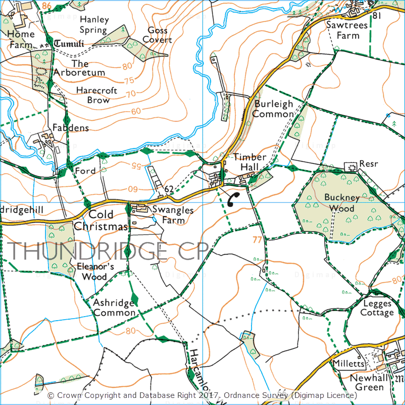
Cold Christmas, 1:25,000 Colour Raster
OS Data Download:
Product Name
OS Publication Date
1:25,000 Colour Raster
December 2016
1:50,000 Colour Raster
December 2016
Points of Interest
December 2016
OS Roam:
Product Name
OS Publication Date
OS Open Map – Local
December 2016
1:25,000 Colour Raster
December 2016
1:50,000 Colour Raster
December 2016
OS VectorMap District
September 2016
The OS data update page is kept up to date with all dataset updates in the collections.
If you have any questions about the dataset updates or Digimap please contact us:
As well as releasing the new OS MasterMap Water Network Layer earlier this month, we have also updated a number of datasets available in the Ordnance Survey collection. Most notably this month we have updated OS Open Map – Local, the most detailed OpenData product available from Ordnance Survey. OS Open Map – Local was initially released as a beta product in March 2015. The October 2016 release of Open Map – Local marks the end of the beta period and provides the first main version of the dataset.
The first main release of Open Map – Local has a few changes over the prevous beta version, including:
enhancements to the features included in the Important Buildings feature class
creation of a raster version optimised for display at 1:10,000 scale, this will be the replacement for OS Street View which is no longer updated and will be withdrawn by OS in March 2017
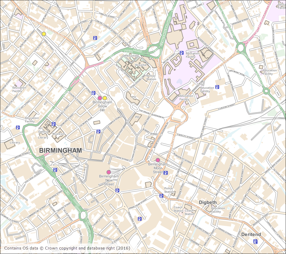
OS Open Map – Local (Raster) Birmingham city centre
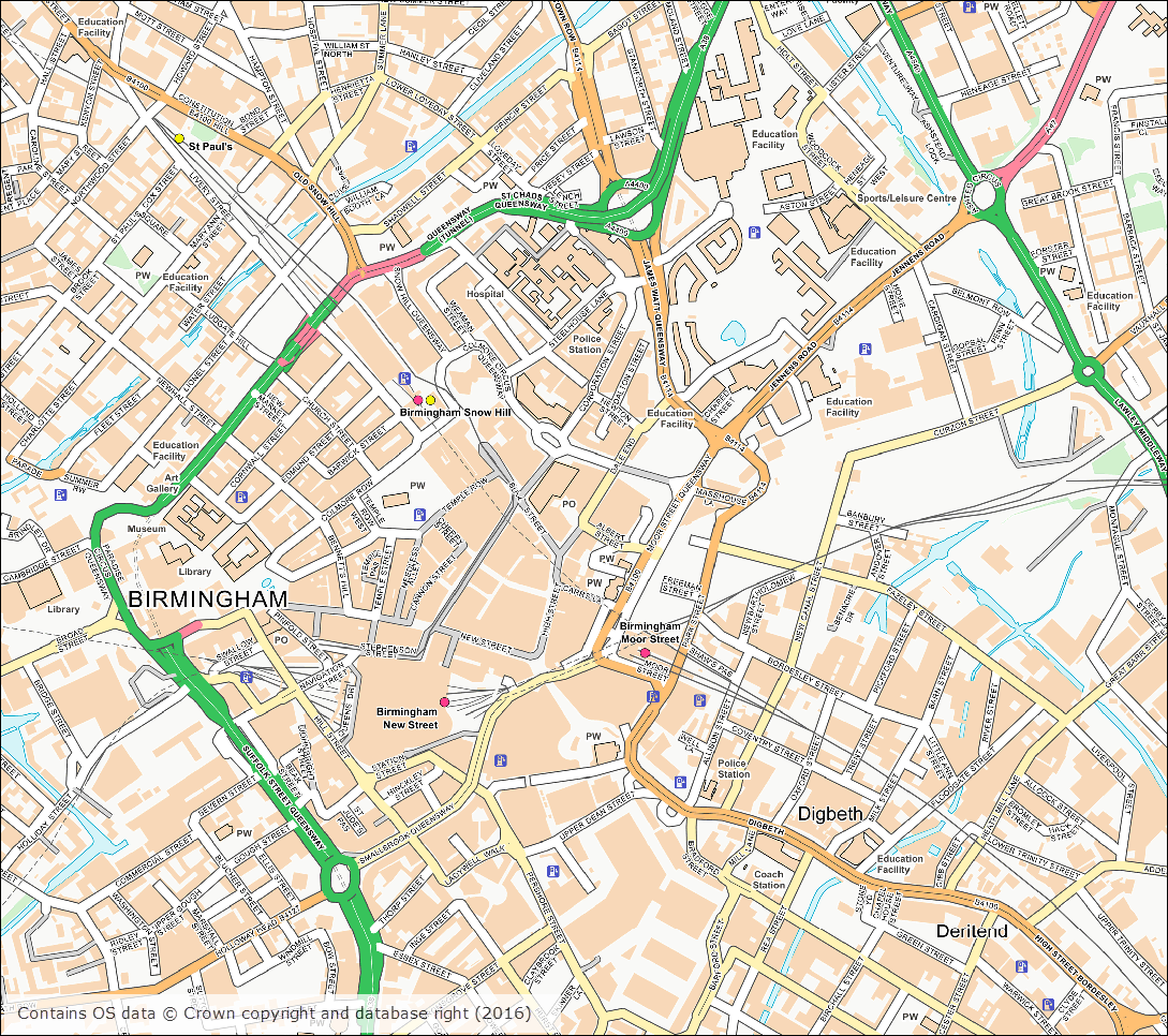
OS Open Map – Local (Vector) Birmingham city centre
The tables below list all the datasets that were updated this month.
OS Data Download:
Product Name
OS Publication Date
OS MasterMap Water Network Layer
October 2016
OS MasterMap Sites Layer
October 2016
OS VectorMap Local
October 2016
OS VectorMap Local Raster
October 2016
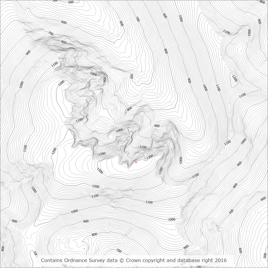
OS Terrain 5 DTM
October 2016
OS Terrain 5 Contours
October 2016
OS Open Map – Local (Raster)
October 2016
OS Open Map – Local (Vector)
October 2016
Code-Point
November 2016
Code-Point Open
November 2016
OS Roam:
Product Name
OS Publication Date
OS VectorMap Local
October 2016
OS VectorMap Local Raster
October 2016
The OS data update page is kept up to date with all dataset updates in the collections.
If you have any questions about the dataset updates or Digimap please contact us:
We are pleased to announce the addition of two new datasets to the Digimap Ordnance Survey Collection, which are available to download through the Data Download application. Both these datasets are detailed network datasets and form part of the OS MasterMap family of products. The datasets should prove useful for individuals carrying out detailed network analysis using the road and river network of Great Britain.
OS MasterMap Highways Network
OS MasterMap Highways Network is a new dataset from Ordnance Survey which provides the most detailed road network dataset available for Great Britain. The new Highways Network product is a replacement for OS MasterMap Integrated Transport Network (ITN), which will be retired at some point in the future. Highways Network was built using ITN as the base network and then further improved adding information from other authoritative sources including the National Street Gazetteer (NSG) and local authorities in England and Wales.
OS MasterMap Highways Network with OS MasterMap Topography Layer (raster version)
Highways Network is provided in GML format as a single, national dataset covering the whole of Great Britain. This is a large dataset and is available through Digimap as a single download of 1.1GB in size.
Ordnance Survey have produced a number of supporting documents that are available for download directly from their website. We recommend that you consult these before using the data.
Current version: June 2016
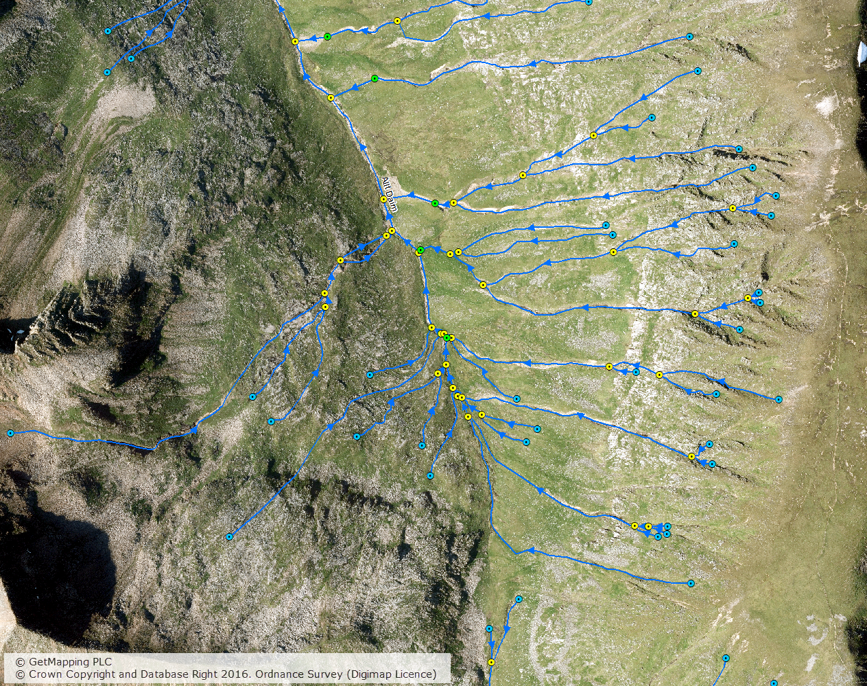
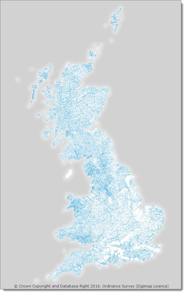
OS MasterMap Water Network Layer
OS MasterMap Water Network Layer is a new network dataset from Ordnance Survey that represenets the centrelines of watercourses including flow direction and suplementary information.
OS MasterMap Water Network Layer on top of aerial imagery for an area of the Scottish Highlands
OS MasterMap Water Network Layer is provided in GML format in 5 x 5km tiles. Water network features that cross tile boundaries are included in all tiles that they cross, so the data is called ‘hairy data’ due to the presence of these ‘hairs’ around the edge of each tile. This means that some processing is required to de-duplicate the features that cross tile boundaries if your order contains data from more than one 5 x 5km tile.
OS MasterMap Water Network Layer is projected in the ESPG 7405, which is a British National Grid projection that also includes the Z value using Ordnance Datum Newlyn.
Ordnance Survey have produced a Getting Started Guide which describes the process of importing the Water Network Layer in to common GIS packages.
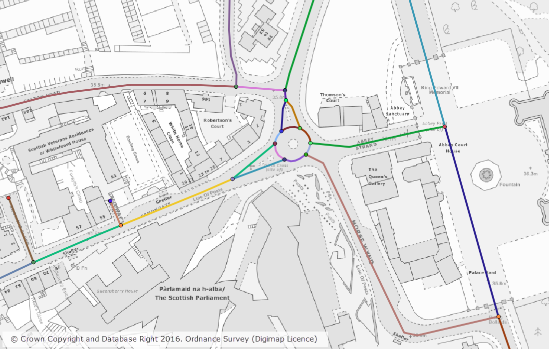
A number of datasets were updated last month in both the Ordnance Survey and Geology collections. In the Ordnance Survey Collection we also added the new OS MasterMap Highways Network to the service. The screen grab below shows the detail included in the Highways Network; there will be a separate blog post about this dataset shortly.
OS MasterMap Highways Network with OS MasterMap Topography Layer (raster version)
The tables below list the datasets that were updated.
OS Data Download:
Product Name
OS Publication Date
Points of Interest
September 2016
OS VectorMap District Raster
September 2016
OS VectorMap District
September 2016
Boundary-Line
October 2016
OS MasterMap Topography Layer – Raster (1:1,000 and 1:2,000)
June 2016
OS Open Rivers
October 2016
OS Integrated Transport Network Layer Urban Paths Theme
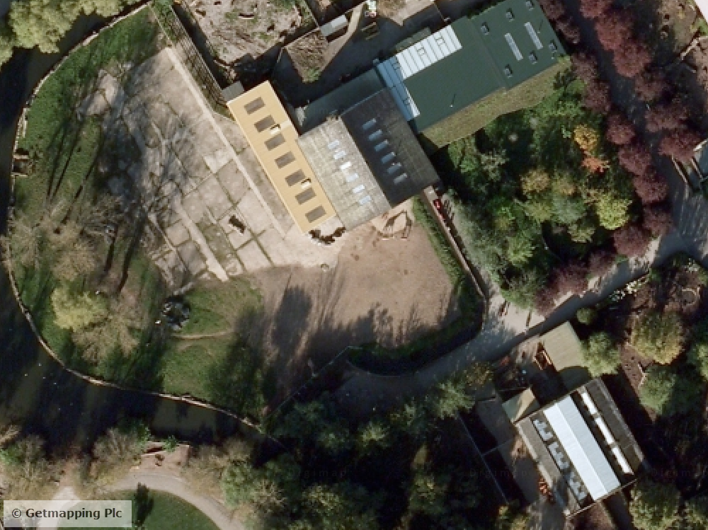
EDINA is pleased to announce the launch of Aerial Digimap, a new Collection offering aerial photography from Getmapping Plc.
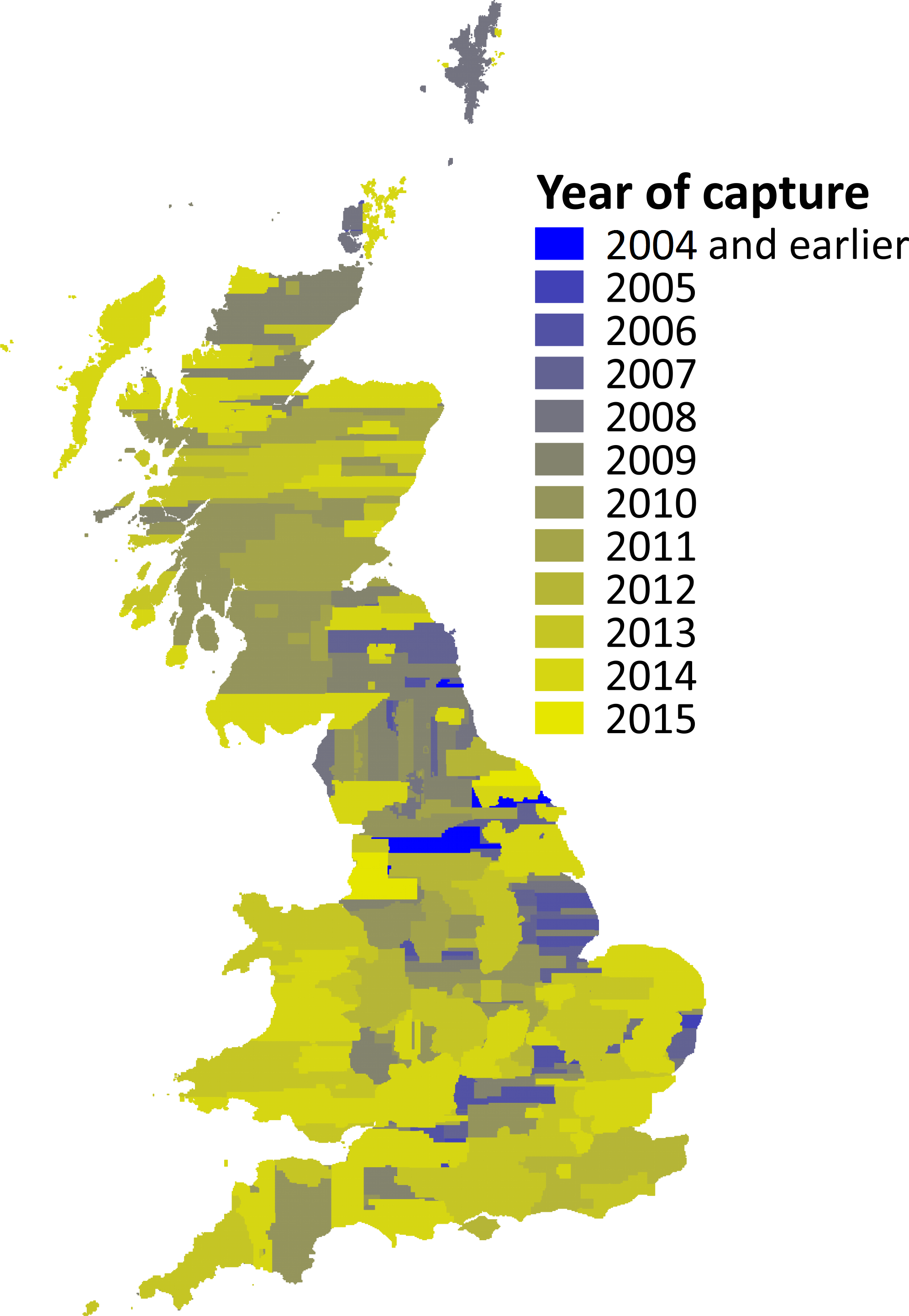
Aerial imagery capture dates
The crystal clear imagery from Getmapping is 25cm resolution vertical aerial photography and the most detailed national coverage available. The largest proportion of the imagery dates from post-2011 with updates due every year.
Aerial Digimap offers both a mapping and a data download facility, both familiar to those who already have access to other Digimap Collections.
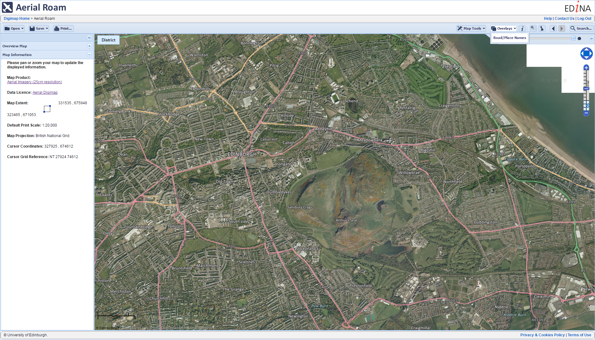
Aerial Roam offers the ability to view, annotate and print the aerial photographs as well as an overlay function to allow comparison with current Ordnance Survey mapping.
Aerial Roam with Road/Place name overlay
Aerial Download offers the ability to select specific locations for which to download the aerial photography for use in local desktop software. Data is delivered in jpeg format each with a corresponding world file (.jgw).
In order to access Aerial Digimap, your institution must subscribe. Please contact your local Digimap Site representative, Learning Resources team or Information Services to express your interest, (you can find your site rep details on this help page: http://bit.ly/DigimapSiteReps).
Subscriptions must be requested by an authorised member of staff. Details about how to subscribe to Aerial Digimap can be found here: http://bit.ly/AerialDigimapSubs
Please contact EDINA directly on edina@ed.ac.uk with any subscription enquiries.
A number of datasets have been updated in June 2016, all in the Digimap Ordnance Survey Collection. As well as updates to the 1:25,000 and 1:50,000 Colour Raster products (which are the digital versions of the ever popular Explorer and Landranger paper map series), this month we have also updated the relatively new OS Open Rivers dataset, an image of the full network is shown on the right hand side. This is the first update to the dataset which was first released in March 2015. Users should note that this dataset is still a Beta version, so changes to the specification and/or delivery method are still possible.
OS Data Download:
Product Name
OS Publication Date
OS MasterMap ITN Layer Urban Paths Theme
April 2016
Code-Point
May 2016
1:250,000 Scale Colour Raster
June 2016
1:25,000 Scale Colour Raster
June 2016
1:50,000 Scale Colour Raster
June 2016
OS Open Rivers
June 2016
*1:50,000 Scale Gazetteer
May 2016
* Note: this is the last update to 1:50,000 Scale Gazetteer as Ordnance Survey have announced that they are retiring this product. Users are advised to use OS Open Names instead. Whilst the data will still be available to download through Digimap, this product will no longer be updated to reflect changes in the real world.