Any views expressed within media held on this service are those of the contributors, should not be taken as approved or endorsed by the University, and do not necessarily reflect the views of the University in respect of any particular issue.
Digimap is an online map and data delivery service, available by subscription to UK Higher and Further Education establishments. Operated by EDINA at the University of Edinburgh, Digimap offers a number of data collections, including Ordnance Survey, historical, geological, aerial photography, LiDAR, marine maps, land cover mapping, global mapping and census data. For more information about Digimap go to our website: https://digimap.edina.ac.uk Background image Contains OS data (c) Crown Copyright and database right 2022
EDINA has been asked to post the following request for assistance from Ordnance Survey regarding the usability of particular datasets. Please follow the links below if you can help.
You may remember a similar survey being conducted in June 2010. This latest survey refers to different datasets.
Hello,
My name is Michael Brown and I work for the Ordnance Survey research department. My work includes the development and application of methods to improve the usability of OS products. I am currently exploring the use of questionnaires to evaluate the usability of our products and guide their further development. If you have any experience of the following Ordnance Survey products please follow the links provided and complete the questionnaire. Each should only take a few minutes to complete, and I would appreciate it if you could complete as many as you can.
If you have any questions feel free to contact me. Thank you for your time.
Dr. Michael Brown
Usability Specialist
Research, L1F2, Ordnance Survey
Adanac Drive, SOUTHAMPTON, United Kingdom, SO16 0AS
michael.brown@ordnancesurvey.co.uk
You can now follow the EDINA Digimap service on Facebook and Twitter, as well as keeping up to date here on our blog. Our Twitter feed can be found on @EDINA_Digimap and our Facebook page is at: http://www.facebook.com/edinadigimap
We will be posting news about the Digimap service, forthcoming events, service maintenance operations and new features and functions, all of which may be of interest to Digimap users. Don’t forget you can also start your own discussions about Digimap on the Facebook page and you can leave comments or queries on the blog.
If you click Like at the bottom of the left hand column on the Facebook page or follow us on Twitter you will be kept up-to-date with all the latest news.
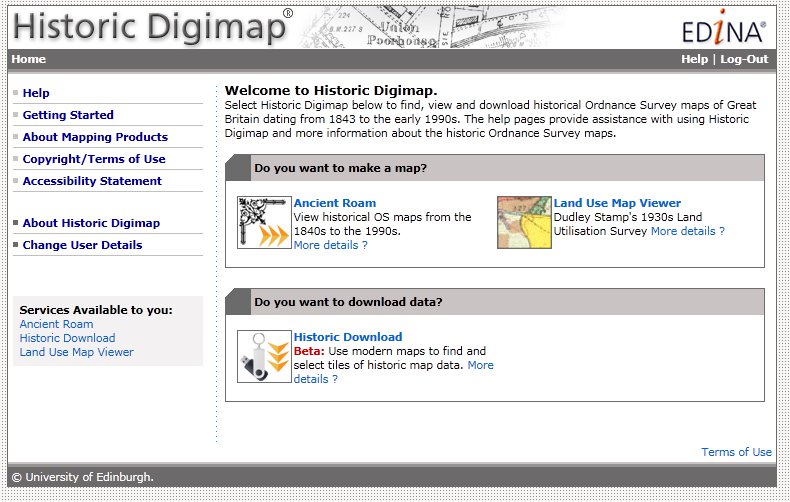
On Tuesday 1st March, EDINA will be updating the metadata for the historical maps in Historic Digimap. The metadata changes will affect only the Scottish County Series maps and will mean that some maps will appear to “move decade”. More details of the implications of these changes are given below.
Accuracy of publication dates
When the maps were originally scanned, the detailed marginalia on the original paper map sheets was not captured at the same time. The marginalia contained information such as the survey year, publication year, re-publication year (if applicable) and surveyor name. During the digitisation process only one year from the marginalia was recorded; it is assumed this was the publication year but there was always some uncertainty around this.
A joint project between EDINA and the National Library of Scotland (NLS) was undertaken to digitise the marginalia of the original paper copies of the historical maps held by NLS. The metadata captured included the Survey Year and Publication Year. Until now, the survey year of all maps in Historic Digimap was unknown. We now have the survey year for a significant number (but not all) of the County Series maps for Scotland at both 1:2500 and 1:10 560 scales.
The significance of this project to Historic Digimap is that we can now use the more accurate and reliable publication dates for many of the County Series maps to improve the mapping and download facilities offered. In order to make use of the new NLS publication dates, these were matched with the original metadata using a series of rigorous database queries and manual processing.
How many maps have changed?
Consequently, around 35,000 County Series map tiles* (18%) now have survey years. Of these, around 28,000 tiles also have a more accurate publication date. In the majority of cases (over 70%) the publication date has only changed by a year or two. For nearly 2,000 tiles the change in publication date is more than 10 years, with the largest single change being 39 years. For those tiles which have not had updates to the survey year, the Landmark publication year used remains unchanged.
So what does this mean for Ancient Roam and Historic Download?
Nothing has changed in Historic Download in terms of how historical maps can be found and downloaded, but the updated publication dates will be reflected in dates provided on the order summary page in the downloader. These will be more accurate and reliable than previously.
For Ancient Roam, there are some more significant effects. The publication date is used to determine which maps are visible in each decade given in the timeline along the top of the map screen.
Many of the maps for which the publication date has changed by one or two years will remain within the same decade and therefore will not be affected. However, for some maps a change of a year or two in the publication date may be enough to shift the map from one decade to another. For example, a map previously thought to have been published in 1889 but now known to have been published in 1901, originally appeared in the 1890s decade but now appears in the 1900s decade.
Where there have been more significant changes in the publication date some have resulted in entirely new decades being available in the timeline for particular areas. For example, in Forfarshire there were two County Series editions in the 1890s. This was because maps originally published in the 1860s and 1870s were re-published in the 1890s. So where no maps appeared for Forfarshire in 1860/70s, they do now!
Other maps with significant publication date changes tend to be odd outlying tiles that for some reason had a significantly different date from neighbouring tiles. This means that some odd ‘holes’ have been filled.
How do I find out the map date source?
In addition to the new survey and publication data information, the Map Details information box will also be updated. A new icon has been added to the tool bar to access the map information and the information box styling has been updated in keeping with the other Digimap Roam clients. Three new attributes have been added to the Map Details information: Year Surveyed (where applicable), Sheet Title (where applicable) and Date Source. The Date Source information will tell you whether the publication year came from the original Landmark data or the NLS metadata.
While these changes to Scottish County Series maps means that the per decade classification is now different, the changes mean that the dates are now more accurate. Our thanks go to the National Library of Scotland for their hard work on this project.
The updates to Historic Digimap will take effect on the evening of 1 March 2011.
*Map tiles refers to the ‘cookie-cut’ National Grid versions of the maps, not the original County Sheets
EDINA is running Digimap training at Leeds Metropolitan University on Wednesday 23 February 2011 Training is free and available to support staff, teaching staff and site representatives. This course will cover an introduction to Digimap’s Ordnance Survey Collection, including mapping facilities and downloading data.
For further information on the course and to book online, please read the EDINA website here:
Digimap OpenStream, EDINA’s new open WMS service, was been updated with the latest version of MiniScale from the OS OpenData collection on 25 January 2011. The most significant changes to this dataset include improved ferry route labeling and a different representation of urban areas.
EDINA aims to provide the latest version of OS OpenData via the OpenStream service. This means that datasets may be updated part way through an academic year.
Work being undertaken by the University of Edinburgh will affect the availability of Digimap’s MasterMap Download facility from Friday 4th to Monday 7th February 2011.
MasterMap Download will be unavailable from 4pm on Friday 4 February until 12 noon on Monday 7 February and will continue to be at risk for the remainder of Monday 7th. We would encourage anyone wishing to take data for use the following week to take it prior to Friday 4th February.
While the maintenance work may be completed over the weekend, there is further software maintenance to be undertaken by EDINA following the University’s works. Currently it is difficult to estimate the length of time this will take, which is why MasterMap Download should be regarded as “at risk” for the remainder of Monday 7th February.
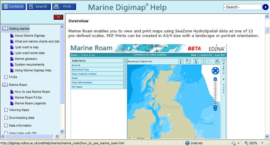
We are currently offering free trial access to the new Marine Roam facility to institutions which do not yet subscribe to Marine Digimap.
Marine Roam provides the only available online mapping tool for Hydrospatial data, a comprehensive dataset of features found in the marine environment, including buoys, wrecks, windfarms, sandbanks, flora and fauna, as well as transportation and socio-economic use information. Marine Roam is currently available as a beta service.
Any staff member at a UK Higher or Further Education Institution can request a free trial. EDINA will issue one username and password per institution which may be shared with anyone at that institution wishing to try the facility. Passwords will be valid until 31 March 2011.
Please feel free to pass this message to others who may be interested or request your trial account.
Information regarding how to subscribe to the Marine Digimap resource can be found at – http://edina.ac.uk/digimap/access/ a subscription provides access to data download facilities as well as online mapping.
Ordnance Survey is currently promoting the GeoVation Challenge with a particular emphasis on the use of OS OpenData. EDINA’s Digimap OpenStream service, providing access to a Web Map Service (WMS) offering OS OpenData products, is available free of charge and can be used to enter the GeoVation Challenge! You just need a .ac.uk email address to register online. Read on for details of the innovation awards funding and prize money.
The current Challenge is “How can we improve transport in Britain?” Check the GeoVation Challenge website for further details. The challenge is open until 12.00 noon on 11 February 2011. If you have a great idea that uses geography to address the challenge, you could win a slice of £150,000 to help make it happen, funded by the Ideas in Transit project. There is also a share of £10,000 for the idea that demonstrates the best use of OS OpenData. The Challenge is open to UK residents 18 and over.
We have implemented a new Help system for the Marine and Geology Digimap collections (Marine Help and Geology Help). The Help pages have been moved to a new production system which will make is easier for us to keep them more up to date and allow you to find the information you are looking for more easily and print better looking pages.
Visually there is not much change to the pages but over the coming months we will be updating and revising the content of the Help pages within Digimap to provide users with improved access to information about the Digimap facilities, the data available and how to use the data in different systems.
If you have any comments about the new Help pages or suggestions please let us know.
Tip: if you want to search for a phrase put it in quotes e.g. “zoom to position”
EDINA has receive a Highly Commended mention at the annual Association for Geographic Information (AGI) Awards for Innovation and Best Practice. http://www.agi.org.uk/agi-awards/
EDINA was entered in the Innovation and Best Practice (Charitable Status) category based on the presentation given at GeoCommunity 2010 by Tim Riley. Tim presented a paper entitled Digimap: 10 Years Old and yet Brand New. The migration of an established service to new GIS infrastructure. This described how much of the infrastructure of Digimap had been updated to a mainly Open Source solution which significantly improved the quality of service offered by Digimap. You can download Tim’s paper here: http://assgeoinf.squarespace.com/storage/geocommunity/papers/TimRiley.pdf