Subpage for Blackford Walks
Route (i) A Craigmillar Castle circuit
Route: Blackford Pond >> Royal Observatory >> Millennium Wood >> Liberton Dams >> Double Hedges >> Craigmillar Castle >> Hawkhill Woods >> Bridgend >> Inch >> Nether Liberton >> West Saville Road >> Blackford hill Stattion >> Blackford Pond.
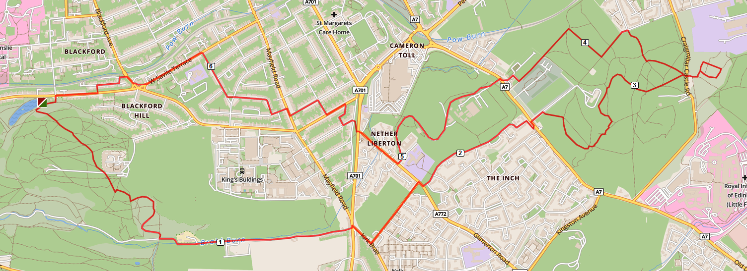
Route description and Notes: A Craigmillar Castle Circuit
Route (ii) A Mortonhall figure of eight
Route: Blackford Pond >> Charterhall Road >> 56 steps, 19 more steps >> Blackford Hill Grove >> Blackford Hill Rise >> Observatory Road >> Harrison Arch >> West Mains Road >> Kings Buildings >> Mayfield Road >> A701>> Montessori Arts School >> Liberton Tower >> Braid Hills Golf Driving Centre >> former site of WWII anti-aircraft defences >> Stanedykehead >> Seven Acre >> Y-junction >> Stables Bar >> Mortonhall House >> Arboretum >> Stenhouse Burn >> Old ha-ha ditch >> Walled Garden >> Stables Bar >> Y-junction >> Braid Hills Golf Course >> Valley of the Braid Burn >> Howe Dean >> Millennium Wood >> Royal Observatory >> Blackford Pond.
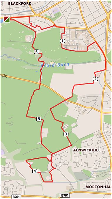
Route description: A MortonHall figure of eight
Trees in Mortonhall ArboretumMortonhall2
Route (iii) Le Tour de Braids
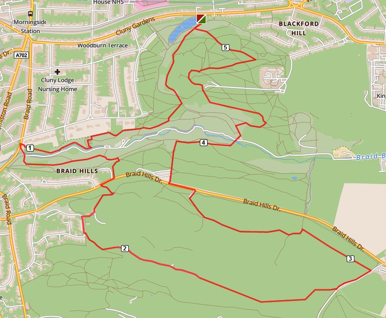
TourDeBraids
Route description: Le Tour de Braids
Route (iv) In the footsteps of RLS
Route: Blackford Pond >> Cluny Dr. >> Hanging Stanes >> Comiston Pl. >> Morningside Cemetery. Grave of ‘Cummy’ the much loved Nanny to RLS, also graves of Sir Edward Appleton, two famous geologists (James Geikie & Ben Peach) and two suffragette sisters (Grace Ross and Martha Georgina Isabella Cadell) >> Dalhousie Terr. >> Braidburn Valley >> Cockmylane >> Comiston Springs Cistern & Wellhead >> White Lady Walk >> Fairmilehead Public Park >> Braid Rd. >> Buck Stane >> Shoulder of Braid Hills >> Braid Burn >> Shoulder of Blackford Hill >> Blackford Pond.
Route description: In the footsteps of RLS
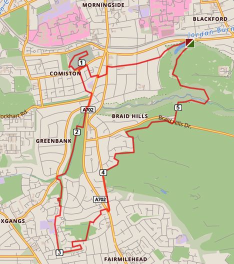
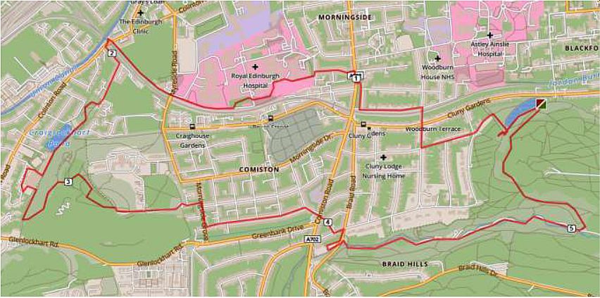
Route (v) A war poets 4-loop walk.
Blackford Pond >> Hermitage of Braid >> Fly walk >> Ashy path >> Firrhill >> Wester Hill >> Old War Hospital >> Old City Hospital >> Poor House Comiston Dr. >> Blackford Pond.
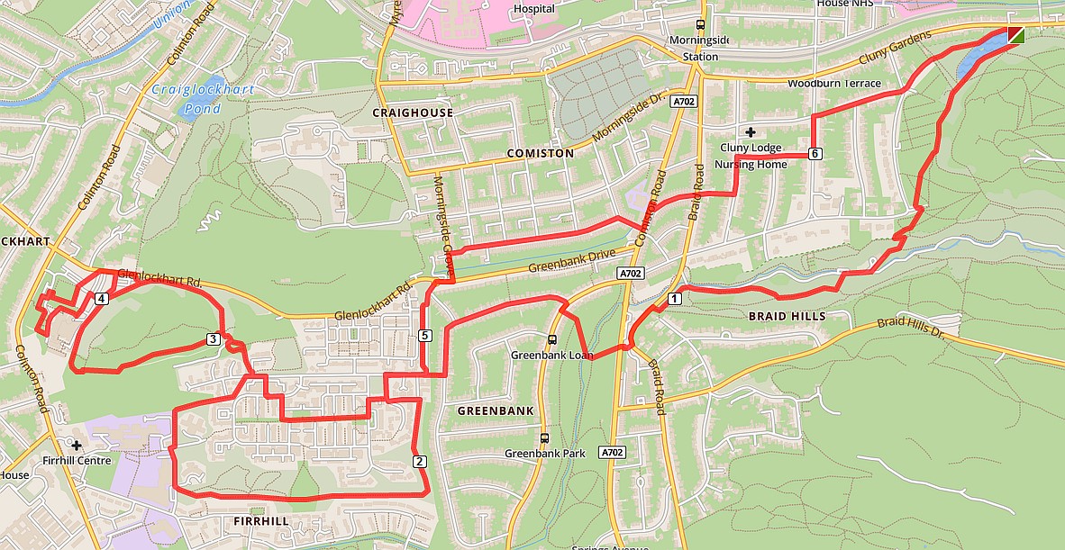
Route description: A war poets 4-loop walk
Notes: A war poets 4-loop walk
Route (vi) A sweep past sixteen old curling ponds.
Blackford Pond >> Royal Ed. >> Union Canal >> Easter Craiglockhart Hill >> Hermitage >> Blackford Pond.
Notes, old maps and photos : S. Edinburgh a sweep past sixteen old curling ponds
Route description: S. Ediburgh a sweep past sixteen old curling ponds
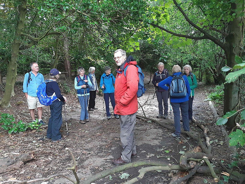
Craig House curling pond. Author and U3A party.
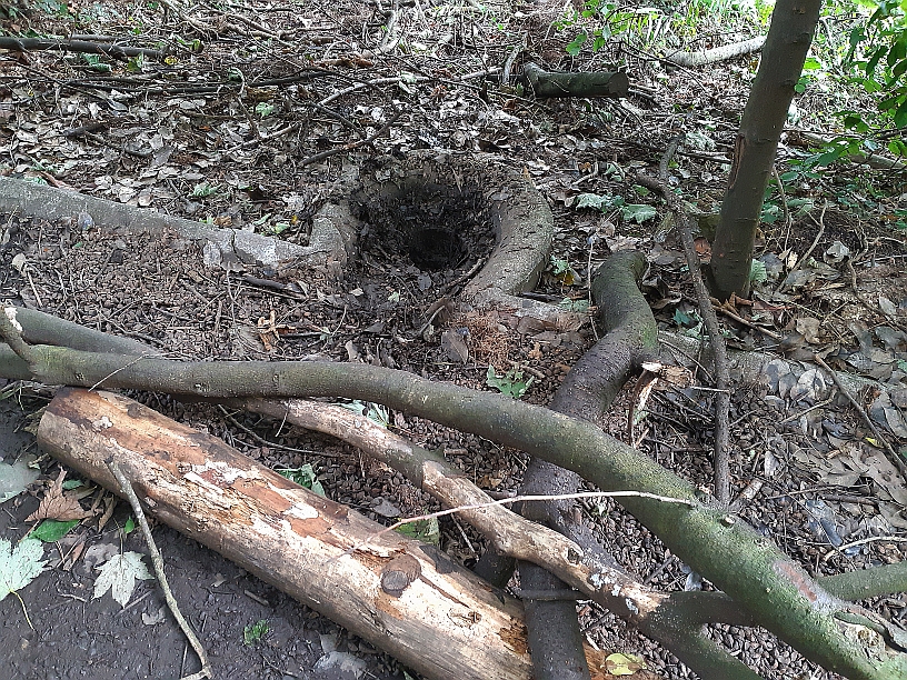
Drain hole of Craig House curling pond
Map of Scottish historical curling ponds
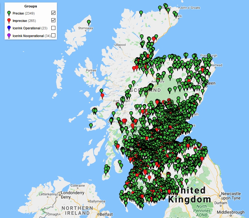
NB. Map, and historical information all from the excellent historical curling places website
Route (vii) The Canal Basin.
Route description and notes: The Canal Basin
Route (viii) Outlying tops of Arthur’s Seat.
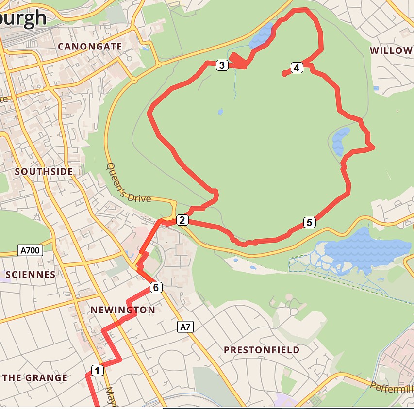
Route description: Outlying tops of Arthur’s Seat
In the 18th century what lay beneath the Earth’s surface was hotly debated. The walk visits sites used in a pioneering C19th geophysical experiment and mathematical quest to determine the Earth’s mass and to probe Earth’s internal structure. The study helped to answer questions such as: Was the Earth hollow or solid? Was its interior full of ocean waters that entered through deep chasms, filled with fermenting mud, or were Earth’s subterranean realms inhabited by strange creatures and spirits, as in the Celtic mythology of “Cruachan”?
Click here PDF for an illustrated description to the background, instrumentation and results of the Arthur’s Seat experiment.
Comments are closed
Comments to this thread have been closed by the post author or by an administrator.