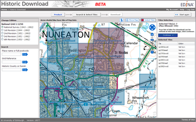
On 31st August, the annual update available through Digimap’s Ordnance Survey Collection will take place. A number of data and service changes will take place.
The annual data update applies to the following datasets:
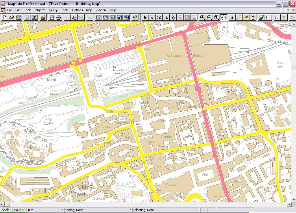
– MasterMap Topography and ITN Layers
– Meridian2
– 1:50 000 Colour Raster
– 1:25 000 Colour Raster
– 1:10 000 Raster
– Strategi
– 1:50 000 Scale Gazetteer
– Code-Point with Polygons
– Boundary Line
NB: Ordnance Survey do not provide regular annual updates to Land-Form PROFILE and do not update Land-Form PANORAMA)
Updated data will be available in all the Digimap OS Collection mapping and download services.
New dataset
During the annual data update, a new dataset will be added to Digimap’s Ordnance Survey Collection. OS VectorMap Local is a 5 x 5km tiled vector dataset, offering detailed national mapping. The data is derived from OS Landplan and is supplied in GML format. It is commonly used as a rich backdrop map to add context to user datasets. Features include roads, railways, vegetation, boundaries and buildings. Pre-defined stylesheets are available to apply to the data, or you can select and style different features in different ways to provide geographic context to your information. OS VectorMap Local will be available to download from the Data Download facility within Digimap’s OS Collection.
As OS VectorMap Local is provided in GML, it needs to be converted to proprietary data formats in order to be fully utilised. Rolta UK (www.rolta-europe.com/osvector.html) have developed a free-to-use data translator tool to convert OS VectorMap Local to ESRI Shapefile and MapInfo TAB formats. Rolta also supply styling which can be applied to Shapefiles using the Layerfiles provided with the software. Styling can be applied to TAB files during the translation process. Further information about OS VectorMap Local, translation and use can be found in the Digimap Help Pages.
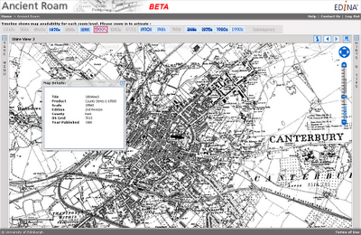
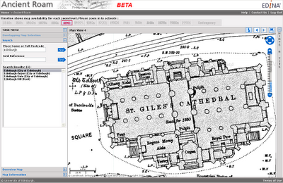
Ancient Roam
The 31st August update will see Ancient Roam move from its Beta phase to become a full service. Ancient Roam has proved very popular since its release in April generating in excess of 300,000 screen maps in four months. On 31st August, the ability to view two maps side by side to compare changes over time will be added. The 2up View provides a quick and easy way to view two maps from different decades at the same time.
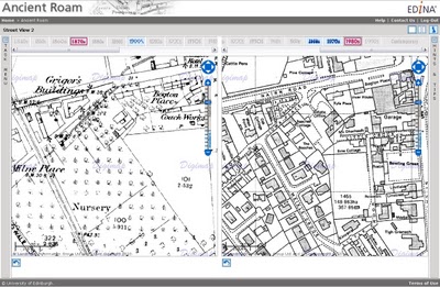
A new drag to zoom tool will also be added to make it even quicker and easier to zoom quickly into your area of interest.
There are more features planned for Ancient Roam over the coming year, so please send us your comments and suggestions if you would like to see anything particular added. Although Ancient Roam is becoming a full service, the exiting Historic Mapper will remain until the end of 2010.
OS OpenData in Digimap
Some data products offered through Digimap have been released by Ordnance Survey under the OS OpenData scheme. Many of these were already available through Digimap and continue to be provided as before. Three of the OS OpenData products have not previously been available through Digimap. These are:
– OS Street View,
– OS VectorMap District
– OS VectorMap District Raster
All the Ordnance Survey products are available to download from the Data Download facility in Digimap’s OS Collection.
Digimap continues to offer full flexibility in identifying and downloading the data you want. Although the OS OpenData products are available from Ordnance Survey’s website directly, search and select options are limited.
If you have any questions about these changes or about Digimap in general, please do not hesitate to contact the EDINA Helpdesk on edina@ed.ac.uk