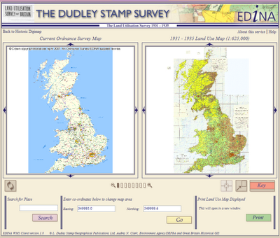
Digimap and Licence Numbers

I’ve been asked to provide my institution’s “Digimap Licence Number”. Where do I find this?

There is no such thing as a “Digimap Licence Number”. If you need a specific licence number, we would suggest the OS Educational Copyright Licence number is the most appropriate one to use.

This licence is arranged directly between the institution and Ordnance Survey and therefore doesn’t relate to Digimap specifically. Institutions can hold an OS Educational Copyright Licence without having a subscription to Digimap, although the licence is required in order to take out a subscription to Digimap.

A copy of the licence (on which you will find the licence number) is held by your institution and the licence number is submitted with your institution’s Digimap subscription forms, which are sent to JISC Collection’s subscription agent. Ordnance Survey will also have a record of it.

Ordnance Survey Licence Agreement Renewal

Lorraine Estelle, CEO of JISC Collections, has issued the following as an email to all institutions subscribing to Digimap’s Ordnance Survey Collection. EDINA will also be distributing this information to site representatives and other support staff.

The current Ordnance Survey Licence Agreement for Digimap ends on 31st July 2009. Ordnance Survey and JISC Collections are working on the renewal of licence which will cover the period from 1st August 2009 to 31st July 2014.

Although the new Licence Agreement is not yet available from the JISC Collections’ website, the subscription fees for first year of the new Agreement from 1st August 2009 to 31st July 2010 are confirmed: in light of the current economic situation the subscription fees for this period will remain at the current level, with no retail price index increase.

JISC Collections will be consulting with users about a new subscription model from 1st August 2010, which it hopes will enable more institutions to afford the other datasets available from the Digimap Collections: Historic Digimap, Marine Digimap and Geology Digimap. The consultation will commence in the autumn of this year.

Given that the pricing model for 1st August 2010 to 31st July 2014 is uncertain until the consultation is complete, institutions signing the new Licence Agreement for 1st August 2009 31st July 2014, may opt-out at 31st July 2010 if they need to.

Northern Ireland map data: JISC Consultation

JISC Collections has an opportunity to add Ordnance Survey of Northern Ireland (OSNI) data to the Digimap Collections. Before a final decision is made to pursue this agreement JISC Collections would like to guage interest in these mapping data from existing subscribers. JISC Collections would welcome feedback on whether or not your institution would participate in an agreement to supply OSNI data through Digimap Collections.

It has been proposed that the following data be included in the licensing arrangement. The suggested formats are also given for each dataset:

  • OSNI Largescale Vector (ntf, dxf, dwg)
  • OSNI 1:50,000 Vector (shapefile, mapinfo tab)
  • OSNI RegionalMap (pgdb, shapefile)
  • OSNI GlobalMap (pgdb, shapefile)
  • OSNI Road Network (shapefile, mapinfo tab)
  • OSNI Boundary Map (pgdb, shapefile)
  • OSNI Pointer Product (format: csv) (Pointer includes Royal Mail Group PAF postcodes)
  • OSNI Place Name Gazetteer Product- OSNI 1:10,000 Raster Product (format: tiff, ecw)
  • OSNI Raster Activity Map Products (format: tiff, ecw)
  • OSNI 1:50,000 Raster Product (format: tiff, ecw)
  • OSNI 1:250,000 Raster Product (format: tiff)
  • OSNI Parliamentary Constituency Raster Map Products (format: jpeg)
  • OSNI Raster Street Map Products (format: tiff, ecw)
  • OSNI Historical Archive Product (format: ecw)
  • OSNI DTM 50m, standard, enhanced Products (format: txt, dbf, dgn)
  • OSNI Orthophotography Product (format: ecw)

More information about the data can be found on the OSNI website: http://www.osni.gov.uk/

The suggested prices for an institutional subscription to this agreement vary according to JISC’s institutional banding, and are as follows:

Higher Education

  • Bands A-B – £750 per annum
  • Bands C-D – £600 per annum
  • Bands E-F – £400 per annum
  • Bands G-J – £100 per annum

Further Education

  • All bands – £75 per institution

If you would find it useful to have access to Northern Ireland data, please contact your Digimap site representative to express an interest in a subscription. If you don’t know who your site representative is, please check the list on our website: http://edina.ac.uk/digimap/list.shtml

If you are a Digimap Site Representative, please gather feedback you receive from Digimap users at your institution and contact Liam Earney (L.Earney@jisc.ac.uk) if you would like to express an interest in a subscription for your institution.

ShareGeo Launched

A new geospatial data sharing facility has been released today which enables Digmap users to find and share geospatial datasets.

ShareGeo forms part of the EDINA Digimap suite of services and is accessible from the Digimap Collections main page in the ‘Find and Share’ section. It is free for all Digimap users to use.


Use ShareGeo to contribute your own (derived or user-generated) geospatial datasets, or to download datasets which are already there for your research, teaching or personal use.

Have you created a geospatial dataset for your dissertation? Do you use them in your teaching? Do you think they would be interesting/useful to others? If so, contribute them to ShareGeo and they will be accessible for download by other Digimap users*.

Geospatial datasets in a number of formats (raster, vector and tabular) can be contributed for anywhere in the world. A minimal amount of metadata is required for each dataset. Access ShareGeo by logging in to Digimap (http://edina.ac.uk/digimap) and then either follow the link on the Collections page to ShareGeo or click on the following link: http://digimap.edina.ac.uk/sharegeo/

Help and further information is available at: http://edina.ac.uk/projects/sharegeo/Help/help.shtml We would welcome comments and feedback sent to us at edina@ed.ac.uk Alternatively you can use the form within ShareGeo at: http://digimap.edina.ac.uk/sharegeo/feedback

*Licensing restrictions may apply to some datasets. If, for example, a dataset is derived from Ordnance Survey data, only Digimap users registered for Digimap’s Ordnance Survey Collection will be able to access it. Specific licence restrictions may apply to individual datasets and these must be adhered to.

NEW! Geospatial data sharing service

EDINA have implemented a new geospatial data sharing facility called ShareGeo. It forms part of the Digimap Collections suite of services.


It is intended that ShareGeo will be accessible to all Digimap users at the beginning of February, however we are providing early access to it for readers of the Digimap blog (details of how to access it are below).

Please feel free to browse and download any datasets that are already there. If you have any geospatial datasets, we would ask you to contribute these to ShareGeo. ShareGeo is free to use for all registered Digimap users.

ShareGeo can be accessed after logging in to Digimap, using the following liks.

  • First login to Digimap at: http://edina.ac.uk/digimap You will see a greyed out link to ShareGeo.
  • The visible link is not active, so you will need to go to ShareGeo by entering the following link in your browser: http://digimap.edina.ac.uk/sharegeo/ (Note: Once the facility is accessible to all, there will be a link on the Digimap Collections page to take you directly to ShareGeo)

Help and further information is available at: http://edina.ac.uk/projects/sharegeo/Help/help.shtml We would welcome comments and feedback sent to us at edina@ed.ac.uk Alternatively you can use the form within ShareGeo at: http://digimap.edina.ac.uk/sharegeo/feedback

If you need help or advice regading ShareGeo please do not hesitate to contact us.

Usage Figures for Site Representatives

Site Representatives for Digimap’s Ordnance Survey Collection may have noticed that the usage statistics for October 2008 are not yet available via the Site Representative’s Support Area.

We are in the process of re-engineering the way we calculate and present usage statistics. Since this process is not yet complete, figures for October 2008 onwards are not yet available. The facility for extracting usage statistics remains available so that site representatives can continue to download figures for previous months.

We hope to have complete usage statistics available in time for the new year. We intend this to include data for all the Digimap Collections. Currently, data is available only for the Ordnance Survey Collection. Please note that information available for some Collections will be more limited than for others, particularly Historic Digimap.

Progress updates will be posted here when available.

Confused?
If you are registered with EDINA as a Digimap Site Representative, you will have access to a specific section of Digimap’s Ordnance Survey Collection called the Site Representative’s Support Area. This will provide you with your institution’s usage data for Digimap. It is only available to site representatives.

GML data translation from Dotted Eyes

Dotted Eyes, a well established digital mapping solution provider, has produced an edition of their InterpOSe GML translator specifically for EDINA Digimap users.

The Digimap Edition of InterpOSe will translate OS MasterMap GML data from Digimap’s MasterMap Download facility and convert it to various file formats, including Shape, TAB, mid/mif and DWG/DXF. InterpOSe deals with both Topography and ITN layers, and is tailored specifically for data from Digimap.

InterpOSe (the Digimap Edition) is free for Digimap users upon registration with Dotted Eyes. Please visit their website for more information and to download a copy of InterpOSe:

http://www.dottedeyes.co.uk/spatial_data_loading/interpose/digimap.php

Britain from Above – Land Use Maps

You may have seen a recent episode of Andrew Marr’s BBC programme Britain from Above which featured the Land Utilisation maps created by Dudley Stamp in the 1930s. You can watch the relevant section again on the BBC website here.

Land Use Viewer
Land Use Viewer interface

These maps are available through Historic Digimap under the Land Use Viewer. You need to have a subscription to Historic Digimap in order to gain access, but there is no individual user registration.

Dudley Stamp's land use map
Sample of Dudley Stamp's land use maps

Withdrawal of Land-Line

Digimap will cease to deliver Land-Line.Plus data at the end of August 2008.

As a registered Digimap user you may continue to hold and use any Land-Line.Plus data you already have until 31 July 2009. Beyond this date, you will be required to delete any Land-Line.Plus data you hold, and will not be licensed to use it thereafter.

Land-Line map of urban area

Land-Line.Plus has been replaced by OS MasterMap Topography Layer. These data are available from Digimap’s MasterMap Download facility, within the Ordnance Survey Collection. The OS MasterMap Topography Layer is as detailed as Land-Line.Plus but contains a much richer attribute set. It is also available in GML format, rather than NTF.

Corresponding OS MasterMap Topography Layer map of urban area

More information about OS MasterMap can be found within the Digimap Help pages.

Historic Digimap: licence and consultation

Reminder of new licence agreement
A new, three-year sub-licence is now available for Historic Digimap, the service offering historic Ordnance Survey maps and data from the Landmark Information Group. Current subscribing institutions will be contacted directly to ensure continued access from 1 August 2008 onwards. The new licence will run from 1 August 2008 until 31 July 2011. Full details, including subscription forms and costs, can be found on the JISC Collections website at: http://www.jisc-collections.ac.uk/catalogue/coll_digimap_historic.aspx

Trials
In addition, 30-day trials are offered to those from institutions wishing to assess the service prior to subscription. Please contact the EDINA Helpdesk on edina@ed.ac.uk to request such a trial. You can read more about Historic Digimap on the EDINA website at: http://edina.ac.uk/digimap/description/historic_overview.shtml

Consultation on additional datasets
JISC Collections are currently running a consultation for the purchase of additional datasets for Historic Digimap. Among the suggested purchases are the GOAD Fire Insurance plans and historical town plans.

Representatives from existing institutions and others interested in the Collection are invited to complete the short survey at their earliest convenience. This can be done online, and should take only a few minutes to complete:

http://www.jisc-collections.ac.uk/consultations/new_agreements/historicdigi_cons

Click the link to the “online response form” in the Introduction.