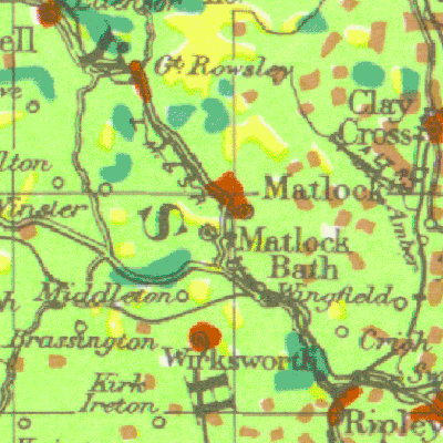
You may have seen a recent episode of Andrew Marr’s BBC programme Britain from Above which featured the Land Utilisation maps created by Dudley Stamp in the 1930s. You can watch the relevant section again on the BBC website here.
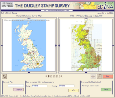
These maps are available through Historic Digimap under the Land Use Viewer. You need to have a subscription to Historic Digimap in order to gain access, but there is no individual user registration.