Any views expressed within media held on this service are those of the contributors, should not be taken as approved or endorsed by the University, and do not necessarily reflect the views of the University in respect of any particular issue.
Digimap is an online map and data delivery service, available by subscription to UK Higher and Further Education establishments. Operated by EDINA at the University of Edinburgh, Digimap offers a number of data collections, including Ordnance Survey, historical, geological, aerial photography, LiDAR, marine maps, land cover mapping, global mapping and census data. For more information about Digimap go to our website: https://digimap.edina.ac.uk Background image Contains OS data (c) Crown Copyright and database right 2022
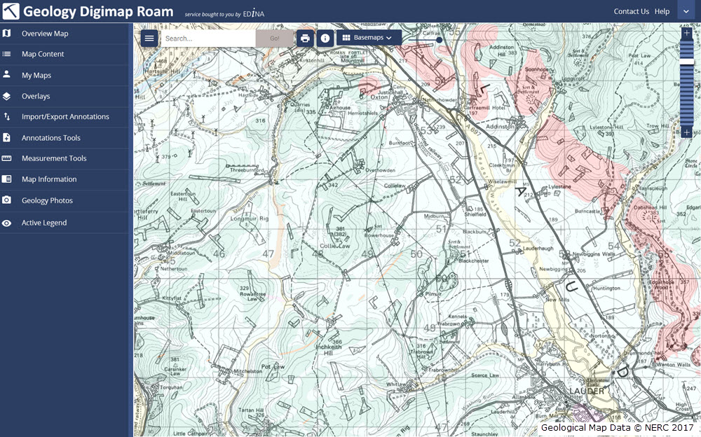
As mentioned at Geoforum earlier this year, we’re currently working hard on a new version of Digimap Roam. The new-look application will bring Digimap Roam, the online mapping tool in the Digimap family, bang up to date with the latest web technologies available. Whilst the functionality will remain the same, the look and feel of the interface will be more modern. The majority of functions will be available from a new menu panel down the left hand side which is hidden by default maximising the area available for the main map element. By utilising the latest technologies we will be able to add new functionality and make further enhancements to the application in the future.
The new interface makes further improvements to the experience on mobile devices, an area where we’re seeing an increase in usage across the service. A mock up of how the new Geology Roam interface might look is included below to give you an idea of the proposed layout and styling:
Mockup of the new Geology Roam interface
Currently we are on target to launch the new interface early in the first semester of the 2017-2018 academic year, but we will post progress updates on this blog as the new interface approaches completion. There will be a phased release with the new Roam applications with the Ordnance Survey Collection being first in line.
We appreciate that you may have teaching or lecture materials that may require updating as a result of this change in interface, so we will run all the existing Roam applications alongside the new versions so you can get up to speed with the new interface whilst the existing versions are still available. At the moment we anticipate running both versions in each Collection side by side until at least the end of the year. During this period we would welcome any comments and feedback that you may have.
As ever, if you have any questions about the new Roam, please do not hesitate to contact us.
This year’s GeoForum, held in the Geological Society of London on the 22nd of June, was a very successful event for all those who attended. Academics and support staff from subscribing institutions got to meet representatives from the Digimap team and experts from our data suppliers and the wider geospatial community.
In the morning session we heard from John Murray who explained some of the complexities involved in using Lidar data for extracting meaningful information to address real world scenarios. The Lidar data used by John is now available through the Digimap Lidar Collection, which is the latest collection to be added to the service. This collection makes data available from the Environment Agency, Scottish Environment Protection Agency (SEPA) and Natural Resources Wales (NRW) easily downloadable through the easy to use Data Download application.
Following John was an informative and engaging presentation by Clare Rowland from the Centre for Ecology and Hydrology (CEH) who produce the Land-Cover Map datasets. Clare was heavily involved in the production of the latest version of the Land-Cover Map (LCM 2015) which is now available to view and print in Environment Roam and to download via Environment Download. Clare highlighted some interesting uses for the data including analysis of how land cover changes are affecting the numbers of bees.
The final presentation of the morning was a round up from EDINA’s Emma Diffley covering the achievements in the last 12 months and the plans for improvements to the service in the next 12 months. Of particular note were the introduction of two new collections: Aerial Digimap, launched in October 2016, and Lidar Digimap, launched in June 2017. The major work being undertaken by the team at the moment is a rewrite of all Roam clients to bring them up to date with the latest technology available, which will give them all a more modern look and feel whilst retaining all the existing functionality.
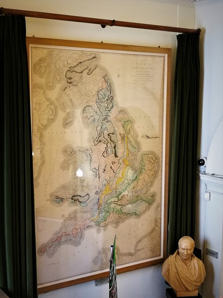
There was a great chance to network over lunch, when we also got to see William Smith’s pioneering Geological Map of Britain.
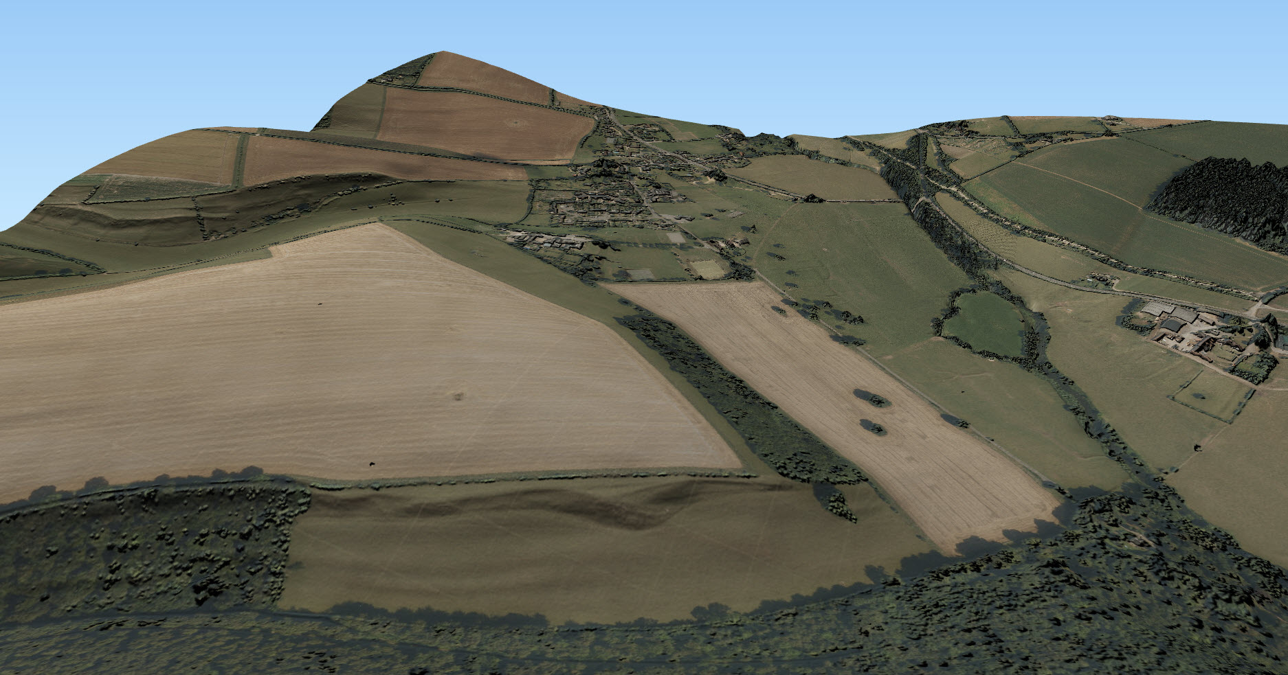
In the afternoon we held a feedback session where all the delegates had their chance to let us know how they feel Digimap is performing and what else they would like to see included in the service. This was then followed by a presentation and demonstration by EDINA’s Ian Holmes on how to use the Data from Digimap in various software packages to create 3D models. He showed us Ordnance Survey data GetMapping Aerial Imagery and some of the Environment Agency’s Lidar data in ArcGIS Pro, QGIS with the QGIS2Threejs plugin, and AutoDESK Infraworks.
The Presentations
John Murray: We have the Technology… We have the data… What next?
GeoForum included a workshop involving all participants on how EDINA runs the Digimap Service. We asked participants what they would like us to add or improve in terms of the data, service and support we provide.
Data
The main theme that came out of this discussion was that there is a great demand for overseas data, both global datasets and national data for other countries. Datasets such as OpenStreetMap and some of the global satellite data are now part of our long-term investment plans for Digimap.
There were also calls for Ordnance Survey’s AddressBase data. We have enquired about this particular dataset with Ordnance Survey before and the sticking point is the joint intellectual property rights with third party organisations. We will keep up the pressure and do our best to make this data available.
Service
The common theme running through most of the service enhancement requests was to be more joined up. Improvements would come by making maps, tools and data more interoperable between collections, improving the ability to analyse all the data that individual users are licensed to use. Other features highlighted come more under the banner of personalisation, allowing users to customise their experience more, or to share maps they have created with other Digimap users.
Support
There was broad consensus that the support we provide for Digimap is excellent, with the content and the broad range of support channels proving very useful. There was most appetite for more webinars and video tutorials which we are committed to expanding in the coming academic year. We also had requests for more marketing materials and detailed usage figures for Site Reps so that they could better support and promote Digimap.
Closing Remarks
Finally EDINA’s new director Janet Roberts closed the day with a strong message about improving the Digimap service for the academic community and the importance of feedback sessions to help guide this process. Janet also reiterated the University of Edinburgh’s commitment to the Digimap service and making further developments beyond the core offering to better meet the sector’s needs.
We feel that the day was a complete success and we learned a lot from the delegates, particularly in the feedback session. With the great presentations we know that the delegates got something from the day too. We see the feedback session as good start in a process whereby we can engage as many users of Digimap to help us continually improve the service specifically for Higher Education.
We have now reached the end of the Lidar Digimap Preview. We hope that everyone who has used the service has found it a great way to access the Lidar data available. From now on the service will continue to be available to Digimap Users whose institution subscribes to the Aerial Digimap service.
Lidar Point Cloud Forth Rail Bridge. Crown copyright Scottish Government, SEPA and Scottish Water (2012).
Despite the addition of Lidar Digimap, Aerial Digimap subscription prices will not be increased for the 17/18 academic year. We will also be looking to add further datasets to Lidar Digimap over the next 12 months, these include:
Additional Point Cloud datasets ideal for use in CAD software for creating 3D models like this one of the Forth Rail Bridge
Photography; aerial images captured at the same time as the Lidar data
We’d also like to thank the hundreds of people who took the time to fill in our user feedback survey on Lidar Digimap, we have seen a huge range of uses for the data across a very broad range of disciplines. This feedback exercise has been very successful and we will be making the draw to see who has won the Amazon vouchers very soon. Keep watching the blog for the announcement in the coming weeks.
If you would like any more information about the Lidar or Aerial Digimap collections or details on how to subscribe then please do not hesitate to contact us:

 This year’s GeoForum, held in the Geological Society of London on the 22nd of June, was a very successful event for all those who attended. Academics and support staff from subscribing institutions got to meet representatives from the Digimap team and experts from our data suppliers and the wider geospatial community.