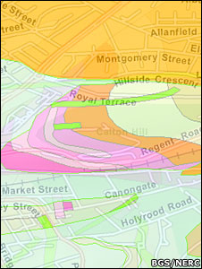
The British Geological Survey’s (BGS) new OpenGeoscience portal allows the public to study all the UK’s rocks on a simple Google map, down to a scale of 1:50,000. Toggling the map shows overlying towns and streets.
A range of educational and professional tools are also brought together on the website, including the huge national geological archive of photographs.
Tens of thousands of images have been amassed into the BGS library, showing different rock forms around Britain, fossil types, and the impact on the landscape of natural events such as flooding.
The whole archive is now searchable and free to use for non-commercial purposes.
The news is reported on the BBC website.