Any views expressed within media held on this service are those of the contributors, should not be taken as approved or endorsed by the University, and do not necessarily reflect the views of the University in respect of any particular issue.
Digimap is an online map and data delivery service, available by subscription to UK Higher and Further Education establishments. Operated by EDINA at the University of Edinburgh, Digimap offers a number of data collections, including Ordnance Survey, historical, geological, aerial photography, LiDAR, marine maps, land cover mapping, global mapping and census data. For more information about Digimap go to our website: https://digimap.edina.ac.uk Background image Contains OS data (c) Crown Copyright and database right 2022
Digimap will be holding a webinar this week, Wednesday 22nd February 10:30 to 11:30, for people who want to use MasterMap in CAD software. This is going to be especially useful for Architecture and Planning students or anyone else who uses CAD software. Attendance is free and only requires an up-to-date web browser. (Browser requirements and test page can be found here: Technical Details.)
All the booking and joining details can be found on the EDINA Training & Events page:
There are more webinars and training events planned for Digimap users this spring on the EDINA training and events page; for a “Digimap Only” list check the Training Events tab here on the blog:
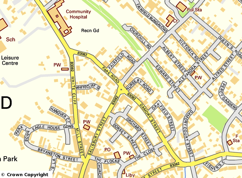
We have the latest OS LocatorTM and OS Street View® data available from our new Data Download site.
Previously we have kept the data fixed for an academic year, this was the result of a consultation with our users when the service was first conceived. This meant that the data used would be consistent and reliable. As the new data download service allows us to make multiple versions of the same data available at the same time we can now offer the latest versions as and when they are delivered to us by Ordnance Survey.
We have not yet decided how many versions of each dataset we will store at EDINA, so please let us know if you have any opinions on this matter. There will be constraints due to any licensing issues and due to the size of the data, but if you have any requirements we’d like to see if we can meet them.
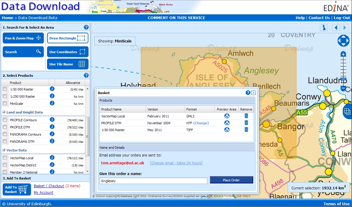
The Digimap Ordnance Survey Collection now has a new Data Download site, with a much improved search and selection interface. The new interface came from your feedback about the existing Data Download and has been designed to allow users:
a much more flexible way to pan and zoom the map while selecting data.
to be able to select more than one product for the area they are downloading data for.
to be able to take their full allowance of data in a single download.
Click for a larger image.
There is more information on how to use the new site in the help pages:
As the service is new we would very much like to hear from you about how you have got on using it. Please contact EDINA with any feedback you might have about this or any of our other services: Contact Us.
The existing Data Download will continue to be run alongside the new site till the end of the year to allow time for any documentation or practical guides to be changed.
You may have noticed that there are currently surveys running on all the Digimap services. These surveys are there to give you the opportunity to help us improve the service; we want your views to help shape the future of Digimap.
There is also another reason we are asking these questions; in the current economic climate, JISC will be shortly undertaking a detailed review of all the geo-services they fund including Digimap. It is very important that you have your say about any of these services that you use as your responses will contribute to this process.
We thank all of you who have responded to this survey; last year the results were fed back into the service and many of the comments were very valuable in helping us decide future directions. It is due to your feedback last time that we have included new features such as the Annotation Tools and prioritised redevelopment of the Data Download interface. Our aim is to do the same again this time and we have given more space to finding out what you want us to do next in the questions.
For those of you that are finding the survey an inconvenience we do apologise, however we hope you understand our reasons for making it as noticeable as possible. Due to good response rates for the Ordnance Survey Collection and Historic Digimap we now allow users to ignore the survey straight away. There is still a short time delay on the Marine and Geology services to make sure people take the time to read what we are asking them to do.
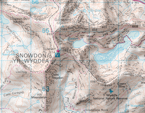
We now have hill shading in all mid and small scale zoom levels of Digimap Roam. The shading helps show the shape of the land, giving you a much better idea of the steepness of the relief and the direction of slope.
The shading is not switched on by default but you simply need to click on the button above the map to switch it on or off. There is also a check-box in the print interface if you want the shading on your printed maps.
We have created the Hill Shading using the Land-Form PANORAMA DTM data and we will soon be using the Land-Form PROFILE DTM data to create a similar effect on the more detailed large scale maps in Digimap Roam.
We have created a video that explains what Digimap is and what it can be used for. Very useful for showing to people who might not see how the service could be relevant for their work.
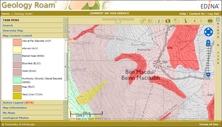
Geology Roam and Geology download are now using the most up-to-date detailed geology map data:
DiGMapGB-50 Version 6.20, 1:50,000 scale data
Geology Data isn’t updated very often, and it is great to have the data refreshed for the new academic year. Version 6 has a few new tiles; there are now only 3 tiles of missing data in Wales, and there have also been a few tile updates elsewhere in the UK such as SC064 which has now been split into two regular sized tiles, SC064E Ben Macdui and SC064W Newtonmore.
There have also been some small changes to the attribution of the data which is now at level 20. The main difference is that each polygon now has a link to both the Lexicon of Named Rock Units and the Rock Classification Schema within it’s attributes. Digimap Roam already provided the key information via the Get Rock Info tool.
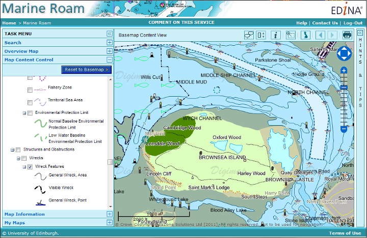
Marine Digimap
Marine Roam and Hydrospatial Download now benefit from updated Hydrospatial data. There are many updates to the features available and more layers area available across more tiles.
On the 13th of September we held the annual update of the maps and map data in Digimap. There haven’t been any major specification changes this time though you will notice some cartographic changes to the MiniScale maps in Digimap Roam.
The Urban areas are now purple and on the more zoomed out maps there has been some enhancement to the relief shading.
All the following data products were updated to the latest version available:
MasterMap Topography and ITN Layers:
Meridian2
Strategi
MiniScale
Code-Point
Code-Point with Polygons
Boundary Line
1:250,000 Colour Raster
1:50 000 Colour Raster
1:25 000 Colour Raster
1:10 000 Raster
1:50 000 Scale Gazetteer
All the products have been updated in Digimap Roam, Carto and all the different Data Downloaders. The following products were not updated as the versions were already the most up-to-date available:
Ancient Roam now has the annotation tools, so all the Roam facilities allow you to add your own features (symbols, lines, polygons and text) to the map.
We are always looking for feedback so if you have any requests for symbols, line styles or any other features you would like put on the map, let us know. You can comment on this post or email us directly here:
The 2011 Esri UK and Eduserv Seminar will be taking place on 13th September at Surgeons Hall in Edinburgh. The event is a chance for Esri users from UK Academia to hear about the new Esri CHEST agreement which started on 1st August, as well as what’s coming in ArcGIS 10.1 and various presentations from members of the Higher Education community. Members of the Digimap team will be attending to present on using Digimap data in ArcGIS, we will also have a stand so if you are attending, come and talk to us!

 Digimap will be holding a webinar this week, Wednesday 22nd February 10:30 to 11:30, for people who want to use MasterMap in CAD software. This is going to be especially useful for Architecture and Planning students or anyone else who uses CAD software. Attendance is free and only requires an up-to-date web browser. (Browser requirements and test page can be found here: Technical Details.)