Lidar Digimap: new collection of data available now!

LidarToday we have launched our new Lidar Digimap Collection. The new Collection is available to preview for all Digmap users until the 31st of July 2017. Lidar data can be downloaded through the Lidar Download for use in GIS and CAD applications; there is no Lidar Roam application for viewing the data.

Lidar Point Cloud Forth Rail Bridge
Lidar Point Cloud Forth Rail Bridge. Crown copyright Scottish Government, SEPA and Scottish Water (2014).

The service allows you to download current and past Lidar data from the Environment Agency (EA), Natural Resources Wales (NRW) and Scottish Environmental Protection Agency (SEPA).

There is already a large amount of data available in the service but we are still processing some of the datasets. Once it has all been processed the service aims to have complete coverage of all the data available from these agencies, including the raw LAS point cloud data and Orthophotography captured during the flights (where available).

Lidar data is very useful when creating 3D terrains and models as can be seen from the images to the left and below. For creating 3D scenes such as the one below, it is very useful to use a Digital Surface Model (DSM) to create a surface and hillshading from which you can drape other data over, such as the imagery from Aerial Digimap in this example:
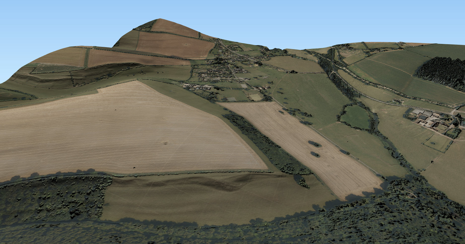
3D scene with Aerial imagery and Lidar
3D scene showing imagery with hillshading derived from the 50cm Lidar DSM. © Getmapping Plc, © Environment Agency copyright and/or database right 2015. All rights reserved.

The following datasets are available through Lidar Digimap at present:

Dataset Availability and publication date
Digital Terrain Model and Digital Surface Model (DTM and DSM) England

  • 25cm: 2009-2015
  • 50cm: 2009-2015
  • 1m: 2010-2016
  • 2m: 2010-2015

Scotland

  • Phase 1 (1m): 2011-2012
  • Phase 2 (1m): 2013-2014

Wales

  • 25cm: 2015
  • 50cm: 2009-2016
  • 1m: 2010-2016
  • 2m: 2010-2016
Point Cloud Scotland

  • Phase 1: 2011-2012
  • Phase 2: 2013-2014


We are currently processing the following datasets and hope to have them available in the service shortly:

Dataset Availability and publication date
Digital Terrain Model and Digital Surface Model (DTM and DSM) England

  • Historical data: 1998-2015

Scotland

  • 50cm
  • 2m
Point Cloud England

  • 2005-2016
Orthophotographs England

  • 2006-2015


The data was collected for flood risk analysis and modelling and primarily follows water courses and coastal habitats. The data covers approximately 72% of England, 20% of Scotland and 70% of Wales. The image below shows the 1m resolution DTM coverage in England:

1m DTM Lidar coverage in England
1m DTM Lidar coverage in England [click to expand]
We are also very keen to know what you have been doing with Lidar data in the past or what you plan to do with the Lidar data you are going to get from the new service. To find out this information from you we have put a survey in the interface and you have the chance to win a £20 Amazon just for filling it in!

Digimap Lidar Survey

Lidar Options

We hope you like using the new Collection, if you have any questions about the data please contact us:

  • Email: edina@ed.ac.uk

Huge number of datasets updated in May 2017

May was one of the busiest in terms of dataset updates in the history of Digimap. Around 20 separate datasets have been updated bringing them bang up to date with the most recent data available from the data suppliers. All the updates are listed in the tables below, broken down by the Collection and service that they can be found in.

Withdrawn Datasets (OS Collection):

OS Download Withdrawn Datasets
OS Download Withdrawn Datasets [click to expand]
Along with the updated data, Ordnance Survey have recently withdrawn three datasets:

  • Land-Form PANORAMA
  • OS Street View
  • Meridian 2 (this was covered in an earlier blog post)

These withdrawn datasets are still available to download through the Ordnance Survey Data Download application in Digimap, but users should be aware that they are no longer updated by Ordnance Survey. Withdrawn datasets have their own separate category in the Select Data panel in OS Data Download, as shown by the image on the left hand side.


OS Roam:

Product Name OS Publication Date
1:50,000 Colour Raster March 2017
OS Open Map – Local (vector) April 2017
VectorMap Local (vector) April 2017
VectorMap District (vector) March 2017
VectorMap Local Raster April 2017
VectorMap District Raster March 2017


OS Download:

Product Name OS Publication Date
VectorMap Local Raster April 2017
VectorMap District Raster March 2017
VectorMap District (vector) March 2017
OS Open Roads October 2016 and April 2017
OS Open Map – Local (raster) April 2017
OS Open Map – Local (vector) April 2017
OS Terrain 5 DTM April 2017
OS Terrain 5 Contours April 2017
OS Open Names April 2017
VectorMap Local (vector) April 2017
Code-Point with Polygons April 2017
OS Open Rivers April 2017


Geology Download:

Product Name BGS Publication Date
Borehole index April 2017


The datset update pages are kept up to date with all dataset updates in the collections:

If you have any questions about the dataset updates or Digimap please contact us:

  • Email: edina@ed.ac.uk

GeoForum 2017: Booking now open

We are now taking bookings for EDINA’s GeoForum 2017 with this year’s event being held at the Geological Society, London on Thursday 22nd June.

Reserve your place now:

GeoForum 2017 Booking

GeoForum is a free all day event aimed at lecturers, researchers and support staff who promote and support the use of geospatial data and services at their institution. Throughout the day we there will be talks and demonstrations to inform you of current geospatial developments at EDINA and the wider community. It is also an opportunity to offer feedback on the services EDINA provides and discuss geospatial issues with the team.

This year we will be introducing some new features to the Digimap Collections and looking at future developments. Come along to have your say and find out more!

Full details of this years event will and the programme will appear on the GeoForum website when available; you can also find out what happened at last year’s event: GeoForum 2016.

  • Location: the Geological Society, Piccadilly, London, W1J 0BD
  • Time: 10:00 till 16:00
  • Booking: GeoForum 2017 Booking

Please contact us if you have any questions:

  • Email: edina@ed.ac.uk