Geology Roam gets enhanced print maps and a new Active Legend.

We have been working on a few improvements to Geology Roam and have now added rock labels to print maps and a new beta active legend.

Print Labels

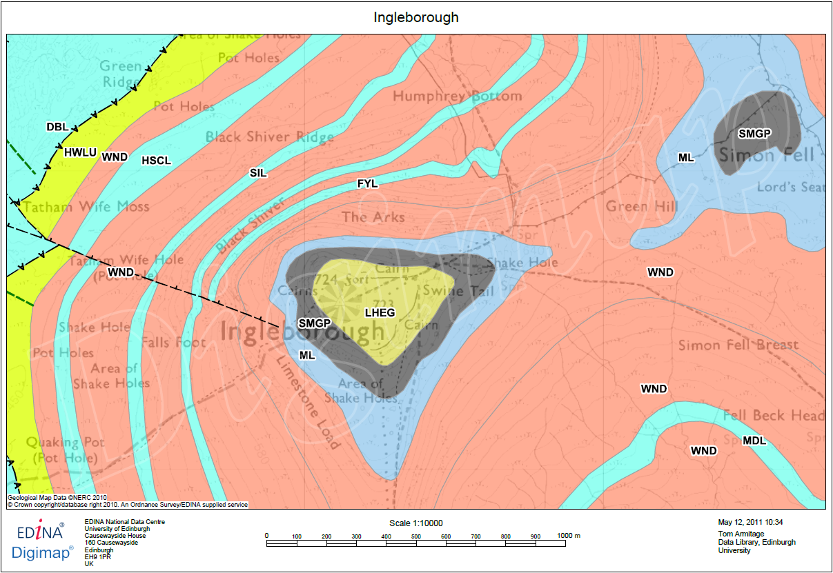
The print labels show the lexicon code for each of the rocks on the map, therefore allowing you to identify them on a paper map and distinguish rocks with similar colours. The codes are placed in the centre of the area of each rock, if the rock area lies at the edge of the map then they are place in the centre of the area shown.

The labels are added by checking the box on the Print Map page. Below is a sample of what the maps look like, click on the thumbnail to view a full size image:

Geology PDF showing labels

There is more information about the map labels in the printing section of the Geology roam help:

How to use Geology Roam: Printing

If you are using Safari use the following link and then use the index to get to the Printing section:
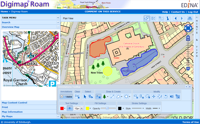
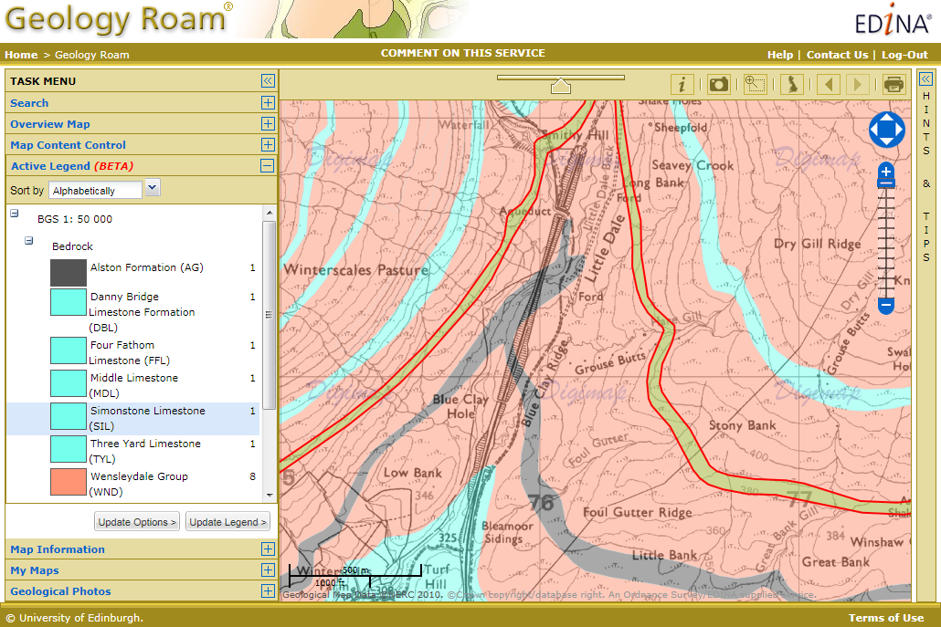
How to use Geology Roam

Active Legend Beta

The active legend allows you to reorder the entries in the legend alphabetically or by the number units of that rock type.  You can also click on the map to highlight rocks which will then be identified in the legend, this process works in reverse too, highlight rock on the map that have been selected in the legend. This functionality is still a beta version and we hope to extend the range of options available in the future. The image below shows the active legend at work, click on the thumbnail to view the full size image.

Active Legend in Geology Roam

Instructions on how to use the Active legend can be found in the Geology Digimap Help pages:

How to use Geology Roam: Active Legend

If you are using Safari use the following link and then use the index to get to the Active Legend section:

How to use Geology Roam

Annotation Tools now in Digimap Roam

The Annotation tools are now available to use in Digimap Roam.  We have a quick guide on what you can do with them on YouTube:

[youtube width=”640″ height=”390″]http://www.youtube.com/watch?v=PSkTZvMNyKU&hd=1[/youtube]

We also have a section in the Digimap Help Pages that describes how each of the different tools works:

Annotation Tools Help

Annotations ToolbarThese annotation tools are a first phase, to see what you find the most useful. We would like to hear from you about any changes or additions you would like making to the tools. Please send feedback to our help desk:

Mailto: EDINA help desk

Changes and Additions to Digimap on Tuesday 17th May

Digimap will be ‘at risk’ between 17:30 and 18:30 on  May 17th to allow for some service changes and improvements to be made. Access to the service will have to be disrupted intermittently during this period as we add in some new features and make some software upgrades.  We apologise for any inconvenience caused and hope that you find the new additions useful.

Along with new features being added on the 17th of May all print requests from Digimap Roam and Geology Roam will have to be made using the print button  Print Button at the top right of the map. We will be removing the print tab from the list on the left of the map on June the 21st, but until then it will carry instructions on where to find the print button.

Print Tab

We are removing the tab to make room for the new features we are planning to add into the list on the left in the future.  You may have noticed that it is already getting a little crowded in Geology Roam, with Geology Photos and an Overview Map being added since the service was launched, and there are more additions on the way.

New Annotation Tools: Coming Soon

EDINA has been busy over these last few months creating some significant new features for Digimap Roam. To go along with the measurement tools we added at the beginning of April we are now working on some annotation tools.

Annotations ToolbarThese tools will allow you to draw symbols, lines and polygons on the map; add text, labels and area values; and set the colour and style of the features you have added. The features you add remain the same geographical size when zooming in and out and you can include them on your PDF print maps.

Annotations in use
Final version may differ from the image shown above.

You can download a sample PDF map here: Sample Annotations

We hope to have the annotation tools added soon, please keep checking the blog or the Digimap Facebook page for further announcements.