Ahhhh. The east coast of Scotland, on a beautiful sunny spring day. Time for folks inland to bask in the sunshine and those right on the coast to experience their very favourite weather phenomenon: the sea fog, or haar.
A glance at the Met Office chart for 06:00 today suggests a high risk of a haar.
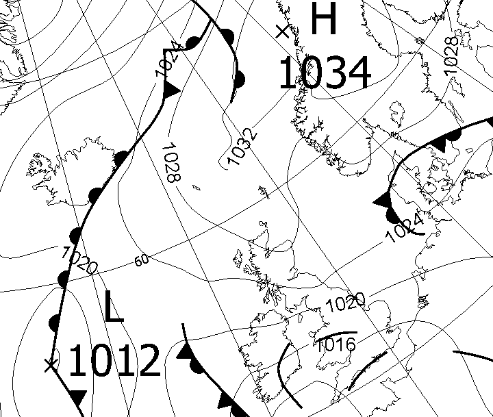
The air is circulating slowly clockwise round that big high (H) over Scandinavia, so it is flowing onto the UK off the North Sea, which is still very cold at this time of year. The haar shows up beautifully in this MODIS image (which I got from NERC’s satellite receiving station in Dundee, now, sadly, closed).
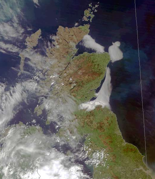
MODIS images have only limited detail. The pixels are 250m wide; this is the price you pay for getting an image every day. If you want more detail, you have to get lucky: satellites such as LandSat 8 (which I have mentioned in earlier posts) and Sentinel 2 only re-visit a location every few days (5 for Sentinel 2). So far, LandSat 8 has not passed over the Firth of Forth during the current haar episode. I originally wrote this post on Sun 27 May, but I extended it on Tues 29 May, because Sentinel 2 took this splendid view of the haar on the intervening Monday.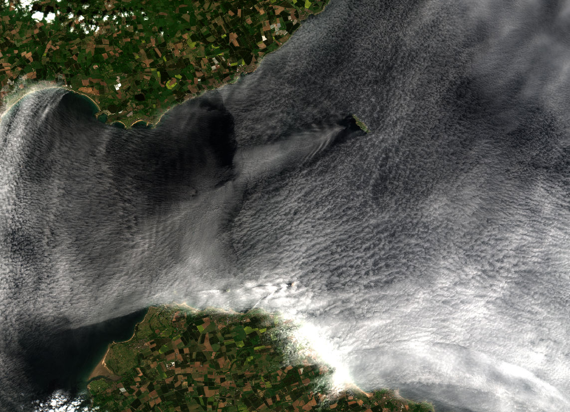
The part of the image that I show here covers the mouth of the Firth of Forth, with Dunbar (where I live) under the thickest part of the haar. The fact that the air is flowing into the Forth from the east is clear not only from the way that east-facing Dunbar is experiencing the worst of the haar, but also from the haar-free region in the southeast corner of the image, and the wakes behind the Isle of May and the Bass Rock.

