Any views expressed within media held on this service are those of the contributors, should not be taken as approved or endorsed by the University, and do not necessarily reflect the views of the University in respect of any particular issue.
Digimap is an online map and data delivery service, available by subscription to UK Higher and Further Education establishments. Operated by EDINA at the University of Edinburgh, Digimap offers a number of data collections, including Ordnance Survey, historical, geological, aerial photography, LiDAR, marine maps, land cover mapping, global mapping and census data. For more information about Digimap go to our website: https://digimap.edina.ac.uk Background image Contains OS data (c) Crown Copyright and database right 2022
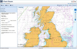
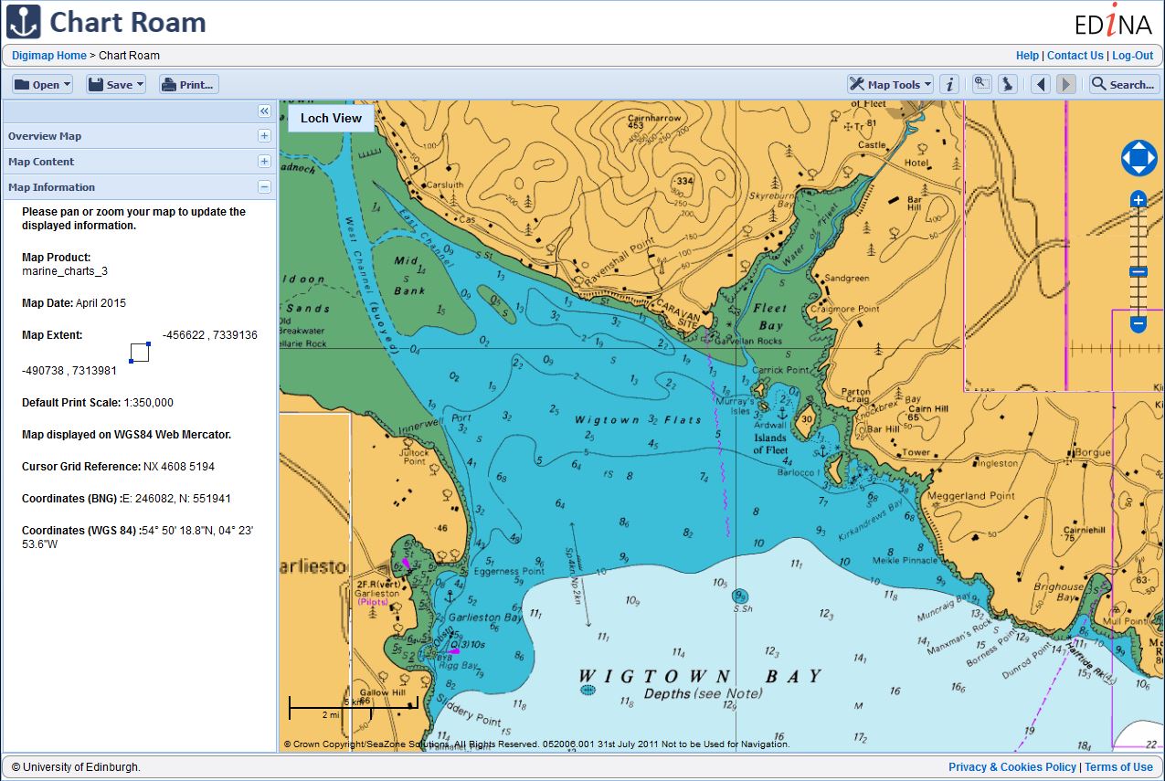
In January 2016, the Marine Maps application available through Marine Digimap will be replaced by a new application called Chart Roam.
As it’s name suggests, the new application will offer the same Chart data currently available through Marine Maps. SeaZone (the data supplier) now call this dataset HydroView Charts. They were previously referred to as the Charted Raster data.
Chart Roam will operate in the same way as all other Roam clients available, offering slippy maps, 12 fixed scale map views, annotation and measurement tools, as well printing in multiple file formats and sizes up to A0.
A date for release will be advertised in the new year.
If you have any questions, please do not hesitate to contact EDINA on edina@ed.ac.uk.
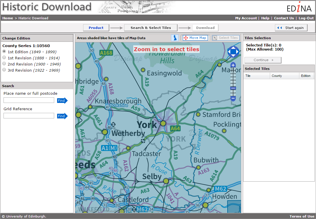
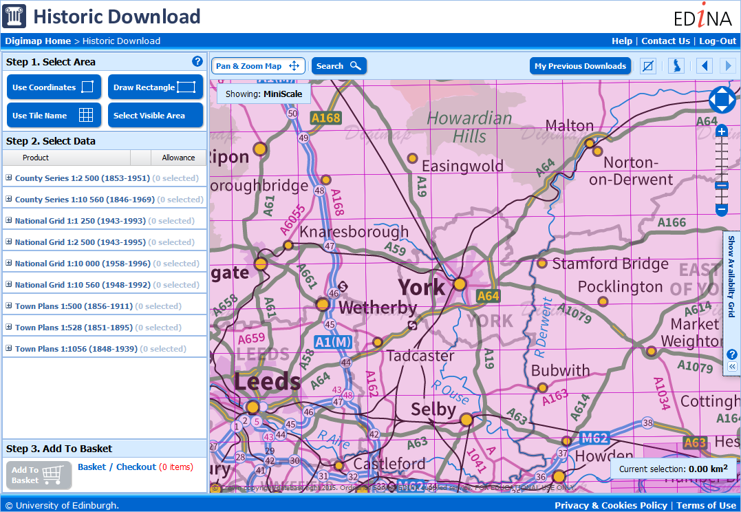
EDINA will be withdrawing the old Historic Download on Friday the 11th of December. With most people now using the new Historic Download we have taken the decision to switch off the old version to free up resources. The new interface contains all the same data but allows you to take multiple products and revisions in a single order. Existing users’ Download History from the old interface will NOT be available to reorder from the new interface so please make sure you have made all the necessary orders in the old interface before the 11th.
New Historic Download
Please note that if you want a definitive list of published dates for the maps you download from the new interface, it is available in the contents.txt file delivered in your zip folder with your data. This text file has the details for every tile / sheet of map data you have taken.
The old Historic Download was the last remaining download interface that was different to the other collections, so now every collection uses the same interface to retrieve data for use in CAD or GIS software.
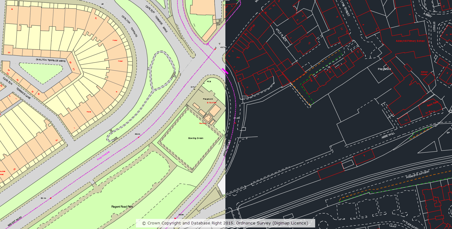
In April 2015 we made OS MasterMap Topography Layer data available to CAD users in DWG format. If you missed the announcement you can read all about it in this blog post. Since adding this option to Digimap we have processed over 13,000 orders for MasterMap in DWG format. Building on this we have now produced an outline ‘Plan’ style of MasterMap in DWG format which is a stripped down representation that mimics the alternative ‘Line Drawing’ style of MasterMap available in the Digimap Roam application.
OS MasterMap Topography Layer in standard and plan style
The alternative ‘Plan’ style is a cut down version of the full dataset and does not include polygons, users requiring the full dataset should download the original ‘Standard’ style which includes both lines and polygons.
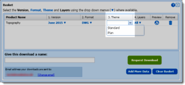
The style is specified in the basket window of the Data Download application using the drop-down in the ‘Theme’ column:
Selecting DWG plan style in the basket
We hope you find this new style useful, if you have any questions or suggestions for further improvements please contact us:
A number of datasets have been updated in the Digimap Ordnance Survey Collection in early October, bringing them up to date with the most recent versions available from Ordnance Survey.
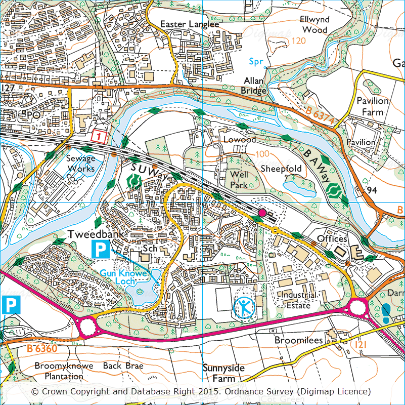
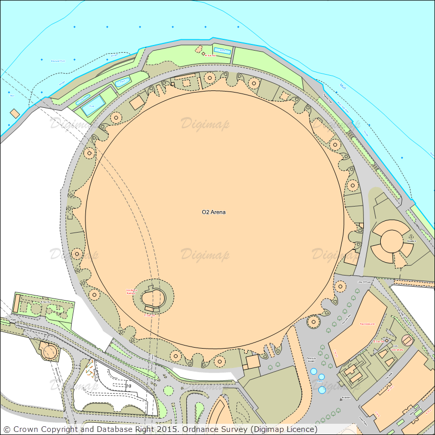
September 2015 OS 1:25,000 Colour Raster showing the new Tweedbank station at the southern end of the new Scottish Borders Railway
Ordnance Survey Roam
The table below lists all the datasets that have been updated in the Digimap Ordnance Survey Roam application and includes the OS release date:
Product Name
OS Release Date
1:25,000 Colour Raster
September 2015
1:50,000 Colour Raster
September 2015
OS VectorMap® District Raster
September 2015
Ordnance Survey Data Download
The table below lists the datasets that have been updated in the Digimap Ordnance Survey Data Download application and includes the OS release date:
Product Name
OS Release Date
1:25,000 Colour Raster
September 2015
1:50,000 Colour Raster
September 2015
OS VectorMap® District
September 2015
OS VectorMap® District Raster
September 2015
Points of Interest
September 2015
OS VectorMap® District has undergone a few significant changes with this update:
A new ‘Functional Sites’ layer is now included which includes features from the old ‘Airport’ and ‘Public Amenity’ layers plus additional information on education facilities – school and higher, medical care, road transport and police stations.
Land polygon(s) are no longer provided so if you wish to colour your land you can download a Shapefile from the OS website that covers the dataset extents and colour this. Full detailed instructions can be found in chapter 6 of the VectorMap District Product Guide published by OS.
As well as these significant changes, OS have made a number of smaller changes including increased detail of buildings and improved data accuracy. You can read about all the changes in this OS blog post and also in the September 2015 Release Notes published by OS to accompany this latest version of the data.
OS have updated the stylesheets to accommodate all these changes, the most recent versions of the stylesheets can be downloaded from the OS GitHub repository and are available for ArcGIS (for data in Shapefile format) and QGIS (for data in Shapefile and GML formats).
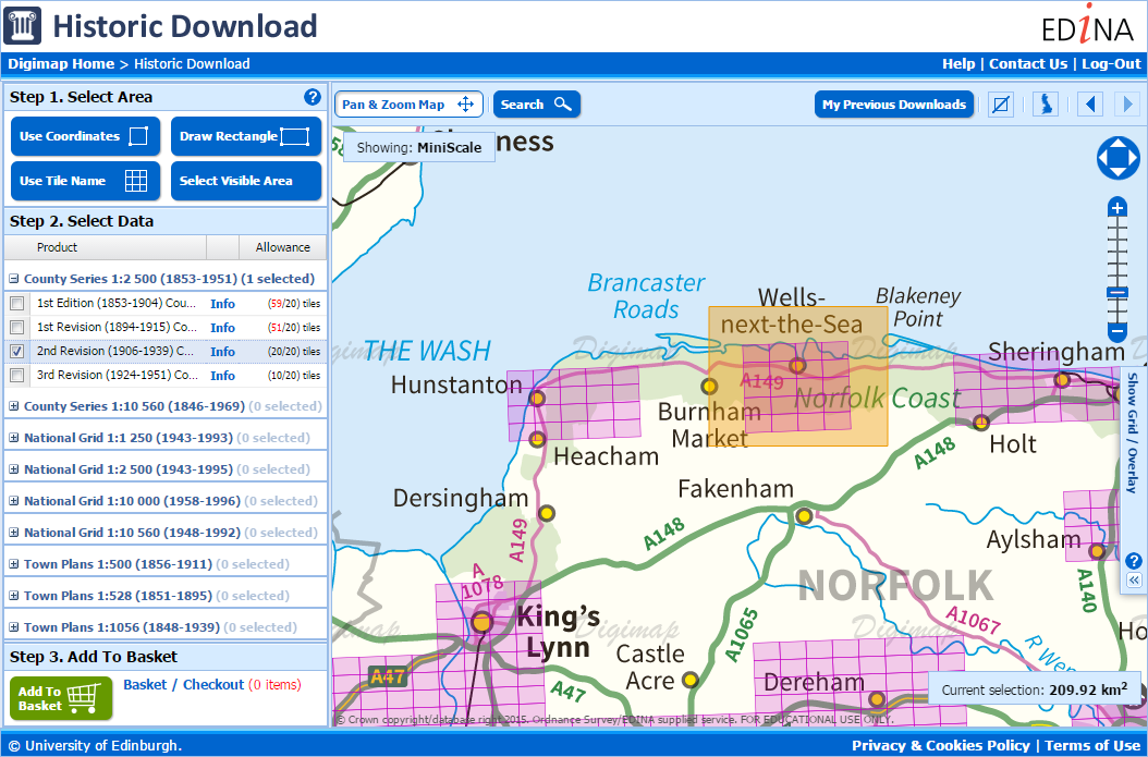
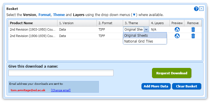
Historic Download has been updated to use the same interface as all the other collections, making it possible to take maps from different series and scales in a single order.
The new interface is much quicker and easier to use to get all the data you need and will be familiar to users who have taken data from the other Digimap Collections. Unlike the old Historic Downloader you select whether you want the Original Map Sheets or the data cut into squares based on the modern National Grid Tiles at the end of the process once your selections are in the basket.
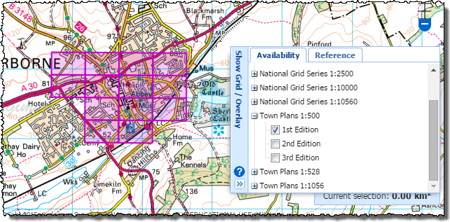
You can add products from multiple series, scales or revisions to a single order and you can see where the data is present by using the Availability Overlays.
The old interface will be retained until the 8th of October to allow time for any course materials to be updated.
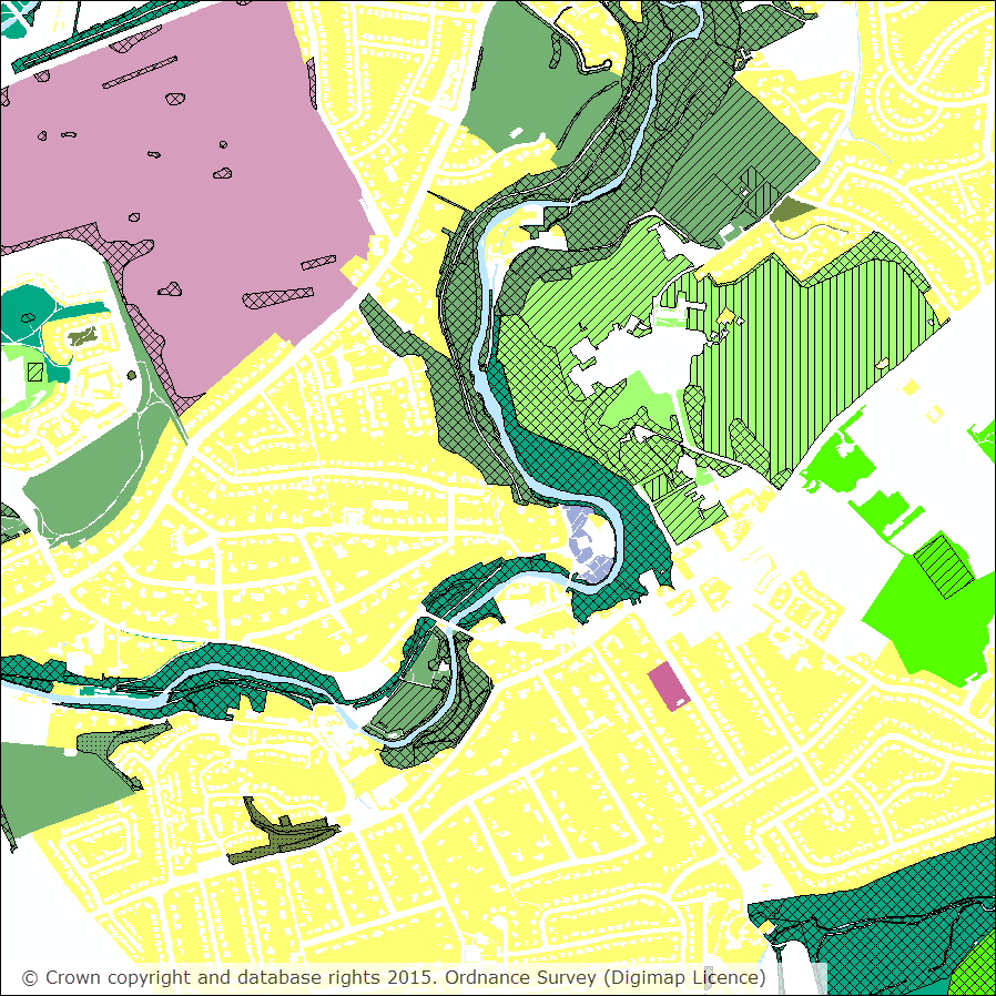
Scotland’s Greenspace Map is now available to download through the Data Download application in the Ordnance Survey Collection of Digimap.
Scotland’s Greenspace Map, coastline taken from GB National Outlines from Ordnance Survey.
Scotland’s Greenspace Map provides information about the type and extent of greenspace in urban Scotland (i.e. towns and cities with a population of over 3000). It was compiled in 2011 from greenspace data provided by the 32 Scottish local authorities.
The dataset categorises greenspace into 23 different open space types (for example, public parks, private gardens, play areas, semi-natural, community gardens and allotments). These types are based on the Planning and Advice Note (PAN) 65 Planning and Open Space. Sometimes one area has more than one type of greenspace. For example, the main (primary) use of the area may be a public park, but within this, an area is used as a play area (secondary use). The primary use is shown as a block of colour and the secondary use is shown as an area of hatching.
Detailed map at 1:10,000 showing primary use (solid colours) with secondary use displayed on top using hatching.
The dataset is supplied in ShapeFile format with documentation and layer files to style the data in QGIS and ESRI’s ArcGIS. Layer files are provided for display at the following scales:
National (approx 1:2,500,000) – uses a solid colour to denote the presence of greenspace within a Local Authority.
1:50,000 – displayed using the broad 9 PAN65 typologies.
1:25,000 – displayed using the 23 greenspace primary land use categories.
1:15,000 – primary land use displayed as per 1:25,000 with a single category to show where a secondary use exists.
1:5,000 – primary land use displayed as per 1:25,000 with secondary use split up in to six categories.
Please note: Scotland’s Greenspace Map is produced by www.greenspacescotland.org.uk and not Ordnance Survey. However the dataset was created using OS MasterMap® Topography
Layer so it is subject to the same licence conditions as the other licensed Ordnance Survey datasets.
A number of datasets have recently been updated in Ordnance Survey Roam, the Digimap online mapping application, bringing them up to date with the most recent versions available from Ordnance Survey. All datasets are available to view using the Roam application in the Ordnance Survey collection.
The table below lists all the datasets that have been updated and includes the OS release date:
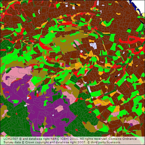
We are pleased to announce that the 2007 Land Cover Map of Great Britain, created by the Centre for Ecology and Hydrology (CEH), is now available in vector format in the Digimap Environment Download service. The new dataset makes it easier for users to perform spatial analysis, such as proximity analysis and land use studies.
The data is available in ESRI Shapefile format, which can be read by most modern Geographic Information Systems, and is supplied on 100km x 100km tiles. Accompanying the data are ESRI Layer files which can be used to display the data using 23 classes based on the UK Biodiversity Action Plan (BAP) Broad Habitats in ESRI software.
The addition of the vector version brings the availability of the 2007 Land Cover Map in line with the 2000 Land Cover Map. A full list of formats available for the 2007 data is included below:
Vector, ESRI shapefile format
25m raster, TIFF format
1km raster , TIFF format
Further information about the Land Cover Map 2007 can be found on the CEH website.
If you have any questions about the dataset or any other part of the service then please get in touch:
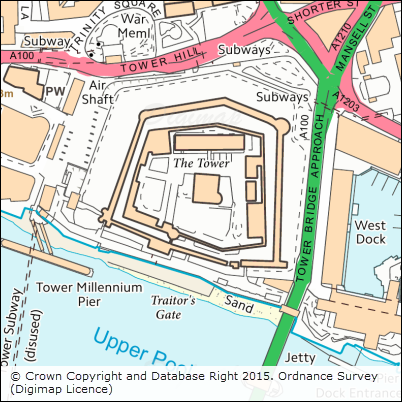
We are pleased to announce the release of DWG versions of both OS Terrain™ 5 (vector) and OS MasterMap® Topography Layer Building Height Attribute, which makes their use in CAD applications much easier and quicker.
Recently we have been working to produce DWG versions of the detailed vector dataset OS Terrain™ 5 and the popular Building Height Attribute component of OS MasterMap® Topography Layer. Both these datasets have proved popular with CAD users for detailed modelling applications but until now using them has proved time-consuming as many steps were required to convert them in to a format suitable for use in CAD applications.
OS Terrain 5 Vector
OS Terrain 5 Vector is dataset consisting of contour lines with five metre vertical spacing and spot heights (point features). The dataset also includes contours for mean high and low water around coastal areas, along with labels for both spot heights and contours. OS Terrain 5 is the most detailed height dataset available from Ordnance Survey. A Digital Terrain Model (DTM) version is also available in ASCII grid format and can be downloaded through Digimap.
Building Height Attribute (BHA)
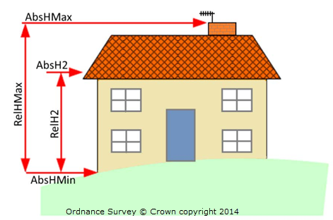
As with the other BHA datasets provided through Digimap the DWG version is supplied as a dataset of building polygons together with the building height attributes supplied by OS in the latest alpha release of their Building Height Attribute dataset (December 2014 at the time of writing). The DWG dataset is a 3D dataset which uses two of the height attributes supplied by OS to create the 3D features. The base height of buildings is set using the value of the AbsHMin attribute and the roof height is defined by the AbsH2 attribute:
All height attributes supplied by OS, as indicated in the image above, are included as XDATA which can be readily viewed in CAD applications.
Note: the DWG BHA dataset is not supplied with a terrain surface so the building features will appear to float above the surface if it is displayed without a suitable terrain surface. We recommend using either OS Terrain 5 or OS Terrain 50, both of which can be downloaded from Digimap.
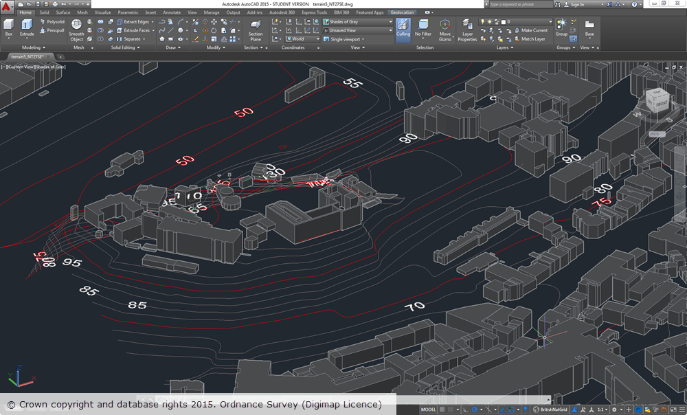
The image below shows OS Terrain 5 vector overlaid with BHA in AutoCAD 2015 for the area around Edinburgh Castle. Both datasets were supplied by Digimap in DWG format and required no manipulation or processing in order to display them.
OS Terrain 5 vector and OS MasterMap BHA datasets are supplied on a 5x5km grid, so you may receive multiple multiple files if your area covers more than one 5km grid square.
We hope this makes it much easier to use the data and we welcome any feedback you may have.