Digimap Data Updates: December 2015

A number of key datatsets have been updated in Digimap this December in several of the collections.

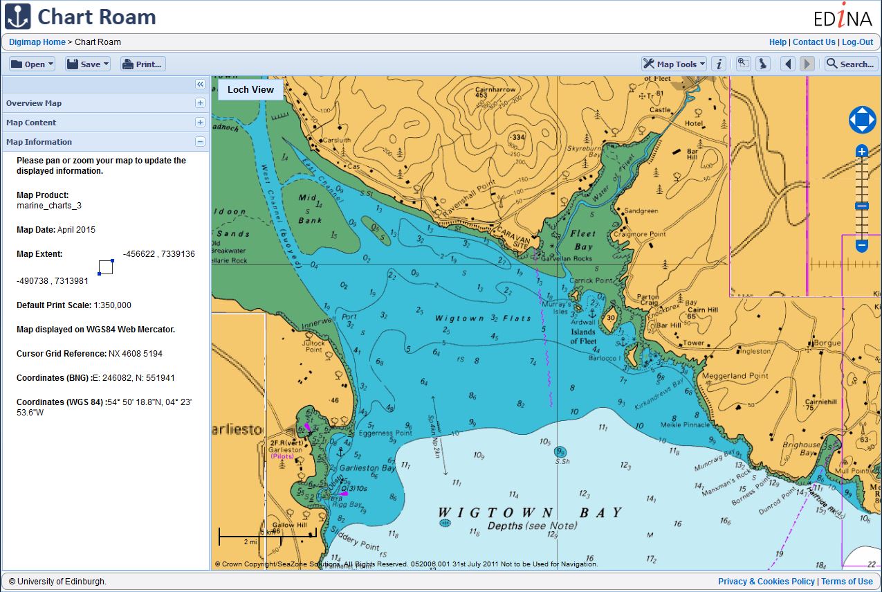
Of particular note are the updates to the Marine collection. The HydroView Charts raster product from SeaZone is now available in two versions: ‘Full Marginalia’ and ‘No Marginalia’. Users can select the version after adding the product to the basket in Marine Download.

Choose Marginalia in the Basket

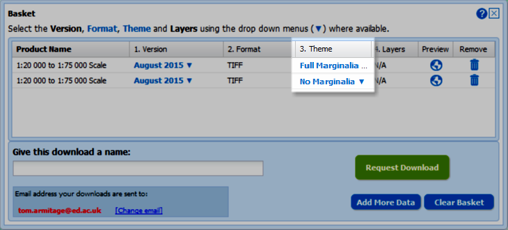
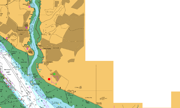
The ‘No Marginalia’ version has all extra information round the map (e.g. north arrows, scale bars, inset maps etc.) removed and replaced with transparent areas. This makes it ideal for use in GIS software allowing you to pan across adjacent charts without this information obscuring the map data.

Marine chart with marginalia  Marine chart with marginalia removed

Furthermore the Charted Raster .tif files are now supplied with .tab files for accurate positioning in MapInfo.

The tables below lists all the datasets that have been updated in each collection together with the publishing date for each one.

Ordnance Survey Data Download

Product Name OS Published Date
Boundary-Line October 2015

Geology Download

Product Name BGS Published Date
Boreholes
  • January 2015,
  • April 2015,
  • July 2015,
  • October 2015

Marine Download

Product Name SeaZone Published Date
HydroSpatial One August 2015
HydroView Charts (all scales) August 2015


If you have any questions about the dataset updates or Digimap please contact us:

  • Phone: 0131 650 3302
  • Email: edina@ed.ac.uk

Datasets updated in Digimap OS Collection – November 2015

November has been a bumper month for updates in the Digimap Ordnance Survey Collection with updates to 15 of the datasets in the collection. Of particular note are the updates to two of the new Open Data products: OS Open Roads and OS Open Names. Both these products are still available as Beta versions as the products are still undergoing development by OS.

OS Open Roads on top of VectorMap Local Raster (displayed in greyscale using QGIS)

The tables below lists all the datasets that have been updated in the Digimap Ordnance Survey Roam and Data Download applications and include OS release dates for each one.

Ordnance Survey Roam

Product Name OS Release Date
OS VectorMap® Local October 2015
OS VectorMap® Local Raster October 2015

Ordnance Survey Data Download

Product Name OS Release Date
Code-Point August 2015 and November 2015 (two versions)
Code-Point with Polygons October 2015
Code-Point Open August 2015 and November 2015 (two versions)
OS Locator November 2015
OS VectorMap® Local October 2015
OS VectorMap® Local Raster October 2015
OS Street View November 2015
OS Terrain™ 50 Contours and DTM July 2015
OS Terrain™ 5 Contours and DTM July 2015 and October 2015 (two versions)
OS MasterMap® Sites Layer October 2015
OS MasterMap® ITN Layer Urban Paths Theme October 2015
OS Open Names (Beta release) October 2015
OS Open Roads (Beta release) October 2015


The data product updates help page is kept up to date with all dataset updates in the Ordnance Survey collection.

If you have any questions about the dataset updates or Digimap please contact us:

  • Phone: 0131 650 3302
  • Email: edina@ed.ac.uk

Chart Roam to replace Marine Maps

In January 2016, the Marine Maps application available through Marine Digimap will be replaced by a new application called Chart Roam.ChartRoam-overview

As it’s name suggests, the new application will offer the same Chart data currently available through Marine Maps.  SeaZone (the data supplier) now call this dataset HydroView Charts.  They were previously referred to as the Charted Raster data.

Chart Roam will operate in the same way as all other Roam clients available, offering slippy maps, 12 fixed scale map views, annotation and measurement tools, as well printing in multiple file formats and sizes up to A0.

A date for release will be advertised in the new year.

If you have any questions, please do not hesitate to contact EDINA on edina@ed.ac.uk.

ChartRoam-blog

Old Historic Download withdrawn Friday 11th December

oldhistdld
Old Historic Download

EDINA will be withdrawing the old Historic Download on Friday the 11th of December.  With most people now using the new Historic Download we have taken the decision to switch off the old version to free up resources. The new interface contains all the same data but allows you to take multiple products and revisions in a single order. Existing users’ Download History from the old interface will NOT be available to reorder from the new interface so please make sure you have made all the necessary orders in the old interface before the 11th.

New Historic Download

Please note that if you want a definitive list of published dates for the maps you download from the new interface, it is available in the contents.txt file delivered in your zip folder with your data. This text file has the details for every tile / sheet of map data you have taken.

The old Historic Download was the last remaining download interface that was different to the other collections, so now every collection uses the same interface to retrieve data for use in CAD or GIS software.