Any views expressed within media held on this service are those of the contributors, should not be taken as approved or endorsed by the University, and do not necessarily reflect the views of the University in respect of any particular issue.
Digimap is an online map and data delivery service, available by subscription to UK Higher and Further Education establishments. Operated by EDINA at the University of Edinburgh, Digimap offers a number of data collections, including Ordnance Survey, historical, geological, aerial photography, LiDAR, marine maps, land cover mapping, global mapping and census data. For more information about Digimap go to our website: https://digimap.edina.ac.uk Background image Contains OS data (c) Crown Copyright and database right 2022
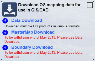
The functionality and datasets offered by MasterMap Download and Boundary Download are now available through the standard Data Download application. This can be found in the Download OS mapping data section of Digimap’s Ordnance Survey Collection.
This means that both MasterMap Download and Boundary Download will be withdrawn at the end of May 2013.
If you have teaching materials or course notes which are currently based on the old MasterMap Download and Boundary Download applications, please make sure you update them before these facilities are withdrawn.
If you have any concerns about this or any other issue then please contact us:
As lots of people are currently working on projects and dissertations we thought we’d share a few tips on using the OS MasterMap data from Digimap.
NOTE: MasterMap Download will be temporarily unavailable as part of the ‘At Risk’ period on Monday the 22nd of August. It will also be unavailable for about an hour on either Wednesday 24th or Thursday the 25th of August as well. This is to allow for some essential hardware maintenance on the server that houses the Database. We are really sorry for any inconvenience this causes.
The MasterMap data available will be updated as part of our annual data refresh at the beginning of September. If you need the 2010-2011s data then please order in advance of Monday the 22nd to ensure you don’t get caught up with the maintenance.
Downloading the Data
Remember that if you just want MasterMap as a background map you can use the 1:1000 or 1:2000 Raster versions of the data. This is available from the Data Download facility:
Once you have downloaded your MasterMap Data you will most likely need to convert it into a format that your GIS can use. There are three main options to do this, InterpOSe, OSM2MIF and Productivity Suite, see the following link for more information:
All Digimap Download facilities should be considered ‘at risk’ next Tuesday (26th April) due to some essential hardware maintenance. MasterMap Download will take longer to process orders on this day so it would be wise get these in beforehand if you have deadlines to meet.