In July 2013 we wrote about the value of the data downloaded and screen maps printed from Digimap:
Digimap 2012-13 Print Maps & Data worth nearly £40 Million
We calculated these values in May so could not include the figures from June and July; we have now added these last two months for 2012-13 to give the full picture.
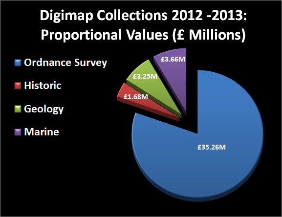
The headline value has risen from £39.5 to £43.8 million, this significant rise is due to download activity as this period is dominated by postgraduate research rather than undergraduate map printing.
Below are the graphs and charts from the previous blog post updated with the latest figures:
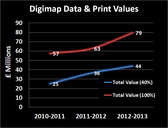
 Please remember that there were many caveats to how these figures were calculated detailed in the previous blog post; and that the figures do not include any cost for the millions of screen maps and help and support that comes from Digimap.
These values also do not include the significant amount of time saved by using Digimap over requesting maps and data direct from the various data suppliers. Digimap provides a single place to get the most popular UK map and spatial data resources.
If you are interested in the updated figures for your institution the please get in touch with us:
- Email: edina@ed.ac.uk
- Tel: 0131 650 3302
2013-14 Values to be even Higher
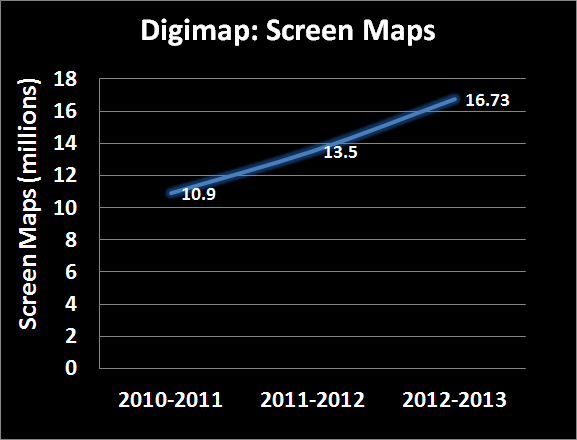
Usage statistics for 2013-14 show that we are more than likely to exceed the figures above; with 5 months to go Digimap has already made 95% of the screen maps that it made in the previous academic year and around 75% of the downloads. We will be recalculating the values once the year ends and hope to publish them in the Autumn.