
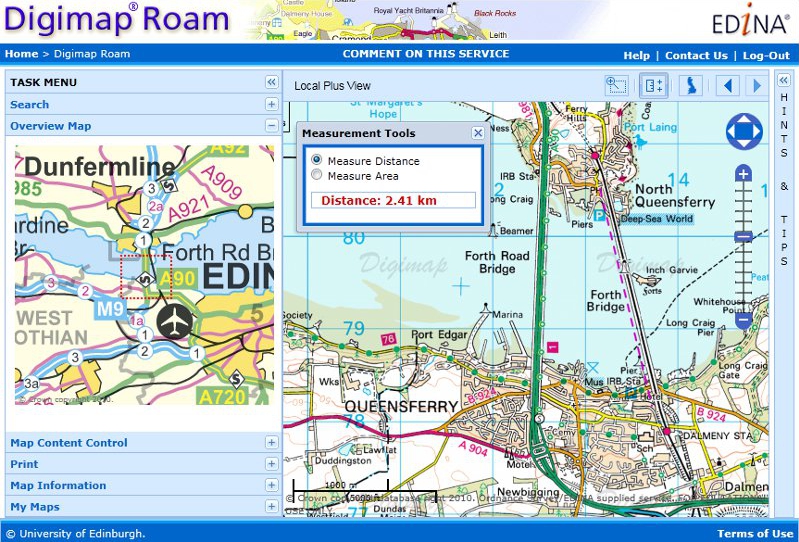
Measurement Tools:
Digimap Roam has new measurement tools that allow you to easily check the distance between two or more points and find out the area of a polygon you draw on the map.
Click on the ![]() icon above the map to activate the tools. Select Distance or Area then start clicking on the map to define your line or polygon; use a double click to finish.
icon above the map to activate the tools. Select Distance or Area then start clicking on the map to define your line or polygon; use a double click to finish.
New Local Plus View:
Digimap Roam has also got a new zoom level to go with the measurement tools, bringing the total to 13. The view, called Local Plus, is a more zoomed out view of the 1:50,000 colour raster maps found in the Local view. The image above uses this new view as well as the measurement tools.
The Local Plus view prints at 1:40,000 compared to 1:20,000 for the Local view.