New Zealand 2023: Part two

New Zealand 2023
Part two: SALSA…

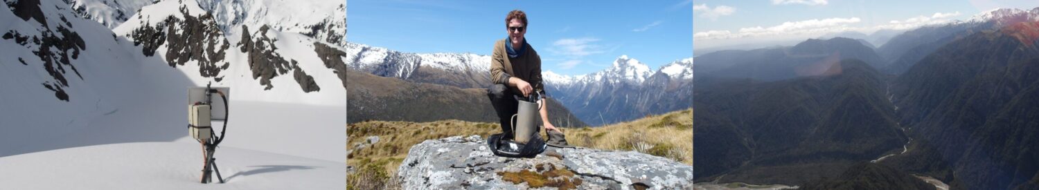
SALSA array installed along the Alpine Fault in the South Alps on the South Island, New Zealand, recording ambient noise for 2 years!
29th October: Rugby, hand-digging technique, and seismic array design
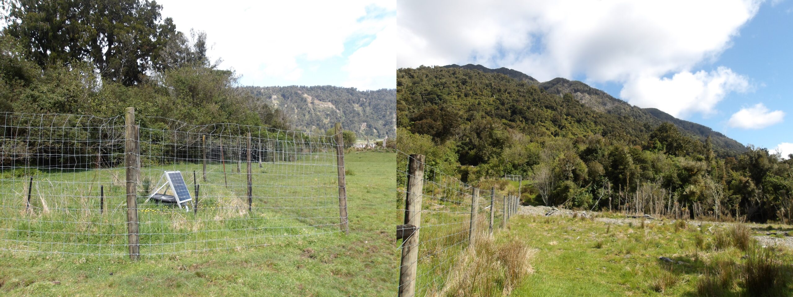
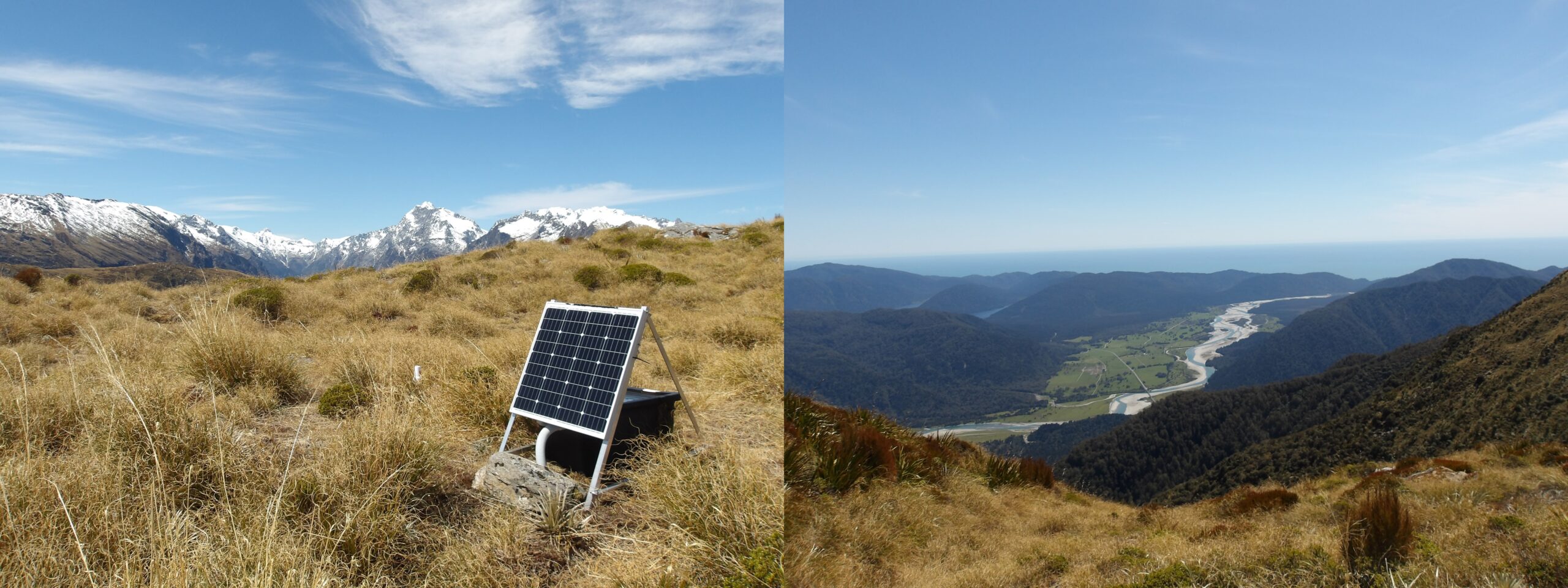
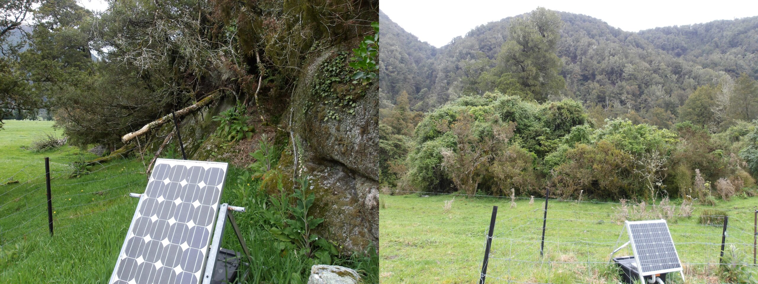
Seismic station PRUA – a fence around our fence, put up by the farmer for extra safety from animals… and from seismologists. The contrast between the rising hanging-wall and the foot-wall, underlain by thick moraine sediments, is clear to see as a sudden topographic rise.
My birthday perhaps wasn’t objectively the most exciting part of the trip, however I got a day with my New Zealand supervisor trapped with me in a truck – an excellent learning opportunity, and our conversations inform large sections of this second chapter. The day started with the last 10 minutes of the rugby world cup final – New Zealand vs. South Africa. I snuck off to a bar in Franz-Josef to catch the last moments of the game after following the close match via text description whilst packing field gear. South Africa were one point ahead but New Zealand on the front foot. The tension was quite clearly nerve-shredding, as bored tourists dressed in designer clothing for a very expensive helicopter ride turned to each other remarking “I still don’t understand the rules of this game”. New Zealand had a kicking opportunity go wide, but that was it really… South Africa won. A shame, but no time to be sad – I had holes to dig. A confused looking field team finally found me at the bar and we set off to two farm sites – PRUA then LMAN.
Both farm sites were on the foot-wall of the fault, on the other side of the Alpine Fault to the Southern Alps. The side with the Southern Alps is called the hanging-wall, and is being uplifted relative to the foot-wall – you can clearly see the sudden steep rise, marking the start of the hanging-wall, from the sites. Glaciation in the Southern Alps scrapes and grinds rock up there; the powdery and cobble-y mess is then either transported by glaciers themselves from the hanging-wall and dumped on the foot-wall leading to huge masses of glacial moraine, or transported by rivers (the powder giving them that lovely cloudy look). This moraine is unconsolidated, and therefore mechanically weak leading to very slow seismic wave speeds. The contrast between the slow moraine and fast schists/granites will be a good test of my seismic velocity models, and has caused problems for earthquake location in the area. I have developed two techniques for digging – the “T-rex” and the “JCB”. The former uses two fingers for extreme precision, scratching through tight spaces between a bucket and wall. The latter uses an inwards scooping motion to remove the catastrophic aftermath of releasing all your frustration on the packed soil with your trowel. Nothing can be done, however, when the folks who filled up the hole have filled it with rocks. At the time they did it for efficiency – easy to fill a hole with rocks. Not so easy to dig them out though!

Seismic station LMAN, next to a deer farm. Man, mole, machine. Happy birthday to the JCB with legs.
Aside from digging holes, I found out I won a prize from the University of Leeds for getting a high score in my master’s degree in exploration geophysics – that was nice, that course was a whopper! Particularly nice when it is sponsored by the hippest new geophysics contractor with the biggest meanest computers, a colour scheme reminiscent of fellow hip companies B&Q and Easyjet, and a name incredibly appropriate to this field work – DUG. My big highlight of the day, however, was a conversation I had about how SALSA was designed. How do you choose where to put a few dozen stations in a 400km-long zone? The primary purpose of SALSA is to perform virtual earthquake analysis from virtual earthquake sources along the fault, determined by the locations of seismometers, to points in the South Island, to inform what kind of shaking you might expect when the Big One goes off. You don’t know where the fault will slip, so you want to place sensors spaced along the fault to give you options to act as the virtual earthquake sources. So let’s draw a line along the mapped fault. Let’s then move the line approximately 2-3km into the hanging-wall, as a) that area will have a small depth to bedrock so recorded signals will be crisper than in mushy sediments; b) there will be less subsurface discontinuities, e.g. due to fault displacement, between your sensors (hanging-wall, east side of the fault) to the rest of the South Island (mainly on the east side of the fault); and c) the fault will dip beneath the hanging-wall so earthquakes modeled at depth will occur within the lateral extent of the hanging-wall surface expression. You also don’t want to duplicate data from pre-existing sites, so want your sensors to be spaced as far apart from each other and other sites as possible. You might also have a good guess, i.e. prior knowledge, of where the earthquake might occur so want more sensors in that area to act as virtual earthquake sources. This is all whacked into an optimisation problem, which tells you where to put your sensors. Job done? No: there are three entities who don’t care about your optimisation algorithm. The first is the Department of Conservation (DOC), from whom you need a permit. Something I found surprising was that the governmental department (for the good of the people) decided to start off with a huge asking price for one of the sites! This was haggled down to beehive-rate apparently. Clearly the digging powers are so strong they thought we were a mining company. You might be able to bypass the holy DOC by asking a landowner if you can use their land. This is one of the many things that makes public relations so crucial – I was impressed by my New Zealand supervisor’s relationship with what appeared to be the entire South Island, his people skills were far better than mine! We gifted the landowners books where we could, and sometimes batteries or solar panels – it’s all about maintaining positive relationships. The second entity that doesn’t care about your optimisation are helicopter pilots. You need reasonably flat ground to land a helicopter, so you need to find a wee flat spot in the mountains. Lastly, the third entity is the sun – you need a clear space facing north (southern hemisphere) to get the most light for your solar panel. Once you’ve done all this to find your sensor locations, then the hard work begins!
30th October: The SAMBA Loop
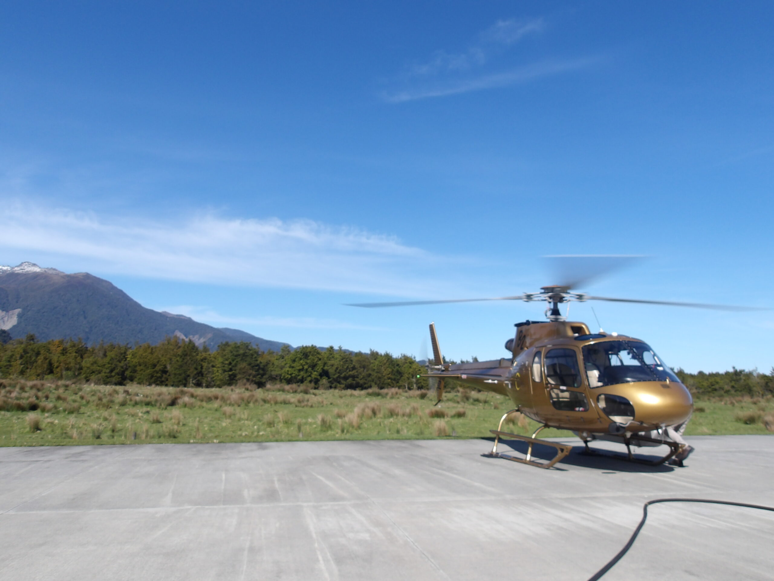
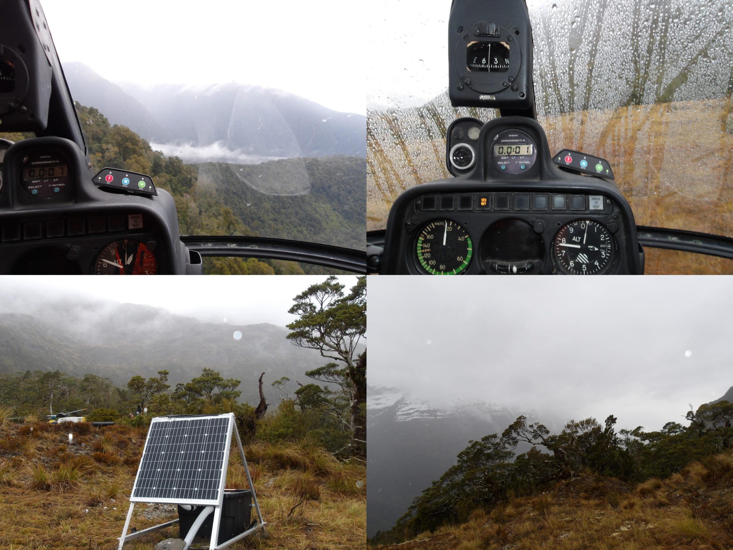
The gold helicopter to HVLK on my UK birthday, in which I almost certainly peaked as a human being. All downhill from here.
The morning of the 30th (still my birthday in the UK) was more action-packed. We headed down to Fox Glacier for some more flying. The plan was to demobilise HVLK then DOUG, returning to the hangar in between to drop stuff off, then do the “SAMBA Loop”. The SAMBA Loop consists of hopping, via helicopter of course, between multiple sites from another experiment called SAMBA (short-period instruments drilled into the bedrock in order to measure microseismicity), to service them, i.e. check everything is working and replace their data cards. We needed to fit two groups into the first helicopter – too many for our little buzzy 4/5-seaters. The helicopter company had a break in between tourists so we went in a big gold one. Imagine a world where rock stars tuck cheap fleeces into muddy waterproof trousers – that world existed for about ten glorious minutes.
Posing with the seismometer at HVLK in my finest attire.
When we landed at HVLK, we found ourselves staring down a fairly large bird, seemingly unimpressed with our rich-copter. The bird was dark against the bright skyline, but after a short period of mutual observation took off with a high-pitched call “keee-ah” and flew low over our heads. The sunshine suddenly glinted off its wings, revealing its beautiful emerald green feathers, with patches of a bright burnt orange on its underside – a kea, or Alpine parrot! Whilst I took a moment to bathe in the wonderful colours of the swooping kea, the others in my team were less useless and had the sense to hide any loose items we had lying around, as kea are notorious for pinching just about anything they can (and chewing cables). At DOUG we attempted to do some soil sampling for a member of the team who had joined our merry expedition and needed samples to calculate weathering rates. We took samples of sand and saprolite from our seismic hole… or at least we thought we had, but the gap in between “amazing, thanks guys” and the following “let me just run you through the sampling process again” was rather short. Still – it was a nice example of scientific collaboration!
Site called DOUG, with an incredible backdrop of the Southern Alps. The sweeping river is the Paringa, which has taken out many flood defences, cutting the roads off to the south.
We were finished at DOUG and waiting for the helicopter to take us round the SAMBA Loop. The soft silence is punctuated by a distant thudding, and everyone piles on top of the gear in anticipation of the strong airflow kicked up by the helicopter rotors. We watched the hills with tense eagerness for sign of the impending transport as the thuds grew louder, before a jet-black helicopter appeared over the brow of the hill… sideways! It loops round with speed and elegance reminiscent of the kea we saw earlier and settles gently onto the grass beside us. As the rotors slow and we release our held breath, the man who steps out the helicopter looks different to the other pilots – he wears dirty jeans, has a leathery face with a hard expression, and has long unkept hair and doesn’t wear a cap or sunglasses. James is the owner of the helicopter company, and is the only pilot we trust to take us round the SAMBA Loop – deeper into the Southern Alps, with treacherous landing conditions. He only says two words – “all good?” – and that’s it. He knows where exactly all the sites are and doesn’t need your GPS. He watches what you do in complete stone silence. James has probably been this cool since birth, which was likely the first time he asked his mother “all good?” and hasn’t said much since. We flew from site to site up scars in the mountainside left by glaciers, past tremendous green U-shaped hanging valleys with waterfalls plunging into wider and taller valleys, and higher – into white snow and grey gravel bordered by mangled masses of dark rock contorted into wondrous shapes by plate tectonics.
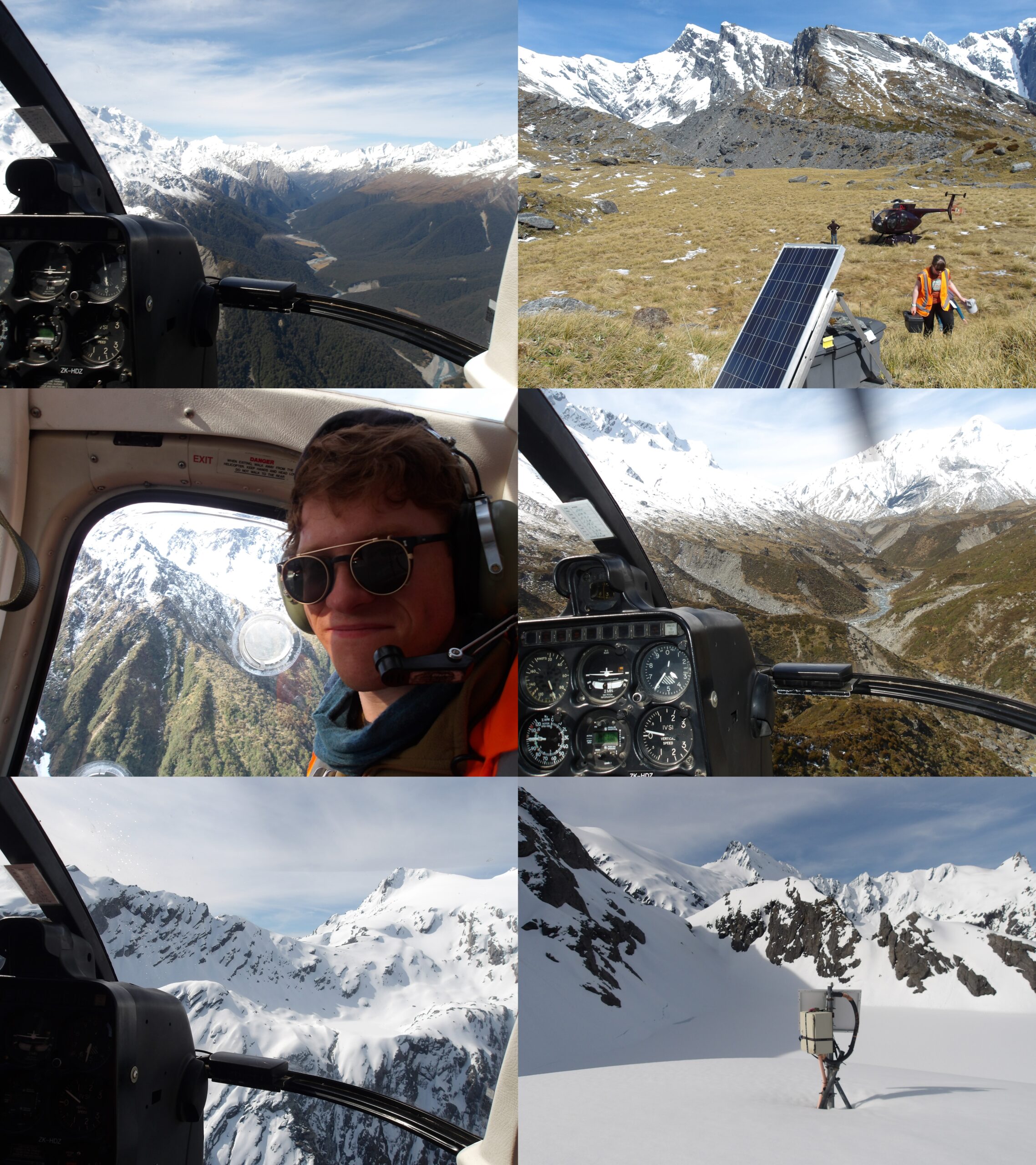
The SAMBA Loop – hopping via helicopter to four sites due servicing.
31st October – 1st November: Down time
On the 31st October, we left Franz-Josef for our new base in Fox Glacier. Whilst one group was down south in Haast, burning through sites like demons, we were to make a start on cleaning the gear. We had a bit of down time before we got to work, so went to lake Matheson and Gillespie’s beach. Around the lake there was a signpost to “the view of all views”, which certainly did have a good view of Mt Cook (Aoraki) and Mt Tasman. The name of Aoraki originates from an old Māori legend about Aoraki and his brothers, who were the sons of Rakinui (the Sky Father). The brothers were on a trip around Papatūānuku (the Earth Mother), when their waka (canoe) hit a reef, and they became stranded. The brothers climbed on to the top of the overturned waka, and waited for rescue. Whilst they waited the freezing southerly wind turned their bodies to stone, and their hair white. The canoe became the South Island and is known by Māori as Te Waka o Aoraki – The Canoe of Aoraki. The elder brother became the tallest mountain. The rest of the brothers and the crew of the canoe became the other mountains of the Southern Alps. I had a wonderful conversation with a Kiwi member of our group about the connection to nature of the Māori, and what it means to the Pākehā (European New Zealanders). The Māori language itself reflects this connection in its metaphorical structure – the word for earth, whenua, also means “placenta”. I was told on Gillespie’s beach of the deep respect for this culture in New Zealand, as the crashing waves threw beautiful green stones known as pounamu onto the shore. After collecting some beautiful stones, we returned the nicest pieces to the beach out of respect to the importance of pounamu to the Māori, as it is a taonga (treasure) deeply linked to ideas surrounding mana (spiritual power) and nature.

Lake Matheson, Fox glacier, and Gillespie’s beach. Down time!

Some clean electronics to be sent back to IRIS.
November commenced with a day of cleaning. To be honest, following the previous section about the SAMBA Loop, any thrilling comments on how I learnt to correctly coil a cable feel a bit lacking. All the equipment at the end of its loan period is going back to IRIS as it’s needed for another experiment, so we made sure to clean any dirt off the cables, sensors, and electronics, before counting it all up and putting it in boxes. We try to avoid detergent if possible, though a little bit is good for cables that are extra dirty. It’s also a good idea to use sponge cloths, as fibrous cloths shed their fibers onto whatever you’re cleaning. We gave the boxes a shake and a brush to get most dirt off, but sometimes dirt on the inside of the connectors needed to be blown out (with compressed air, or from a distance – you don’t want too much moisture in there).
2nd – 3rd November: Last few sensors
Picking up where we left off with TURI2 in drier conditions.
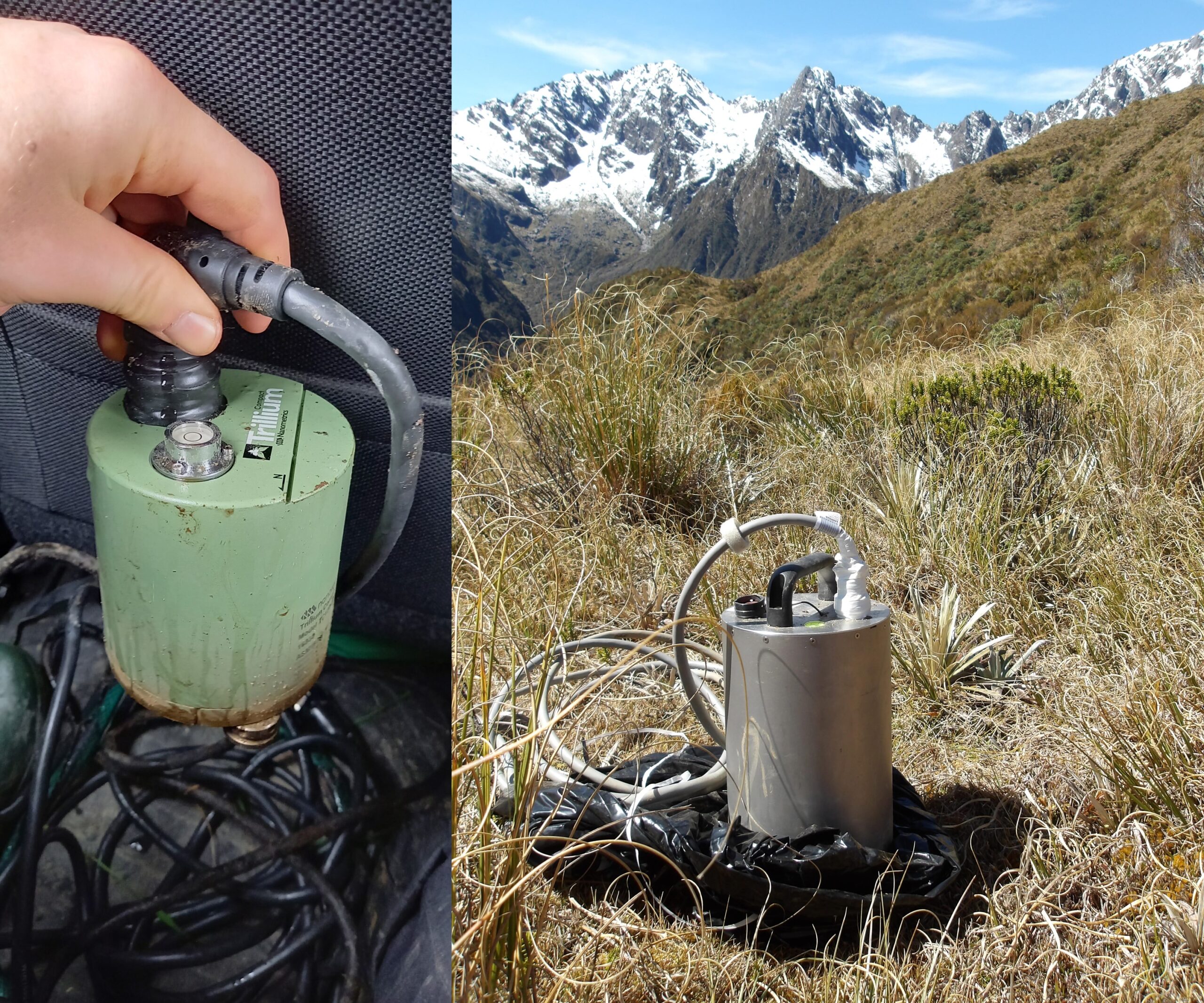
Broadband sensors used in the SALSA array – the compact form on the left is much easier to handle.
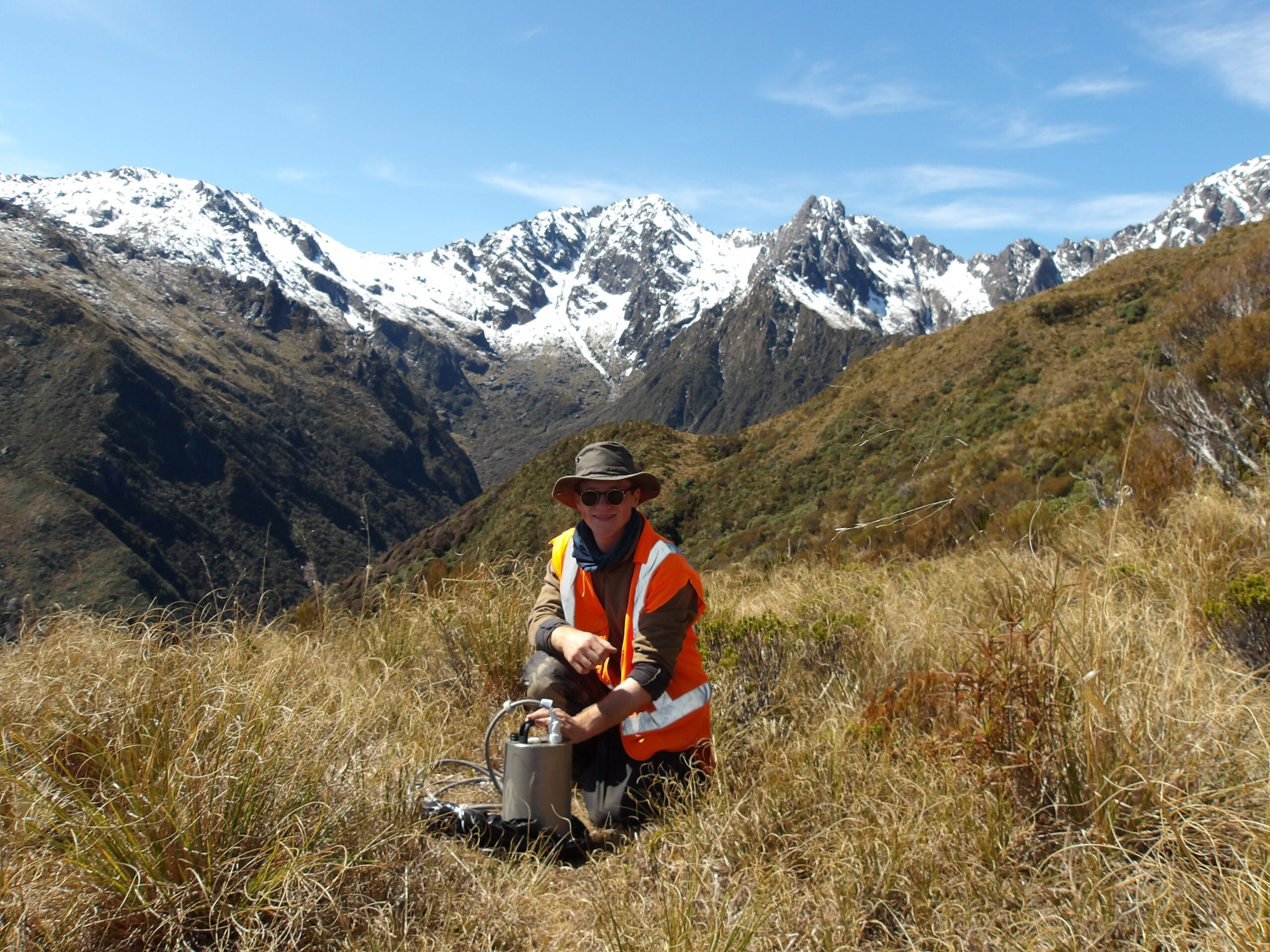
There were sensors left in the northern end of the array that still needed pulling out – including TURI2, the site we had to abandon once the rainwater-filled hole was deeper than arm-length. We set off on a long drive back north, past Franz-Josef and Hokitika. Along the way, it was pointed out to me that many valleys branching off away from us were strands of the fault – the fault bifurcates towards the surface, the location of bifurcations largely controlled by the topography at the surface. Most of the seismic moment contributing to the earthquake, the patch on the fault that slips and generates elastic waves, will occur at depth, so these bifurcations are only really important for seismic sensors very close to the fault zone – the bifurcations will not soak up energy like the crumple zone of a car in the same way that the Marlborough Fault System soaks up energy from the Alpine Fault and slows its movement in the north. Geologists have found markers of deformation to infer which bifurcations are the main fault strands, using shear strain markers and a dark glassy rock called pseudotachylite which is formed by frictional melting during earthquakes (the same way that you generate heat by rubbing your hands). We arrived at TURI2 and thankfully the water had drained out, leaving a thick layer of silt on the walls of the hole. The hole looked disappointingly shallow when I stepped back to look at it – clearly arm-length isn’t that long! The bucket covering the sensor was peaking out of the wall exactly where we thought we had felt it on our first visit, so it didn’t take long to retrieve it. The sensor looked in rough shape, but cleaned up nicely. It was a Trilium Compact – the same type of sensor as most of the other sites but a lot smaller and easier to handle. The sensors need to be level and face north, so have a level bubble and north arrow on top with adjustable feet on the bottom (your compass needs to be corrected for magnetic declination). This is checked when they are removed, and feeds into the metadata supplied to IRIS. They are placed on a paving slab for good contact with the ground, which is often sanded into place at the bottom of the hole, which should be at bedrock if possible, again for good contact. A bucket is placed over the sensors so they’re not freely buried, and the cable feeds up and out the ground into the sensor box on the surface. We then set off for two farm sites – MOSQ and HAUP, the former named after the ominous-sounding Mosquito Creek. Small flies called sandflies are the New Zealand equivalent of Scottish midges however there are less of them and their bites are not lubricated – they just much away. They’re a bit of a pain, but my Scottish insect repellent worked well… the big guns!
Farm sites MOSQ (left) and HAUP (right).
Southern site CHIL, in the mountains near Haast.

A borehole reaching 80m, with a seismometer sanded in at the bottom, in order to monitor microseismicity. Unfortunately, a quarry opened up after the seismometer was installed.
We returned to Fox, and the next day set out in the opposite direction to the southern end of the array near Haast, named after Julius von Haast – a geologist and explorer sent by Prussia to assess the suitability of New Zealand for German immigration, and founder of the Canterbury Museum in Christchurch. As we moved south, the height of the mountains started to decrease. This is because the movement of the fault here becomes more strike-slip, along the fault line, and less dip-slip, across the fault line. The transition between the two is due to a small change in the fault orientation and the stress field – the Pacific plate rotates about a point called an Euler pole, and when you move in a straight line through this curved motion then the stress field will appear to change direction. We first took a helicopter to CHIL, relatively deep into the Southern Alps. It was moody weather, as mist rose up from the treetops in the mountains and rain streamed off the windshield. This was a job of simply replacing some parts in the sensor box – the sensor itself didn’t need to come out. The locals round Haast told us some interesting fault-related tales. At the helicopter pad, we were told of valley folk who claim to hear the fault cracking and creaking at night. They live in the fault zone itself, where powdery fault gouge slowly deforms beneath their feet. The farmer at the next site we visited, MARK, told us a tale from his grandfather, who was riding a bike through the forest in the early 20th century when an earthquake struck and he saw the bike path swell, rising and falling as low-frequency surface wave visibly propagated across the area. He also pointed us towards a location near MARK where he claimed to have found the tops of several trees buried as far as his digger could reach, probably 5-6m. This will have been due to liquefaction, where shaking of wet soil during an earthquake causes it to behave as a liquid, and so the trees sank into the ground. When we were done in Haast, we stopped by at a fiber-optic station on the way to Fox. The cable extends 40km, with parts within the fault zone and alongside seismometers. Fiber-optic cables are increasingly being used as instruments similar to seismometers, as pulses sent along the cable will reflect back where they encounter parts of the cable that are strained by passing seismic waves. There are advantages and disadvantages to using these cables as seismic sensors. The sampling rate can be crazy high because of the speed that these pulses of light travel down the cable, the cable is often already installed by civil engineering companies, and provides a near-continuous monitoring array along its length. We watched cars travelling along the length of the cable on the real-time monitor. The way in which the signals from fiber-optic cables relate to actual ground motion is not yet completely clear, as the coupling with the ground will not be constant along the cable due to cable properties and installation, and only the component of cable strain parallel to its length has an effect, which changes orientation… so the instrument response is complicated. That being said, the inclusion of these cables into the geophysical measurement arsenal is very cool! We downloaded data from several earthquakes for another researcher. I also saw the opening of a borehole from another experiment, containing a seismometer sanded in approximately 80m-down. When you speak into the hole it sounds like you’re on the Wembley loudspeakers! The GeoNet boreholes have seismometers clamped to the walls so they’re easier to pull out. So many different ways to measure seismic waves!

Furry friends at Haast helipad (left), and farm site MARK (right).
4th – 5th November: Journey back to Wellington

Packing 31 sensor boxes to be sent back to New Mexico.
All 31 sensors were packed and ready to go back to IRIS. We loaded them onto shipping palettes, strapped them up and left them in a warehouse in Whataroa to be picked up. After a minor game of tetris and a lot of swearing at giant clingfilm, the job was done! We were to set off from Fox on the 4th, stopping in Greymouth for the night and then onto Picton, where we would catch the ferry to Wellington on the 5th. On the way back we passed through townships called Lyell and Murchison, towns that were once relatively lively during the mining boom but have since quietened down. Both towns were named after geologists, the former after Charles Lyell and the latter after Roderick Murchison. Murchison town is known for the 1929 Murchison earthquake, the third deadliest in New Zealand, killing 17 people and damaging townships across the northern and central South Island. The teleseismic waves, travelling through the deep interior of the Earth, were picked up on the other side of the core by Danish seismologist Inge Lehmann, one of my scientific heroes, who used them during her discovery of the Earth’s solid inner core.
The ferry arrived into Wellington as the skies darkened on 5th November – Guy Fawkes Night. It is slightly strange that the people of Wellington celebrate a 400-year-old failed terrorist plot in Britain, but I think the idea is that you don’t think about it too hard and just enjoy the fireworks, which were visible from the ship as small bursts of red, gold, and green. The occasional thud was audible, as long as the fireworks were located such as the hills reflected the noise back to us and not away from us. It was a good opportunity to reflect on the last two weeks. I thought about the folks that enabled and encouraged me to follow my passions, and all the moments of luck that went my way, that led to this opportunity. And then I thought about the development through time of my connection to geoscience and nature – it used to be an outlet for rapidly developing creativity, but now has transformed to something more of a template to exercise philosophical ideas. What can we take away from the geophysical scientific method, that we can use to learn about ourselves? There are lessons to take from the scientific ideas of prior knowledge, of dealing with uncertainty in what we believe to be facts and in our theories, of observing the world around us with an open creative mind and keen eye, of rejecting naive ideas of verification – replacing the dogmatic worship of a singular so-called Truth with pluralism, and being comfortable with simply not knowing. For me, this is a far more interesting and valuable reward given by science than the iron crown of a relentless march towards technological “progress”. More relevant to the field work itself, came ideas about what data itself really is and where it fits into reality. I will use the terminology of Karl Popper, whereby World 1 is the realm of states and processes (what many of us consider to be the “real” world), World 2 is the realm of our experience (driven by our perception of the environment), and World 3 is the realm of products of our thoughts – theoretical constructs built by mankind to house abstract ideas such as art and scientific theories to best approximate Worlds 1 and 2. Which world does data belong in? The intuitive answer is World 1. The data is often described as the “truth” – it is what you record, from an instrument that doesn’t care about your theories that make up World 3. The seismometer shakes, generating a voltage that gets recorded – end of story, that’s the data. You might say it belongs to World 2, because you perceive the data through your senses, which is valid but I think misses a more fundamental point. What I have come to appreciate on this trip is that “truth” is even more complex than I previously thought. In order to interrogate theories, you need facts. In seismology, the “fact” is the recorded ground motion. However, this is not the data that we recorded – we simply recorded voltage generated by the seismometer. It requires several assumptions to extract the “fact” of ground motion from these voltages. The scientific theory of magnetic induction, the assumption of perfect coupling and orientation (the seismometer is not recording the motion of the rock, but the motion of the instrument, which is simply sat upon a paving slab silted into the bottom of a hole orientated by hand and buried beneath a bucket, which approximates the motion of the rock), and the assumption that the known instrument response is correct, all belong to World 3. Induced voltage may belong to World 1, the real world, but what we usually refer to as “data”, the ground response, belongs to World 3. The notion that the data we measure is not the holy Truth, but belongs in the same logically-constructed world as scientific theories, hammers home the importance of recognising and being comfortable with uncertainty. This applies to us as humans too. Things that happen to us belong in World 1, and our experiences of them belong in World 2. The facts we logically (or otherwise) derive from these experiences belong in World 3. Not World 1. They are not the Truth. I fundamentally believe that we cannot know the Truth for this reason. If mankind were to fully understand this, then intolerance in every sense, in my opinion the root of most evils, will have its logical foundations stripped away, and the human condition would be substantially improved.
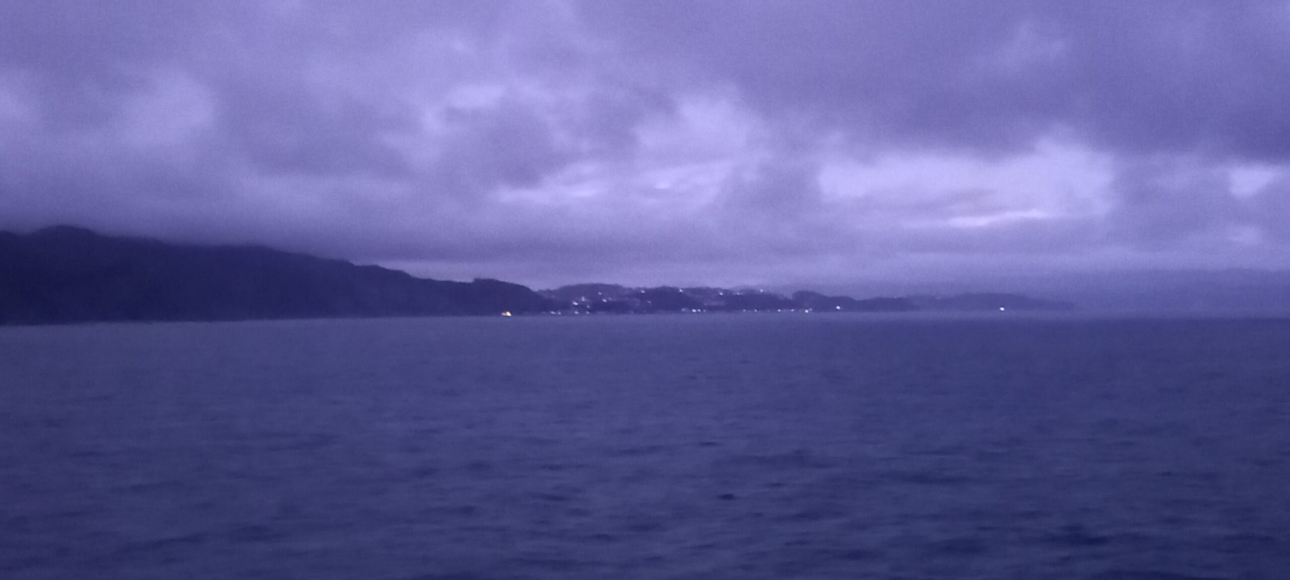
Fireworks greeted our return to Wellington on a fresh mild evening over the Cook Strait.