
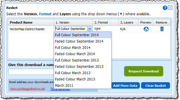
We have updated all the new style Download interfaces in Digimap to make it easier to change the options for the data you have selected. When you have added some data to your basket you can now see more clearly what can be changed; the version (date and style), the format and the layers.
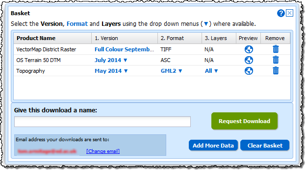
Where these options are highlighted in blue with a ▼ next to them you can click them and get a drop down menu with the alternatives.
Make the changes you need, add a name, then click on the Request Download button to order your data.
We have also made a slight change to the Product Information pages for some of the data products too. Where the data is available on tiles you can now click a Show Grid button to see the tile outlines on the map. When you make a selection on the map you will get all the grid tiles that are partially or entirely within your orange selection area.
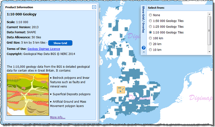
This feature is particularly useful for data products like the 1:10,000 and 1:25,000 scale geology data and the Marine HydroView Charts, where the data isn’t a continuous coverage and your selected area may contain no tiles. When you click the Show Grid button it will also automatically open the menu from the right of the map which allows you to change the grid shown or switch it off.
Remember, you open the Product Information panels by clicking on the blue Info links in the list of data products to the left of the map.
Please let us know if you have any questions about these changes or anything else:
- Email: edina@ed.ac.uk
- Phone: 0131 650 3302
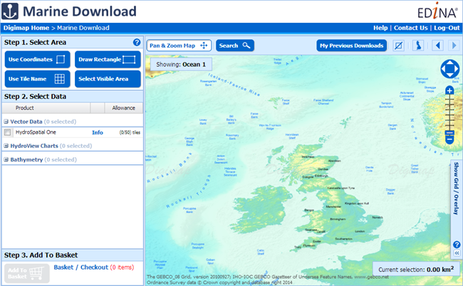
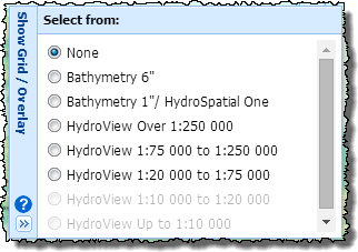 Marine Download works in the same way as Data Download, Environment Download and Geology Download; you select your area, pick your products and download the data. The main difference is with datasets as these don’t all form continuous coverage of the UK Coastal waters. We have therefore included overlays that show where the tiles of each dataset can be found. These are very useful when choosing your data, just open the “Show Grid / Overlay” menu on the right of the map and pick the overlay for the data you are selecting.
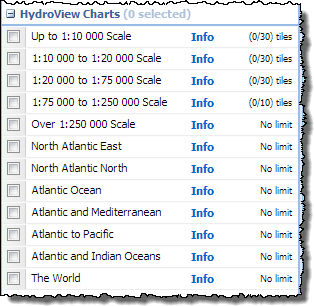 The data in Marine Download is broken into three categories, Hydrospatial, Hydroview Charts and Bathymetry. In the Hydrospatial category the same themes as before can be found, the Hydroview Charts are broken up into categories depending on their scale including those extra charts with wider ocean or global extents.