New data added to Global Digimap: Collins Bartholomew World Panorama

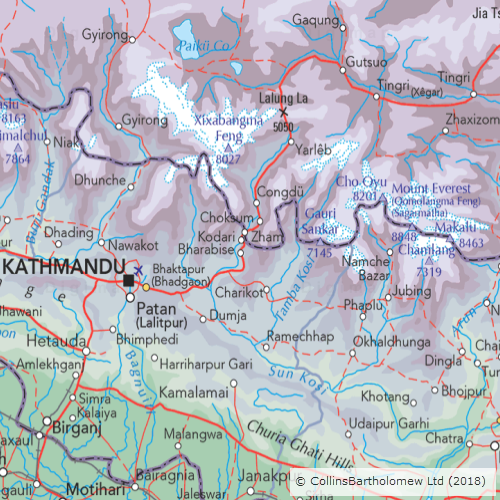
EDINA are thrilled to announce an exciting new addition to Global Digimap – Collins Bartholomew’s raster World Panorama https://www.collinsbartholomew.com/map-data-products/panorama/world-panorama/

This beautiful new addition to Global Digimap is an excellent addition providing a wonderful cartographic product ideal for small scale extents.

World Panorama Data - Collins Bartholomew

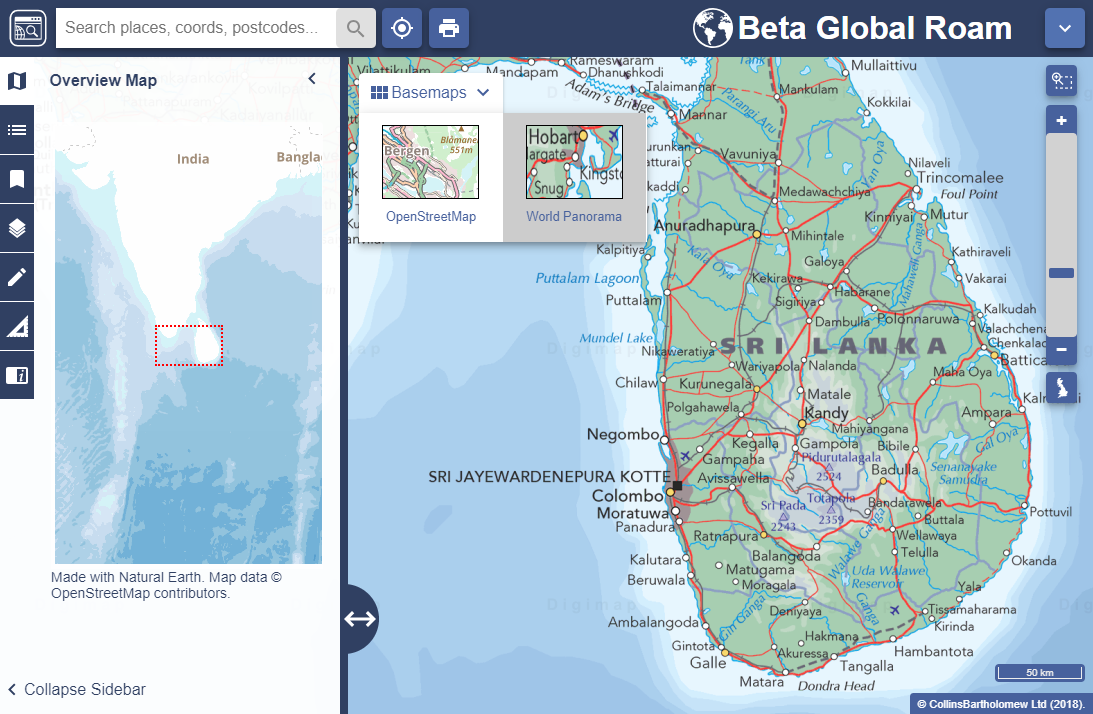
EDINA feel this addition, available via it’s ‘Alternate Base Map’ function is a perfect enhancement to the collection. With it’s origins in The Times Atlas, World Panorama exemplifies what is best about a mapping product where cartographic presentation is at the fore. With a geopolitical committee sitting behind the product, providing input on boundaries and territory disputes it is the epitome of an authoritative dataset. This provides excellent comparison to OpenStreetMap, a massive crowd-sourced dataset of volunteered geographic information.

Available as a raster product and still to be added to Data Download, EDINA are keen to hear if this mapping product is attractive to you as a core offering in Global Digimap. If you have any comments about this new addition, please do let us know using the details below.

World Panorama - EverestWebinar

We are running another short webinar on Global Digimap on Wednesday 9 January from 13:00-13:30 where we will showcase the new dataset as well as talk about the latest developments and additions to the service. There will also be plenty of opportunity to ask any questions you may have about the service and suggest any improvements you would like to see. Places are limited, so please register using the link below if you wish to attend:

Register for the Global Digimap Webinar, 1pm Wednesday 9 January


If you have any questions about this, please don’t hesitate to contact us:

  • Email: edina@ed.ac.uk
  • Phone: 0131 650 3302

Global Roam now available

We are very pleased to announce the release of Global Roam. This builds on the release of Global Download last week and allows users to browse global data in the familiar, user friendly, Roam online mapping interface. Global Roam is very much a work in progress and you will find that some of the standard functions are not yet available, but we were keen to get something out to users as soon as possible and we’d love to know what you think of it and where you think it can be improved.

Global Roam showing Central Park in Manhattan

As mentioned in our previous blog post, Global Digimap is available as a beta service as we look to build a suite of datasets, themes and formats that best meets the needs of our users. We will continue to develop the Global Digimap service over the coming months, shaped by the feedback that you give.

Global Roam delivers the familiar Roam interface with detailed global data sourced from Natural Earth and OpenStreetMap. The application includes the usual annotation tools (recently renamed ‘drawing tools’) along with global search functionality. The most zoomed out maps use Natural Earth data which changes to OpenStreetMap as you zoom in. Future plans include:

  • adding additional data from the rich OpenStreetMap dataset including point features
  • integrating the print interface to allow high quality printed maps up to A0
  • addition of the feature information tool allowing users to view the attributes of selected features
  • creating alternative grey-scale and colour basemap styles
  • inclusion of the measurement tools [update: these were added 30/08/2018]
  • customisation of the map through the Map Content panel

It’s worth mentioning that maps saved in Global Roam are not compatible with other Roam clients and vice versa as they use a different projection system. [update: this was resolved 30/08/2018]

Access to Global Digimap

During this development phase, and in return for engagement with the development process, the service will be free of charge for institutions that subscribe to another Digimap Collection. We would like to know what you like and don’t like about it, what features and what new data you would like to see added.  We can’t promise to include everything but the more we hear from you the better able we are to prioritise different requirements and create the best possible service.

If you would like access to Global Digimap please ask your local Digimap Site Representative to request access through the Digimap helpdesk and we will ensure your institution is switched on.

Get in touch

It is never too early to let us know what else you would like to see, we are very keen to hear your ideas of how we can make something really useful; our contact details are below:

  • Email: edina@ed.ac.uk [Subject: Global Digimap]
  • Phone: 0131 650 3302