Any views expressed within media held on this service are those of the contributors, should not be taken as approved or endorsed by the University, and do not necessarily reflect the views of the University in respect of any particular issue.
Digimap is an online map and data delivery service, available by subscription to UK Higher and Further Education establishments. Operated by EDINA at the University of Edinburgh, Digimap offers a number of data collections, including Ordnance Survey, historical, geological, aerial photography, LiDAR, marine maps, land cover mapping, global mapping and census data. For more information about Digimap go to our website: https://digimap.edina.ac.uk Background image Contains OS data (c) Crown Copyright and database right 2022
As of 4 August 2008, the following courses will be FREE. Previously they have only been available via a subscription to ESRI Virtual Campus.
1. Introduction to GIS Data ReViewer
2. Introduction to Map Production System-Atlas
3. Introduction to Map Production System-Atlas (for ArcGIS 9.0-9.1)
If you wish to take this training, visit the ESRI Training and Education website http://training.esri.com where you can enroll for free.
If you have previously accessed these courses through the ESRI Virtual Campus, you will continue to have access to the course. If you have any questions, please contact ESRI directly.
The EDINA Helpdesk endeavours to provide a quick reply to all enquiries. An initial response time of one working day is our goal, with an aim to resolve queries completely within 5 working days. However, every effort is made to answer user questions more expeditiously.
Digimap service users can significantly improve the speed with which their queries are resolved by providing detailed information about their problem. The more you tell us, the quicker we can help you find a solution.
What information to include
You should consider submitting as much information as possible, including the following:
your full name and your institution
which Digimap facilities you are using (e.g. Classic, Hydrospatial Download or Geology Maps)
which data you are using (e.g. Land-Form PROFILE or 1:625,000 BGS data)
which location (coverage) for the data in question (e.g. place names, tiles, co-ordinates)
which web browser you are using (e.g. Internet Explorer, Firefox, Opera)
the full text and URL of an error message, if appropriate and possible
perhaps a screenshot, especially for webpages displaying error messages
a detailed description of the problem, and the steps taken which led to it
Submission of these details with your query will make it easier for EDINA to identify and respond to the problem quickly and have you back on track.
Contact Us
The EDINA Helpdesk is staffed between 0900 and 1700 hours, Monday to Friday. You can contact the Helpdesk by email on edina@ed.ac.uk or by telephone on 0131 650 3302.
After 1 August 2008 you will need to use OS MasterMap Topography layer instead of Land-Line data. Land-Line is the most detailed data available through the Data Download facility within Digimap’s OS Collection. It has been replaced by OS MasterMap Topography layer, which is equally detailed and available through the MasterMap Download facility.
Two OS MasterMap Layers, Topography and Integrated Transport Network, have been available from Digimap’s OS Collection since September 2007. These layers are available through the MasterMap Download facility. You can read more about OS MasterMap data on our OS MasterMap website and within the Digimap Help pages. Look in the sections under MasterMap Download and Data Information.
There are several software packages available which make the process of loading and viewing the OS MasterMap in GIS applications quite simple, more simple than using Land-Line data, in fact. These are in addition to ‘built-in’ converters supplied with the most recent versions of ArcGIS (Productivity Suite), MapInfo and AutoCAD software.
Viewing data
If you wish to simply view the OS MasterMap data (rather than undertake any spatial analysis, querying or manipulation), there is a simple viewer produced by Snowflake Software. It is called the OS MasterMap Viewer and can be downloaded for free (upon registration) from the Snowflake website.
MapInfo
The following applications are free and will load OS MasterMap, fully represented, into MapInfo:
InterpOSe (Digimap Edition) from Dotted Eyes. This is available free of charge on registration with Dotted Eyes. It includes full OS MasterMap styling, and will convert data to various file formats, including Shape, TAB, mid/mif and DWG/DXF.
ArcGIS
The following applications are freely available:
Productivity Suite 1.1. This is freely available to those licensed to use ArcGIS through Eduserv Chest. It contains MapManager and will convert OS MasterMap to Geodatabase format and comes complete with a number of layer files for representation (details can be found in the local installation folder of Productivity Suite). You will need a special Athens username and password to access the software download area. This should be available from your local Chest Representative or ESRI Technical Contact.
InterpOSe (Digimap Edition) from Dotted Eyes. This is available free of charge on registration with Dotted Eyes. It includes full OS MasterMap styling, and will convert data to various file formats, including Shape, TAB, mid/mif and DWG/DXF.
AutoCAD
InterpOSe (Digimap Edition) from Dotted Eyes. This will convert OS MasterMap to DXF and DWG and has a template file (.DWT) for representing the data using OS style. InterpOSe can be downloaded for free from Dotted Eyes website on registration there.
There are other packages and resources available which are detailed on our OS MasterMap website. Ordnance Survey also provide information about software which will read OS MasterMap data.
Instructions on using MapManager 9.1 and InterpOSe are included in the Digimap Help pages. Look in the section labelled “Using Data with GIS”. If you have any questions about the information provided here, please contact the EDINA Helpdesk on edina@ed.ac.uk or 0131 650 3302.
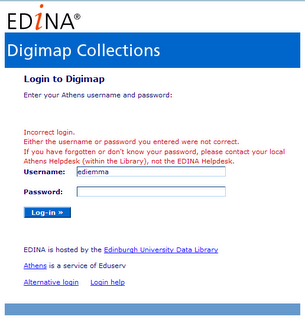
If you cannot access Digimap because you have forgotten your password, you will need to talk to someone at your institution, maybe in your Library, Computing Services, Learning Resources Centre or Information Services, to be reminded of it or have it reset.
EDINA does not know your password, and cannot give you a new one. Try searching your institution’s portal or website for information about access to electronic resources and what to do if you have forgotten your password.