
We are delighted to announce that Environment Digimap now offers the CEH Land Cover® Plus: Crops dataset. CEH Land Cover® Plus: Crops has been produced by the Centre for Ecology & Hydrology in partnership with Remote Sensing Applications Consultants and provides annually updated arable crop information for the whole of Great Britain.
Environment Digimap is the only platform dedicated to the academic sector offering this data. CEH Land Cover® Plus: Crops data is available for both 2016 and 2017. Environment Digimap’s Roam application has the new datasets displayed as alternative basemaps, allowing you to compare the two years side by side using the “2-up” map function. The opacity slider also enables the underlying context map to be viewed easily.
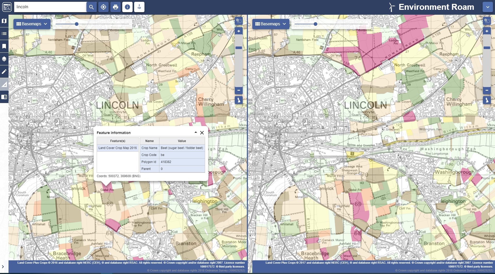
The Info Tool also enables you to query the Crops data, giving information about the crop name, code, the polygon identifier and the coordinates of the point chosen. All other functions in Roam operate as usual, including the ability to annotate measure and print. The Map Content is also available in the left hand panel to help you identify crop types.
The CEH Land Cover® Plus: Crops data is also available to download from Environment Download. Select your area of interest as usual, add the Crop data to your basket and select from File Geodatabase or GeoPackage as optional formats. You can also choose to select individual crop layers rather than the full suite if you wish.
If your institution has a subscription to Environment Digimap, this dataset is available at no additional charge. If your institution does not have a subscription to Environment Digimap, prices and details of the subscription process can be found on our website.*
*Please note that in order to place a subscription order you must be a suitably authorised member of staff. If you have any questions about this, please don’t hesitate to contact us.
- Email: edina@ed.ac.uk
- Phone: 0131 650 3302