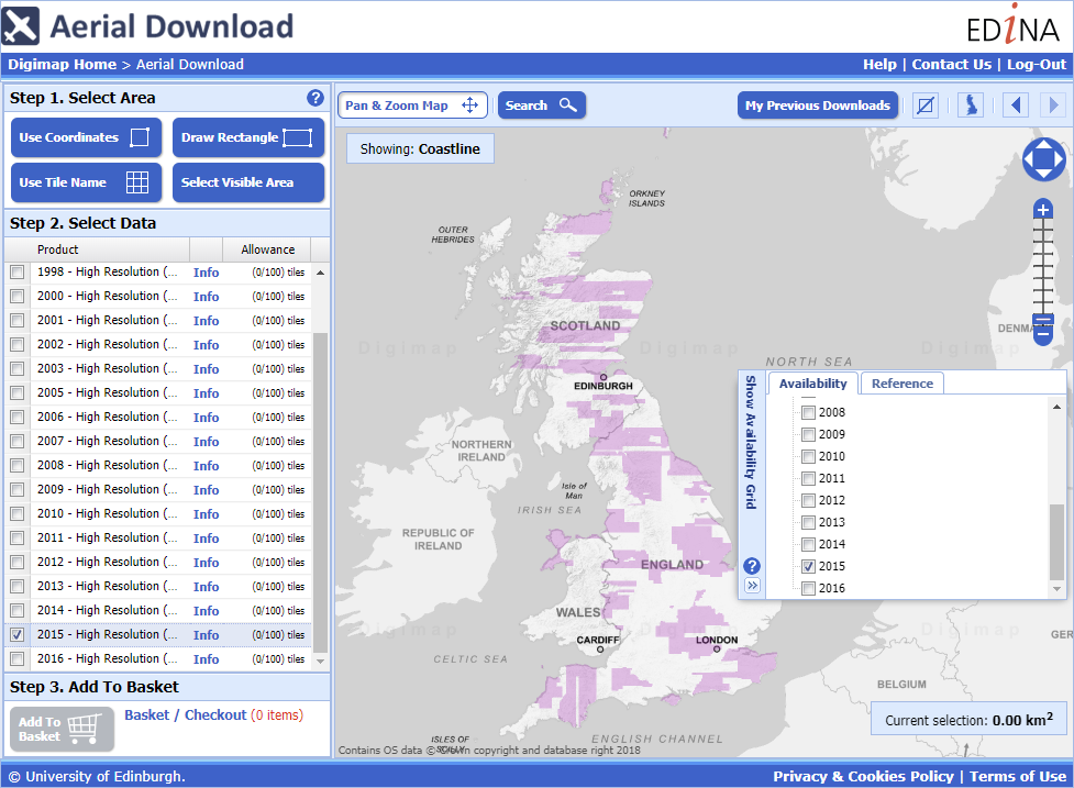
You can now search and download the imagery data from Aerial Digimap by the year it was flown.
This allows you to be sure that you are downloading only the latest data, but it also allows you to download multiple images for the same location taken on different dates. We currently have data from 1998 through to 2016, with more English and Welsh images coming for 2016. When you are in Aerial Download you can see the extents of each year using the Show Availability Grid tool on the right side of the map as shown in the image above.
There is a table below detailing how many 1x1km images there are for each year, with the majority coming from 2013 to 2016, but some of the older images will be very useful to compare to the newer ones where they overlap:
| Year | Number of Images |
| 1998 | 165 |
| 2000 | 855 |
| 2001 | 891 |
| 2002 | 75 |
| 2003 | 11 |
| 2005 | 423 |
| 2006 | 4,620 |
| 2007 | 7,799 |
| 2008 | 5,757 |
| 2009 | 25,066 |
| 2010 | 35,607 |
| 2011 | 18,642 |
| 2012 | 16,619 |
| 2013 | 54,534 |
| 2014 | 71,404 |
| 2015 | 81,378 |
| 2016 | 18,769 |
Here are two images of Lerwick taken 8 years apart:


As you can see there has been construction in the West of the area with new buildings and car parks added.
We hope that you find the ability to make this sort of comparison useful for your research. If you have any questions about this or any other aspects of the Digimap service then please don’t hesitate to contact us.
- Email: edina@ed.ac.uk
- Phone: 0131 650 3302

