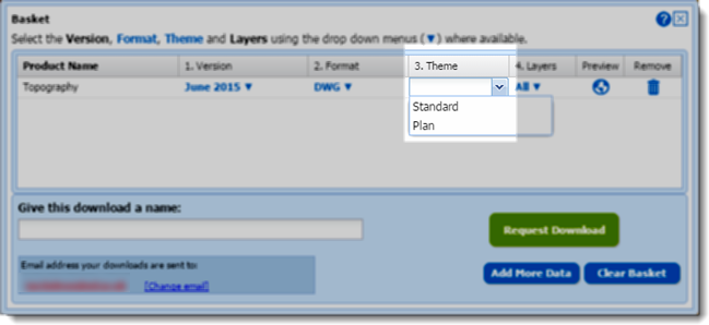
In April 2015 we made OS MasterMap Topography Layer data available to CAD users in DWG format. If you missed the announcement you can read all about it in this blog post. Since adding this option to Digimap we have processed over 13,000 orders for MasterMap in DWG format. Building on this we have now produced an outline ‘Plan’ style of MasterMap in DWG format which is a stripped down representation that mimics the alternative ‘Line Drawing’ style of MasterMap available in the Digimap Roam application.

The alternative ‘Plan’ style is a cut down version of the full dataset and does not include polygons, users requiring the full dataset should download the original ‘Standard’ style which includes both lines and polygons.
The style is specified in the basket window of the Data Download application using the drop-down in the ‘Theme’ column:

We hope you find this new style useful, if you have any questions or suggestions for further improvements please contact us:
- Phone: 0131 650 3302
- Email: edina@ed.ac.uk
