Any views expressed within media held on this service are those of the contributors, should not be taken as approved or endorsed by the University, and do not necessarily reflect the views of the University in respect of any particular issue.
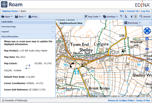
Digimap is an online map and data delivery service, available by subscription to UK Higher and Further Education establishments. Operated by EDINA at the University of Edinburgh, Digimap offers a number of data collections, including Ordnance Survey, historical, geological, aerial photography, LiDAR, marine maps, land cover mapping, global mapping and census data. For more information about Digimap go to our website: https://digimap.edina.ac.uk Background image Contains OS data (c) Crown Copyright and database right 2022
All the Digimap Roam interfaces are due to change this August, with the provisional date set to Tuesday the 13th. There are three specific changes that all existing users of any of the Roam interfaces need to know:
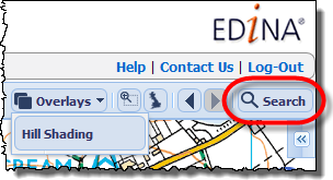
To search for your chosen location you now click on the Search button found above the map on the right-hand side.
Once you have clicked the Search button a new window will open allowing you to do a simple search for a place name or postcode, or a more advanced search using coordinates on either the British National Grid as a grid reference or Eastings and Northings, or as Latitude and Longitude values.
Print Changes
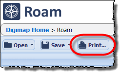
To make a PDF, PNG or JPG print file of your map you now click on the Print button which can be found above the map on the left-hand side.
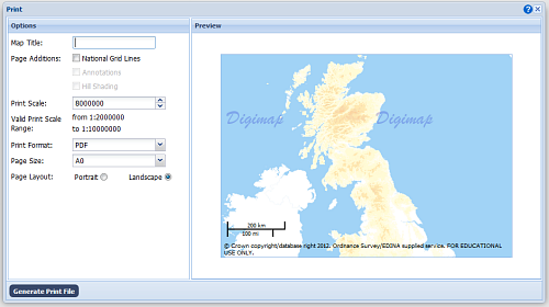
Once you have clicked the Print button a new window will open allowing you to change the print options such as paper size, orientation and scale.
Once you are happy with the settings click Generate Print File, you will be asked to save the file created in the usual way for your browser.
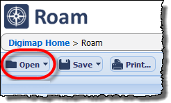
Opening and Saving Maps and Annotations
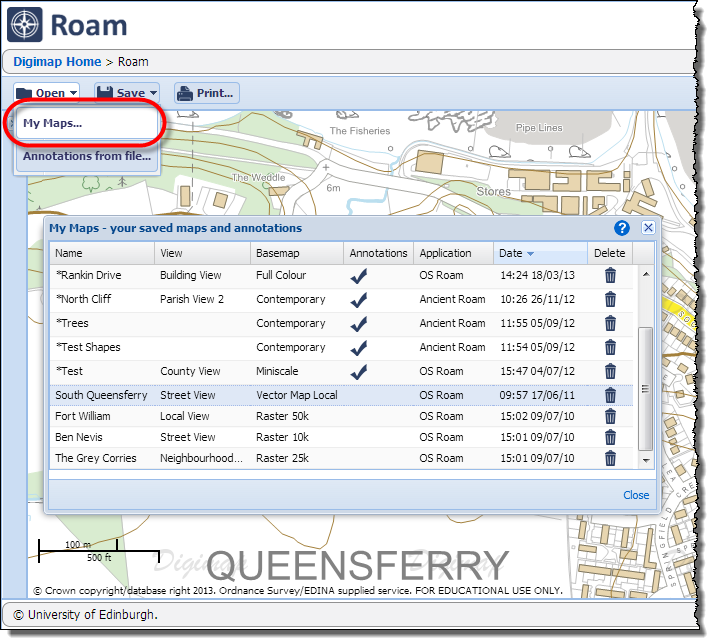
Don’t panic! All your saved maps and annotations from the previous version of Roam will all still be available. To open existing maps or annotations click on the Open button and then My Maps… Once you have clicked on the button a new window will open that allows you to access all the maps and annotations you have saved in any of the Roam interfaces. Annotations are now saved as part of your Map!
In this window you can choose your map and also delete ones you no longer need. If you made a map in a different Roam, opening it will take you to the location and the equivalent zoom level. If it had Annotations, these will be drawn on the new map.
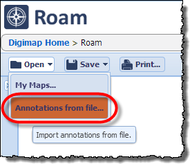
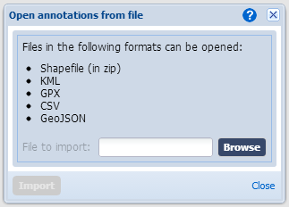
The Open button also allows you to import annotations from a file saved on your computer. Click on the Annotations from file… option to open a window where you can specify the file you want to upload.
When using the service you can click on the blue question mark icon for help on how to use this feature.
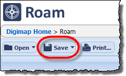
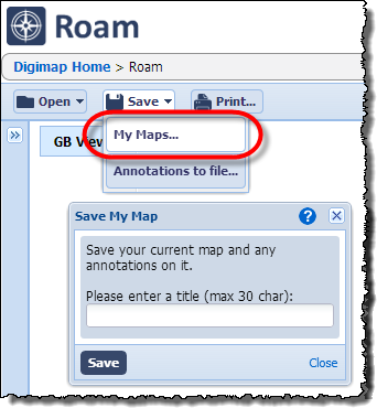
When it comes to saving your maps and annotations you now just click on the Save button and again pick the My Maps… option. This will open the Save My Map window where you save both the map and any annotations that are on it.
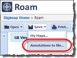
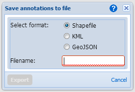
In a similar way to importing annotations, to Export them to a file you click the Save button and then choose the Annotations to file… In the window that opens select the format of the file you want to save and give it a name; clicking Export will then download the file to your web browser’s usual location.
Other Changes
There are several other changes to the interface that make it easier to use some features of Roam that you may have missed in the past, see this previous blog post for more information:
EDINA has launched a new version of Geology Download to replace the existing one and the Lexicon Download. The updated interface can be found in the Download area of the Geology section of Digimap.
The new interface looks very similar to the Data Download service in the Ordnance Survey Collection and so benefits from all the enhanced functionality and ease of use brought about when that interface was developed:
New Geology Download has all the datasets that the old interface provided, with the addition of the Lexicon of Named Rock Units and the Boreholes Index shapefile. We also hope to add some extra datasets in the coming weeks from the British Geological Survey (BGS) OpenGeoscience data holdings.
Both the old Geology Download and the Lexicon Download will be withdrawn on the 31st of August. If you support the use of Geology Digimap please update any support materials or practical exercises you may have created for the old interface.
You can find a “how to” guide for the updated interface here: