Any views expressed within media held on this service are those of the contributors, should not be taken as approved or endorsed by the University, and do not necessarily reflect the views of the University in respect of any particular issue.
Digimap is an online map and data delivery service, available by subscription to UK Higher and Further Education establishments. Operated by EDINA at the University of Edinburgh, Digimap offers a number of data collections, including Ordnance Survey, historical, geological, aerial photography, LiDAR, marine maps, land cover mapping, global mapping and census data. For more information about Digimap go to our website: https://digimap.edina.ac.uk Background image Contains OS data (c) Crown Copyright and database right 2022
All Digimap services will be unavailable for at least 2 hours on Saturday 26th of January for some essential hardware maintenance. The service should also be considered ‘at risk’ for the rest of the weekend. We apologise for any inconvenience caused.
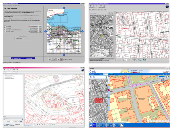
Digimap has become a teenager today, 10th January 2013. There have been some big changes to the service over the years, with interfaces coming and going and Ordnance Survey maps being joined by Historic (2005), Geology (2007), Marine (2009) and soon Environment (2013).
How Digimap Carto has changed since the service launched on the 10th of January 2000.
We’d really like to thank all our site reps and other institutional staff who have supported and promoted the service over the last 13 years.
Remember you can have your say about any of the Digimap Collections in the Impact Surveys available in the service and listed below. Please fill one in to let us know how we are doing and help us improve the service for the future: