image_pdfimage_print

Week 10 – Urban Conditions, Mobility Strategies, and Degrees of Intervention

image_pdfimage_print

This week I examined the project again in relation to the real conditions of Edinburgh. The exhibition strategy for public space cannot rely only on a single route. It has to be adjusted according to spatial density, systems of management, and patterns of movement. In other words, the question becomes how the exhibition can actually take shape under different urban conditions.

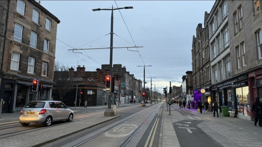
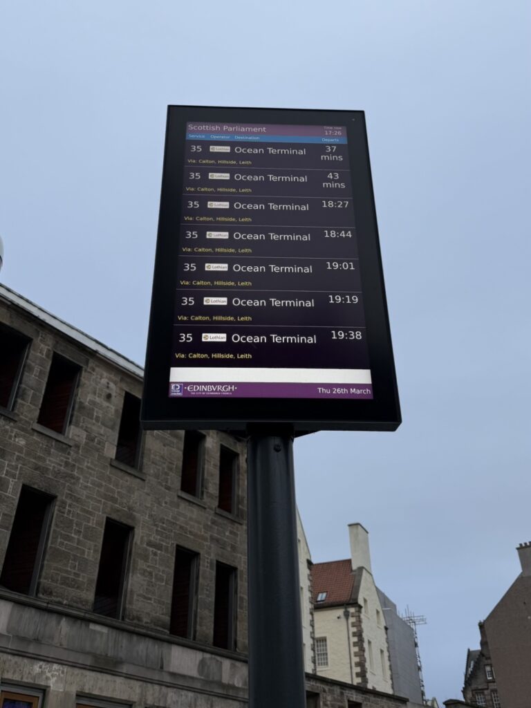
Tourist activity is concentrated in the city centre, especially around Princes Street, Royal Mile, and Waverley Bridge, all of which are marked by high footfall, high consumption, and high visibility. By contrast, Leith Walk, Ocean Terminal, and Holyrood function more as spaces of local everyday life. On this basis, I adjusted the mobility strategy. The earlier plan of linking all sites by bus is not appropriate in high-density areas, where it would increase transport pressure in already crowded conditions. Princes Street, Royal Mile, and Waverley Bridge are therefore now connected by walking, without direct use of the bus system. Holyrood, Leith Walk, and Ocean Terminal still retain the 35 bus as a link during off-peak hours. Because buses are already heavily used in Edinburgh—with Lothian Buses carrying over 100 million passengers each year—avoiding peak times is necessary. At the same time, the project still treats movement as a curatorial condition, so I have not removed the bus completely, but instead limited it to the 10am–4pm off-peak period. The shift between walking and bus travel can itself become part of how audiences understand spatial difference in the city.

The pedestrian routes in high-density areas do not involve steps, so they are fully suitable for wheelchair access, while the 35 bus offers connection across the lower-density sites without creating extra burden for viewing.

Street view of the Royal Mile, documenting the high-density pedestrian environment of the city centre during route testing. Photograph by Hazel Ren, March 2026.
Street and tramline view of Leith Walk, documenting a lower-density urban condition and transport-linked route connection. Photograph by Hazel Ren, March 2026.
Bus 35 digital stop display, documenting route timing and off-peak public transport conditions during fieldwork. Photograph by Hazel Ren, March 2026.

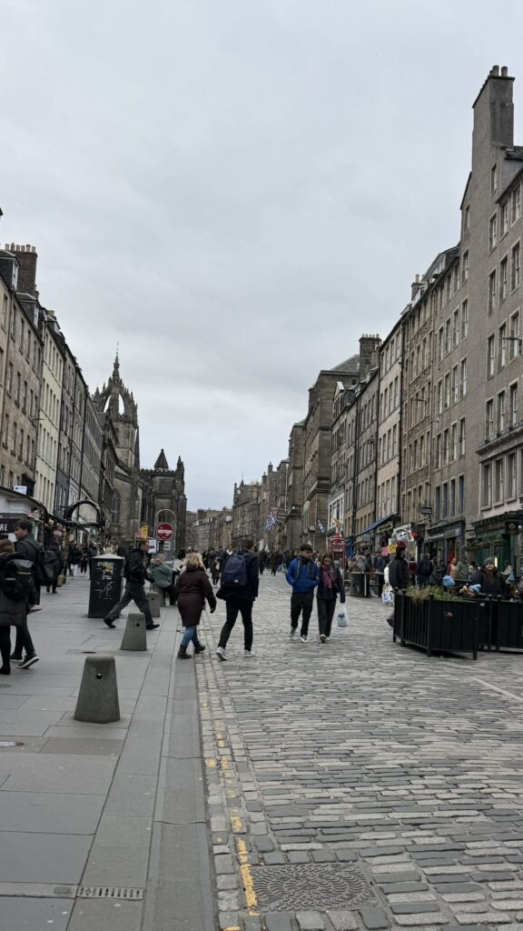
This adjustment also made the relationship between artists and sites clearer. Toby Paterson suits Princes Street because the issue there lies in how commercial frontage, pedestrian flow, and urban surfaces organise movement and looking. Holyrood Park does not require a stronger visual centre, so Clara Ursitti’s sensory intervention is more appropriate. Her work can draw viewers out of the compressed speed of the city centre and make entry into space slower and more bodily aware. Leith Walk is better suited to Chris Johanson’s text-based or light graphic intervention, because the issue there is not tourist spectacle, but the continuing relations between stopping, passing through, watching, and being overlooked within everyday circulation.

I also looked at precedents for linking transport and culture in Edinburgh. Travelling Treasures embedded cultural content into transport experience, making movement itself part of the narrative. Fringe Days Out used buses to enable more community groups to take part in cultural events. Both cases suggest that public transport can function not only as infrastructure, but also as a means of cultural organisation and public connection.

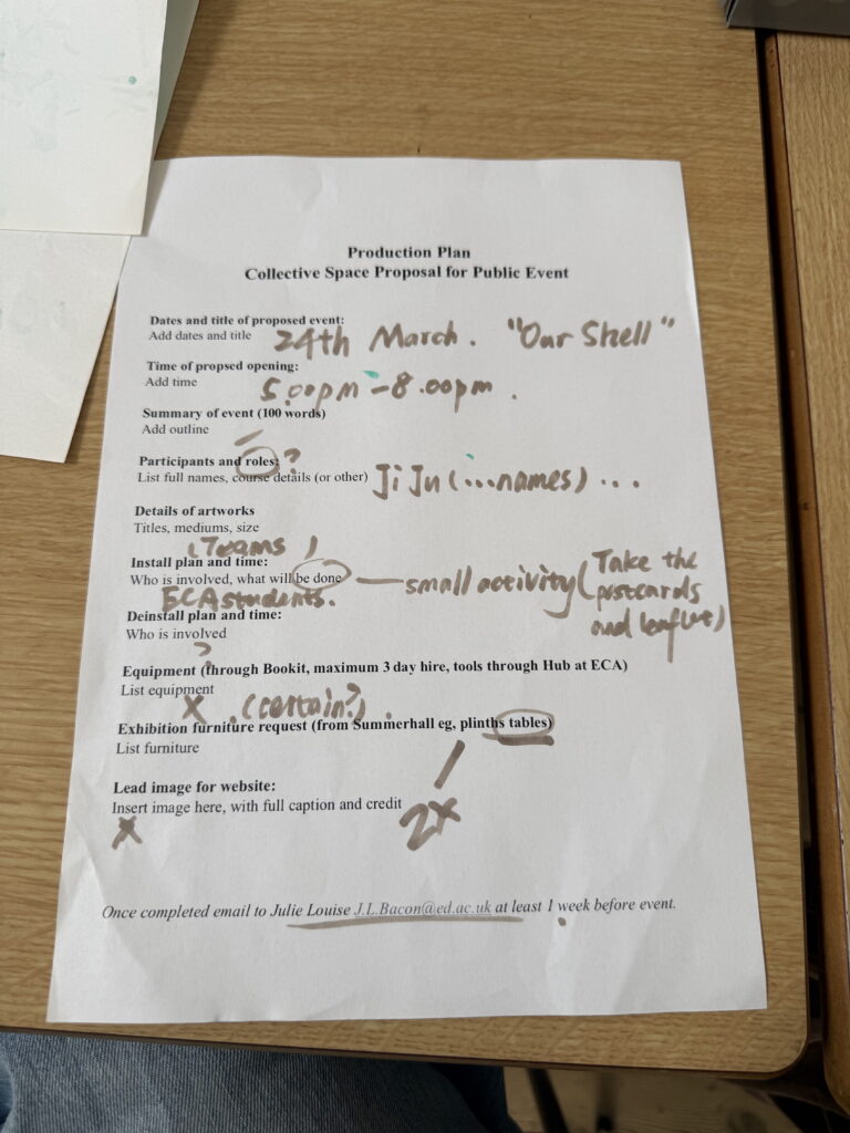
Because the project uses a graded intervention strategy in relation to permission, activities are matched to spatial conditions. Low-intensity interventions such as walking, QR codes, signage, and non-gathered experiences are more easily aligned with ordinary spatial use. Medium-intensity interventions require case-by-case evaluation. High-intensity activities such as performance or clear forms of gathering require formal permission. At present, everything in the project is low-intensity except for the slow-walk performance at Royal Mile.

References

City of Edinburgh Council. “Use of Public Spaces for Events and Filming Policy.” October 5, 2023. https://democracy.edinburgh.gov.uk/documents/s61901/Item%207.3%20-%20Use%20of%20Public%20Spaces%20for%20Events%20and%20Filming.pdf.

City of Edinburgh Council. “Use of Public Spaces for Events and Filming: Final Report.” May 11, 2023. https://democracy.edinburgh.gov.uk/documents/s57266/8.3%20-%20Use%20of%20Public%20Spaces%20for%20Events%20and%20Filming_Final.pdf.

Edinburgh Festival Fringe Society. “Fringe Days Out.” Accessed April 16, 2026. https://www.edfringe.com/experience/school-and-community-engagement/school-and-community-projects/fringe-days-out/.

Edinburgh Festival Fringe Society. “Fringe Days Out Returns in 2024 to Help Edinburgh Communities Engage with the Fringe.” April 30, 2024. https://www.edfringe.com/about-us/news-and-blog/fringe-days-out-returns-in-2024-to-help-edinburgh-communities-engage-with-the-fringe/.

Le Lieu, centre en art actuel. Manœuvres – Le Lieu, centre en art actuel. Edited by Richard Martel. Dijon: Les presses du réel, 1992. Accessed April 16, 2026. https://www.lespressesdureel.com/EN/ouvrage.php?id=2298&menu=0.

Lothian Buses. “Public Transport Use in the Capital Continues to Grow.” January 9, 2026. https://www.lothianbuses.com/news/2026/01/public-transport-use-in-the-capital-continues-to-grow/.

Lothian Buses. “Lothian City Buses: Service 35.” Accessed April 16, 2026. https://www.lothianbuses.com/our-services/lothian-city-buses/.

Week 9 – Testing Non-Linear Viewing and Rethinking Publics

image_pdfimage_print

This week I carried out a site visit of the full route and reconsidered the structure. Although the six-site model had already been designed to move away from the control of a single path, in curatorial terms it still depended on the assumption that viewers would be able to complete all the sites in sequence. A viewing process of more than four hours made two issues very clear: the route was too long, and the structure still relied too much on the logic of “complete viewing”.

I therefore had to reposition the role of the full route within the project. My decision was to treat it only as the most intensive mode of entry, while also introducing shorter route combinations and fragmented entry. This would allow viewers to enter through the map, choose their own path, and decide how long to stay. The deeper purpose of this change was to make the viewing structure more consistent with the real use of urban space. Entry is often incomplete, pauses are often accidental, and movement is shaped by time, stamina, interest, and transport. Non-linearity therefore became an explicit methodological judgement: the viewer’s own choice is itself part of the argument of the project.

This also led me to rethink the issue of guidance. The project cannot simply leave viewers to explore at random, otherwise the critical framework becomes too weak. But it also cannot tightly direct every step, otherwise it repeats the very spatial management logic it seeks to question. I therefore began to move towards a structure that is partly guided and partly open. Key sites provide prompts and frameworks, while other parts leave room for viewers to connect experiences themselves. In this model, walking matters because it organises perception and allows judgement to emerge through movement. The route is no longer a simple tool linking sites, but one of the project’s actual curatorial structures.

This week I also clarified my thinking on publics. What matters more in the project is not which fixed identity category a viewer belongs to, but how they enter the route, how long they stay, how quickly they move, and whether they can bring the dispersed site experiences into some kind of coherent understanding. Publics therefore no longer appear as a pre-existing whole, but as positions formed through the interweaving of viewing, entry, and judgement. This gives the non-linear structure a clearer methodological meaning: it responds not only to social identity difference, but also to how time, mobility, and modes of spatial use shape the conditions under which publics enter the work.

References

Brauner, Maren, and Irene Grillo. “Walking as a Form of Critical Curating.” OnCurating, no. 8. Accessed April 16, 2026. https://www.on-curating.org/issue-8-reader/walking-as-a-form-of-critical-curating-1132.html.

Le Lieu, centre en art actuel. Manœuvres – Le Lieu, centre en art actuel. Edited by Richard Martel. Dijon: Les presses du réel, 1992. Overview accessed April 16, 2026. https://www.lespressesdureel.com/EN/ouvrage.php?id=2298&menu=0.

Lippard, Lucy R. The Lure of the Local: Senses of Place in a Multicentered Society. New York: New Press, 1997.

VisitScotland. “Edinburgh and the Lothians.” Accessed April 16, 2026. https://www.visitscotland.org/research-insights/regions/edinburgh-lothians.

Week 8-From Proposal to Production

image_pdfimage_print

This week the project began to shift from a set of separate ideas into a structural problem. The real question was no longer how to add more content, but whether the parts already in place could be organised into a sequence that others could enter and read. In my case, the six sites, routes, interpretive tools, and public materials all have to be designed as one integrated system of reading.

The week’s discussion of archives and exhibition history helped me think this through more clearly. In her work on “remembering exhibitions”, Reesa Greenberg argues that the reappearance of an exhibition does not mean bringing the past back intact, but reorganising experience through forms such as replica, riff, and reprise. This was important for my project because what I am examining is not a one-off event, but a spatial structure that recurs across the city. Routes, stopping points, entrances, and patterns of use all form their own order within everyday practice. What curating can do, then, is rearrange these naturalised traces so that they no longer operate simply as background.

This also forced me to correct my own language. “Outdoor wandering” is not accurate enough. The project is closer to an organised critical route than to wandering in any simple sense. That matters to me because the route is one way in which the project argues for its own question. Viewers do not first see the works and then understand the route; the route itself actively shapes how they understand both the works and the city

Production checklist and early booklet sketch for the Summerhall collective event. Photograph by Hazel Ren, March 2026.

The collective practice at Summerhall also made me aware of another issue: publics do not begin with the work itself. Posters, pamphlets, layout, and spatial sequence all influence the way viewers first approach a project. Promotion and entrance design, therefore, have to be taken seriously. This also led me back to my own project: the six sites cannot be linked merely through thematic similarity. Their relation has to be concretely supported through maps, on-site texts, booklets, and other devices, so that the project can truly function as a readable whole.

References

Brauner, Maren, and Irene Grillo. “Walking as a Form of Critical Curating.” OnCurating, no. 8. Accessed April 16, 2026. https://www.on-curating.org/issue-8-reader/walking-as-a-form-of-critical-curating-1132.html.

Greenberg, Reesa. “Archival Remembering Exhibitions.” Journal of Curatorial Studies (BRISTOL) 1, no. 2 (June 2012): 159–78. https://doi.org/10.1386/jcs.1.2.159_1.

Lewis Jacob, Adam. Underground, Overground, Inside and Out: Exploring the Dynamics of Artist-Run Spaces. MA Contemporary Art Theory: Curating course presentation, University of Edinburgh, 2026.

Week 7 – Finalizing the Title and Revising the Funding Logic

image_pdfimage_print

This week, I focused on two questions: how can the title clearly reflect the argument of the exhibition, and how can the budget move from an idealised figure to a realistic funding logic?

After discussions with my tutor and group members, I finalised the title Whose Space? Invisible Boundaries in Edinburgh’s Public Life. I became more certain that a title should not aim for obscure metaphor, but should allow a first-time reader to grasp the content and direction of the project.

The budget needed deeper work. An initial upper figure of around £10,000 forced me to distinguish between what is genuinely necessary and what still remains at a conceptual stage. Three artist residencies, several commissions, a complete AR system, public events, security, and documentation all seemed reasonable when taken separately, but clearly too large when placed within the framework of an emerging curator’s project. I therefore had to prioritise those elements that most directly support the argument of the exhibition: site interpretation, basic accessibility measures, essential documentation, and AR as a key interpretive tool. Because of cost, AR cannot be developed as a full-route system. Instead, it needs to be retained as an interpretive device for only a small number of key sites. Princes Street and Waverley Bridge are the most suitable places for this, because they most clearly show how commercial visibility and infrastructural movement shape spatial use. Other sites can instead be addressed through performance or rhythm-based interventions. The result is that AR remains central, but with a more clearly defined role: it serves spatial interpretation.

In terms of funding routes, the City of Edinburgh Council’s Local Events Open Fund currently appears the most suitable primary option. The Council’s 2026/27 overview shows that the fund is divided into three bands—£20,000, £12,000, and £5,000—and gives priority to commitment to communities, environmental responsibility, fair work, and equality, diversity and inclusion, while supporting activities with public cultural value in Edinburgh. A strong supplement to this is Creative Scotland’s Open Fund for Individuals, which supports research, development, and project delivery, with grants between £500 and £50,000.

I also researched local precedents in Edinburgh related to public-space commissions. The Council’s grant register specifically mentions the Edinburgh Art Festival – New Waverley Commission 2017 project, aimed at producing a work that directly responded to the New Waverley environment. The Edinburgh Art Festival 2017 Commissions Programme also describes its publicly sited works as opening overlooked urban spaces. This shows that site-responsive, public-facing commissions connected to specific city environments are not exceptional or unimaginable within Edinburgh. Even though my project remains a speculative proposal, it is not detached from the reality of the city.

References

City of Edinburgh Council. “Local Events Open Fund 2026/27.” Accessed April 16, 2026. https://consultationhub.edinburgh.gov.uk/sfc/local-events-open-fund-2026-27/.

City of Edinburgh Council. Local Events Open Fund Overview. Accessed April 16, 2026. https://consultationhub.edinburgh.gov.uk/sfc/local-events-open-fund-2026-27/supporting_documents/local-events-open-fund-overviewpdf.

City of Edinburgh Council. “Live Grant Register.” Accessed April 16, 2026. https://www.edinburgh.gov.uk/downloads/file/38021/grant-register.

Creative Scotland. “Open Fund for Individuals.” Accessed April 16, 2026. https://www.creativescotland.com/funding/funding-programmes/open-funding/open-fund-for-individuals.

Culture & Business Scotland. “C&BS Fund.” Accessed April 16, 2026. https://cultureandbusiness.scot/cbs-fund/.

Edinburgh Art Festival. “Edinburgh Art Festival 2017 Commissions Programme.” Accessed April 16, 2026. https://www.edinburghartfestival.com/edinburgh-art-festival-2017-commissions-programme/.

University of Edinburgh. Week 7 SICP Toolkit. MA Contemporary Art Theory: Curating course document, 2026.


Week 6 – From Proposal to Spatial Testing

image_pdfimage_print

After the curatorial pitch, the project entered a testing phase, which raised a basic question: once the exhibition enters real urban space, can its original structure still hold? Public space is not a neutral display container. Its use is always shaped by systems of management, pedestrian flow, and architectural environment, so curatorial form itself must be reshaped by real conditions. This week, therefore, my work focused on spatial testing. For a project structured around six public sites, permission becomes a crucial issue. It is one of the clearest and most direct expressions of spatial power, because it reveals how a place is organised, restricted, and made accessible to different people.

This also pushed me to rethink the place of “intervention” within the project. Simply bringing works into the city is not enough to produce an effective intervention. It has to be able to interrupt patterns of use that have already been accepted as normal, so that a naturalised spatial order reappears as something constructed. The Situationist International provided an important reference here, especially through its discussions of dérive and psychogeography, which examine how the city organises perception and action through flow, function, and rhythm. Marcus Jack’s classroom use of Debord’s statement that “all that was once directly lived has become mere representation” was also important for me, because my project deals with a similar spatial reality: some places appear natural only because the inequalities within them have been repeated so often that they are no longer questioned. In that sense, the value of intervention is not to create a visual event, but to disturb existing spatial relations.

The collective spatial test at Summerhall gave me a further insight. Shared themes do not automatically produce coherence. The distances between works, the order in which they enter the viewer’s field of vision, and the arrangement of different media all directly affect how the exhibition is understood. Adjustments to the position of video, installation, and painting were therefore not minor technical matters, but ways of constructing the inner logic of the exhibition. The lesson for my personal project was clear: the six sites cannot be treated as six separate statements, but must form a rhythm and set of relations that can be genuinely perceived.

Collective discussion and artwork grouping during the first offline setup at Summerhall, March 2026. Photograph by Hazel Ren.
Early wall arrangement test during the collective setup at Summerhall, March 2026. Photograph by Hazel Ren.
Initial spatial test during the first offline collective setup at Summerhall, March 2026. Photograph by Hazel Ren.

References

Han, Shuyan, Dexuan Song, Leiqing Xu, Yu Ye, Shurui Yan, Feng Shi, Yuhao Zhang, Xiaodong Liu, and Hu Du. “Behaviour in Public Open Spaces: A Systematic Review of Studies with Quantitative Research Methods.” Building and Environment 223 (September 2022): 109444. https://doi.org/10.1016/j.buildenv.2022.109444.
Chitrakar, Rajjan M, Douglas C Baker, and Mirko Guaralda. “How Accessible Are Neighbourhood Open Spaces? Control of Public Space and Its Management in Contemporary Cities.” Cities 131 (December 2022): 103948. https://doi.org/10.1016/j.cities.2022.103948.

Lewis Jacob, Adam. Underground, Overground, Inside and Out: Exploring the Dynamics of Artist-Run Spaces. MA Contemporary Art Theory: Curating course presentation, University of Edinburgh, 2026.

University of Edinburgh. Week 6 SICP Toolkit. MA Contemporary Art Theory: Curating course document, 2026.