African Savanna Cyclone Experiment
CyclEx description
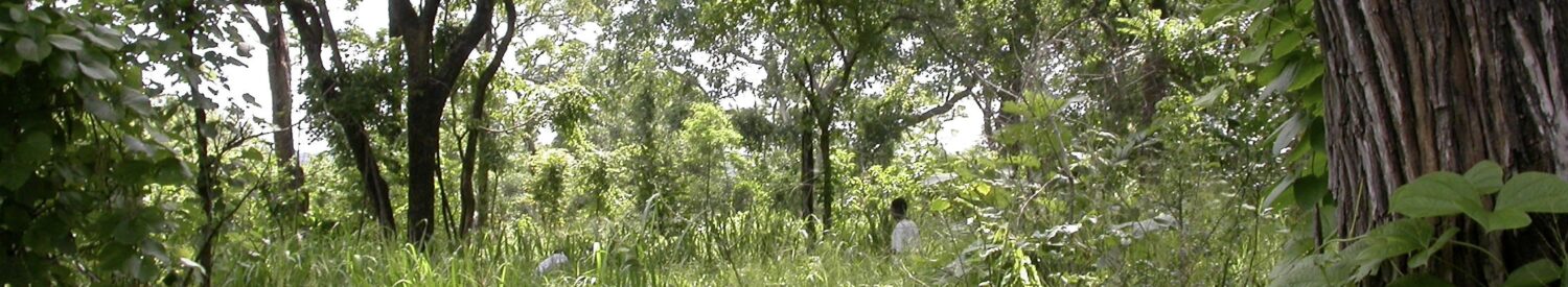
Savannas are the dominant land cover in the tropics, support the livelihoods of 100s of millions of the world’s poorest people, and harbour an ancient, unique, and charismatic flora and fauna (Ryan et al, Phil. Trans. R. S. 2016). They are also widely theorised to be a bi-stable alternative to forests under prevalent climate conditions.
That ecosystems can have alternative stable states has major implications for how we manage and predict the future of the biosphere. The presence of alternative stable states in the dry tropics particularly matters because the low woody biomass state (savanna) and the high biomass (forest) state provide radically different ecosystem services, and the low biomass state supports unique biodiversity.
Despite the importance of understanding the presence or absence of alternative stable states, the empirical evidence to date is weak, and mostly limited to model simulations or analysis of static spatial patterns. In other fields, long term observations of state changes have been used to support the theory, but this has not been done in savannas. Thus, alternative stable state theory remains controversial.
We propose that tropical cyclones represent an important edge-case which can be used as a strong test of the presence of alternative stable states are laying the foundations for an experiment to test this in a cyclone affected area of Mozambique. We will examine both the role of cyclones in savanna demography, and the broader question of the stability of savanna-dry forest systems.
We will test the following overarching hypothesis: Cyclones can trigger a state shift from forest to savanna, which persists due to stabilising feedbacks.
To address this hypothesis, we will address the following questions with a mixture of field work and remote sensing, integrated with a process-based model of savanna dynamics:
- Q1: a) What area was impacted by Cyclone Idai, and with what severity? b) How do initial stand structure, vegetation type, soil type, wind speed and inundation combine to predict cyclone damage and wind throw?
- Q2: Are there species-level effects in the propensity of trees to windthrow, mortality and resprouting? Do these effects go on to influence the stand structure and composition of the post-cyclone state?
- Q3: What is the long term trajectory of woody biomass after intense windthrow? How do the key feedback mechanisms thought to maintain the low biomass savanna state (fire and herbivory) change during recovery?
Several approaches will be used to address these questions:
- 1) Establishment of 8 x 1-ha permanent sample plots (PSPs) in the most impacted areas, recording the impact of the cyclone and the structure and floristics of the trees, grasses and woody debris. These plots will allow the analysis of the long term response to the cyclone and the testing of the theory that cyclones can “flip” closed canopy dry forests into a stable savanna state.
- 2) Following the Urgency Grant, we will continue to monitor the PSPs, evaluating growth, mortality and recruitment, as well as the prevalence of fire and animal damage. In the long term this will reveal if the area returns to its pre-cyclone state or if patches can remain “stuck” in the low biomass, savanna state. This will be evidenced by the detailed process understanding from the PSPs, wide area remote sensing, and generalised by using a simple savanna demography model to address our overall hypothesis.
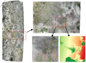
- 3) Using a small drone around 150 ha of impacted woodlands was surveyed photographically in 30 transects. Digitisation of treefall occurrence at the stem level was undertaken including estimation of fallen tree height and Diameter at Breast Height. The spatial distribution of cyclone impact in terms of number of fallen trees and biomass of fallen trees in these transects will be linked to EO platforms including ALOS Palsar and Sentinel 1 / 2 with the aim of developing landscape scale estimation of biomass impacts of cyclone Idai and how the intensity of impact varies spatially.
Comments are closed
Comments to this thread have been closed by the post author or by an administrator.