Remote Sensing and Emissions Reduction Technology – Career Opportunities in Earth Observation
Summary
MSc Earth Observation and Geoinformation Management alumni Katherine and Sarah, highlight the how the skills and networks gained from the programme were key to succeeding in their current roles.
Katherine James
After completing my MSc in Earth Observation and Geoinformation Management, I began working as a test engineer at a lidar company. This gave me a wider understanding of the variety of applications that lidar could be used for. I then embarked on a challenging but incredibly rewarding career as a remote sensing specialist at The HALO Trust. The HALO Trust is an NGO that clears land mines and other explosive remnants of war, so families, communities and countries can recover.
As a remote sensing specialist, I plan and execute the trials of different drone mounted sensors for the detection of unexploded ordnance (UXO), landmines and other features that may indicate contamination such as trenches, bunkers and craters. I support the wider usage of these in a variety of our programmes so that we can provide more informative data to our clearance operations department, so they can create targeted clearance plans to ensure our teams are operating as safely as possible.
I started in March 2021 based in Somaliland, in Northeast Africa planning and executing trials for how we can utilise a drone mounted thermal camera for the detection of subsurface and surface level anti-vehicle mines. Since these initial trials I have trialled lidar sensors for battlefield and minefield feature detection in Angola, Ukraine and Sri Lanka, as well as Multispectral sensor trials in Angola and Ukraine to detect surface and partially buried anti-vehicle and anti-personnel mines.
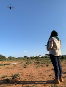
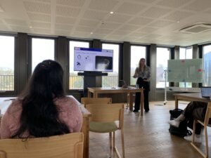
Somaliland 2021
I have developed and deployed training courses for the utilisation of a variety of drones across our programmes, from using a Mavic (small quadcopter drone) with RGB in Iraq for the identification and mapping of Improvised Explosive Devices, to training our Angolan team to utilise a lidar scanner on an M300 (large quadcopter drone) to identify historic trenches and military bases.
These courses are now being delivered in Ukraine to a variety of teams, including drone teams and our survey teams who are utilising large drones with high resolution RGB sensors to map suspected areas of contamination and identify and confirm what evidence is visible and where it is located. I have had the opportunity to work in seven of HALOs programmes, which include: Somaliland, Angola, Iraq, Kosovo, Sri Lanka, Cambodia and Ukraine. Each have their own challenges, but have taught me so much about the wider impact that mine clearance has on communities.
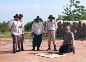
Cambodia 2023
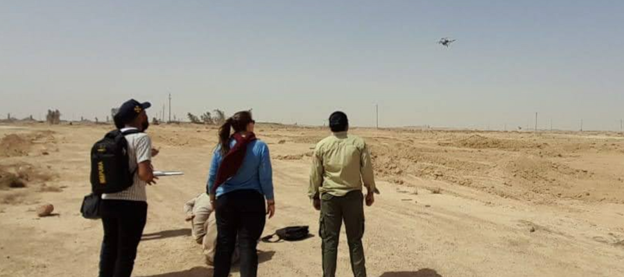
Iraq 2022
I have learned a great deal from this career, including gaining the EOD (Explosive Ordnance Disposal) Level 1 qualification which enables a person to locate, expose and destroy in situ, single items of specific UXO, in which they are trained on, learning how to deploy a range of drones in a variety of different contexts as well as expanding the remote sensing and GIS skills that I gained from my degrees.
Sarah Cheesbrough
Sarah pursued an MSc in Earth Observation and Geoinformation Management at the University of Edinburgh during 2018-2019, after completing her undergraduate studies at the University’s School of GeoSciences. Throughout the programme, she gained valuable industry experience through a part-time internship at Global Surface Intelligence, an Edinburgh-based start-up. This role involved assisting the organisation with the development of new products and services, aligning customer needs with technical feasibility.
Upon graduation, Sarah joined Satellite Applications Catapult as an Earth Observation Consultant. The technical expertise she acquired during her MSc allowed her to contribute effectively to a project aiming to develop an Earth Observation data cube for South Pacific nations. The strong theoretical foundation in Earth observation she gained, continues to support her as the field rapidly evolves, with satellites providing increasingly advanced capabilities. The network developed during the programme has proven invaluable; Sarah regularly interacts with her peers from the programme, as well as teaching staff, often at events and conferences.
Now, with over five years at Satellite Applications Catapult, Sarah has recently transitioned into a new role as Mission Manager for Emissions Reduction. In this capacity, she is focusing on shaping the future growth strategy for emissions reduction technology across various satellite platforms.
______________________________________
Learn more about our MSc in Earth Observation and Geoinformation Management
Our MSc Earth Observation and Geoinformation Management will help you lead your own future in Earth Observation by exposing you to latest research and industrial innovation, and helping you develop skills to tackle global challenges.
You will do this by combining satellite data, technology and science to find new solutions to the World’s biggest challenges.
MSc Earth Observation and Geoinformation Management