Reflections from a scoping trip by a first-year PhD student
A blog post by John Mutua an EPSRC and FAO CASE Funded PhD Student working with the Jameel Observatory and supervised by Gary, Alan Duncan, Simon Fravel all from UoE, Tim Robinson from FAO and An Noetenbert from CIAT. John writes here about a scoping trip for his PhD research where he travelled to several farms in Kenya.
If there is anything I knew I was familiar with was the crop and livestock systems of Kenya. I grew up on a modest farm in Makueni County, Kenya, where my parents kept livestock and grew a variety of crops. So, when I started my PhD research on estimating livestock diets in East Africa, it was like “coming home”. Previously, I was a geospatial analyst at the Alliance of Bioversity International and CIAT in Kenya where I worked on various research topics including climate risk assessment, land degradation assessment, and land cover mapping – this laid the groundwork for my PhD research.
This spring I got to conduct my first scoping fieldwork in Kenya with my supervisor Dr Gary Watmough. As a PhD researcher it’s always good to collect data while in the field and while at it have an efficient way of data collection. Before travelling, I designed tools for data collection at two levels (i) Livestock diet composition using ArcGIS Survey123, and (ii) Plot boundary data collection using Esri Collector – for use as input data in mapping pasture conditions using satellite data.
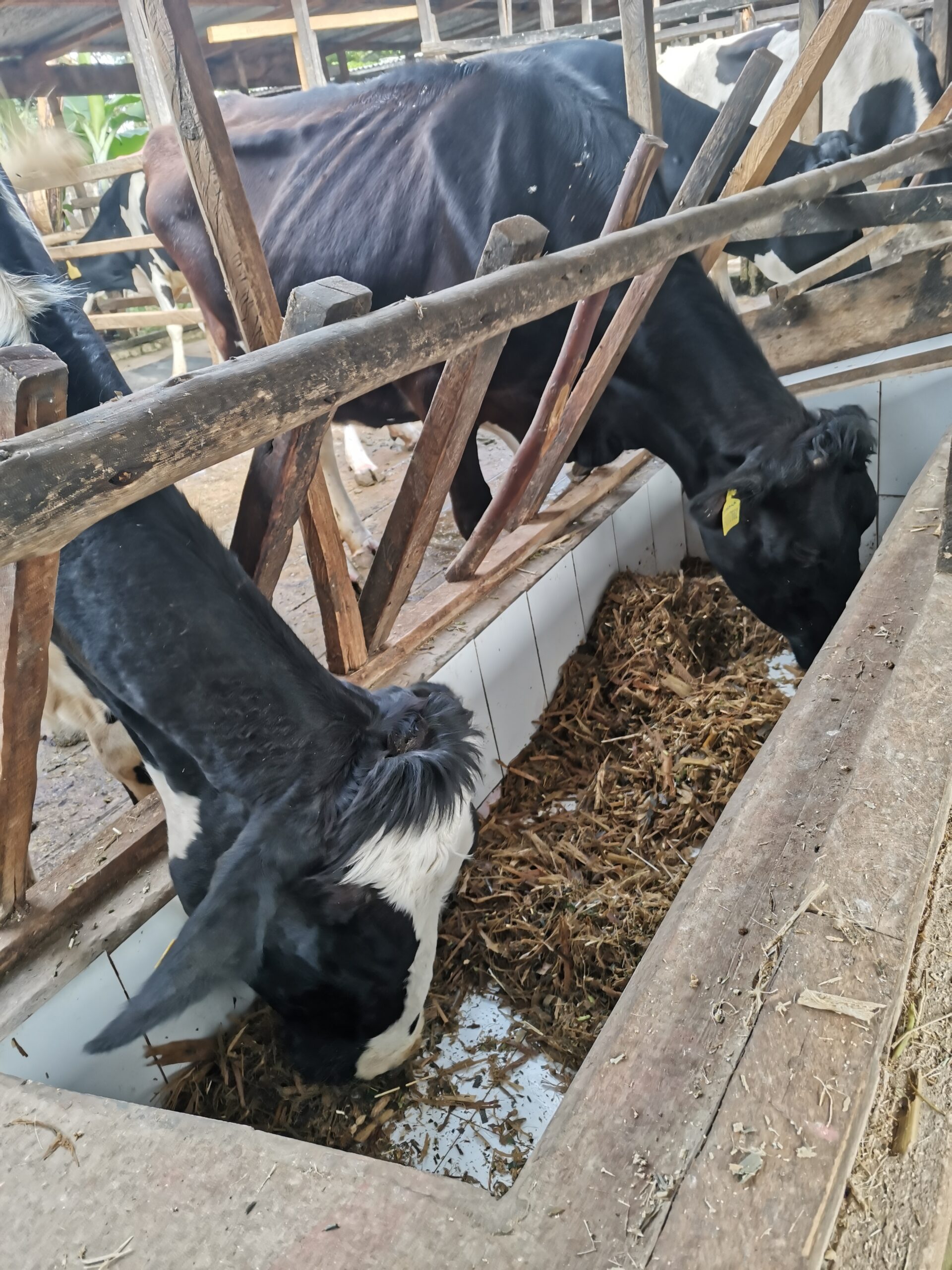
Our first stop was Meru County, Kenya – a humid region which is Kenya’s intensive milk production region; it is home to thousands of dairy smallholder farmers practicing zero grazing (cows remain in barns and feed is brought to them). Cows are offered a range of cultivated and wild grasses such as Napier grass, Kikuyu grass, Panicum maximum grass, Rhodes grass, legumes such as Greenleaf desmodium, Sweet potato vines, Crop residues from Maize, Sorghum and Maize silage. Our next stop was Kapiti estate in Machakos county, Kenya – it’s a research site for sustainable livestock and rangeland management. Here livestock are left to graze freely at the farm with little information on type and quality of pasture they feed on.
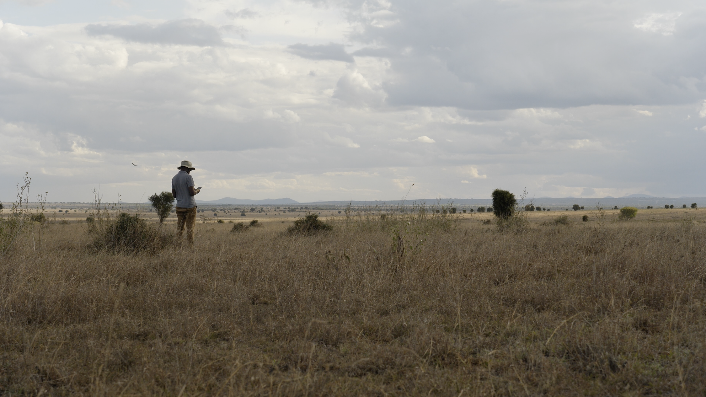
While out in the field, I kept asking myself what the drivers of livestock diets in the areas I visited could be – I noticed huge differences in the feed offered to animals in Meru, even over short distances, which surprised me. In Kapiti where animals are left to graze in the field, there are a variety of grass species on the landscape, something that is difficult to distinguish using freely available satellite imagery. I am currently filtering through data including GPS tracks, field boundaries, and photographs collected during this trip – The scoping trip helped me gain a deeper understanding of the topic, and this will help me refine my research project with details of what I’ll be working on for the remainder of my PhD. In my second year, I plan to host a results validation workshop with stakeholders from the livestock sector including the smallholder dairy farmers of Meru and other less intensive regions to share my initial findings.
*The second photo was taken by Nat Daudrich of Community Jameel.


This is great work and observatory on the trip. Waiting on photo and image assessment results on how to differentiate the feeds on varying geographical areas. Nice journey my mentor.