
Following our survey in April to learn more about Digimap users’ data priorities for the future, we have some interesting results, with common themes emerging.
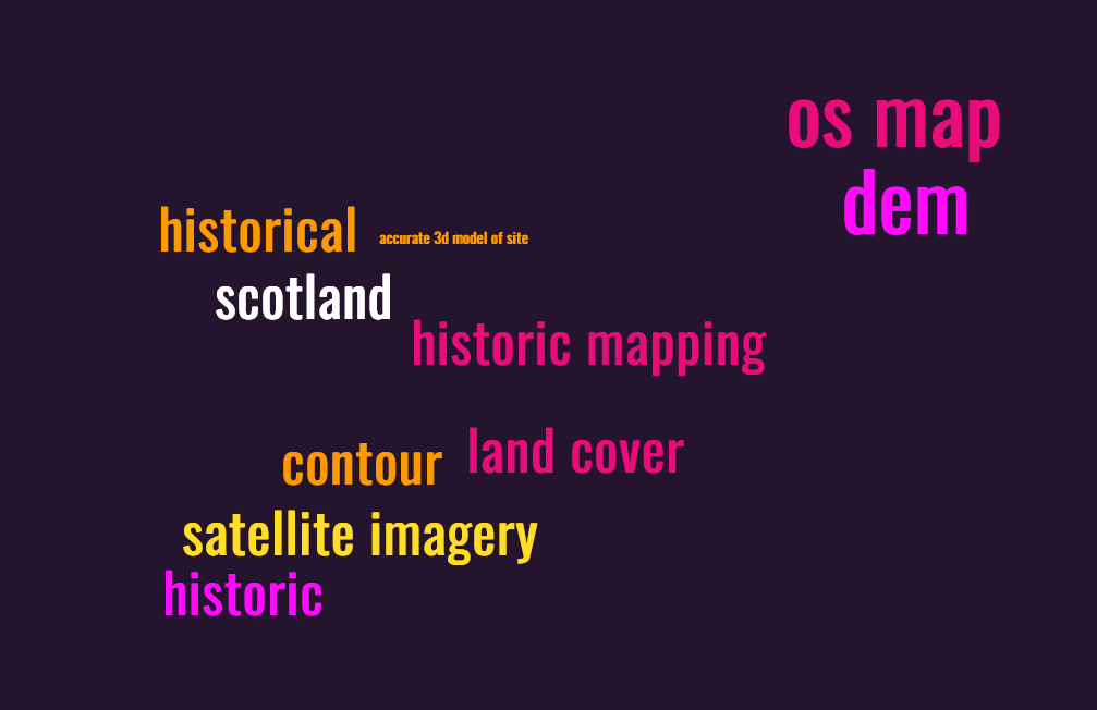
First priority datasets:
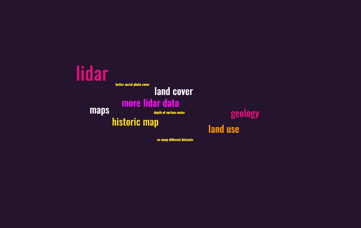
Second priority datasets:
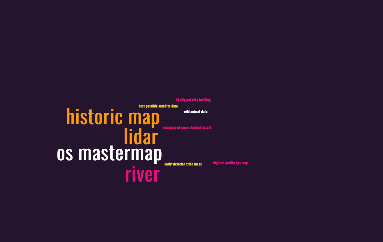
Third priority datasets:
Combined, the three priorities look like this: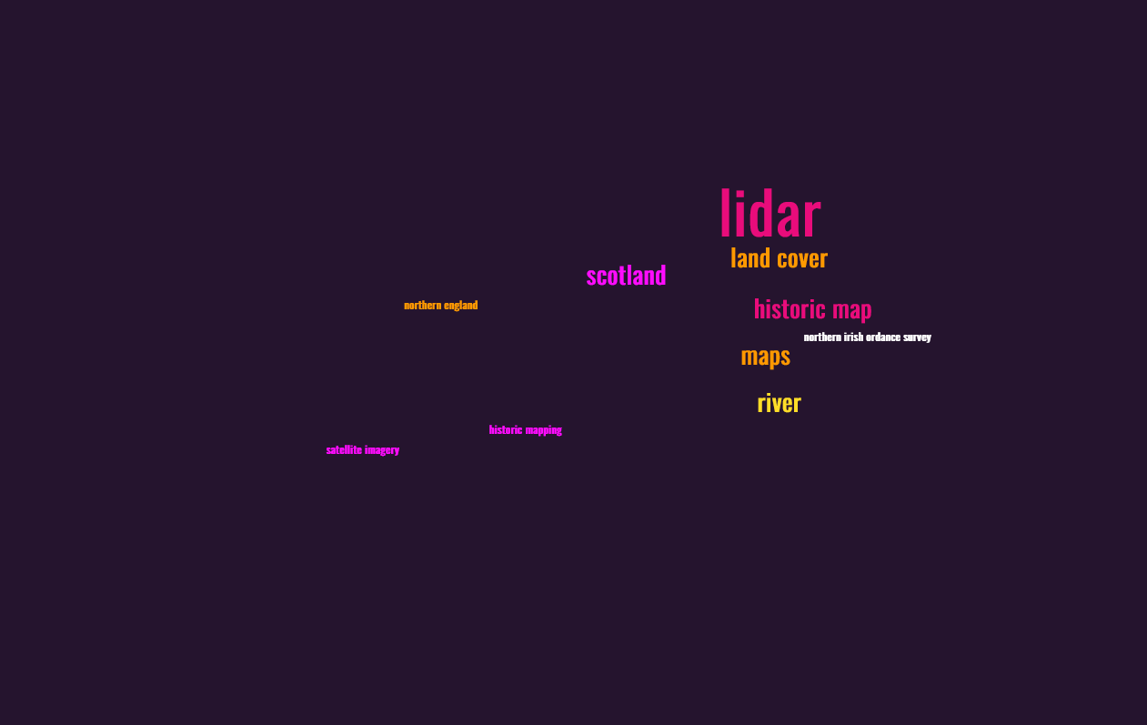
In summary, we think there is demand for more lidar data, more historical data and satellite imagery. We will continue to look at the detail of the survey and use the results to inform our pursuit of additional datasets for Digimap.
In the meantime, do explore what’s already there. Your institution may not subscribe to all the Digimap Collections but you can express your interest in those you don’t currently have access to by logging in to Digimap and following the prompts against each Collection. There is already a range of historical maps (OS, dating back to the 1840s), aerial photography (as much as is available from Getmapping Ltd at 25cm resolution) and Lidar data (originating from GB environment agencies), as well as a full range of DTM and DEM data, detailed OS topographical maps and land cover information. A complete list of all the data available can be found in the Digimap help pages: https://digimap.edina.ac.uk/help/our-maps-and-data/